Ryde is a suburb of Sydney, New South Wales, Australia. Ryde is located 13 km north-west of the Sydney central business district and 8 km east of Parramatta. Ryde is the administrative centre of the local government area of the City of Ryde and part of the Northern Sydney region. It lies on the north bank of the Parramatta River. People from Ryde are colloquially known as Ryders, Rydiens or Rydemen.

Warrawee is a suburb on the Upper North Shore of Sydney in the state of New South Wales, Australia. Warrawee is located 17 kilometres north-west of the Sydney Central Business District, in the local government area of Ku-ring-gai Council. Warrawee is predominantly a residential suburb with few commercial entities. Notably, its railway station supports no commercial activities, which is uncommon on the Sydney train network.

North Epping is a suburb of Sydney, in the state of New South Wales, Australia 19 kilometres north-west of the Sydney central business district in the local government area of Hornsby Shire. North Epping is in the Northern Sydney region, and is often referred to as part of the "North-West" or North Shore. Epping is a separate suburb to the south and under the Parramatta City Council, which shares the postcode of 2121.

Eastwood is a suburb of Sydney, Australia. Eastwood is located 17 kilometres north-west of the Sydney central business district in the local government areas of the City of Ryde and the City of Parramatta. Eastwood is in the Northern Sydney region and is on the Sydney Trains Northern Line (Sydney). despite it being partially in the City of Parramatta. The area is best known for being an ethnic enclave for immigrant populations in Sydney, mainly of East Asian origin but the suburb also has a significant number of other immigrant populations, such as Italian and Anglo-Saxon people. Eastwood was originally its own town but due to the expansion of Sydney, was eventually absorbed.

Strathfield railway station is a heritage-listed railway station located on the Main Suburban line in the Sydney suburb of Strathfield in the Municipality of Strathfield local government area of New South Wales, Australia. The station is served by Sydney Trains' T1 North Shore & Western Line, T9 Northern Line and T2 Inner West & Leppington Line suburban services as well as NSW TrainLink Intercity and regional services. The station is located on the Main Northern and Main Western railway lines, forming a major junction for regional and suburban rail services. The station and associated infrastructure was added to the New South Wales State Heritage Register on 2 April 1999.

Macquarie Park is a suburb in the Northern Sydney region of Sydney, New South Wales, Australia. Macquarie Park is located 13 kilometres north-west of the Sydney central business district in the local government area of the City of Ryde.

Marsfield is a suburb in the Northern Sydney region of Sydney, in the state of New South Wales, Australia. Marsfield is located 16 kilometres north-west of the Sydney central business district in the local government area of the City of Ryde.

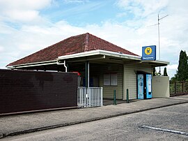
West Ryde is a suburb of Sydney, in the state of New South Wales, Australia. West Ryde is located 16 kilometres north-west of the Sydney central business district, in the local government area of the City of Ryde and is part of the Northern Sydney region.

Edgecliff is a small suburb in the Eastern Suburbs of Sydney, in the state of New South Wales, Australia. Edgecliff is located 4 kilometres east of the Sydney central business district, in the local government area of the Municipality of Woollahra. The postcode is 2027.

The City of Ryde is a local government area in the Northern Sydney region, in New South Wales, Australia. It was first established as the Municipal District of Ryde in 1870, became a municipality in 1906 and was proclaimed as the City of Ryde in 1992.

Hartley is a historical village in the Central West region of New South Wales, Australia, within the City of Lithgow local government area, located approximately 127 kilometres (79 mi) west of Sydney. Hartley is located below the western escarpment of the Blue Mountains.

Chatswood West is a suburb on the Lower North Shore of Sydney, in the state of New South Wales, Australia. Chatswood West is located 11 kilometres north-west of the Sydney central business district, in the local government areas of the City of Willoughby and City of Ryde. Chatswood is a separate suburb to the east. The locality of Chatswood located west of the Pacific Highway is informally known as West Chatswood, and should not be confused with the separate suburb of Chatswood West, nor should it be confused with the West Chatswood Post Office on Railway Street in the suburb of Chatswood. Chatswood West shares the same postcode as Chatswood which is 2067.

Denistone West is a suburb in Northern Sydney, in the state of New South Wales, Australia. Denistone West is located 16 kilometres north-west of the Sydney central business district in the local government area of the City of Ryde. Denistone and Denistone East are separate suburbs; Denistone West was gazetted as a suburb in its own right on 5 February 1999.
Denistone East is a suburb in Northern Sydney, Australia. Denistone East is 16 kilometres north-west of the Sydney central business district in the local government area of the City of Ryde. Denistone and Denistone West are separate suburbs; Denistone East was gazetted as a suburb in its own right on 5 February 1999.

Northern Sydney is a large metropolitan area in Greater Sydney, New South Wales, Australia on the north shore of Sydney Harbour and Parramatta River. The region embraces suburbs in Sydney's north-east, north and inner north west. Northern Sydney is divided into distinctive regions such as the North Shore, Northern Beaches and Forest District.

The Hermitage is a heritage-listed residence and former research institute and government office located at 1–13 Pennant Avenue, Denistone in the City of Ryde local government area of New South Wales, Australia. It was possibly designed by architect John Bibb and built from 1838 to 1842 in the Australian colonial Victorian era style. It is also known as The Hermitage and Garden. The property is privately owned. It was added to the New South Wales State Heritage Register on 2 April 1999.
Smalls Creek, a northern tributary of the Parramatta River, is a creek west of Sydney Harbour, located in Sydney, New South Wales, Australia. It joins the Parramatta River at Meadowbank Park, Meadowbank.

John Blaxland was an English-born Australian businessman and politician.

Riverview House is a heritage-listed former orchard and now residence at 135 Marsden Road, West Ryde in the City of Ryde local government area of New South Wales, Australia. It was built from 1860 to 1878 by George Spurway. The property is privately owned. It was added to the New South Wales State Heritage Register on 2 April 1999.

Brush Farm is a heritage-listed former farm, residence and vineyard and now tourist attraction, community facility, exhibition venue and meeting venue at Marsden Road, Eastwood, New South Wales, a suburb of Sydney, Australia. It was built from 1794 to 1894. It is also known as Home for Boys, Eastwood Home for Mothers and Babies and Brush Farm Home for Mentally Deficient Children, and Brush Farm Girls' Home. The property is owned by City of Ryde. It was added to the New South Wales State Heritage Register on 2 April 1999.