This article needs additional citations for verification .(July 2015) |
This article possibly contains original research .(October 2021) |
Derai দিরাই | |
---|---|
Country | Bangladesh |
Division | Sylhet |
District | Sunamganj |
Thana | 1942 |
Upazila | 1982 |
Government | |
• MP (Sunamganj-2) | Joya Sengupta |
• Upazila Chairman | Muhammad Manzur Alam Chowdhury |
Area | |
• Total | 420.93 km2 (162.52 sq mi) |
Population (2011) | |
• Total | 243,690 |
• Density | 580/km2 (1,500/sq mi) |
Time zone | UTC+6 (BST) |
Postal code | 3040-41 |
Website | www |
Derai is an upazila (sub-district) of the Sunamganj District in northeastern Bangladesh, part of the Sylhet Division. [1]
Derai was previously known as Babaganj Bazar. It was home to two influential Hindu residents; Jitarāma and Dvidarāma, who renamed the area to Derai Bazar. On 10 December 1892, the Assam Gazette notification #5954 recognised the name of the area as Derai. In 1938, the Nankar Rebellion started in Derai and surrounding areas. Derai was made a thana in 1942.
During the Bangladesh Liberation War of 1971, a brawl took place in Derai between the Pakistan Army and Bengali freedom fighting forces. Among the freedom fighters here, Commander Ataur Rahman and Abdul Khaliq were wounded with Azimullah, Kuti Miah and Gopendra Das being killed.
Derai was heavily affected by the 1974 floods and that of 1988. The Jamiah Hafizia Hussainiya Madrasa was founded in 1978. In 1982, Derai thana was made an upazila. The 2004 Indian Ocean earthquake and tsunami was also very damaging to Derai. [1]
According to the 2011 Bangladesh census, Derai Upazila had 45,040 households and a population of 243,690. 71,432 (29.31%) were under 10 years of age. Derai had a literacy rate (age 7 and over) of 37.13%, compared to the national average of 51.8%, and a sex ratio of 987 females per 1000 males. 36,183 (14.85%) lived in urban areas. [2] [3]
As of the 2001 Bangladesh census, Derai has a population of 202791; male 105252, female 97539; Muslim 144136, Hindu 58576, Christian 33 and others 46. Males constitute 51.38% of the population, and females 48.62%.
In 1991, Derai had an average literacy rate of 25.3% (7+ years), and the national average of 32.4% literate. [4] In 2011, Derai had a literacy rate of 37.13%.
Derai thana was formed in 1942 and it was turned into an upazila in 1982.
Derai Upazila is divided into Derai Municipality and nine union parishads: Bhatipara, Charnarchar, Derai Sarmangal, Jagdal, Karimpur, Kulanj, Rafinagar, Rajanagar, and Taral. The union parishads are subdivided into 137 mauzas and 232 villages. [2]
Derai Municipality is subdivided into 9 wards and 29 mahallas. [2]
Number | Name | Notes |
---|---|---|
01 | Nasir Uddin Chowdhury | |
02 | Abdul Quddus | |
03 | Muhammad Hafizur Rahman Taluqdar | 20/3/2014-9/5/2019 |
04 | Muhammad Manzur Alam Chowdhury | Present |
Lakshmipur is a district in Bangladesh with an area of 1,440 km2. It is bordered by Chandpur to the north, Bhola and Noakhali districts to the south, Noakhali to the east, and Barisal and Bhola districts to the west. Lakshmipur was part of Noakhali until 15 February 1984. At that time, the western part of Noakhali was promoted from Lakshmipur subdivision to Lakshmipur district to provide administrative facilities.
Kachua is an upazila (sub-district) of Chandpur District in Bangladesh, located in the Chittagong Division. It is a part of the Greater Comilla region.
Sandwip is an upazila of Chattogram District in Chattogram Division, Bangladesh. It encompasses the islands of Sandwip and Urir Char.
Begumganj is an upazila of the Noakhali District in Bangladesh's Chittagong Division. Begumganj Thana, now an upazila, was established in 1892.
Ramgati is an upazila (sub-district) of Lakshmipur District in Bangladesh, part of the Chittagong Division. The Government of Bangladesh plans to build an airport in this upazila.
Baniachong, is an upazila of Habiganj District in Sylhet Division, Bangladesh.
Nabiganj (Bengali: নবীগঞ্জ, romanized: Nobīgonj, is an Upazila of Habiganj District in the Division of Sylhet, Bangladesh.
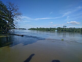
Kulaura, is the biggest upazila (subdistrict) of the Moulvibazar District in north-eastern Bangladesh. The total area of this upazila is 545 km2. Hakaluki Haor, the largest marsh wetland in Sylhet Division and one of the largest in Bangladesh is partially located there.
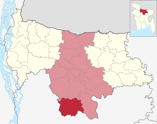
Dowarabazar (Bengali: দোয়ারাবাজার, is an upazila of Sunamganj District in the Division of Sylhet, Bangladesh.
Jamalganj (Bengali: জামালগঞ্জ, is an upazila of Sunamganj District in the Division of Sylhet, Bangladesh.
Sullah (Bengali: শাল্লা, romanized: Shalla, also spelt Sulla, is an upazila of the Sunamganj District, located in Bangladesh's Sylhet Division. Its headquarters is located in Ghungiargaon.
Sunamganj Sadar (Bengali: সুনামগঞ্জ সদর, is an upazila of Sunamganj District in the Division of Sylhet, Bangladesh.
Balaganj is an upazila of Sylhet District in Sylhet Division, Bangladesh.
Bishwanath is an upazila of Sylhet District in the Division of Sylhet, Bangladesh.
Kanaighat is an upazila of Sylhet Division of Bangladesh. It is the second-largest upazila (sub-district) of Sylhet District after Gowainghat Upazila. It is named after the town of Kanaighat, which is also the only municipality in the Upazila.
Zakiganj is an upazila of Sylhet District in Sylhet Division, Bangladesh.
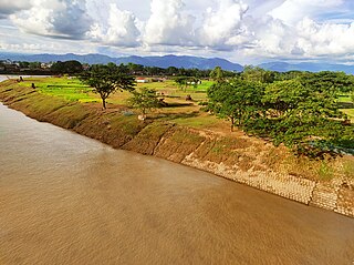
Boalmari is an upazila (sub-district) of Faridpur District in central Bangladesh, located in the Dhaka Division. It is named after its headquarters, the town of Boalmari.
Bhaluka is an upazila of the Mymensingh District located in Bangladesh. It is one of the oldest small business hubs in the area.
Atpara is the smallest upazila of Netrokona District, in the Division of Mymensingh, Bangladesh.
Shantiganj (Bengali: শান্তিগঞ্জ, romanized: Shantigônj, formerly known as South Sunamganj or Dakshin Sunamganj (Bengali: দক্ষিণ সুনামগঞ্জ, is an upazila of the Sunamganj District in Sylhet Division, Bangladesh.