Baniachong constituted the grand estate (zamindari) of Anwar Khan, who was looked upon as a raja by the local people. Estate of Baniachong was so vast, it crisscrossed all districts of Sylhet region as well as the greater Mymensingh, Dhaka and Comilla.[citation needed]
In accordance with the Pargana system introduced by Murshid Quli Khan in 1722, Anwar Khan claimed tenure of 28 Parganas of Muazzamabad, but his claim was rejected after an investigation by the revenue office, as these Parganas belong to the posterity of Shah Muazzam Uddin Qureshi, who assumed the name of Muazzam Khan when he ascended the throne of Muazzamabad.
Hence, these 28 Parganas: Banshikunda (Vamshikunda), Ranadigha, Shelvarsh, Sukhaid, Bétaal, Palash, Laxmanshree, Chamtala, Pagla (Paragala), Dohaliya, Bazu Jatua, Sinchapaid, Shafahar (Shaharpara), Sik Sonaita (Sonauta), Atuajan (Atuajahan), Aatgaon, Kuwazpur, Joar Baniyachung, Kasba Baniyachung, Jalsuka, Bithangal, Joanshahi, Mudaikaid (Mudakadi), Kuresha, Jantari (Yantri), Haveli Sonaita, Satar Sati and Paikuda, were allotted to new landholders that created numerous zamindars and taluquedars in former Muazzamabad (districts of Sunamganj and Habiganj).
The history of the battle between Anwar Khan and his brother Hussain Khan (Bara Bhuiyans of Baniachang) with the Mughal army in the first decade of the seventeenth century is found in the Baharistan-i-Gayebi. Zamindars of Banyachung was renowned for their generosity, but the last zamindar was more than generous; he was well known for his gullibility and his aged but adept and calculating servants such as dewans and chaudharies swindled him left, right and centre. By the time of the retirement, dewans and chauddharies working for Banyachung zamindar ended up holding more lands than the zamindar himself. This was achieved through a severance scheme conjured up by a shrewd dewan; this scheme made the zamindar honour-bound to grant land (taluque) to his servants on retirement and there were two categories of taluque: (i) Khalisa and (ii) Mujrahi, aka Mujrai. The first category of taluque, i.e. Khalisa, was reserved for the male servants and the second category of taluque, i.e. Mujrai, was reserved for zamindar's courtesans. This scheme ruined the zamindary of Baniyachung within a very short span of time and created numerous Khalisadar and Mujraidar in the region, who nowadays style themselves as chowdhury in Sylhet region.
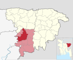
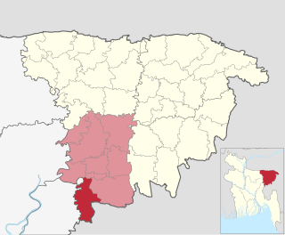
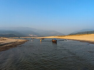
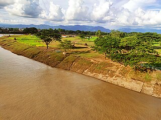
Baniachang Upazila is bounded by Sullah and Derai upazilas on the north, Habiganj Sadar and Lakhai upazilas on the south, Habiganj Sadar and Nabiganj upazilas on the east, Ajmiriganj, Mithamain and Austagram upazilas on the west. Main rivers are Kushiyara, Kalai and Barak. Notable beels: Charagaon, Bata, Sonamua, Dhala, Chatal and Chandra Beel.
According to the 2011 Bangladesh census, Baniachong Upazila had 59,433 households and a population of 332,530. 102,564 (30.84%) were under 10 years of age. Baniachong had a literacy rate (age 7 and over) of 34.65%, compared to the national average of 51.8%, and a sex ratio of 1029 females per 1000 males. 28,506 (8.57%) lived in urban areas.[3][4]
As of the 1991 Bangladesh census, Baniachong has a population of 3,34,605. Males constitute 50.84% of the population, and females 49.16%. This Upazila's eighteen up population is 115151. Baniachong has an average literacy rate of 20.8% (7+ years), and the national average of 32.4% literate.[5]
Baniachang (town) consists of 7 mouzas. The area of the town is 3.06km2. It has a population of 21,111; male 50.75%, female 49.25%. Literacy rate among the town people is 25.3%. Once the town was the capital of the ancient Loud Kingdom of Sylhet. It has one post house ("dak bungalow").
Administration
Baniachang thana, now an upazila, was established in 1790 and was turned into a sub-division of a district in 1934.
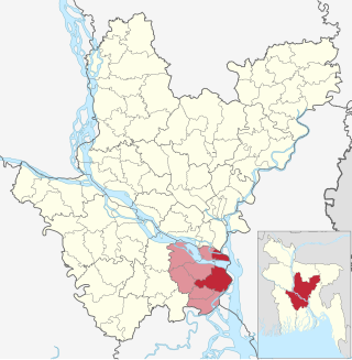
Baniachang Upazila is divided into 15 union parishads: Baraiuri, Dakshin Paschim Baniachong, Dakshin Purba Baniachong, Daulatpur, Kagapasha, Khagaura, Makrampur, Mandari, Muradpur, Pailar Kandi, Pukhra, Sujatpur, Subidpur, Uttar Paschim Baniachong, and Uttar Purba Baniachong. The union parishads are subdivided into 237 mauzas and 359 villages.[3]
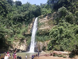
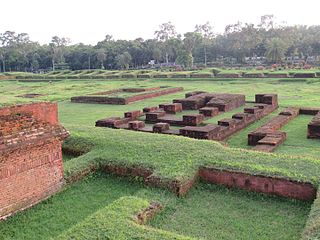
Archaeological heritage and relics remnants of ancient Rajbari (1737–38) at Puranbagh, Bibir Dargah Mosque, Bithangal Akhra.
Habiganj, formerly known as Habibganj, is a district in north-eastern Bangladesh, located in the Sylhet Division. It was established as a district in 1984 as a successor to its subdivision status since 1867. It is named after its headquarters, the town of Habiganj.
Haziganj or Hajiganj is an upazila of Chandpur District in the Division of Chittagong, Bangladesh.
Barura is an Upazila of Comilla District in the Division of Chittagong, Bangladesh.
Muradnagar is an upazila of the Comilla District in Chittagong Division, Bangladesh.
Lakhai is an upazila of Habiganj District in the Division of Sylhet, Bangladesh.
Madhabpur is an upazila (sub-district) of Habiganj District, located in Bangladesh's Sylhet Division.
Nabiganj is an Upazila of Habiganj District in the Division of Sylhet, Bangladesh.
Barlekha is an upazila (sub-district) of Moulvibazar District, located in Sylhet Division, Bangladesh.
Dharmapasha, also spelled as Dharampasha or Dharamapasha, is an upazila of Sunamganj District in the Division of Sylhet, Bangladesh.
Bishwanath is an upazila of Sylhet District in the Division of Sylhet, Bangladesh.
Golapganj Upazila, previously known as Gulabganj, is an upazila of Sylhet District in Sylhet Division, Bangladesh.
Companiganj is an upazila of Sylhet District in the Division of Sylhet, Bangladesh.
Kanaighat is an upazila of Sylhet Division of Bangladesh. It is the second-largest upazila (sub-district) of Sylhet District after Gowainghat Upazila. It is named after the town of Kanaighat, which is also the only municipality in the Upazila.
Bandar is an upazila (sub-district) of the Narayanganj District in central Bangladesh, part of the Dhaka Division. Bandar is a part of Greater Dhaka; the conurbation surrounding the Bangladeshi capital city of Dhaka.
Bhedarganj is an upazila (sub-district) of Shariatpur District in central Bangladesh, located in the Dhaka Division. It is a part of the Greater Faridpur region and is named after its administrative centre, the town of Bhedarganj.
Rajarhat is an upazila of Kurigram District in the Division of Rangpur, Bangladesh. Since 1981 it had been a Thana and later on September 14, 1983 was turned into an upazila by the government.
Sujanagar is an upazila of the Pabna District of northern Bangladesh's Rajshahi Division. It is the home of agriculture across the district, and the Onion Capital of the country.
Dakshin Surma, also known as South Surma, is an upazila of Sylhet District in Sylhet Division, Bangladesh.
Comilla Sadar Dakshin Upazila is an upazila of Comilla District in Chattogram Division, Bangladesh.
Shantiganj, formerly known as South Sunamganj or Dakshin Sunamganj, is an upazila of the Sunamganj District in Sylhet Division, Bangladesh.
This page is based on this Wikipedia article Text is available under the CC BY-SA 4.0 license; additional terms may apply. Images, videos and audio are available under their respective licenses.