
Lancashire is a ceremonial county in North West England. It is bordered by Cumbria to the north, North Yorkshire and West Yorkshire to the east, Greater Manchester and Merseyside to the south, and the Irish Sea to the west. The largest settlement is Blackpool, and the county town is the city of Preston.

Greater Manchester is a ceremonial county in North West England. It borders Lancashire to the north, Derbyshire and West Yorkshire to the east, Cheshire to the south, and Merseyside to the west. Its largest settlement is the city of Manchester.

The River Tame flows through Greater Manchester, England. It rises on Denshaw Moor and flows to Stockport where it joins the River Goyt to form the River Mersey.

Thirlmere is a reservoir in the Borough of Allerdale in Cumbria and the English Lake District. The Helvellyn ridge lies to the east of Thirlmere. To the west of Thirlmere are a number of fells; for instance, Armboth Fell and Raven Crag both of which give views of the lake and of Helvellyn beyond. It runs roughly south to north and is bordered on the eastern side for much of its length by the A591 road and on the western side by a minor road. It occupies the site of a former natural lake: this had a fordable waist so narrow that it was sometimes regarded as two lakes. In the 19th century Manchester Corporation constructed a dam at the northern end, raising the water level, flooding the valley bottom, and creating a reservoir to provide the growing industrial city of Manchester with water supplies via the 96 mile-long Thirlmere Aqueduct. The reservoir and the aqueduct still provide water to the Manchester area, but under the Water Act 1973 ownership passed to the North West Water Authority; as a result of subsequent privatisation and amalgamation they are now owned and managed by United Utilities, a private water and waste water company.
The Metropolitan Borough of Wigan is a metropolitan borough of Greater Manchester, England. It is named after its largest town, Wigan but covers a far larger area which includes the towns of Atherton, Ashton-in-Makerfield, Golborne, Hindley, Ince-in-Makerfield, Leigh and Tyldesley. The borough also covers the villages and suburbs of Abram, Aspull, Astley, Bryn, Hindley Green, Lowton, Mosley Common, Orrell, Pemberton, Shevington, Standish, Winstanley and Worsley Mesnes. The borough is also the second-most populous district in Greater Manchester.

Rochdale is a town in Greater Manchester, England, and the administrative centre of the Metropolitan Borough of Rochdale. In the 2021 census the town had a population of 111,261, compared to 223,773 for the wider borough. Rochdale is in the foothills of the South Pennines and lies in the dale (valley) of the River Roch, 5 miles (8 km) northwest of Oldham, and 10 miles (16 km) northeast of Manchester.

Milnrow is a town within the Metropolitan Borough of Rochdale, in Greater Manchester, England. It lies on the River Beal at the foothills of the South Pennines, and forms a continuous urban area with Rochdale. It is 2 miles (3.2 km) east of Rochdale town centre, 10 miles (16.1 km) north-northeast of Manchester, and spans from Windy Hill in the east to the Rochdale Canal in the west. Milnrow is adjacent to junction 21 of the M62 motorway, and includes the village of Newhey, and hamlets at Tunshill and Ogden.

Orrell is a suburb of Wigan in the Metropolitan Borough of Wigan, Greater Manchester, England. The population of the ward had fallen at the 2011 Census to 11,513. The area lies 3 miles (4.8 km) to the west of Wigan town centre. The area is contiguous with Pemberton.

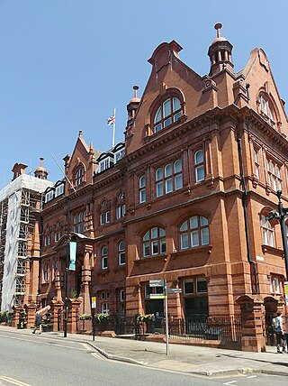
United Utilities Group plc (UU), the United Kingdom's largest listed water company, was founded in 1995 as a result of the merger of North West Water and NORWEB. The group manages the regulated water and waste water network in North West England, which includes Cumbria, Greater Manchester, Lancashire, Merseyside, most of Cheshire and a small area of Derbyshire, which have a combined population of more than seven million.
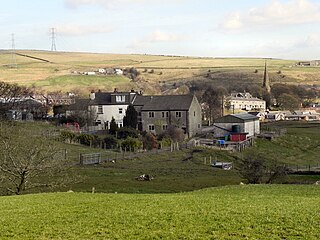
Wardle is a village near Littleborough within the Metropolitan Borough of Rochdale, in Greater Manchester, England. It lies amongst the foothills of the South Pennines, 1.8 miles (2.9 km) east-southeast of Whitworth, 2.5 miles (4 km) north-northwest of Rochdale and 12 miles (19 km) north-northeast of the city of Manchester.

Belmont is a village and former civil parish, now in the parish of North Turton, in the unitary authority area of Blackburn with Darwen, in the ceremonial county of Lancashire, England. It is close to Darwen and has around 500 inhabitants.

Pendleton is an inner-city suburb and district of Salford, Greater Manchester, England. The A6 dual carriageway skirts the east of the district. Historically in Lancashire, Pendleton experienced rapid urbanisation during the Industrial Revolution.
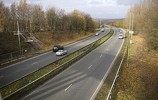
The A666 is a major road in Greater Manchester and Lancashire, England.

Edgworth is a small village within the borough of Blackburn with Darwen, Lancashire, England. It is north east of North Turton between Broadhead Brook on the west and Quarlton Brook in the south east. The ground ranges from 650 feet (200 m) to 1,100 feet (340 m) above sea level.

Rock Mill was cotton spinning mill in the Waterloo district of Ashton-under-Lyne, Greater Manchester, in England. It was built between 1891 and 1893 for the Ashton Syndicate by Sydney Stott of Oldham. Rock Mill was built on the site of Wilshaw Mill retaining and using the octagonal chimney. It ceased spinning cotton in the 1960s and was demolished in 1971; the site became the location for the town's first Asda supermarket, which opened in 1972, until Asda relocated to a much larger new store site in Cavendish Street in 1989.

Atlas Mill was a cotton spinning mill in the Waterloo district of Ashton-under-Lyne, Greater Manchester, in England. It was built between 1898 and 1900 for the Ashton Syndicate by Sydney Stott of Oldham. It was last mill in Ashton to cease spinning. It was spinning artificial fibres in 1987, it closed in 1990 and was demolished in 1994; the site is now a housing estate.

The Jumbles Reservoir is a heavily modified, high alkalinity, shallow reservoir in North West England. It lies in Jumbles Country Park, in the valley of Bradshaw Brook, partly in the Metropolitan Borough of Bolton, Greater Manchester, and partly in Blackburn with Darwen, Lancashire. It was opened on 11 March 1971 by Queen Elizabeth II for the then Bolton Corporation Waterworks. The reservoir's original purpose was to guarantee water for the Croal-Irwell river system and the associated industries.

Ward's Reservoir, known locally as the Blue Lagoon, is a small reservoir close to the village of Belmont, Lancashire, England. It is in the West Pennine Moors north of Bolton.

Rumworth Lodge Reservoir is a large shallow reservoir in Bolton, Greater Manchester, England.

