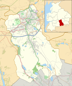
Lancashire is a ceremonial county in North West England. It is bordered by Cumbria to the north, North Yorkshire and West Yorkshire to the east, Greater Manchester and Merseyside to the south, and the Irish Sea to the west.

Blackburn is an industrial town and the administrative centre of the Blackburn with Darwen borough in Lancashire, England. The town is north of the West Pennine Moors on the southern edge of the Ribble Valley, 8 mi (13 km) east of Preston and 21 mi (34 km) north-northwest of Manchester. Blackburn is the core centre of the wider unitary authority area along with the town of Darwen. It is the second largest town in Lancashire.

Darwen is a market town and civil parish in the Blackburn with Darwen borough in Lancashire, England. The residents of the town are known as "Darreners". The A666 road passes through Darwen towards Blackburn to the north, Bolton to the south and Pendlebury where it joins the A6, about 18 miles (29 km) north-west of Manchester. The population of Darwen stood at 28,046 in the 2011 census. The town comprises four wards and has its own town council.
Padiham is a market town and civil parish on the River Calder, in the Borough of Burnley in Lancashire, England. It is located north west of Burnley, and north east of the towns of Clayton le Moors and Great Harwood. It is edged by the foothills of Pendle Hill to the north-west and north-east. The United Kingdom Census 2011 gave a parish population of 10,098, estimated in 2019 at 10,138.

Brierfield is a town and civil parish in the Borough of Pendle, in Lancashire, England. It is 3 miles (4.8 km) north east of Burnley, 1 mile (1.6 km) south west of Nelson, and 1 mile (1.6 km) north east of Reedley. The parish had a population of 8,193, at the census of 2011.

Radcliffe is a market town in the Metropolitan Borough of Bury, Greater Manchester, England. It lies in the Irwell Valley 7 miles (11 km) northwest of Manchester and 3 miles (5 km) southwest of Bury and is contiguous with Whitefield to the south. The disused Manchester Bolton & Bury Canal bisects the town.

Standish is a village in the Metropolitan Borough of Wigan, Greater Manchester, England. Within the boundaries of the historic county of Lancashire, it is on the A49 road between Chorley and Wigan, near Junction 27 of the M6 motorway. The population of the village was 13,278 in the 2011 census.

Rishton is a town in the Hyndburn district of Lancashire, England, about 2 miles (3 km) west of Clayton-le-Moors and 4 miles (6 km) north east of Blackburn. It was an urban district from about 1894 to 1974. The population at the census of 2011 was 6,625.

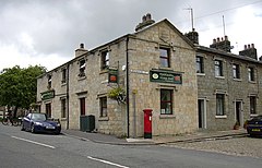
Feniscowles is a village in the unitary authority of Blackburn with Darwen, Lancashire, England. It lies approximately 3 miles (4.8 km) west of Blackburn, in the civil parish of Livesey.

Livesey is a civil parish in the unitary borough of Blackburn with Darwen, in the ceremonial county of Lancashire, England. The population of the civil parish at the 2011 census was 6,202.
North Turton is a civil parish of the unitary authority of Blackburn with Darwen in Lancashire, England. According to the United Kingdom Census 2001 the civil parish has a population of 3,736, increasing to 3,867 at the 2011 Census. North Turton is the northern part of the historic area of Turton. Created by the 1972 Local Government Act, the area is adminstered by Blackburn with Darwen Borough Council and North Turton Parish Council.

Eccleshill is a civil parish in the Borough of Blackburn with Darwen, Lancashire, England. The population of the parish was only 319, at the census of 2011. It contains the hamlets of Eccleshill, Grimshaw and Waterside. Located within the parish is Shaws of Darwen, whom manufacture goods such as sinks and architectural terracotta.

Yate and Pickup Bank is a civil parish in the borough of Blackburn with Darwen, Lancashire, England. The population of the civil parish taken at the census of 2011 was 366. The parish contains two hamlets, Bank Fold and Pickup Bank and part of the village of Belthorn which is on the boundary with Hyndburn. It has boundaries with the parishes of Eccleshill to the west and North Turton to the south.

Turton is a historical area in the North West of England. It is part of the ceremonial counties of Lancashire and Greater Manchester. The Turton area is located north of Bolton and south of Blackburn. The area historically formed a township in the ancient parish of Bolton le Moors. The principal village in the township is now known as Chapeltown.
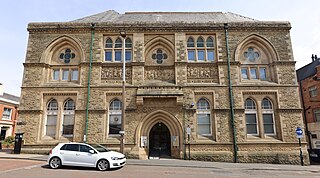
The Blackburn Museum and Art Gallery is the local museum service for the borough of Blackburn with Darwen Borough Council. It is a museum with collections of Christian icons, Egyptian hieroglyphs, and local history, as well as those of the former Lewis Textile Museum.

Lower Darwen is a village in the unitary borough of Blackburn with Darwen, contiguous with the town of Darwen, in the county of Lancashire. It is located between the towns of Blackburn and Darwen. Nearby places include Ewood and Blackamoor. It is situated in the valley of the River Darwen.

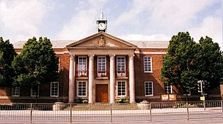
Blackburn with Darwen Borough Council is the local authority of Blackburn with Darwen in the ceremonial county of Lancashire, England. Since 1998 it has been a unitary authority, being a district council which also performs the functions of a county council; it is independent from Lancashire County Council.

Hapton is a village and civil parish in the Borough of Burnley in Lancashire, England, 3 miles (4.8 km) west of Burnley, with a railway station on the East Lancashire Line. At the United Kingdom Census 2011, it had a population of 1,979.

Empress Mill, Ince was a single storey shed mill alongside the Leeds and Liverpool Canal, spinning cotton in Ince, Wigan, Greater Manchester, England. It was acquired by the Lancashire Cotton Corporation in 1930, and passed to Courtaulds in 1964. Production ceased in 1975. It was the last mill in Ince to close, despite the intervention of Member of Parliament Michael McGuire, and a debate in the House of Commons on 20 March 1975.

Imperial Mill, Blackburn is a cotton spinning mill at Wallace and Gorse Street in Greenbank, Blackburn, Lancashire, England. It was designed by P.S. Stott, built in 1901, on the banks of the Leeds and Liverpool Canal. It was taken over by the Lancashire Cotton Corporation in the 1929's and production finished in 1980.