Lower Darwen

Last updated

Lower Darwen
Fore Street United Methodist Free Church, Lower Darwen (geograph 2515049).jpg
Fore Street United Methodist Free Church
Location map United Kingdom Blackburn.svg
Red pog.svg
Lower Darwen
Shown within Blackburn
Location map United Kingdom Blackburn with Darwen.svg
Red pog.svg
Lower Darwen
Shown within Blackburn with Darwen
Lancashire UK location map.svg
Red pog.svg
Lower Darwen
Location within Lancashire
OS grid reference SD688250
Unitary authority
Ceremonial county
Region
Country England
Sovereign state United Kingdom
Post town DARWEN
Postcode district BB3
Dialling code 01254
Police Lancashire
Fire Lancashire
Ambulance North West
UK Parliament
List of places
UK
England
Lancashire
53°43′16″N2°28′23″W / 53.721°N 2.473°W / 53.721; -2.473

Lower Darwen is a village in the unitary borough of Blackburn with Darwen, contiguous with the town of Darwen, in the county of Lancashire. It is located between the towns of Blackburn and Darwen. Nearby places include Ewood and Blackamoor. It is situated in the valley of the River Darwen.

Contents

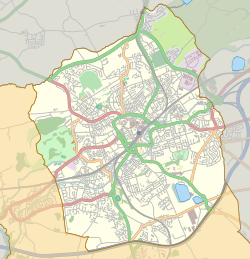
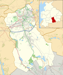
The former township of Lower Darwen, abolished in the 1890s, extended south to Earnsdale Brook, [1] and included areas now in the town of Darwen. [2]

History

Until the end of the eighteenth century, Lower Darwen was a farming area. The first cotton mill in the village of Lower Darwen was built about the year 1774, by Mr. Thomas Eccles, yeoman and manufacturer. [3] Although this did not have a major impact on the village at first, by the 1820s, the majority of the village was involved in the textile industry. [4]

Lower Darwen was formerly a township and chapelry in the parish of Blackburn, [5] in 1866 Lower Darwen became a separate civil parish, [6] on 25 March 1893 the parish was abolished and merged with Blackburn. [7] In 1891 the parish had a population of 5573. [8] It is now in the unparished area of Blackburn.

Lower Darwen is on the Blackburn to Bolton railway line, and the line through the village was opened in 1847. [9] Lower Darwen formerly had a railway station, however, this closed in 1958. [10] There was also a motive power depot north of the station, which closed in the 1960s. [9] Since the 1980s, the village has expanded rapidly, with many new houses being built, including one large estate on the site formerly occupied by ROF Blackburn.

It is not far from junction four of the M65 Motorway.

A new road was built when the M65 was extended and the junction four created. Originally named Eccleshill Road, the road was renamed to Paul Rink Way in September 2008. Blackburn with Darwen Borough Council has stated it chose this road for the renaming because it would not affect anyone, as there are no houses or business directly on the road. [11]

On this road is a new housing estate, along with a Premier Inn and Brewers Fayre.

Notable people

Related Research Articles

<span class="mw-page-title-main">Blackburn</span> Town in Lancashire, England

Blackburn is an industrial town and the administrative centre of the Blackburn with Darwen borough in Lancashire, England. The town is north of the West Pennine Moors on the southern edge of the Ribble Valley, 8 mi (13 km) east of Preston and 21 mi (34 km) north-northwest of Manchester. Blackburn is the core centre of the wider unitary authority area along with the town of Darwen. It is the second largest town in Lancashire.

<span class="mw-page-title-main">Blackburn with Darwen</span> Borough in England

Blackburn with Darwen is a borough and unitary authority area in Lancashire, North West England. It consists of the towns of Blackburn and Darwen but covers a wider area which includes the villages of Lower Darwen, Feniscowles, Brownhill and Hoddlesden.

<span class="mw-page-title-main">Darwen</span> Human settlement in England

Darwen is a market town and civil parish in the Blackburn with Darwen borough in Lancashire, England. The residents of the town are known as "Darreners". The A666 road passes through Darwen towards Blackburn to the north, Bolton to the south and Pendlebury where it joins the A6, about 18 miles (29 km) north-west of Manchester. The population of Darwen stood at 28,046 in the 2011 census. The town comprises four wards and has its own town council.

<span class="mw-page-title-main">Clayton-le-Moors</span> Human settlement in England

Clayton-le-Moors is an industrial town in the borough of Hyndburn in the county of Lancashire, England. located two miles north of Accrington. The town has a population of 8,522 according to the 2011 census.

<span class="mw-page-title-main">Barugh, South Yorkshire</span> Village in South Yorkshire, England

Barugh is a village in the metropolitan borough of Barnsley in South Yorkshire, England. The village falls within the Barnsley Metropolitan ward of Darton West. Until 1974 it was in the West Riding of Yorkshire.

<span class="mw-page-title-main">Ardsley, South Yorkshire</span> Village in South Yorkshire, England

Ardsley is a small village approximately 3 miles (5 km) east from Barnsley and forms part of the Metropolitan Borough of Barnsley of South Yorkshire, England. The village is in the Stairfoot ward of Barnsley Metropolitan Council. It is historically part of the West Riding of Yorkshire. The A635 divides the village into two parts.

<span class="mw-page-title-main">Belmont, Lancashire</span> Human settlement in England

Belmont is a village and former civil parish, now in the parish of North Turton, in the unitary authority area of Blackburn with Darwen, in the ceremonial county of Lancashire, England. It is close to Darwen and has around 500 inhabitants.

<span class="mw-page-title-main">Altham, Lancashire</span> Human settlement in England

Altham is a village and civil parish in the Borough of Hyndburn, in Lancashire, England. The village is 4 miles (6.4 km) west of Burnley, 3 miles (4.8 km) north of Accrington, and 2 miles (3.2 km) north-east of Clayton-le-Moors, and is on the A678 Blackburn to Burnley road.

<span class="mw-page-title-main">River Roddlesworth</span> River in Lancashire, England

The River Roddlesworth is a river in Lancashire, England, a tributary of the River Darwen.

<span class="mw-page-title-main">Livesey</span>

Livesey is a civil parish in the unitary borough of Blackburn with Darwen, in the ceremonial county of Lancashire, England. The population of the civil parish at the 2011 census was 6,202.

<span class="mw-page-title-main">A678 road</span> Road in Lancashire, England

The A678 is a road in Lancashire, England, which runs between the towns of Blackburn and Padiham.

<span class="mw-page-title-main">Belthorn</span> Human settlement in England

Belthorn is a small moorland village situated to the south-east of Blackburn in Lancashire, England. It is about two-thirds of a mile (1.1 km) away from junction 5 of the M65 motorway, which runs from Colne to Preston. Belthorn has a primary school, Belthorn Academy, and a large playing field with a children's recreational area.

<span class="mw-page-title-main">Newchurch, Lancashire</span> Human settlement in England

Newchurch or Newchurch in Rossendale is a village within the borough of Rossendale in Lancashire, England. It is around one mile east of Rawtenstall and half a mile north of Waterfoot.

<span class="mw-page-title-main">Higher Walton, Lancashire</span> Human settlement in England

Higher Walton is a village in South Ribble, Lancashire, England. It is on the old road between Blackburn and Preston where it crosses the River Darwen. The road, at this point, is now part of the A675. Nearby places include Walton-le-Dale, Coupe Green, and Bamber Bridge.

<span class="mw-page-title-main">Ribbleton</span> Human settlement in England

Ribbleton is a suburb and ward of the city of Preston, Lancashire, England. It is located to the east of the city centre, between the A59 New Hall Lane and the B6243 Longridge Road. The M6 motorway also runs through the area. The ward had a population of 7,351 recorded in the 2001 census increasing to 8,548 at the 2011 Census.

<span class="mw-page-title-main">Wilpshire</span> Human settlement in England

Wilpshire is a village and civil parish in the county of Lancashire, England. It is 2.5 miles (4.0 km) north of Blackburn, and forms part of the town's urban area, although it is in the Ribble Valley local government district. In the 2001 United Kingdom census, the parish had a population of 2,569, increasing to 2,582 at the 2011 Census.

<span class="mw-page-title-main">Little Harwood</span> Suburb of Blackburn, England)

Little Harwood is a suburb of Blackburn in the Blackburn with Darwen district, in the ceremonial county of Lancashire, England, situated at the northern edge of the town.

<span class="mw-page-title-main">Kenyon, Cheshire</span> Human settlement in England

Kenyon is a village and former civil parish, now in the parish of Croft, in the Warrington district, in the ceremonial county of Cheshire, England. In 1931 the parish had a population of 259.

<span class="mw-page-title-main">Carleton, Lancashire</span> Village in Lancashire, England

Carleton is a village on the coastal plain of the Fylde in the Borough of Wyre in Lancashire, England. It consists of Great Carleton, Little Carleton, Norcross and Whiteholme and is situated close to Poulton-le-Fylde. Other nearby settlements include Thornton, Bispham and Blackpool. Historically, Carleton was in the parish of Poulton-le-Fylde. It borders the Borough of Blackpool immediately to the west.

<span class="mw-page-title-main">Coates (ward)</span> Human settlement in England

Coates was one of the 20 electoral wards that formed the Parliamentary constituency of Pendle, Lancashire, England. The ward returned three councillors to represent the northern half of Barnoldswick on Pendle Borough Council. The incumbent councillors were Marjorie Adams, Lindsay Gaskell and Janine Throupe, all Liberal Democrats. As of the May 2011 Council election, Coates had an electorate of 4,166. In 2020 the ward was abolished.

References

  1. William Farrer; J Brownbill (eds.). A History of the County of Lancaster. Vol. 6 (1911): Townships: Lower Darwen. pp. 275–278. Retrieved 25 March 2010 via British History Online.
  2. "Darwen Historic Towns Assessment Report" (PDF). Lancashire Historic Town Survey Programme. Lancashire County Council. May 2005. Archived from the original (PDF) on 12 June 2011. Retrieved 25 March 2010.
  3. Lower Darwen Mill Archived 4 May 2005 at the Wayback Machine
  4. Lower Darwen Village Archived 4 May 2005 at the Wayback Machine
  5. "History of Lower Darwen, in Blackburn with Darwen and Lancashire". A Vision of Britain through Time . Retrieved 25 March 2024.
  6. "Relationships and changes Lower Darwen CP/Tn through time". A Vision of Britain through Time. Retrieved 25 March 2024.
  7. "Blackburn Registration District". UKBMD. Retrieved 25 March 2024.
  8. "Population statistics Lower Darwen CP/Tn through time". A Vision of Britain through Time. Retrieved 25 March 2024.
  9. 1 2 Taylor, Stuart (2003). Blackburn's Railways in the 1950s and 60s. Bredbury, Greater Manchester: Foxline (Publications). ISBN   978-1-870119-84-9.
  10. James, David (2004). Lancashire's Lost Railways. Catrine, Ayrshire: Stenlake Publishing. ISBN   978-1-84033-288-9. OCLC   56002103.
  11. Pye, Catherine (9 September 2008). "Darwen road tribute to green pioneer". Blackburn Citizen. Newsquest Media Group . Retrieved 23 March 2010.