Eccleshill, Lancashire

Last updated

Eccleshill
Nos 1to 9 Leonard Terrace, Waterside - geograph.org.uk - 158168.jpg
Leonard Terrace, Waterside (April 2006)
Location map United Kingdom Blackburn with Darwen.svg
Red pog.svg
Eccleshill
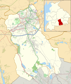
Shown within Blackburn with Darwen
Lancashire UK location map.svg
Red pog.svg
Eccleshill
Location within Lancashire
Population319 (2011 Census)
OS grid reference SD707236
Civil parish
  • Eccleshill
District
Shire county
Region
Country England
Sovereign state United Kingdom
Post town DARWEN
Postcode district BB3
Dialling code 01254
Police Lancashire
Fire Lancashire
Ambulance North West
UK Parliament
List of places
UK
England
Lancashire
53°42′29″N2°26′35″W / 53.708°N 2.443°W / 53.708; -2.443

Eccleshill is a civil parish in the Borough of Blackburn with Darwen, Lancashire, England. The population of the parish was only 319, at the census of 2011. [1] [2] It contains the hamlets of Eccleshill, Grimshaw and Waterside. [3] Located within the parish is Shaws of Darwen, whom manufacture goods such as sinks and architectural terracotta.

The factory situated in Waterside opened in 1908, and in the 1920s, the company was the largest employer in Darwen. [4]

The Lancashire and Yorkshire Railway's Hoddlesden Branch Line, the goods line opened in 1876 passed through the parish. It was built to provide one service to Hoddlesden, south of Eccleshill and although the passenger service was proposed the application was not successful. The goods station at Hoddlesden closed in 1950, but the line remained open to Waterside to serve Shaws of Darwen until 1962. [5]
See also

Related Research Articles

<span class="mw-page-title-main">Blackburn</span> Town in Lancashire, England

Blackburn is an industrial town and the administrative centre of the Blackburn with Darwen borough in Lancashire, England. The town is north of the West Pennine Moors on the southern edge of the Ribble Valley, 8 mi (13 km) east of Preston and 21 mi (34 km) north-northwest of Manchester. Blackburn is the core centre of the wider unitary authority area along with the town of Darwen. It is the second largest town in Lancashire.

<span class="mw-page-title-main">Blackburn with Darwen</span> Borough in England

Blackburn with Darwen is a borough and unitary authority area in Lancashire, North West England. It consists of the towns of Blackburn and Darwen but covers a wider area which includes the villages of Lower Darwen, Feniscowles, Brownhill and Hoddlesden.

<span class="mw-page-title-main">Darwen</span> Human settlement in England

Darwen is a market town and civil parish in the Blackburn with Darwen borough in Lancashire, England. The residents of the town are known as "Darreners". The A666 road passes through Darwen towards Blackburn to the north, Bolton to the south and Pendlebury where it joins the A6, about 18 miles (29 km) north-west of Manchester. The population of Darwen stood at 28,046 in the 2011 census. The town comprises four wards and has its own town council.

<span class="mw-page-title-main">Carnforth</span> Town and civil parish in Lancashire, England

Carnforth is a market town and civil parish in the City of Lancaster in Lancashire, England, situated at the north-east end of Morecambe Bay. The parish of Carnforth had a population of 5,560 in the 2011 census, an increase from the 5,350 recorded in the 2001 census. The town is situated around 7 miles north of Lancaster, 17 miles south of Kendal, 40 miles east of Barrow-in-Furness and 28 miles northwest of Settle. The town is also close to the Cumbria/Lancashire border.

<span class="mw-page-title-main">Metropolitan Borough of Wigan</span> Borough of Greater Manchester, England

The Metropolitan Borough of Wigan is a metropolitan borough of Greater Manchester, England. It is named after its largest town, Wigan but covers a far larger area which includes the towns of Atherton, Ashton-in-Makerfield, Golborne, Hindley, Ince-in-Makerfield, Leigh and Tyldesley. The borough also covers the villages and suburbs of Abram, Aspull, Astley, Bryn, Hindley Green, Lowton, Mosley Common, Orrell, Pemberton, Shevington, Standish, Winstanley and Worsley Mesnes. The borough is also the second-most populous district in Greater Manchester.

<span class="mw-page-title-main">Westhoughton</span> Town in Greater Manchester, England

Westhoughton is a town and civil parish in the Metropolitan Borough of Bolton, Greater Manchester, England, 4 miles (6 km) southwest of Bolton, 5 miles (8 km) east of Wigan and 13 miles (21 km) northwest of Manchester.

<span class="mw-page-title-main">Eccleshill, Bradford</span> Area of Bradford, West Yorkshire, England

Eccleshill is an area, former village, and ward within the City of Bradford Metropolitan District Council in the county of West Yorkshire, England. The ward population of Eccleshill is 17,540, increasing at the 2011 Census to 17,945. Eccleshill is a more or less completely residential urban area with very little open space although there is substantial open land directly to the east.

<span class="mw-page-title-main">Shaw and Crompton</span> Civil parish in Greater Manchester, England

Shaw and Crompton is a civil parish in the Metropolitan Borough of Oldham, Greater Manchester, England, and lies on the River Beal at the foothills of the South Pennines. It is located 2.3 miles (3.7 km) north of Oldham, 3.6 miles (5.8 km) south-east of Rochdale and 8.7 miles (14 km) north-east of Manchester. Its largest settlement is Shaw.

<span class="mw-page-title-main">Feniscowles</span> Human settlement in England

Feniscowles is a village in the unitary authority of Blackburn with Darwen, Lancashire, England. It lies approximately 3 miles (4.8 km) west of Blackburn, in the civil parish of Livesey.

<span class="mw-page-title-main">Livesey</span>

Livesey is a civil parish in the unitary borough of Blackburn with Darwen, in the ceremonial county of Lancashire, England. The population of the civil parish at the 2011 census was 6,202.

North Turton is a civil parish of the unitary authority of Blackburn with Darwen in Lancashire, England. According to the United Kingdom Census 2001 the civil parish has a population of 3,736, increasing to 3,867 at the 2011 Census. North Turton is the northern part of the historic area of Turton.

<span class="mw-page-title-main">Pleasington</span> Human settlement in England

Pleasington is a village and civil parish in the Borough of Blackburn with Darwen, Lancashire, England. It had a population of 467 in the 2001 census, reducing to 446 at the 2011 census.

<span class="mw-page-title-main">Yate and Pickup Bank</span> Civil parish in Blackburn with Darwen, Lancashire, UK

Yate and Pickup Bank is a civil parish in the borough of Blackburn with Darwen, Lancashire, England. The population of the civil parish taken at the census of 2011 was 366. The parish contains two hamlets, Bank Fold and Pickup Bank and part of the village of Belthorn which is on the boundary with Hyndburn. It has boundaries with the parishes of Eccleshill to the west and North Turton to the south.

<span class="mw-page-title-main">Lower Darwen</span> Human settlement in England

Lower Darwen is a village in the unitary borough of Blackburn with Darwen, contiguous with the town of Darwen, in the county of Lancashire. It is located between the towns of Blackburn and Darwen. Nearby places include Ewood and Blackamoor. It is situated in the valley of the River Darwen.

<span class="mw-page-title-main">Wilpshire</span> Human settlement in England

Wilpshire is a village and civil parish in the county of Lancashire, England. It is 2.5 miles (4.0 km) north of Blackburn, and forms part of the town's urban area, although it is in the Ribble Valley local government district. In the 2001 United Kingdom census, the parish had a population of 2,569, increasing to 2,582 at the 2011 Census.

<span class="mw-page-title-main">Hoddlesden</span> Human settlement in England

Hoddlesden is a village in the borough of Blackburn with Darwen, in Lancashire, England. The village population at the 2011 census was 1,239. It is in the borough's East Rural ward, and is situated east of Darwen. To the north there are the parishes of Eccleshill and Yate and Pickup Bank, to the east there is Haslingden Grane, part of the West Pennine Moors, and to the south-west there is Blacksnape, a small hamlet.

<span class="mw-page-title-main">Trent Mill</span> Cotton mill in Greater Manchester, England

Trent Mill was a cotton spinning mill on Duchess Street in Shaw and Crompton, Greater Manchester, England. It was built by F.W. Dixon & Son in 1908. It closed and was taken over by the Lancashire Cotton Corporation in 1929 reopened in 1938 and closed again in 1962, and was demolished in 1967.

<span class="mw-page-title-main">Hawk Mill, Shaw</span> Cotton mill in Greater Manchester, England

Hawk Mill, Shaw was a cotton spinning mill in Shaw, Oldham, Greater Manchester. It was built in 1908. It was taken over by the Lancashire Cotton Corporation in the 1931 and passed to Courtaulds in 1964. The mill closed in 1967, and was demolished in 1991.

<span class="mw-page-title-main">Newby Mill, Shaw</span> Cotton mill in Greater Manchester, England

Elm Mill, was a four-storey cotton spinning mill in Shaw and Crompton, Greater Manchester, England. It was built in 1890 for the Elm Spinning Company Ltd., and was called Elm Mill until it closed in 1928. It was revived by the Lancashire Cotton Corporation in 1929 and called Newby Mill. LCC and all their assets passed to Courtaulds in 1964. Production at Newby finished in 1970, and it was used for warehousing. Subsequently, named Shaw No 3 Mill, it became part of Littlewood's Shaw National Distribution Centre. It was demolished to make way for housing in 2022.

References

  1. UK Census (2011). "Local Area Report – Eccleshill Parish (1170211124)". Nomis. Office for National Statistics . Retrieved 4 March 2018.{{cite web}}: CS1 maint: date and year (link)
  2. "Eccleshill Parish Council". lancashireparishcouncils.gov.uk. 11 February 2007. Archived from the original on 11 February 2007. Retrieved 30 October 2020.
  3. "Map of Eccleshill parish". Lancashire County Council. 4 March 2008. Retrieved 4 March 2008.
  4. "About Shaws of Darwen". Shaws of Darwen. 16 May 2008. Archived from the original on 16 May 2008. Retrieved 4 March 2008.
  5. "England & Wales: closed railways". 5 September 2008. Archived from the original on 5 September 2008. Retrieved 17 December 2008.