Tockholes

Last updated

Tockholes
Victoria Hotel, Tockholes - geograph.org.uk - 151012.jpg
Tockholes village
Location map United Kingdom Blackburn with Darwen.svg
Red pog.svg
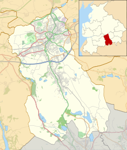
Tockholes
Shown within Blackburn with Darwen
Lancashire UK location map.svg
Red pog.svg
Tockholes
Location within Lancashire
Population478 (2011)
OS grid reference SD665235
Civil parish
  • Tockholes
Unitary authority
Ceremonial county
Region
Country England
Sovereign state United Kingdom
Post town DARWEN
Postcode district BB3
Dialling code 01254
Police Lancashire
Fire Lancashire
Ambulance North West
UK Parliament
List of places
UK
England
Lancashire
53°42′22″N2°30′29″W / 53.706°N 2.508°W / 53.706; -2.508

Tockholes is a village and civil parish which forms part of the Blackburn with Darwen unitary authority in the English county of Lancashire, [1] England. Tockholes consists of the village of Tockholes itself and the hamlet of Ryal Fold, and has a population of 454, [2] increasing to 478 at the 2011 Census. [3] It lies on the West Pennine Moors and is surrounded by the towns of Blackburn to the north and Darwen to the east and by the villages of Belmont to the south and Withnell to the west. Darwen Tower is a prominent local landmark that lies to the east of Tockholes and the Roddlesworth Reservoirs and Tockholes forest plantation lie to the south with the M65 passing to the north. There are two churches: Tockholes United Reformed Church and Saint Stephen's Church.

Contents

History

Early settlement

Archaeological records for the area in and around Tockholes reveal the presence of Tribal communities as early as 2,000BC. [4] The area is thought to have been inhabited by both Celtic and Anglo-Saxon settlers. Artifacts found in the area to support early settlement include a stone axe head, bronze spear head and later coins. There is a strong connection with early settlers nearby with Bronze Age barrows, stone circles, settlements and a variety of objects all being found over the surrounding countryside. Despite running close to an ancient Roman route between Preston and Bolton, There is little evidence of any Roman settlement at Tockholes.

13th & 14th centuries

In the first half of the 13th century Tockholes was found to be held in thegnage by a local family of the name of Pleasington for a yearly service of 2s. [5] The manor was split in half between Robert de Pleasington and Elias de Pleasington. The manor was subsequently held in demesne by a Joice de Tockholes and a Geoffrey de Sutton. In around 1250 Joice de Tockholes released his tenement to His Lord Elias de Pleasington and at some point during the early reign of Edward I, A William de Livesey was mesne tenant here and was granted the feudal rights and services due from Geoffrey de Sutton. [6]

In 1314–15 the son of John de Pleasington, Robert conveyed his land to William de Holand and in 1332 he granted the manor of Tockholes in fee to Robert de Radcliffe.

Civil War

In 1833 a large pit was discovered in Tockholes located in a field with the official title of "Pit Field", this field had previously been known locally as "Kill Field". In the pit were found the remains of some forty horses along with Cannonballs, Clubs and Large Buttons.

At some point during the Civil War, either during the course of the Earl of Derby's movements between Preston, Bolton, and Blackburn in 1643, or in 1644 with the passage of Prince Rupert's army, severe fighting took place about the lower part of Tockholes, in the vicinity of the church and then on to Cartridge-hill and Hollinshead Hall. Several cannonballs have been picked up in other parts of Tockholes, One was found in a field just above the Bethesda Chapel and another was found on Cartridge-hill, a lofty fell a mile or so further to the south above Hollinshead Hall. Musket bullets have also been found in a field behind the Old Independent Chapel only a short distance from the "Kill Field" Pit. The artifacts recovered in Tockholes seem to indicate a severe battle in which troops, horses and musketeers were engaged and in which at least one piece of ordnance was brought into use by one side or the other. A battle in which at least forty horses were killed must have been quite a fierce one for such a small village.

As the pit was found so close to the old Church of Tockholes, it is supposed that the bodies of the soldiers killed in the Battle would have been removed and buried in consecrated ground, their weapons and items of value being claimed by the prevailing side. [7]

20th Century to Present

Ruined Well House of Hollinshead Hall The Well House, Hollinshead Hall ruins - geograph.org.uk - 116184.jpg
Ruined Well House of Hollinshead Hall

Approximately two miles to the south are the ruins of Hollinshead Hall, the former Tockholes manor house and what may be an older Manor house can be found on the road from the centre of the village known as Top o't Low past Victoria Terrace and the Bethesda Chapel towards Abbey Village. This Manor house was still occupied during the 1930s though not by the original family.

Tockholes itself has quite a lot of history. During the time of the religious purges it was a centre for nonconformist followers to come to worship. The Chapel situated at the bottom of Long Lane was one of the earliest Congregational Chapels in Lancashire though not in the present building. When slavery was still practised in England, I believe one of the local farmers went to Liverpool and bought a slave to work on his farm but the villagers objected so strongly at this that he was made to declare him a free man and pay him his due wages.[ citation needed ] The row of cottages in Silk Hall fold were built during the 17th century to accommodate silk weavers and the old weaving rooms are situated in the rooms at the top of the stone staircase the roof windows are still to be seen.

Tockholes was also host to the 'Live the Dream' rave that took place on 16 September 1989; that was a big turning point in house/techno culture. [8] [9]

Notable people

Among the notable people born in Tockholes is Charles Hill (1816–1889) who became an industrialist in Sweden.

See also

Related Research Articles

<span class="mw-page-title-main">Blackburn</span> Town in Lancashire, England

Blackburn is an industrial town and the administrative centre of the Blackburn with Darwen borough in Lancashire, England. The town is north of the West Pennine Moors on the southern edge of the Ribble Valley, 8 mi (13 km) east of Preston and 21 mi (34 km) north-northwest of Manchester. Blackburn is the core centre of the wider unitary authority area along with the town of Darwen. It is the second largest town in Lancashire.

<span class="mw-page-title-main">Blackburn with Darwen</span> Borough in England

Blackburn with Darwen is a borough and unitary authority area in Lancashire, North West England. It consists of the towns of Blackburn and Darwen but covers a wider area which includes the villages of Lower Darwen, Feniscowles, Brownhill and Hoddlesden.

<span class="mw-page-title-main">Darwen</span> Human settlement in England

Darwen is a market town and civil parish in the Blackburn with Darwen borough in Lancashire, England. The residents of the town are known as "Darreners". The A666 road passes through Darwen towards Blackburn to the north, Bolton to the south and Pendlebury where it joins the A6, about 18 miles (29 km) north-west of Manchester. The population of Darwen stood at 28,046 in the 2011 census. The town comprises four wards and has its own town council.

<span class="mw-page-title-main">Adlington, Lancashire</span> Town and civil parish in Lancashire, England

Adlington is a village and civil parish in Lancashire, England, near the West Pennine Moors and approximately three miles south of Chorley. It became a separate parish in 1842 then grew into a township around the textile and coal mining industries until these closed in the 1960s. It had a population of 5,270 at the 2001 census, but in the last decade this has risen by over 2,000 more people to 7,326. The measured population at the 2011 Census was 6,010. The Leeds and Liverpool Canal runs through the village and is host to White Bear Marina which is the largest marina on the Leeds and Liverpool Canal.

<span class="mw-page-title-main">Blackburn Hundred</span> Former sub-division of Lancashire, UK

Blackburn Hundred is a historic sub-division of the county of Lancashire, in northern England. Its chief town was Blackburn, in the southwest of the hundred. It covered an area similar to modern East Lancashire, including the current districts of Ribble Valley, Pendle, Burnley, Rossendale, Hyndburn, Blackburn with Darwen, and South Ribble.

<span class="mw-page-title-main">Little Lever</span> Village in Greater Manchester, England

Little Lever is a village in the Metropolitan Borough of Bolton, Greater Manchester, England. Within the Historic County of Lancashire, it is 2 miles (3.2 km) southeast of Bolton, 2 miles (3.2 km) west of Radcliffe and 4 miles (6.4 km) southwest of Bury. In the 19th century, the population was employed in cotton mills, paper mills, bleach works, terracotta works, a rope works and numerous collieries.

<span class="mw-page-title-main">Belmont, Lancashire</span> Human settlement in England

Belmont is a village and former civil parish, now in the parish of North Turton, in the unitary authority area of Blackburn with Darwen, in the ceremonial county of Lancashire, England. It is close to Darwen and has around 500 inhabitants.

<span class="mw-page-title-main">River Roddlesworth</span> River in Lancashire, England

The River Roddlesworth is a river in Lancashire, England, a tributary of the River Darwen.

<span class="mw-page-title-main">Hollinshead Hall</span>

Hollinshead Hall was a manor house close to the village of Tockholes, Lancashire. It is unclear whether the hall was originally the manor house of Tockholes, or if Hollinshead was indeed a manor in its own right alongside Tockholes and Livesey. The ruins of the hall are situated approximately 2 miles (3.2 km) south of the village.

<span class="mw-page-title-main">Livesey</span>

Bradshaw is a village of the unparished area of South Turton in the Metropolitan Borough of Bolton in Greater Manchester, England. It gives its name to the larger Bradshaw electoral ward, which includes Harwood. within the Historic County of Lancashire, Bradshaw lies on the southern edge of the West Pennine Moors.

<span class="mw-page-title-main">Pleasington</span> Human settlement in England

Pleasington is a village and civil parish in the Borough of Blackburn with Darwen, Lancashire, England. It had a population of 467 in the 2001 census, reducing to 446 at the 2011 census.

Turton is a historical area in the North West of England. It is divided between the ceremonial counties of Lancashire and Greater Manchester. The Turton area is located north of Bolton and south of Blackburn. The area historically formed a township in the ancient parish of Bolton le Moors. The principal village in the township is now known as Chapeltown.

Witton Football Club was a football club from Blackburn in Lancashire.

<span class="mw-page-title-main">Elma Yerburgh</span>

Elma Amy Yerburgh was a member of the Thwaites family who was owner and then chairman of the Thwaites Brewery company from 1888 to 1946. She was the daughter of Daniel Thwaites, M.P. for Blackburn, and was married to Robert Yerburgh, M.P. for Chester. In the town of Blackburn she was known for her generosity to the company's workers and as a public benefactor, who helped fund the construction of the War Memorial wing to Blackburn Royal Infirmary and helped found the town's Empire Theatre, now named after her. Her name was also commemorated in "Elma's Pound", a beer specially brewed by Thwaites Brewery for Christmas 2007 to celebrate their 200th anniversary.

<span class="mw-page-title-main">Grade I listed churches in Lancashire</span>

Lancashire is a county in North West England. In 1974 parts of the historic county were divided between Greater Manchester, Merseyside, Cheshire and Cumbria, and part of the West Riding of Yorkshire was transferred into the county, creating the non-metropolitan county of Lancashire. Together with the unitary authorities of Blackburn with Darwen and Blackpool it now forms the ceremonial county of Lancashire.

Pleasington is a civil parish in Blackburn with Darwen, Lancashire, England. The parish contains 12 buildings that are recorded in the National Heritage List for England as designated listed buildings. Of these, one is listed at Grade I, the highest of the three grades, one at Grade II*, the middle grade, and the others are at Grade II, the lowest grade. Apart from the village of Pleasington, the parish is rural, and many of the listed buildings are farmhouses. The other listed buildings are the parish church, an ice house, an entrance to Woodfold Park, and three bridges.

References

  1. "North Turton with Tockholes : Statistics and census information : Council and democracy : Blackburn with Darwen Borough Council". Archived from the original on 19 October 2012. Retrieved 24 October 2021.
  2. Office for National Statistics : Census 2001 : Parish Headcounts : Blackburn with Darwen Archived 12 June 2011 at the Wayback Machine Retrieved 4 February 2010
  3. UK Census (2011). "Local Area Report – Tockholes Parish (1170211128)". Nomis. Office for National Statistics . Retrieved 6 March 2018.
  4. "Sites and Finds Record", 1986, Central Lancashire Archaeological Research Unit
  5. Dods. MSS. cxlix, fol. 108b; Towneley MS. HH, no. 3350. Geoffrey de Sutton rendered 2s. yearly, of which sum 12d. was to be paid to Adam de Tockholes and his heirs for the fee of Tockholes and 12d. to Robert de Pleasington.
  6. "Townships: Tockholes | British History Online". British-history.ac.uk. Retrieved 24 October 2021.
  7. "Nightingale, B. (Benjamin), 1854–1927, History of the old Independent chapel Tockholes, near Blackburn Lancashire; or, About two centuries and a half of nonconformity in Tockholes"
  8. "Live the Dream: How Blackburn dominated warehouse raves in the Summer of Love". Mixmag.net.
  9. "Archived copy". Archived from the original on 30 December 2018. Retrieved 30 December 2018.{{cite web}}: CS1 maint: archived copy as title (link)

Commons-logo.svg Media related to Tockholes at Wikimedia Commons