Dosso del Liro

Last updated
Dosso del Liro
Comune
Comune di Dosso del Liro
Panorama di Dosso.JPG
Italy provincial location map 2015.svg
Red pog.svg
Dosso del Liro
Location of Dosso del Liro in Italy
Coordinates: 46°10′N9°16′E / 46.167°N 9.267°E / 46.167; 9.267 Coordinates: 46°10′N9°16′E / 46.167°N 9.267°E / 46.167; 9.267
Country Italy
Region Lombardy
Province Province of Como (CO)
Area
  Total 23.2 km2 (9.0 sq mi)
Population (Dec. 2004)
  Total 297
  Density 13/km2 (33/sq mi)
Time zone CET (UTC+1)
  Summer (DST) CEST (UTC+2)
Postal code22015
Dialing code 0344

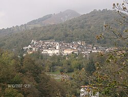
Dosso del Liro (Comasco: Dòss [ˈdɔs] ) is a comune (municipality) in the Province of Como in the Italian region Lombardy, located about 80 kilometres (50 mi) north of Milan and about 40 kilometres (25 mi) northeast of Como, on the border with Switzerland. As of 31 December 2004, it had a population of 297 and an area of 23.2 km². [1]

<i>Comune</i> third-level administrative divisions of the Italian Republic

The comune is a basic administrative division in Italy, roughly equivalent to a township or municipality.

Province of Como Province of Italy

The Province of Como is a province in the north of the Lombardy region of Italy and borders the Swiss cantons of Ticino and Grigioni to the North, the Italian provinces of Sondrio and Lecco to the East, the Province of Monza and Brianza to the south and the Province of Varese to the West. The city of Como is its capital — other large towns, with more than 10,000 inhabitants, include Cantù, Erba, Mariano Comense and Olgiate Comasco. Campione d'Italia also belongs to the province and is enclaved in the Swiss canton of Ticino.

Italy republic in Southern Europe

Italy, officially the Italian Republic, is a country in Southern and Western Europe. Located in the middle of the Mediterranean Sea, Italy shares open land borders with France, Switzerland, Austria, Slovenia and the enclaved microstates San Marino and Vatican City. Italy covers an area of 301,340 km2 (116,350 sq mi) and has a largely temperate seasonal and Mediterranean climate. With around 61 million inhabitants, it is the fourth-most populous EU member state and the most populous country in Southern Europe.

Dosso del Liro borders the following municipalities: Cama (Switzerland), Consiglio di Rumo, Gravedona, Grono (Switzerland), Livo, Peglio, Roveredo (Switzerland).

Cama, Switzerland Place in Graubünden, Switzerland

Cama is a municipality in the Moesa Region in the Swiss canton of Graubünden.

Consiglio di Rumo Frazione in Lombardy, Italy

Consiglio di Rumo is a frazione of the comune of Gravedona ed Uniti, Province of Como, Lombardy, northern Italy, located about 80 kilometres (50 mi) north of Milan and about 40 kilometres (25 mi) northeast of Como, on the border with Switzerland. It was a separate comune until May 16, 2011, when it was annexed by Gravedona, following an act of fusion passed by Lombardy Region.

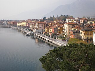
Gravedona was a comune of Como Province, Italy. It merged into Gravedona ed Uniti.

Demographic evolution

Dosso del Liro

Related Research Articles

Anzano del Parco Comune in Lombardy, Italy

Anzano del Parco is a comune (municipality) in the Province of Como in the Italian region Lombardy, located about 35 kilometres (22 mi) north of Milan and about 11 kilometres (7 mi) southeast of Como.

Bizzarone Comune in Lombardy, Italy

Bizzarone is a comune (municipality) in the Province of Como in the Italian region Lombardy, located about 45 kilometres (28 mi) northwest of Milan and about 11 kilometres (7 mi) west of Como, on the border with Switzerland.

Cavargna Comune in Lombardy, Italy

Cavargna is a comune (municipality) in the Province of Como in the Italian region Lombardy, located about 70 kilometres (43 mi) north of Milan and about 30 kilometres (19 mi) north of Como, on the border with Switzerland. As of 31 December 2004, it had a population of 296 and an area of 15.1 square kilometres (5.8 sq mi).

Cerano dIntelvi Comune in Lombardy, Italy

Cerano d'Intelvi is a comune (municipality) in the Province of Como in the Italian region Lombardy, located about 50 kilometres (31 mi) north of Milan and about 15 kilometres (9 mi) north of Como, on the border with Switzerland.

Cernobbio Comune in Lombardy, Italy

Cernobbio is a comune (municipality) in the province of Como, Lombardy, northern Italy. It is located about 40 kilometres (25 mi) north of Milan and about 2 kilometres (1 mi) northwest of Como, on the border with Switzerland and near the Lake Como. The highest peak is the Monte Bisbino, at 1,325 metres (4,347 ft).

Gravedona ed Uniti Comune in Lombardy, Italy

Gravedona ed Uniti is a comune (municipality) in the Province of Como in the Italian region Lombardy, located about 80 kilometres (50 mi) north of Milan and about 40 kilometres (25 mi) northeast of Como.

Livo, Lombardy Comune in Lombardy, Italy

Livo is a comune (municipality) in the Province of Como in the Italian region Lombardy, located about 80 kilometres (50 mi) north of Milan and about 40 kilometres (25 mi) northeast of Como, on the border with Switzerland. As of 31 December 2004, it had a population of 212 and an area of 32.5 km².

Maslianico Comune in Lombardy, Italy

Maslianico is a comune (municipality) in the Province of Como in the Italian region Lombardy, located about 45 kilometres (28 mi) north of Milan and about 5 kilometres (3 mi) northwest of Como, on the border with Switzerland. As of 31 December 2004, it had a population of 3,469 and an area of 1.3 km².

Moltrasio Comune in Lombardy, Italy

Moltrasio is a comune (municipality) in the Province of Como in the Italian region Lombardy, located about 45 kilometres (28 mi) north of Milan and about 6 kilometres (4 mi) north of Como, near the border with Switzerland, on the western shore of Lake Como.

Peglio, Lombardy Comune in Lombardy, Italy

Peglio is a comune (municipality) in the Province of Como in the Italian region Lombardy, located about 80 kilometres (50 mi) north of Milan and about 40 kilometres (25 mi) northeast of Como. As of 31 December 2004, it had a population of 209 and an area of 10.8 square kilometres (4.2 sq mi).

Rodero Comune in Lombardy, Italy

Rodero is a comune (municipality) in the Province of Como in the Italian region Lombardy, located about 45 kilometres (28 mi) northwest of Milan and about 13 kilometres (8 mi) west of Como, on the border with Switzerland.

Ronago Comune in Lombardy, Italy

Ronago is a comune (municipality) in the Province of Como in the Italian region Lombardy, located about 45 kilometres (28 mi) northwest of Milan and about 8 kilometres (5 mi) west of Como, on the border with Switzerland.

Schignano Comune in Lombardy, Italy

Schignano is a comune (municipality) in the Province of Como in the Italian region Lombardy, located about 50 kilometres (31 mi) north of Milan and about 13 kilometres (8 mi) north of Como, on the border with Switzerland.

Uggiate-Trevano Comune in Lombardy, Italy

Uggiate-Trevano is a comune (municipality) in the Province of Como in the Italian region Lombardy, located about 40 kilometres (25 mi) northwest of Milan and about 9 kilometres (6 mi) west of Como, on the border with Switzerland.

Valbrona Comune in Lombardy, Italy

Valbrona is a comune (municipality) in the Province of Como in the Italian region Lombardy, located about 45 kilometres (28 mi) north of Milan and about 20 kilometres (12 mi) northeast of Como. As of 31 December 2004, it had a population of 2,575 and an area of 13.9 square kilometres (5.4 sq mi).

Valsolda Comune in Lombardy, Italy

Valsolda is a comune (municipality) of about 1,400 inhabitants in the Province of Como in the Italian region Lombardy on the border with Switzerland. It is located about 60 kilometres (37 mi) north of Milan, about 25 kilometres (16 mi) north of Como and 2 kilometres (1.2 mi) east of Lugano.

Quistello Comune in Lombardy, Italy

Quistello is a comune (municipality) in the Province of Mantua in the Italian region Lombardy, located about 150 kilometres (93 mi) southeast of Milan and about 20 kilometres (12 mi) southeast of Mantua.

San Giacomo delle Segnate Comune in Lombardy, Italy

San Giacomo delle Segnate is a comune (municipality) in the Province of Mantua in the Italian region Lombardy, located about 160 kilometres (99 mi) southeast of Milan and about 30 kilometres (19 mi) southeast of Mantua.

San Giovanni del Dosso Comune in Lombardy, Italy

San Giovanni del Dosso is a comune (municipality) in the Province of Mantua in the Italian region Lombardy, located about 160 kilometres (99 mi) southeast of Milan and about 30 kilometres (19 mi) southeast of Mantua.

Schivenoglia Comune in Lombardy, Italy

Schivenoglia is a comune (municipality) in the Province of Mantua in the Italian region Lombardy, located about 160 kilometres (99 mi) southeast of Milan and about 30 kilometres (19 mi) southeast of Mantua.

References

  1. All demographics and other statistics: Italian statistical institute Istat.