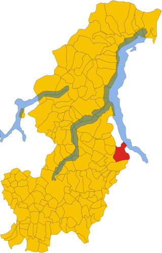
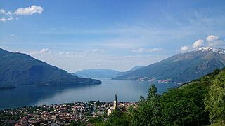
Alserio is a comune (municipality) in the Province of Como in the Italian region Lombardy, located about 35 kilometres (22 mi) north of Milan and about 10 kilometres (6 mi) southeast of Como. As of 31 December 2004, it had a population of 1,127 and an area of 1.9 square kilometres (0.73 sq mi).
Beregazzo con Figliaro is a comune (municipality) within the Province of Como, Lombardy, Italy. The municipality is located about 35 kilometres (22 mi) northwest of Milan and about 11 kilometres (7 mi) southwest of Como. As of 31 December 2004, it had a population of 2,387 and an area of 3.8 square kilometres (1.5 sq mi).
Capiago Intimiano is a comune (municipality) in the Province of Como in the Italian region Lombardy, located about 35 kilometres (22 mi) north of Milan and about 6 kilometres (4 mi) southeast of Como. As of 31 December 2004, it had a population of 5,196 and an area of 5.7 square kilometres (2.2 sq mi).
Carugo is a comune (municipality) in the Province of Como in the Italian region Lombardy, located about 30 kilometres (19 mi) north of Milan and about 14 kilometres (8.7 mi) southeast of Como. As of 31 December 2004, it had a population of 5,729 and an area of 4.1 square kilometres (1.6 sq mi).
Casnate con Bernate is a comune (municipality) in the Province of Como in the Italian region Lombardy, about 30 kilometres (19 mi) north of Milan and about 5 kilometres (3 mi) south of Como. As of 1 January 2010, it had a population of 4,908 and an area of 5.3 square kilometres (2.0 sq mi).
It comprises the fractions of Casnate and Bernate, which once were distinct municipalities until they were merged in July 1937.

Faggeto Lario is a comune (municipality) in the Province of Como in the Italian region of Lombardy, located about 45 kilometres (28 mi) north of Milan and about 7 kilometres (4 mi) northeast of Como.

Lezzeno is a comune (municipality) in the Province of Como in the Italian region Lombardy, located about 50 kilometres (31 mi) north of Milan and about 15 kilometres (9 mi) northeast of Como. As of 31 December 2004, it had a population of 2,088 and an area of 22.5 square kilometres (8.7 sq mi).

Lipomo is a comune (municipality) in the Province of Como in the Italian region Lombardy, located about 35 kilometres (22 mi) north of Milan and about 3 kilometres (2 mi) southeast of Como. As of 31 December 2004, it had a population of 5,758 and an area of 2.5 square kilometres (0.97 sq mi).

Peglio is a comune (municipality) in the Province of Como in the Italian region Lombardy, located about 80 kilometres (50 mi) north of Milan and about 40 kilometres (25 mi) northeast of Como. As of 31 December 2004, it had a population of 209 and an area of 10.8 square kilometres (4.2 sq mi).
Rezzago is a comune (municipality) in the Province of Como in the Italian region Lombardy, located about 45 kilometres (28 mi) north of Milan and about 14 kilometres (9 mi) northeast of Como. As of 30 November 2012, it had a population of 317 and an area of 3.8 square kilometres (1.5 sq mi).

Sala Comacina is a comune (municipality) in the Province of Como in the Italian region Lombardy, located about 60 kilometres (37 mi) north of Milan and about 20 kilometres (12 mi) northeast of Como. As of 31 December 2004, it had a population of 618 and an area of 5.3 square kilometres (2.0 sq mi).
Senna Comasco is a comune (municipality) in the Province of Como in the Italian region Lombardy, located about 35 kilometres (22 mi) north of Milan and about 6 kilometres (4 mi) south of Como. As of 31 December 2004, it had a population of 2,995 and an area of 2.7 square kilometres (1.0 sq mi).

Sorico is a comune (municipality) in the Province of Como in the Italian region Lombardy, located about 80 kilometres (50 mi) north of Milan and about 45 kilometres (28 mi) northeast of Como. As of 31 December 2004, it had a population of 1,188 and an area of 23.3 square kilometres (9.0 sq mi).
Stazzona is a comune (municipality) in the Province of Como in the Italian region Lombardy, located about 70 kilometres (43 mi) north of Milan and about 40 kilometres (25 mi) northeast of Como. As of 31 December 2004, it had a population of 672 and an area of 7.5 square kilometres (2.9 sq mi).

Torno is a comune (municipality) in the Province of Como in the Italian region Lombardy, located about 45 kilometres (28 mi) north of Milan and about 5 kilometres (3 mi) northeast of Como.
Trezzone is a comune (municipality) in the Province of Como in the Italian region Lombardy, located about 80 kilometres (50 mi) north of Milan and about 45 kilometres (28 mi) northeast of Como. As of 31 December 2004, it had a population of 212 and an area of 4.0 square kilometres (1.5 sq mi).

Valbrona is a comune (municipality) in the Province of Como in the Italian region Lombardy, located about 45 kilometres (28 mi) north of Milan and about 20 kilometres (12 mi) northeast of Como. As of 31 December 2004, it had a population of 2,575 and an area of 13.9 square kilometres (5.4 sq mi).
Veleso is a comune (municipality) in the Province of Como in the Italian region Lombardy, located about 50 kilometres (31 mi) north of Milan and about 12 kilometres (7 mi) northeast of Como. As of 31 December 2004, it had a population of 275 and an area of 5.9 square kilometres (2.3 sq mi).

Vercana is a comune (municipality) in the Province of Como in the Italian region Lombardy, located about 80 kilometres (50 mi) north of Milan and about 45 kilometres (28 mi) northeast of Como. As of 31 December 2004, it had a population of 729 and an area of 14.6 square kilometres (5.6 sq mi).
Zelbio is a comune (municipality) in the Province of Como in the Italian region Lombardy, located about 50 kilometres (31 mi) north of Milan and about 12 kilometres (7 mi) northeast of Como. As of 31 December 2004, it had a population of 206 and an area of 4.7 square kilometres (1.8 sq mi).


