
Albiolo is a comune (municipality) in the Province of Como in the Italian region Lombardy, located about 40 kilometres (25 mi) northwest of Milan and about 12 kilometres (7 mi) west of Como.
Appiano Gentile is a comune (municipality) in the Province of Como in the Italian region Lombardy, located about 35 kilometres (22 mi) northwest of Milan and about 12 kilometres (7 mi) southwest of Como.
Beregazzo con Figliaro is a comune (municipality) within the Province of Como, Lombardy, Italy. The municipality is located about 35 kilometres (22 mi) northwest of Milan and about 11 kilometres (7 mi) southwest of Como. As of 31 December 2004, it had a population of 2,387 and an area of 3.8 square kilometres (1.5 sq mi).
Bregnano is a comune (municipality) in the Province of Como in the Italian region Lombardy, located about 25 kilometres (16 mi) northwest of Milan and about 13 kilometres (8 mi) south of Como.
Capiago Intimiano is a comune (municipality) in the Province of Como in the Italian region Lombardy, located about 35 kilometres (22 mi) north of Milan and about 6 kilometres (4 mi) southeast of Como. As of 31 December 2004, it had a population of 5,196 and an area of 5.7 square kilometres (2.2 sq mi).
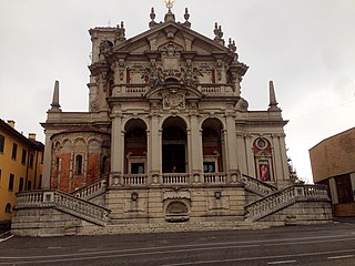
Carlazzo is a comune (municipality) in the Province of Como in the Italian region Lombardy, located about 60 kilometres (37 mi) north of Milan and about 25 kilometres (16 mi) north of Como. As of 31 December 2004, it had a population of 2,838 and an area of 12.7 square kilometres (4.9 sq mi).
Cusino is a comune (municipality) in the Province of Como in the Italian region Lombardy, located about 70 kilometres (43 mi) north of Milan and about 30 kilometres (19 mi) north of Como. As of 31 December 2004, it had a population of 247 and an area of 9.7 km².
Fenegrò is a comune (municipality) in the Province of Como in the Italian region Lombardy, located about 30 kilometres (19 mi) northwest of Milan and about 14 kilometres (9 mi) southwest of Como. As of 1 January 2022, it had a population of 3,211 and an area of 5.4 km².
Limido Comasco is a comune (municipality) in the Province of Como in the Italian region Lombardy, located about 30 kilometres (19 mi) northwest of Milan and about 15 kilometres (9 mi) southwest of Como. As of 31 December 2004, it had a population of 2,579 and an area of 4.5 km².
Lurago Marinone is a comune (municipality) in the Province of Como in the Italian region of Lombardy. The comune is located about 30 kilometres (19 mi) northwest of Milan and about 15 kilometres (9 mi) southwest of Como.
Lurate Caccivio is a comune (municipality) in the Province of Como in the Italian region Lombardy, located about 35 kilometres (22 mi) northwest of Milan and about 9 kilometres (6 mi) southwest of Como.
Olgiate Comasco is a comune (municipality) in the Province of Como in the Italian region Lombardy, located about 40 kilometres (25 mi) northwest of Milan and about 10 kilometres (6 mi) southwest of Como. It received the honorary title of city with a presidential decree in 1998.
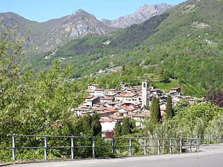
Plesio is a comune (municipality) in the Province of Como in the Italian region Lombardy, located about 70 kilometres (43 mi) north of Milan and about 30 kilometres (19 mi) northeast of Como. As of 31 December 2004, it had a population of 833 and an area of 17.0 square kilometres (6.6 sq mi).

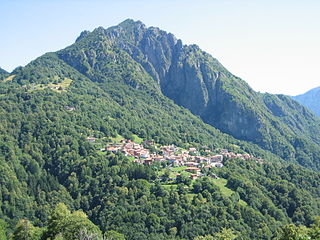
San Bartolomeo Val Cavargna is a comune (municipality) in the Province of Como in the Italian region Lombardy, located about 70 kilometres (43 mi) north of Milan and about 30 kilometres (19 mi) north of Como. As of 31 December 2004, it had a population of 1,102 and an area of 11.1 square kilometres (4.3 sq mi).
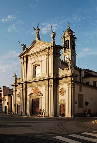
Senna Comasco is a comune (municipality) in the Province of Como in the Italian region Lombardy, located about 35 kilometres (22 mi) north of Milan and about 6 kilometres (4 mi) south of Como. As of 31 December 2004, it had a population of 2,995 and an area of 2.7 square kilometres (1.0 sq mi).
Stazzona is a comune (municipality) in the Province of Como in the Italian region Lombardy, located about 70 kilometres (43 mi) north of Milan and about 40 kilometres (25 mi) northeast of Como. As of 31 December 2004, it had a population of 672 and an area of 7.5 square kilometres (2.9 sq mi).

Val Rezzo is a comune (municipality) in the Province of Como in the Italian region Lombardy, located about 70 kilometres (43 mi) north of Milan and about 30 kilometres (19 mi) north of Como, on the border with Switzerland. As of 31 December 2004, it had a population of 202 and an area of 6.6 square kilometres (2.5 sq mi).
Veleso is a comune (municipality) in the Province of Como in the Italian region Lombardy, located about 50 kilometres (31 mi) north of Milan and about 12 kilometres (7 mi) northeast of Como. As of 31 December 2004, it had a population of 275 and an area of 5.9 square kilometres (2.3 sq mi).
Zelbio is a comune (municipality) in the Province of Como in the Italian region Lombardy, located about 50 kilometres (31 mi) north of Milan and about 12 kilometres (7 mi) northeast of Como. As of 31 December 2004, it had a population of 206 and an area of 4.7 square kilometres (1.8 sq mi).

Perledo is a comune (municipality) in the Province of Lecco in the Italian region Lombardy, located about 60 kilometres (37 mi) north of Milan and about 20 kilometres (12 mi) northwest of Lecco. As of 31 December 2004, it had a population of 900 and an area of 12.5 square kilometres (4.8 sq mi).


