Related Research Articles

The Byrd Glacier is a major glacier in Antarctica, about 136 km (85 mi) long and 24 km (15 mi) wide. It drains an extensive area of the Antarctic plateau, and flows eastward to discharge into the Ross Ice Shelf.
The Britannia Range is a range of mountains bounded by the Hatherton Glacier and Darwin Glacier on the north and the Byrd Glacier on the south, westward of the Ross Ice Shelf in Antarctica.

The Churchill Mountains is a major range of mountains and associated elevations bordering the western side of the Ross Ice Shelf, between Byrd Glacier and Nimrod Glacier. They are south of the Britannia Range and north of the Geologists Range, Miller Range and Queen Elizabeth Range.

Minnesota Glacier is a broad glacier, about 40 nautical miles long and 5 nautical miles wide, flowing east through the Ellsworth Mountains in Antarctica, separating the Sentinel Range and the Heritage Range. It is nourished by ice from the plateau west of the mountains and by Nimitz Glacier and Splettstoesser Glacier, and merges into the larger Rutford Ice Stream at the eastern margin of the Ellsworth Mountains.

The Heritage Range is a major mountain range, 160 km (99 mi) long and 48 km (30 mi) wide, situated southward of Minnesota Glacier and forming the southern half of the Ellsworth Mountains in Antarctica. The range is complex, consisting of scattered ridges and peaks of moderate height, escarpments, hills and nunataks, with the various units of relief set off by numerous intervening glaciers.

Mount Segers is a mountain at the south extremity of Sullivan Heights in the Sentinel Range, Ellsworth Mountains in Antarctica, separated from Vinson Massif to the southwest by Vranya Pass. It is situated 11 km (7 mi) east of Mount Tyree, on the east side of the head of Crosswell Glacier and surmounting Hinkley Glacier to the southeast.
Surveyors Range is a 30 miles (48 km) long mountain range in the Churchill Mountains of Antarctica.
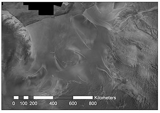
Rutford Ice Stream is a major Antarctic ice stream, about 290 kilometres (180 mi) long and over 24 kilometres (15 mi) wide, which drains southeastward between the Sentinel Range, Ellsworth Mountains and Fletcher Ice Rise into the southwest part of Ronne Ice Shelf. Named by US-ACAN for geologist Robert Hoxie Rutford, a member of several USARP expeditions to Antarctica; leader of the University of Minnesota Ellsworth Mountains Party, 1963-1964. Rutford served as Director of the Division of Polar Programs, National Science Foundation, 1975-1977.
The Enterprise Hills are a prominent group of largely ice-free hills and peaks in the form of an arc. The feature extends for about 30 nautical miles (60 km) to form the north and northeast boundary of Horseshoe Valley in the Heritage Range of the Ellsworth Mountains. These hills were mapped by the United States Geological Survey from surveys and U.S. Navy air photos, 1961–66; the name was applied by the Advisory Committee on Antarctic Names in association with the name Heritage Range.
Wessbecher Glacier is a glacier about 7 nautical miles (13 km) long, draining southeast from Mount Inderbitzen and south from Mount Mullen between Peristera Peak, Lishness Peak and Stikal Peak on the main ridge of Sentinel Range on the west and Marze Peak in Petvar Heights on the east, in the Ellsworth Mountains, Antarctica.
Crosswell Glacier is a glacier 10 nautical miles long, flowing north-northeast from Mount Shinn between Sullivan Heights and Bearskin Ridge, in the central part of the Sentinel Range, Ellsworth Mountains, Antarctica. Together with Patton and Pulpudeva Glaciers, it enters Ellen Glacier northwest of Mamarchev Peak and southeast of Mount Jumper.
Guerrero Glacier is a glacier about 7 nautical miles (13 km) long in Doyran Heights, draining from the southeast slopes of Mount Havener southwest of Beloslav Peak to the south side of Taylor Spur, in the southeast part of the Sentinel Range, Ellsworth Mountains, Antarctica. It was first mapped by the United States Geological Survey from surveys and U.S. Navy air photos, 1957–59, and was named by the Advisory Committee on Antarctic Names for John F. Guerrero, a meteorologist at South Pole Station in 1957.
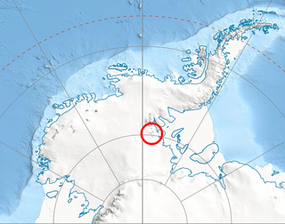
Plummer Glacier is a short glacier descending east through the Enterprise Hills to the north of Lippert Peak and the Douglas Peaks, in the Heritage Range in Antarctica. Mapped by United States Geological Survey (USGS) from surveys and U.S. Navy air photos, 1961–66. Named by Advisory Committee on Antarctic Names (US-ACAN) for Charles C. Plummer, United States Antarctic Research Program (USARP) glaciologist at Palmer Station in 1965.
Evans Peak is a prominent rock peak, 3,950 metres (12,960 ft) high, standing 3 nautical miles (6 km) east-northeast of Mount Ostenso in the Sentinel Range of the Ellsworth Mountains, Antarctica. It overlooks Rumyana Glacier to the north and Patton Glacier to the south. The peak was named by the University of Minnesota Geological Party to these mountains, 1963–64, for John Evans, a geologist with the party.
Patton Glacier is a broad tributary glacier in the Sentinel Range, Ellsworth Mountains. It drains the east slope of the main ridge between Mounts Ostenso and Tyree, flows east-northeastwards between Evans Peak and Versinikia Peak on the north and Mount Bearskin on the south, and enters Ellen Glacier northeast of Zalmoxis Peak and southeast of Mount Jumper.
Gliozzi Peak is a peak, 1,475 metres (4,840 ft) high, standing 3 nautical miles (6 km) south of Plummer Glacier in the Douglas Peaks of the Heritage Range, Antarctica. It was named by the Advisory Committee on Antarctic Names for James Gliozzi, a glaciologist on the United States Antarctic Research Program South Pole—Queen Maud Land Traverse I of 1964–65.
Hansen Glacier is a tributary glacier 10 nautical miles long, flowing northeast from Mount Tuck between Veregava Ridge and Doyran Heights to join Dater Glacier west of Dickey Peak, in the Sentinel Range of the Ellsworth Mountains in Antarctica.
Hudak Peak is a peak rising to 1,440 metres (4,720 ft) immediately south of Plummer Glacier in the Douglas Peaks of the Heritage Range, in the Ellsworth Mountains of Antarctica. It was named by the Advisory Committee on Antarctic Names in 2004 after Curtis M. Hudak, a geologist on the United States Antarctic Research Program 1979–80 Ellsworth Mountains expedition.
Hudman Glacier is a glacier draining south of Mount Landolt between Marze Peak and Miller Peak in Petvar Heights at the south end of the Sentinel Range, in the Ellsworth Mountains of Antarctica, flowing south-southeast to Minnesota Glacier. It was mapped by the United States Geological Survey from surveys and U.S. Navy air photos, 1957–59, and was named by the Advisory Committee on Antarctic Names for Captain Rayburn A. Hudman, United States Marine Corps, who died in the crash of a Lockheed P2V-2n Neptune, modified for extreme range, flying in sub zero temperatures and Ski equipped for landing on the Ice runways at McMurdo Sound Antarctica on October 18, 1956.
Donnellan Glacier is a steep valley glacier fed by highland ice adjacent to Opalchenie Peak and Fukushima Peak on Vinson Plateau, the summit plateau of Vinson Massif, in the Sentinel Range of the Ellsworth Mountains, Antarctica. The glacier flows west-southwestward from Opalchenie Peak along the northwest side of Mount Slaughter into Nimitz Glacier.
References
- ↑ "Douglas Peaks". Geographic Names Information System . United States Geological Survey, United States Department of the Interior . Retrieved 27 January 2012.
 This article incorporates public domain material from "Douglas Peaks". Geographic Names Information System . United States Geological Survey.



 | This Ellsworth Land location article is a stub. You can help Wikipedia by expanding it. |