Droescher's Mill

Last updated
Droescher's Mill
DROESCHERS MILL, CRANFORD, UNION COUNTY.jpg
Location map of Union County, New Jersey.svg
Red pog.svg
USA New Jersey location map.svg
Red pog.svg
Usa edcp location map.svg
Red pog.svg
Location347 Lincoln Avenue East, Cranford, New Jersey
Coordinates 40°39′1″N74°18′6″W / 40.65028°N 74.30167°W / 40.65028; -74.30167
NRHP reference No. 74001192 [1]
NJRHP No.2653 [2]
Significant dates
Added to NRHPJanuary 8, 1974
Designated NJRHPSeptember 18, 1973

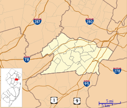
Droescher's Mill is located at 347 Lincoln Avenue East in the township of Cranford in Union County, New Jersey, United States. The mill was added to the National Register of Historic Places on January 8, 1974, for its significance in commerce. [1] [3] It is the oldest continuously operated commercial building in New Jersey. [4]

Contents

History

Also known as the Williams-Droescher Mill, Droescher's Mill is the last remaining mill on the Rahway River. It was constructed in 1737 by Benjamin Williams as a saw mill alongside a dam. Williams used the flow of the river to turn an undershot water wheel to power his saws. Lumber cut here went into the construction of the first houses built in the area. Shortly before his death in 1779, Williams erected a second building only a few feet from his sawmill for the manufacture of woolens. [5]

In 1902, Severin R. Droescher bought the mill and renovated it into the structure as seen today. S.R. Droescher used it to run the Cranford Oil Stone Works where whetstones and oilstones were made. [6]

Lincoln Ave East and Lincoln Ave West, the road that passes through Cranford and on which the mill sits, was originally part of the Naraticong Trail, a route to the sea of the Unami tribe of the Lenape people. Lincoln Avenue was known as the Old York Road by the 1700s, a colonial road from Elizabeth to Philadelphia.

Aside from the Naraticong Trail, the Great Minisink Trail also passed through Cranford as a traditional Lenape route to collect marine foods at the shore. [7]

Rahway River Parkway

The mill and surrounding parkland are local landmarks along the Cranford section of the Rahway River Parkway, a nearly century-old greenway of parkland that hugs the Rahway River and its tributaries throughout Union County, New Jersey. It was designed in the 1920s by the well-known Olmsted Brothers firm, sons of the eminent landscape architect Frederick Law Olmsted.

The Cranford section of the parkway follows the banks of the meandering Rahway River as it flows south through Lenape Park, Nomahegan Park, [8] Hampton Park, MacConnell Park, Girl Scout Park, the Cranford Canoe Club, Hanson Park, [9] Sperry Park, Josiah Crane Park, Droescher's Mill Park (also known as Squire Williams Park), [10] and Mohawk Park. [11]

The "Friends of Rahway River Parkway," a nonprofit group, has been formed exclusively to encourage and advocate for the preservation, restoration and enhancement of the Rahway River Parkway, in accord with the Olmsted design principles inherent in its origins, and to promote appropriate public enjoyment of the Parkway. [12]

Alluem Yoga, a yoga studio located in the mill, has organized Rahway River Parkway clean-ups on the stretch of the Parkway at the mill.

Cranford Riverwalk

The Cranford Riverwalk and Heritage Corridor portion of the Rahway River Parkway begins at the parklands near where Orange Avenue meets Springfield at the Cranford Canoe Club and follows the Rahway River on its path southbound to the mill. [13] [14] [15]

See also

Related Research Articles

<span class="mw-page-title-main">Cranford, New Jersey</span> Township in Union County, New Jersey, US

Cranford is a township in Union County, in the U.S. state of New Jersey, located 18 miles (29 km) southwest of Manhattan. As of the 2020 United States census, the township's population was 23,847, an increase of 1,222 (+5.4%) from the 2010 census count of 22,625, which in turn reflected an increase of 47 (+0.2%) from the 22,578 counted in the 2000 census.

<span class="mw-page-title-main">Union County, New Jersey</span> County in New Jersey, United States

Union County is a county in the northern part of the U.S. state of New Jersey. As of the 2020 United States census, the county was the state's seventh-most-populous county with a population of 575,345, its highest decennial count ever and an increase of 38,846 (+7.2%) from the 2010 census count of 536,499. Its county seat is Elizabeth, which is also the most populous municipality in the county, with a 2020 census population of 137,298, and the largest by area, covering 13.46 square miles (34.9 km2). The county serves as a transition point between the Central Jersey and North Jersey regions of the state.

<span class="mw-page-title-main">Clark, New Jersey</span> Township in Union County, New Jersey, US

Clark is a township in southern Union County, in the U.S. state of New Jersey. As of the 2020 United States census, the township's population was 15,544, an increase of 788 (+5.3%) from the 2010 census count of 14,756, which in turn reflected an increase of 159 (+1.1%) from the 14,597 counted in the 2000 census.

<span class="mw-page-title-main">Kenilworth, New Jersey</span> Borough in Union County, New Jersey, US

Kenilworth is a borough in Union County, in the U.S. state of New Jersey. As of the 2020 United States census, the borough's population was 8,427, an increase of 513 (+6.5%) from the 2010 census count of 7,914, which in turn reflected an increase of 239 (+3.1%) from the 7,675 counted in the 2000 census.

<span class="mw-page-title-main">East Coast Greenway</span> Long-distance hiking trail in the United States

The East Coast Greenway is a 3,000-mile (4,800 km) pedestrian and bicycle route between Maine and Florida along the East Coast of the United States. The nonprofit East Coast Greenway Alliance was created in 1991 with the goal to use the entire route with off-road, shared-use paths; as of 2021, over 1,000 mi (1,600 km) of the route (35%) meets these criteria. In 2020, the Greenway received over 50 million visits.

<span class="mw-page-title-main">Rahway River</span> River in the United States

The Rahway River is a river in Essex, Middlesex, and Union Counties, New Jersey, United States, The Rahway, along with the Elizabeth River, Piles Creek, Passaic River, Morses Creek, the Fresh Kills River, has its river mouth at the Arthur Kill.

<span class="mw-page-title-main">Linear park</span> Long strip of naturally occurring land for recreation

A linear park is a type of park that is significantly longer than it is wide. These linear parks are strips of public land running along canals, rivers, streams, defensive walls, electrical lines, or highways and shorelines. Examples of linear parks include everything from wildlife corridors to riverways to trails, capturing the broadest sense of the word. Other examples include rail trails, which are disused railroad beds converted for recreational use by removing existing structures. Commonly, these linear parks result from the public and private sectors acting on the dense urban need for open green space. Linear parks stretch through urban areas, coming through as a solution for the lack of space and need for urban greenery. They also effectively connect different neighborhoods in dense urban areas as a result, and create places that are ideal for activities such as jogging or walking. Linear parks may also be categorized as greenways. In Australia, a linear park along the coast is known as a foreshoreway. When being designed, linear parks appear unique as they are planned around the public's opinion of how the space will affect them.

<span class="mw-page-title-main">Elizabeth River (New Jersey)</span> River in Union County, New Jersey, U.S.

The Elizabeth River runs through Essex and Union counties, New Jersey in the United States for 11.9 miles (19.2 km) before draining into the Arthur Kill.

Cranford, New Jersey is home to a diverse number of historic architectural styles, historically significant buildings, and landmarks. Structures dating from 1740 through the present can be found in a relatively small area of the township.

<span class="mw-page-title-main">Goffle Brook Park</span>

Goffle Brook Park is a public, county park spanning much of the length of Goffle Brook through the borough of Hawthorne in Passaic County, New Jersey, United States. Since its designation and construction between 1930 and 1932, the park has served to protect the waters of Goffle Brook while at the same time providing recreational opportunities to the residents of Passaic County and nearby Bergen County. Goffle Brook Park has been included in the National Register of Historic Places since 2002.

<span class="mw-page-title-main">Merchants and Drovers Tavern</span> United States historic place

The Merchants and Drovers Tavern is located at 1632 Saint Georges Avenue in the city of Rahway in Union County, New Jersey, United States. The historic tavern was added to the National Register of Historic Places on November 21, 1978, for its significance in architecture, commerce, and transportation.

<span class="mw-page-title-main">Crane-Phillips House</span> Historic house in New Jersey, United States

The Crane-Phillips House, located at 124 N. Union Avenue in Cranford in Union County, New Jersey, United States, is a Victorian cottage in the architectural style of Andrew Jackson Downing, the first American architect. The Crane-Phillips House is now a museum operated by the Cranford Historical Society that offers visitors a glimpse of what life was like for a modest family in the Victorian era of opulence. It illustrates the late 19th century as the era of invention and highlights inventions that changed everyday life for the average person by way of the house's second owners, the Phillips family. Henry J. Phillips, an American Civil War veteran of the 7th New York Militia, was one of the first inventors of the modern kitchen hood. During the war, he had also patented a convertible tent and overcoat for military use. His brother, Charles Henry Phillips, was the inventor of Phillips' Milk of Magnesia.

William Miller Sperry (1858–1927) is the namesake of the William Miller Sperry Observatory in Cranford, New Jersey. According to his sworn passport application, he was born on September 14, 1858, in Bristol, Tennessee. He moved to Cranford in 1898 and succeeded his brother Thomas Sperry as president of S&H Green Stamps. Buried in Fairview Cemetery, Sperry was the donor behind Sperry Park bordering the Rahway River in Cranford. The site is also part of the Rahway River Parkway, a greenway of the Union County Department of Parks and Recreation Sperry's great-granddaughter, Frances Beinecke, is an environmentalist and the former president of Natural Resources Defense Council, and his grandson is William Sperry Beinecke.

<span class="mw-page-title-main">Cranford Canoe Club</span> Canoe club in Cranford, New Jersey, USA

The Cranford Canoe Club is one of the oldest canoe clubs in the United States and a community landmark known as part of Cranford, New Jersey's historic fabric and identity for over 100 years. The current canoe club, while not the first, is the last surviving canoe club on the Rahway River.

<span class="mw-page-title-main">Rahway River Parkway</span> Greenway of parkland along the banks the main stem Rahway River

The Rahway River Parkway is a greenway of parkland along the banks the main stem Rahway River and its tributaries in Union County, New Jersey, United States. Created in the 1920s, it was one of the inaugural projects of the newly created Union County Parks Commission. It was designed by the Olmsted Brothers firm, sons of landscape architect Frederick Law Olmsted. The Rahway River Greenway plan expands on the original design. Many of the crossings of the river are late 19th century or early 20th century bridges. The East Coast Greenway uses paths and roads along the parkway.

<span class="mw-page-title-main">Warinanco Park</span> 205-acre park in Roselle and Elizabeth, New Jersey, U.S.

Warinanco Park is a county park in Union County, New Jersey. It is 205 acres (83 ha) in size. It is located in Roselle at the border with the neighboring cities of Elizabeth and Linden.

<span class="mw-page-title-main">Union County Park Commission Administration Buildings</span> United States historic place

The Union County Park Commission Administration Buildings are located in Warinanco Park in Elizabeth, New Jersey. The Administration Building and the Service Building were built in 1924-1925 in the Tudor Revival style soon after the establishment of the commission. They were listed on the state (#2675) and the federal registers of historic places in 1985.

<span class="mw-page-title-main">Passaic River Parkway</span>

Passaic River Parkway, often called Passaic River Park, is a linear park along the banks of the Passaic River in Union County, New Jersey. It is one of the three "emerald necklaces" in the Union County Park System, the others being Rahway River Parkway and Elizabeth River Parkway.

Lenape Park is a 450-acre wildlife reserve and park that is part of the Rahway River Parkway in Union County, New Jersey. The park is located in four towns: Westfield, Springfield, Kenilworth, and Cranford.

References

  1. 1 2 "National Register Information System  (#74001192)". National Register of Historic Places . National Park Service. March 13, 2009.
  2. "New Jersey and National Registers of Historic Places – Union County" (PDF). New Jersey Department of Environmental Protection – Historic Preservation Office. March 25, 2024. p. 8. listed as Droescher's Mill
  3. Brooks, Robert (July 1973). "National Register of Historic Places Inventory/Nomination: Droescher's Mill". National Park Service. With accompanying photo
  4. "Township of Cranford - Home - www.cranford.com". Archived from the original on 2011-06-19. Retrieved 2011-09-30.
  5. ["Glimpse of History" http://www.nj.com/news/local/index.ssf/2009/08/glimpse_of_history_4.html]
  6. American Machinist. McGraw-Hill. 1904.
  7. The Story of New Jersey's Civil Boundaries 1606 - 1968, by John P. Snyder, reprinted by the New Jersey Geological Survey, 2004, plates 2 & 3.
  8. Federal Writers' Project, The WPA Guide to New Jersey: The Garden State (1939) ("CRANFORD is an old residential town spread along the RAHWAY RIVER PARKWAY, a link of nearly 7 miles joining a series of county parks and playgrounds with the Essex County park system. There are facilities for summer and winter sports, a rifle range, and picnic grove. The Fourth of July canoe regatta is an annual affair. Gardens of fine old Victorian houses line the edge of the parkway on the riverbank. A broadening of the river parkway at the northern end of Cranford is known as NOMAHEGAN PARK. The name Nomahegan is a variation of Noluns Mohegans, as the New Jersey Indians were called in the treaty ending the Indian troubles in 1758. It is translated as women Mohegans or she-wolves and was applied to them in scorn by the fighting Iroquois."); Bulletin of the United States Geological Survey, Issues 112-121 (1894) (The "Nomahiggin" or "Normahiggin" is a brook in Westfield and Cranford townships, Union County, tributary to Rahway River).
  9. "Hanson Park Conservancy". Archived from the original on 2016-11-07. Retrieved 2016-11-09.
  10. Jun 3, 1976 - http://www.digifind-it.com/cranford/DATA/newspapers/chronicle/1976/1976-06-03.pdf Archived 2016-11-08 at the Wayback Machine (opening of Squire Williams Picnic Grove in the park across the Rahway River from Droescher's Mill)
  11. Friends of Rahway River Parkway http://www.rahwayriverparkway.org/the-inception-of-a-parkway.html Archived 2016-11-07 at the Wayback Machine
  12. "Home". rahwayriverparkway.org.
  13. "Cranford Riverwalk Restoration Project Will Resume Activites [sic]". 9 September 2020.
  14. "Cranford Heritage Plaza and Riverwalk at Cranford Heritage Corridor·Cranford, NJ 07016".
  15. "About Us".