National Register of Historic Places listings in Mercer County, New Jersey

Last updated

Location of Mercer County in New Jersey Map of New Jersey highlighting Mercer County.svg
Location of Mercer County in New Jersey

List of the National Register of Historic Places listings in Mercer County, New Jersey

Contents

Contents: Counties and communities in New Jersey
AtlanticBergen (Closter, Franklin Lakes, Ridgewood, Saddle River, Wyckoff) – BurlingtonCamdenCape MayCumberlandEssexGloucesterHudsonHunterdonMercerMiddlesexMonmouthMorrisOceanPassaicSalemSomersetSussexUnionWarren

This is intended to be a complete list of properties and districts listed on the National Register of Historic Places in Mercer County, New Jersey. Latitude and longitude coordinates of the sites listed on this page may be displayed in an online map. [1]


    This National Park Service list is complete through NPS recent listings posted March 8, 2024. [2]

Current listings

[3] Name on the Register [4] ImageDate listed [5] Location City or townDescription
1 Abbott Farm Archeological Site
Abbott Farm Archeological Site HamiltonTwpNJ RoeblingParkView.jpg
Abbott Farm Archeological Site
December 8, 1976
(#76001158)
John A. Roebling Park, other nearby public and private lands
40°11′10″N74°43′37″W / 40.186°N 74.727°W / 40.186; -74.727 (Abbott Farm Archeological Site)
Hamilton and Bordentown Townships, Bordentown [6] Paleoindian settlement, 500 BC-500 AD. [7] Extends into Burlington County.
2 John Abbott II House
John Abbott II House John Abbott House 7-2011.jpg
John Abbott II House
June 18, 1976
(#76001159)
2200 Kuser Rd.
40°12′14″N74°40′51″W / 40.203889°N 74.680833°W / 40.203889; -74.680833 (John Abbott II House)
Hamilton Township Used to hide state treasury during American Revolution [8]
3 Abbott-Decou House
Abbott-Decou House HamiltonTwpNJ AbbottDecouHouse.jpg
Abbott-Decou House
July 1, 1976
(#76001160)
58 Soloff Dr.
40°11′08″N74°43′11″W / 40.185556°N 74.719722°W / 40.185556; -74.719722 (Abbott-Decou House)
Hamilton Township Fine example of 18th century Quaker Georgian architecture. [9]
4 Adams and Sickles Building
Adams and Sickles Building Adams and Sickles Trenton.JPG
Adams and Sickles Building
January 31, 1980
(#80002498)
1 W. End Ave.
40°13′36″N74°46′45″W / 40.226667°N 74.779167°W / 40.226667; -74.779167 (Adams and Sickles Building)
Trenton Focal point for West End neighborhood, remembered for soda fountain and corner druggist. [10]
5 American Cigar Company Building
American Cigar Company Building AMERICAN CIGAR COMPANY BUILDING, TRENTON, MERCER COUNTY.jpg
American Cigar Company Building
December 30, 2011
(#11000965)
176 Division St.
40°12′45″N74°44′41″W / 40.212498°N 74.744743°W / 40.212498; -74.744743 (American Cigar Company Building)
Trenton Built in 1903 as part of Trenton's vibrant cigar industry
6 Anderson-Capner House
Anderson-Capner House Anderson-Capner house 7-2011.jpg
Anderson-Capner House
April 3, 1973
(#73001107)
700 Trumbull Ave.
40°14′52″N74°44′06″W / 40.247755°N 74.734912°W / 40.247755; -74.734912 (Anderson-Capner House)
Lawrence Pre-revolutionary farmhouse built 1764 [11]
7 Archeological Site No. 1-18th Century Vessel (28ME196)
Archeological Site No. 1-18th Century Vessel (28ME196) Address restricted.PNG
Archeological Site No. 1-18th Century Vessel (28ME196)
August 14, 1986
(#86001508)
Address restricted [12]
Trenton
8 Baker-Brearley House
Baker-Brearley House Baker-Brearley House 8-2011.jpg
Baker-Brearley House
August 31, 1979
(#79001499)
East of Lawrenceville on Meadow Rd
40°17′33″N74°42′03″W / 40.292504°N 74.700792°W / 40.292504; -74.700792 (Baker-Brearley House)
Lawrenceville Georgian house built 1761 [13]
9 Bear Tavern Road--Jacob's Creek Crossing Rural Historic District
Bear Tavern Road--Jacob's Creek Crossing Rural Historic District BEAR TAVERN ROAD-JACOBS CREEK CROSSING RURAL HISTORIC DISTRICT;.jpg
Bear Tavern Road--Jacob's Creek Crossing Rural Historic District
November 30, 2011
(#11000872)
Bear Tavern Rd. & Jacobs Creek Rd.
40°17′21″N74°50′29″W / 40.289151°N 74.841399°W / 40.289151; -74.841399 (Bear Tavern Road--Jacob's Creek Crossing Rural Historic District)
Hopewell Township, Ewing Township Colonial rural landscape, route of Continental Army in 1776 [14]
10 Bellevue Avenue Colored School
Bellevue Avenue Colored School Bellevue Colored.JPG
Bellevue Avenue Colored School
January 2, 1997
(#96001547)
81 Bellevue Ave.
40°13′32″N74°46′17″W / 40.225556°N 74.771389°W / 40.225556; -74.771389 (Bellevue Avenue Colored School)
Trenton
11 Berkeley Square Historic District
Berkeley Square Historic District Berkeley Sq HD Trenton.JPG
Berkeley Square Historic District
November 20, 1980
(#80002499)
Roughly bounded by W. State St., Parkside, Riverside, and Overbrook Aves.
40°13′49″N74°47′23″W / 40.230278°N 74.789722°W / 40.230278; -74.789722 (Berkeley Square Historic District)
Trenton
12 Bow Hill
Bow Hill Bow Hill Trenton.JPG
Bow Hill
January 25, 1973
(#73001111)
477 Jeremiah Ave. off Lalor St.
40°11′32″N74°44′39″W / 40.192222°N 74.744167°W / 40.192222; -74.744167 (Bow Hill)
Hamilton Township
13 Charles Brearley House
Charles Brearley House Charles Brearly Trenton.JPG
Charles Brearley House
April 14, 1995
(#95000407)
73 N. Clinton Ave.
40°13′23″N74°45′18″W / 40.223056°N 74.755°W / 40.223056; -74.755 (Charles Brearley House)
Trenton
14 Broad Street National Bank
Broad Street National Bank Broad Street Bank Trenton.JPG
Broad Street National Bank
January 17, 2008
(#07001404)
143 E. State Street
40°13′12″N74°45′43″W / 40.219907°N 74.762068°W / 40.219907; -74.762068 (Broad Street National Bank)
Trenton
15 Camden and Amboy Railroad Right of Way Site
Camden and Amboy Railroad Right of Way Site CAMDEN AND AMBOY RAILROAD RIGHT OF WAY SITE, HIGHTSTOWN, MERCER COUNTY, NY.jpg
Camden and Amboy Railroad Right of Way Site
June 16, 2016
(#16000252)
N. side of Rogers Ave. about 100 yds. W. of Mercer St.
40°16′09″N74°31′31″W / 40.269291°N 74.525172°W / 40.269291; -74.525172 (Camden and Amboy Railroad Right of Way Site)
Hightstown
16 Carver Center
Carver Center Carver Center, Trenton, NJ.jpg
Carver Center
July 7, 2022
(#100007871)
40 Fowler Street
40°13′29″N74°46′07″W / 40.2248°N 74.7686°W / 40.2248; -74.7686 (Carver Center)
Trenton Known as Sunlight Elks Lodge
17 Henry Clay and Bock & Co. Ltd. Cigar Factory
Henry Clay and Bock & Co. Ltd. Cigar Factory Cigar Factory Trenton.JPG
Henry Clay and Bock & Co. Ltd. Cigar Factory
June 12, 1979
(#79001500)
507 Grand St.
40°12′11″N74°44′45″W / 40.203056°N 74.745833°W / 40.203056; -74.745833 (Henry Clay and Bock & Co. Ltd. Cigar Factory)
Trenton Most architecturally distinctive industrial building in Trenton [15]
18 Grover Cleveland Home
Grover Cleveland Home 15 Hodge Road, Princeton, NJ - Grover Cleveland home.jpg
Grover Cleveland Home
October 15, 1966
(#66000463)
15 Hodge Road
40°21′05″N74°40′04″W / 40.351389°N 74.667778°W / 40.351389; -74.667778 (Grover Cleveland Home)
Princeton Known as Westland Mansion
19 Crosswicks Creek Site III
Crosswicks Creek Site III Crosswicks Creek, Bordentown, NJ - site III.jpg
Crosswicks Creek Site III
November 26, 1990
(#87001795)
Address restricted [12]
Hamilton Township Extends into Burlington County
20 Delaware and Raritan Canal
Delaware and Raritan Canal HamiltonTwpNJ DelawareRaritanCanal 1.jpg
Delaware and Raritan Canal
May 11, 1973
(#73001105)
Follows the Delaware River to Trenton, then E to New Brunswick
40°19′55″N74°39′09″W / 40.331930°N 74.652628°W / 40.331930; -74.652628 (Delaware and Raritan Canal)
Princeton
21 Gen. Philemon Dickinson House
Gen. Philemon Dickinson House Dickenson House Trenton.JPG
Gen. Philemon Dickinson House
May 17, 1974
(#74001172)
46 Colonial Ave.
40°13′36″N74°47′01″W / 40.226667°N 74.783611°W / 40.226667; -74.783611 (Gen. Philemon Dickinson House)
Trenton
22 Douglass House
Douglass House Douglass House, Trenton, NJ.jpg
Douglass House
December 18, 1970
(#70000387)
Corner of Front and Montgomery Streets
40°13′08″N74°45′42″W / 40.218913°N 74.761726°W / 40.218913; -74.761726 (Douglass House)
Trenton George Washington's headquarters prior to the Battle of Princeton [16]
23 Drumthwacket
Drumthwacket Drumthwacket1.jpg
Drumthwacket
June 10, 1975
(#75001142)
344 Stockton Rd.
40°20′22″N74°40′29″W / 40.339444°N 74.674722°W / 40.339444; -74.674722 (Drumthwacket)
Princeton Official residence of the governor of New Jersey [17]
24 East Trenton Public Library
East Trenton Public Library EAST TRENTON PUBLIC LIBRARY, MERCER COUNTY.jpg
East Trenton Public Library
March 5, 2008
(#08000134)
701 N. Clinton Ave.
40°14′00″N74°44′30″W / 40.233255°N 74.741769°W / 40.233255; -74.741769 (East Trenton Public Library)
Trenton
25 Albert Einstein House
Albert Einstein House Albert-einstein-house.JPG
Albert Einstein House
January 7, 1976
(#76002297)
112 Mercer St.
40°20′40″N74°39′59″W / 40.344444°N 74.666389°W / 40.344444; -74.666389 (Albert Einstein House)
Princeton
26 First Presbyterian Church
First Presbyterian Church First Presbyterian Church, Trenton, NJ.jpg
First Presbyterian Church
September 9, 2005
(#05000967)
120 East State Street
40°13′14″N74°45′48″W / 40.220446°N 74.763312°W / 40.220446; -74.763312 (First Presbyterian Church)
Trenton Includes churchyard cemetery
27 First Presbyterian Church of Pennington
First Presbyterian Church of Pennington Pennington 1st Presbyterian Church, Pennington, NJ.JPG
First Presbyterian Church of Pennington
August 24, 2011
(#11000591)
13 S. Main St.
40°19′39″N74°47′25″W / 40.3275°N 74.790278°W / 40.3275; -74.790278 (First Presbyterian Church of Pennington)
Pennington
28 Golden Swan-True American
Golden Swan-True American Golden Swan Trenton.JPG
Golden Swan-True American
April 30, 2008
(#08000361)
101-107 S. Warren St.
40°13′09″N74°45′58″W / 40.2192°N 74.766011°W / 40.2192; -74.766011 (Golden Swan-True American)
Trenton
29 William Green House
William Green House WilliamGreenHouse.jpg
William Green House
December 4, 1973
(#73001106)
Metzger Drive
40°15′54″N74°46′39″W / 40.26502178604058°N 74.77741373763769°W / 40.26502178604058; -74.77741373763769 (William Green House)
Ewing Township Historic farmhouse, dating to 1717. On Preservation New Jersey's list of 10 most endangered historic sites [18]
30 Green-Reading House
Green-Reading House GREEN-READING HOUSE; EWING TOWNSHIP, MERCER COUNTY, NJ.jpg
Green-Reading House
March 12, 1998
(#98000237)
107 Wilburtha Rd.
40°15′38″N74°49′32″W / 40.260427°N 74.825467°W / 40.260427; -74.825467 (Green-Reading House)
Ewing Township Federal style farmhouse from ca. 1797 [19]
31 Harbourton Historic District
Harbourton Historic District Village Store, Harbourton, NJ.jpg
Harbourton Historic District
December 31, 1974
(#74001167)
Junction of Harbourton/Rocktown and Harbourton/Mt. Airy Roads
40°21′08″N74°51′12″W / 40.352222°N 74.853333°W / 40.352222; -74.853333 (Harbourton Historic District)
Harbourton
32 John D. Hart House
John D. Hart House JOHN D. HART HOUSE, MERCER COUNTY, NJ.jpg
John D. Hart House
October 18, 1972
(#72000800)
54 East Curlis Avenue, Pennington
40°19′18″N74°46′59″W / 40.321667°N 74.783056°W / 40.321667; -74.783056 (John D. Hart House)
Hopewell Township Built c.1800, fine example of a clapboard house [20]
33 Hart-Hoch House
Hart-Hoch House HART-HOCH HOUSE, MERCER COUNTY, NJ.jpg
Hart-Hoch House
March 14, 1973
(#73001109)
Southwest of Pennington on CR 546 and Scotch Rd.
40°18′34″N74°48′43″W / 40.309444°N 74.811944°W / 40.309444; -74.811944 (Hart-Hoch House)
Hopewell Township Federal style home, ca. 1800 [21]
34 Joseph Henry House
Joseph Henry House Joseph-henry-house.JPG
Joseph Henry House
October 15, 1966
(#66000464)
Princeton University campus
40°20′58″N74°39′32″W / 40.349444°N 74.658889°W / 40.349444; -74.658889 (Joseph Henry House)
Princeton
35 Donald Grant Herring Estate
Donald Grant Herring Estate Donald Grant Herring Estate.jpg
Donald Grant Herring Estate
January 17, 1992
(#91001927)
52, 72 and 75 Arreton Rd., Princeton
40°22′56″N74°39′57″W / 40.382222°N 74.665833°W / 40.382222; -74.665833 (Donald Grant Herring Estate)
Princeton
36 Higbee Street School
Higbee Street School 20 Bellevue Trenton.JPG
Higbee Street School
April 14, 1995
(#95000409)
20 Bellevue Ave.
40°14′04″N74°45′57″W / 40.234444°N 74.765833°W / 40.234444; -74.765833 (Higbee Street School)
Trenton
37 Highfields
Highfields HIGHFIELDS, EAST AMWELL TOWNSHIP, HUNTERDON COUNTY.jpg
Highfields
September 23, 1994
(#94001096)
End of Lindbergh Rd., East Amwell Township
40°25′26″N74°46′04″W / 40.423889°N 74.767778°W / 40.423889; -74.767778 (Highfields)
Hopewell Township Home of Charles and Anne Lindbergh. Site of the Lindbergh kidnapping. [22] Extends into Hunterdon County
38 Hog Island Cranes
Hog Island Cranes TrentonNJ HogIslandCranes.jpg
Hog Island Cranes
June 17, 1980
(#80002500)
Trenton Marine Terminal
40°11′27″N74°45′22″W / 40.190833°N 74.756111°W / 40.190833; -74.756111 (Hog Island Cranes)
Trenton
39 Hopewell Station
Hopewell Station Hopewell Station.jpg
Hopewell Station
June 22, 1984
(#84002728)
Railroad Place
40°23′29″N74°45′48″W / 40.391389°N 74.763333°W / 40.391389; -74.763333 (Hopewell Station)
Hopewell part of the Operating Passenger Railroad Stations TR
40 House at 379 West State Street
House at 379 West State Street 379 W State Trenton.JPG
House at 379 West State Street
January 23, 1980
(#80002501)
379 W. State St.
40°13′29″N74°46′41″W / 40.224722°N 74.778056°W / 40.224722; -74.778056 (House at 379 West State Street)
Trenton Queen Anne revival house [23]
41 Hunt Farmstead
Hunt Farmstead HUNT HOMESTEAD, ROSEDALE, MERCER COUNTY.jpg
Hunt Farmstead
October 28, 1988
(#87002555)
197 Blackwell Rd.
40°19′18″N74°45′39″W / 40.321778°N 74.760718°W / 40.321778; -74.760718 (Hunt Farmstead)
Hopewell Township
42 In and Out Social Club
In and Out Social Club In and Out Club Trenton.JPG
In and Out Social Club
March 26, 1987
(#87000513)
714-716 S. Clinton Ave.
40°12′34″N74°45′06″W / 40.209444°N 74.751667°W / 40.209444; -74.751667 (In and Out Social Club)
Trenton Built in 1893 for "social, intellectual, and recreative purposes." [24]
43 Jugtown Historic District
Jugtown Historic District Jugtown Princeton.JPG
Jugtown Historic District
January 22, 1987
(#86003670)
Nassau and Harrison Sts., Harrison St. N, and Evelyn Pl.
40°21′14″N74°38′49″W / 40.353889°N 74.646944°W / 40.353889; -74.646944 (Jugtown Historic District)
Princeton
44 King's Highway Historic District
King's Highway Historic District Kingston Bridge, Kingston, NJ - south view.jpg
King's Highway Historic District
December 21, 2000
(#00001493)
NJ 27, US 206
40°20′54″N74°39′52″W / 40.348261°N 74.664502°W / 40.348261; -74.664502 (King's Highway Historic District)
Lawrenceville, Princeton Extends into Middlesex and Somerset Counties
45 Kingston Mill Historic District
Kingston Mill Historic District Kingston Mill, Kingston, New Jersey.jpg
Kingston Mill Historic District
April 10, 1986
(#86000707)
Roughly bounded by Herrontown, River, Princeton-Kingston Roads
40°22′25″N74°37′14″W / 40.373577°N 74.620630°W / 40.373577; -74.620630 (Kingston Mill Historic District)
Princeton Extends into Middlesex and Somerset Counties, includes Kingston Bridge
46 Rudolph V. Kuser Estate
Rudolph V. Kuser Estate Kuser Mansion Trenton.JPG
Rudolph V. Kuser Estate
August 24, 1979
(#79001501)
315 W. State St.
40°13′23″N74°46′36″W / 40.223056°N 74.776667°W / 40.223056; -74.776667 (Rudolph V. Kuser Estate)
Trenton
47 Lake Carnegie Historic District
Lake Carnegie Historic District Andrew Carnegie Lake Carnegie.jpg
Lake Carnegie Historic District
June 28, 1990
(#90001000)
Roughly bounded by Lake Carnegie shoreline from Conrail bridge at west end to dam west of Kingston at east end
40°20′51″N74°38′12″W / 40.3475°N 74.636667°W / 40.3475; -74.636667 (Lake Carnegie Historic District)
Princeton
48 Lawrence Township Historic District
Lawrence Township Historic District Harmony Hall MercerCo NJ HABS.jpg
Lawrence Township Historic District
September 14, 1972
(#72000799)
Lawrenceville and vicinity N, including both sides of U.S. 206
40°18′01″N74°43′12″W / 40.300278°N 74.72°W / 40.300278; -74.72 (Lawrence Township Historic District)
Lawrence Township Includes Lawrenceville School
49 Lawrenceville School
Lawrenceville School Edith Memorial Chapel, Lawrenceville School (Lawrenceville, NJ).JPG
Lawrenceville School
February 24, 1986
(#86000158)
Main St.
40°17′45″N74°43′49″W / 40.295833°N 74.730278°W / 40.295833; -74.730278 (Lawrenceville School)
Lawrenceville
50 Ichabod Leigh House
Ichabod Leigh House ICHABOD LEIGH HOUSE, HOPEWELL, MERCER COUNTY, NY.jpg
Ichabod Leigh House
March 4, 1975
(#75001139)
953 Cherry Valley Road
40°22′21″N74°43′55″W / 40.3725°N 74.731944°W / 40.3725; -74.731944 (Ichabod Leigh House)
Hopewell Township
51 Thomas Maddock's Sons Company
Thomas Maddock's Sons Company THOMAS MADDOCK'S SONS COMPANY, MERCER COUNTY, NJ.jpg
Thomas Maddock's Sons Company
March 14, 2008
(#08000178)
American Metro Boulevard
40°15′27″N74°42′17″W / 40.257383°N 74.704672°W / 40.257383; -74.704672 (Thomas Maddock's Sons Company)
Hamilton Township Sanitary pottery manufacturing plant built 1924-25 [25]
52 Mansion House
Mansion House Trenton City Museum.JPG
Mansion House
February 6, 1973
(#73001112)
Cadwalader Park
40°14′12″N74°47′22″W / 40.236667°N 74.789444°W / 40.236667; -74.789444 (Mansion House)
Trenton Also known as Ellarslie and the McCall House, home to the Trenton City Museum
53 Maybury Hill
Maybury Hill Maybury-hill-princeton.JPG
Maybury Hill
November 11, 1971
(#71000502)
346 Snowden Lane
40°22′02″N74°38′34″W / 40.367222°N 74.642778°W / 40.367222; -74.642778 (Maybury Hill)
Princeton
54 Mercer Street Friends Center
Mercer Street Friends Center Mercer Street Friends.JPG
Mercer Street Friends Center
August 12, 1971
(#71000505)
151 Mercer St.
40°13′02″N74°45′40″W / 40.217222°N 74.761111°W / 40.217222; -74.761111 (Mercer Street Friends Center)
Trenton
55 Mill Hill Historic District
Mill Hill Historic District Mill Hill HD Trenton.JPG
Mill Hill Historic District
December 12, 1977
(#77000880)
Roughly bounded by Clay, Jackson, Front, Market, Broad, and Greenwood Streets
40°13′01″N74°45′40″W / 40.216944°N 74.761111°W / 40.216944; -74.761111 (Mill Hill Historic District)
Trenton Includes Douglass House and Mercer Street Friends Center
56 Morven
Morven MorvenNJ.jpg
Morven
January 25, 1971
(#71000503)
55 Stockton St.
40°20′51″N74°40′01″W / 40.3475°N 74.666944°W / 40.3475; -74.666944 (Morven)
Princeton
57 Mott School and Second Street School
Mott School and Second Street School MOTT SCHOOL, TRENTON, MERCER, NJ.jpg
Mott School and Second Street School
April 15, 1986
(#86000809)
Centre and 643-645 Second Sts.
40°12′07″N74°45′24″W / 40.201944°N 74.756667°W / 40.201944; -74.756667 (Mott School and Second Street School)
Trenton
58 Mount Rose Distillery
Mount Rose Distillery Mount Rose Distillery, 192 Pennington Rocky Hill Road, Hopewell, NJ.jpg
Mount Rose Distillery
December 12, 1996
(#96001471)
Address restricted [12]
40°22′02″N74°44′49″W / 40.367361°N 74.747083°W / 40.367361; -74.747083 (Mount Rose Distillery)
Hopewell Township
59 Mountain Avenue Historic District
Mountain Avenue Historic District MOUNTAIN AVENUE HISTORIC DISTRICT, PRINCETON, MERCER COUNTY.jpg
Mountain Avenue Historic District
February 2, 1995
(#94001604)
73-143 Mountain Ave.
40°21′25″N74°40′25″W / 40.356944°N 74.673611°W / 40.356944; -74.673611 (Mountain Avenue Historic District)
Princeton
60 Nassau Hall, Princeton University
Nassau Hall, Princeton University Nassau Hall Princeton.JPG
Nassau Hall, Princeton University
October 15, 1966
(#66000465)
Princeton University campus
40°20′55″N74°39′34″W / 40.348611°N 74.659444°W / 40.348611; -74.659444 (Nassau Hall, Princeton University)
Princeton
61 New Jersey Division of Motor Vehicles Building
New Jersey Division of Motor Vehicles Building New Jersey Division of Motor Vehicles Building, Trenton, NJ.jpg
New Jersey Division of Motor Vehicles Building
March 20, 2023
(#100008729)
25 South Montgomery Street
40°13′10″N74°45′42″W / 40.2195°N 74.7618°W / 40.2195; -74.7618 (New Jersey Division of Motor Vehicles Building)
Trenton
62 Old Barracks
Old Barracks Old Barracks, October 2012.jpg
Old Barracks
January 25, 1971
(#71000506)
S. Willow St.
40°13′10″N74°46′07″W / 40.219444°N 74.768611°W / 40.219444; -74.768611 (Old Barracks)
Trenton
63 Old Eagle Tavern
Old Eagle Tavern Old Eagle Tavern Trenton.JPG
Old Eagle Tavern
November 3, 1972
(#72000801)
431, 433 S. Broad St.
40°12′47″N74°45′34″W / 40.2131°N 74.7594°W / 40.2131; -74.7594 (Old Eagle Tavern)
Trenton
64 Old Ryan Farm
Old Ryan Farm Temple House - Old Ryan Farm - Ewing NJ.jpg
Old Ryan Farm
September 10, 1971
(#71000507)
27 Federal City Road
40°16′47″N74°46′15″W / 40.2798°N 74.7709°W / 40.2798; -74.7709 (Old Ryan Farm)
Ewing Township Known as the Benjamin Temple House
65 Isaac Pearson House
Isaac Pearson House Isaac Pearson House 7-2011.jpg
Isaac Pearson House
February 1, 2006
(#05001568)
Hobson Ave. at Emiline Ave.
40°11′16″N74°42′44″W / 40.1878°N 74.7122°W / 40.1878; -74.7122 (Isaac Pearson House)
Hamilton Township
66 Pennington Railroad Station
Pennington Railroad Station Pennington Station.jpg
Pennington Railroad Station
December 31, 1974
(#74001170)
Corner of Franklin and Green Ave.
40°19′58″N74°47′41″W / 40.3328°N 74.7947°W / 40.3328; -74.7947 (Pennington Railroad Station)
Pennington
67 Penns Neck Baptist Church
Penns Neck Baptist Church PennsNeckNJ Church2.jpg
Penns Neck Baptist Church
December 28, 1989
(#89002160)
US 1 at Princeton-Hightstown Road
40°19′55″N74°38′15″W / 40.3319°N 74.6375°W / 40.3319; -74.6375 (Penns Neck Baptist Church)
Penns Neck
68 Pennsylvania Railroad Bridge
Pennsylvania Railroad Bridge Pennsy bridge 1.jpg
Pennsylvania Railroad Bridge
June 6, 1979
(#79001502)
Spans Delaware River
40°12′24″N74°46′09″W / 40.2067°N 74.7692°W / 40.2067; -74.7692 (Pennsylvania Railroad Bridge)
Trenton
69 Philadelphia and Reading Railroad Freight Station
Philadelphia and Reading Railroad Freight Station Reading Freight Trenton.JPG
Philadelphia and Reading Railroad Freight Station
May 14, 1979
(#79001503)
260 N. Willow St.
40°13′34″N74°46′03″W / 40.2261°N 74.7675°W / 40.2261; -74.7675 (Philadelphia and Reading Railroad Freight Station)
Trenton
70 Joseph Phillips Farm
Joseph Phillips Farm JOSEPH PHILLIPS FARM; MERCER COUNTY, NJ.jpg
Joseph Phillips Farm
May 2, 1977
(#77000879)
North of Titusville on Hunter Road
40°20′23″N74°53′56″W / 40.3397°N 74.8989°W / 40.3397; -74.8989 (Joseph Phillips Farm)
Hopewell Township Started by Joseph Phillips in 1732, now the Howell Living History Farm, which operates and preserves it as it was in 1900 [26]
71 Pleasant Valley Historic District
Pleasant Valley Historic District PLEASANT VALLEY HISTORIC DISTRICT, MERCER COUNTY, NJ.jpg
Pleasant Valley Historic District
June 14, 1991
(#91000676)
Centered on junction of Pleasant Valley Road with Woodens Lane and Hunter Road
40°20′18″N74°53′44″W / 40.3383°N 74.8956°W / 40.3383; -74.8956 (Pleasant Valley Historic District)
Hopewell Township Extends into Hunterdon County, includes Joseph Phillips Farm
72 President's House
President's House Maclean house.jpg
President's House
July 17, 1971
(#71000504)
Nassau St.
40°20′56″N74°39′36″W / 40.3489°N 74.66°W / 40.3489; -74.66 (President's House)
Princeton
73 Princeton Battlefield
Princeton Battlefield Princeton Battlefield State Park (Princeton, NJ).JPG
Princeton Battlefield
October 15, 1966
(#66000466)
Princeton Battlefield State Park; also Roughly Quaker Rd. from Stockton Rd. to Stony Brook
40°19′45″N74°40′36″W / 40.3292°N 74.6767°W / 40.3292; -74.6767 (Princeton Battlefield)
Princeton Boundary increases approved October 10, 1989 and April 26, 2019
74 Princeton Historic District
Princeton Historic District Princeton Historic District-088.jpg
Princeton Historic District
June 27, 1975
(#75001143)
Irregular pattern between Lytle St. and Haslet Ave. from Lovers Lane to Olden Sts.
40°20′48″N74°39′51″W / 40.3467°N 74.6642°W / 40.3467; -74.6642 (Princeton Historic District)
Princeton
75 Princeton Ice Company
Princeton Ice Company Princeton Ice Company upper dam (1902).jpg
Princeton Ice Company
August 28, 2007
(#07000874)
57 Mountain Ave.
40°21′26″N74°40′17″W / 40.3573°N 74.6713°W / 40.3573; -74.6713 (Princeton Ice Company)
Princeton
76 Prospect
Prospect Prospect-presidents-house.JPG
Prospect
February 4, 1985
(#85002434)
Princeton University campus
40°20′49″N74°39′24″W / 40.3469°N 74.6567°W / 40.3469; -74.6567 (Prospect)
Princeton
77 Riverview Cemetery
Riverview Cemetery McClellan monument vista, Riverview Cemetery, Trenton, NJ.jpg
Riverview Cemetery
March 27, 2017
(#100000810)
870 Centre Street
40°11′42″N74°45′12″W / 40.19492°N 74.75344°W / 40.19492; -74.75344 (Riverview Cemetery)
Trenton
78 Roebling Machine Shop
Roebling Machine Shop Roebling Shop side.JPG
Roebling Machine Shop
September 4, 1997
(#97000932)
675 S. Clinton Ave.
40°12′35″N74°45′11″W / 40.2097°N 74.7531°W / 40.2097; -74.7531 (Roebling Machine Shop)
Trenton Oldest surviving building in the Roebling complex, built innovative wire rope making machines [27]
79 John A. Roebling's Sons Company, Trenton N.J., Block 3
John A. Roebling's Sons Company, Trenton N.J., Block 3 John A. Roebling's Sons Company, Trenton N.J., Block 3 (5).jpg
John A. Roebling's Sons Company, Trenton N.J., Block 3
August 22, 2012
(#12000528)
Bounded by Hamilton Ave., Clark, Elmer, & E. Canal Sts.
40°12′46″N74°45′19″W / 40.2127°N 74.7552°W / 40.2127; -74.7552 (John A. Roebling's Sons Company, Trenton N.J., Block 3)
Trenton Northern portion of Roebling complex, built wire for North Sea Mine Barrage, Golden Gate Bridge, among other structures
80 John Rogers House
John Rogers House John Rogers House NJ.jpg
John Rogers House
January 31, 1978
(#78001770)
South of Princeton on S. Post Rd.
40°15′45″N74°38′52″W / 40.262414°N 74.6479°W / 40.262414; -74.6479 (John Rogers House)
West Windsor
81 V. Henry Rothschild-F.A. Straus and Co.-Atlantic Products Corporation Mill Complex
V. Henry Rothschild-F.A. Straus and Co.-Atlantic Products Corporation Mill Complex V. HENRY ROTHSCHILD CO. HAMILTON TOWNSHIP MERCER COUNTY NJ.jpg
V. Henry Rothschild-F.A. Straus and Co.-Atlantic Products Corporation Mill Complex
November 19, 2020
(#100005815)
1 North Johnston Ave.
40°13′58″N74°44′00″W / 40.2329°N 74.7333°W / 40.2329; -74.7333 (V. Henry Rothschild-F.A. Straus and Co.-Atlantic Products Corporation Mill Complex)
Hamilton Township
82 Sacred Heart Church
Sacred Heart Church Sacred Heart Trenton.JPG
Sacred Heart Church
May 2, 2002
(#02000434)
343 S. Broad St.
40°12′59″N74°45′40″W / 40.2164°N 74.7611°W / 40.2164; -74.7611 (Sacred Heart Church)
Trenton
83 Samuel Sloan House
Samuel Sloan House Samuel Sloan House, Mercer County, New Jersey.jpg
Samuel Sloan House
March 28, 1974
(#74001168)
238 S. Main St.
40°15′58″N74°31′32″W / 40.2661°N 74.5256°W / 40.2661; -74.5256 (Samuel Sloan House)
Hightstown
84 Smith-Ribsam House
Smith-Ribsam House SMITH-RIBSAM HOUSE, LAWRENCE TWP, MERCER COUNTY.jpg
Smith-Ribsam House
June 9, 1988
(#88000722)
45 Pine Knoll Dr.
40°16′27″N74°43′28″W / 40.274167°N 74.724444°W / 40.274167; -74.724444 (Smith-Ribsam House)
Eldridge Park
85 Somerset Roller Mills
Somerset Roller Mills Somerset Roller Mills, Mercer City, New Jersey.jpg
Somerset Roller Mills
November 19, 1974
(#74001171)
NJ 29
40°16′45″N74°51′13″W / 40.279167°N 74.853611°W / 40.279167; -74.853611 (Somerset Roller Mills)
Titusville
86 St. Michael's Episcopal Church
St. Michael's Episcopal Church St Mikes Trenton.JPG
St. Michael's Episcopal Church
April 29, 1982
(#82003280)
140 N. Warren St.
40°13′20″N74°45′55″W / 40.222222°N 74.765278°W / 40.222222; -74.765278 (St. Michael's Episcopal Church)
Trenton
87 State House Historic District
State House Historic District Old Trenton NJ Masons.JPG
State House Historic District
August 27, 1976
(#76001161)
Roughly bounded by Capitol Plaza, Willow, State and Lafayette Sts.
• Boundary increase (listed April 2, 1992, refnum 92000295): W. State St. south side, west of New Jersey State House

40°13′14″N74°46′15″W / 40.220556°N 74.770833°W / 40.220556; -74.770833 (State House Historic District)
Trenton
88 Israel Stevens House
Israel Stevens House Israel Stevens House 2012-09-30 09-46-05.jpg
Israel Stevens House
March 15, 2005
(#05000176)
2167 Brunswick Ave.
40°15′19″N74°44′00″W / 40.255278°N 74.733333°W / 40.255278; -74.733333 (Israel Stevens House)
Lawrence
89 Stockton Street Historic District
Stockton Street Historic District StocktonStHistoricDistrictHightstown.jpg
Stockton Street Historic District
November 25, 2005
(#05001331)
126-136 Stockton St., 219-237 Rogers Ave.
40°16′15″N74°31′42″W / 40.2709°N 74.5284°W / 40.2709; -74.5284 (Stockton Street Historic District)
Hightstown
90 Stokely-Van Camp Industrial Complex
Stokely-Van Camp Industrial Complex Stokeley VC Trenton.JPG
Stokely-Van Camp Industrial Complex
March 11, 1983
(#83001603)
Lalor Street at Stokely Ave.
40°11′59″N74°45′16″W / 40.199722°N 74.754444°W / 40.199722; -74.754444 (Stokely-Van Camp Industrial Complex)
Trenton
91 Joseph Stout House
Joseph Stout House Joseph Stout House, Hopewell Township, NJ.jpg
Joseph Stout House
October 29, 1974
(#74001169)
Province Line Road
40°24′34″N74°44′44″W / 40.409444°N 74.745556°W / 40.409444; -74.745556 (Joseph Stout House)
Hopewell Township
92 Titusville Historic District
Titusville Historic District TITUSVILLE H.D. MERCER COUNTY, NJ.jpg
Titusville Historic District
March 17, 1983
(#83001604)
River Drive
40°18′22″N74°52′44″W / 40.306111°N 74.878889°W / 40.306111; -74.878889 (Titusville Historic District)
Titusville
93 William Trent House
William Trent House William Trent House, Trenton, NJ.jpg
William Trent House
April 15, 1970
(#70000388)
15 Market Street
40°12′46″N74°45′58″W / 40.212778°N 74.766111°W / 40.212778; -74.766111 (William Trent House)
Trenton
94 Trenton and Mercer County War Memorial-Soldiers' and Sailors' Memorial Building
Trenton and Mercer County War Memorial-Soldiers' and Sailors' Memorial Building 2014-12-27 15 46 06 Front of the Trenton War Memorial in Trenton, New Jersey.JPG
Trenton and Mercer County War Memorial-Soldiers' and Sailors' Memorial Building
December 11, 1986
(#86003480)
W. Lafayette St.
40°13′06″N74°46′06″W / 40.218333°N 74.768333°W / 40.218333; -74.768333 (Trenton and Mercer County War Memorial-Soldiers' and Sailors' Memorial Building)
Trenton
95 Trenton Battle Monument
Trenton Battle Monument 2023-09-16 15 41 12 The Trenton Battle Monument in Trenton, Mercer County, New Jersey.jpg
Trenton Battle Monument
May 6, 1977
(#77000881)
Warren and Broad Streets
40°13′33″N74°45′53″W / 40.225833°N 74.764722°W / 40.225833; -74.764722 (Trenton Battle Monument)
Trenton Commemorates the Battle of Trenton
96 Trenton Central Office of the Bell Telephone Company
Trenton Central Office of the Bell Telephone Company TRENTON CENTRAL OFFICE OF BELL TEL. CO., MERCER COUNTY, NJ.jpg
Trenton Central Office of the Bell Telephone Company
April 3, 2017
(#100000826)
214-218 E. State St.
40°13′14″N74°45′40″W / 40.220513°N 74.761001°W / 40.220513; -74.761001 (Trenton Central Office of the Bell Telephone Company)
Trenton
97 Trenton City Hall
Trenton City Hall Trenton NJ City Hall.JPG
Trenton City Hall
January 30, 1978
(#78001771)
309 State St.
40°13′12″N74°45′34″W / 40.22°N 74.759444°W / 40.22; -74.759444 (Trenton City Hall)
Trenton
98 Trenton City/Calhoun Street Bridge
Trenton City/Calhoun Street Bridge Calhoun Street Bridge 2.jpg
Trenton City/Calhoun Street Bridge
November 20, 1975
(#75001621)
Spans Delaware River between Morrisville, PA and Trenton, NJ
40°13′11″N74°46′42″W / 40.219722°N 74.778333°W / 40.219722; -74.778333 (Trenton City/Calhoun Street Bridge)
Trenton
99 Trenton Ferry Historic District
Trenton Ferry Historic District TRENTON FERRY H.D., MERCER COUNTY, NJ.jpg
Trenton Ferry Historic District
June 26, 2013
(#13000355)
Roughly bounded by South Broad and Federal Streets, the Delaware River and the Amtrak Northeast Corridor
40°12′36″N74°45′34″W / 40.210000°N 74.759444°W / 40.210000; -74.759444 (Trenton Ferry Historic District)
Trenton Working class urban mixed-use neighborhood of row houses, duplexes, churches, and commercial buildings [28]
100 Trenton Friends Meeting House
Trenton Friends Meeting House Trenton Friends.JPG
Trenton Friends Meeting House
April 30, 2008
(#08000362)
142 E. Hanover St.
40°13′16″N74°45′46″W / 40.221181°N 74.762644°W / 40.221181; -74.762644 (Trenton Friends Meeting House)
Trenton
101 Trenton Jewish Community Center Bath House and Day Camp
Trenton Jewish Community Center Bath House and Day Camp T bath house 3.JPG
Trenton Jewish Community Center Bath House and Day Camp
February 23, 1984
(#84002730)
999 Lower Ferry Rd.
40°15′33″N74°47′58″W / 40.259167°N 74.799444°W / 40.259167; -74.799444 (Trenton Jewish Community Center Bath House and Day Camp)
Ewing Township
102 Trenton Watch Company Building-Circle F Manufacturing Company Building
Trenton Watch Company Building-Circle F Manufacturing Company Building TRENTON WATCH COMPANY BUILDING - CIRCLE F. MANUFACTURING COMPANY BUILDING, MERCER COUNTY, NJ.jpg
Trenton Watch Company Building-Circle F Manufacturing Company Building
April 3, 2017
(#100000827)
720 Monmouth St.
40°13′02″N74°44′48″W / 40.217111°N 74.746644°W / 40.217111; -74.746644 (Trenton Watch Company Building-Circle F Manufacturing Company Building)
Trenton
103 Tusculum
Tusculum TUSCULUM, PRINCETON, MERCER COUNTY, NJ.jpg
Tusculum
January 5, 1978
(#78003171)
North of Princeton on Cherry Hill Rd.
40°21′58″N74°40′17″W / 40.366111°N 74.671389°W / 40.366111; -74.671389 (Tusculum)
Princeton
104 U.S. Post Office and Courthouse
U.S. Post Office and Courthouse Clarkson S. Fisher Federal Building and U.S. Courthouse.jpg
U.S. Post Office and Courthouse
May 24, 2012
(#12000309)
402 E. State St.
40°13′16″N74°45′26″W / 40.221132°N 74.757314°W / 40.221132; -74.757314 (U.S. Post Office and Courthouse)
Trenton
105 University Cottage Club
University Cottage Club University Cottage Club Princeton.JPG
University Cottage Club
November 19, 1999
(#99001315)
51 Prospect Ave.
40°20′53″N74°39′07″W / 40.348056°N 74.651944°W / 40.348056; -74.651944 (University Cottage Club)
Princeton
106 Colonel John Van Cleve Homestead
Colonel John Van Cleve Homestead Colonel John Van Cleve Homestead, Poor Farm Main House, Hopewell Township, Mercer County, NJ.jpg
Colonel John Van Cleve Homestead
February 16, 1983
(#83001605)
Northwest of Pennington on Poor Farm Road
40°21′11″N74°49′27″W / 40.353056°N 74.824167°W / 40.353056; -74.824167 (Colonel John Van Cleve Homestead)
Hopewell Township
107 Jeremiah Vandyke House
Jeremiah Vandyke House Jeremiah Vandyke House.jpg
Jeremiah Vandyke House
March 29, 1978
(#78001769)
Featherbed Lane
40°24′34″N74°46′51″W / 40.409444°N 74.780833°W / 40.409444; -74.780833 (Jeremiah Vandyke House)
Hopewell Township
108 Washington Crossing State Park
Washington Crossing State Park Washington Crossing State Park, NJ view of Delaware River.jpg
Washington Crossing State Park
October 15, 1966
(#66000650)
Titusville, New Jersey, on the Delaware River
40°17′57″N74°52′07″W / 40.299167°N 74.868611°W / 40.299167; -74.868611 (Washington Crossing State Park)
Titusville
109 Washington Road Elm Allée
Washington Road Elm Allee Washington Road Elm Allee (east side).jpg
Washington Road Elm Allée
January 14, 1999
(#98001571)
Washington Rd., bet. the Penns Neck Circle and The D&R Canal
40°20′08″N74°38′37″W / 40.335556°N 74.643611°W / 40.335556; -74.643611 (Washington Road Elm Allée)
West Windsor
110 Isaac Watson House
Isaac Watson House Isaac Watson House, Hamilton Township, NJ.jpg
Isaac Watson House
January 21, 1974
(#74001173)
151 Westcott Street
40°11′26″N74°43′38″W / 40.190556°N 74.727222°W / 40.190556; -74.727222 (Isaac Watson House)
Hamilton Township
111 John Welling House
John Welling House JOHN WELLING HOUSE, PENNINGTON, MERCER COUNTY.jpg
John Welling House
March 14, 1973
(#73001110)
Curlis Ave. at Birch St.
40°19′17″N74°46′58″W / 40.321389°N 74.782778°W / 40.321389; -74.782778 (John Welling House)
Pennington Rare example of a Dutch clapboard and shingle house [29]
112 West Trenton Station
West Trenton Station West Trenton NJ railway station.jpg
West Trenton Station
June 22, 1984
(#84004031)
Sullivan Way
40°15′27″N74°48′57″W / 40.2575°N 74.815833°W / 40.2575; -74.815833 (West Trenton Station)
West Trenton part of the Operating Passenger Railroad Stations TR
113 John White House
John White House JOHN WHITE HOUSE; LAWRENCEVILLE, MERCER COUNTY.jpg
John White House
January 29, 1973
(#73001108)
Cold Soil Road, Lawrenceville
40°18′52″N74°43′42″W / 40.314444°N 74.728333°W / 40.314444; -74.728333 (John White House)
Lawrence Township
114 Windsor Historic District
Windsor Historic District Church Street 2.JPG
Windsor Historic District
April 10, 1992
(#88001710)
Roughly bounded by properties along Main St. and Church St.
40°14′27″N74°35′06″W / 40.240833°N 74.585°W / 40.240833; -74.585 (Windsor Historic District)
Robbinsville
115 Witherspoon Street School for Colored Children
Witherspoon Street School for Colored Children WITHERSPOON STREET SCHOOL FOR COLORED CHILDREN; PRINCETON, MERCER COUNTY.jpg
Witherspoon Street School for Colored Children
March 9, 2005
(#05000125)
35 Quarry St.
40°21′19″N74°39′46″W / 40.355278°N 74.662778°W / 40.355278; -74.662778 (Witherspoon Street School for Colored Children)
Princeton
116 Jeremiah Woolsey House
Jeremiah Woolsey House JEREMIAH WOOLSEY HOUSE, MERCER COUNTY, NJ.jpg
Jeremiah Woolsey House
January 27, 1975
(#75001140)
Southwest of Pennington on Washington Crossing Road
40°18′32″N74°49′36″W / 40.308889°N 74.826667°W / 40.308889; -74.826667 (Jeremiah Woolsey House)
Hopewell Township Dutch Colonial house built 1765. Jeremiah Woolsey served as a commissioner to recruit men to serve in the Continental Army during the American Revolution. [30]

Former listings

[3] Name on the RegisterImageDate listedDate removedLocationCity or townDescription
1 Hutchinson House January 25, 1973
(#73002201)
March 6, 19751 mi. NE of Hutchinson Mill-Pond Rd.
Hamilton Square Destroyed by fire in 1974.
2 Princessville Inn
Princessville Inn Princessville Cemetery 01.jpg
Princessville Inn
June 27, 1980
(#80002497)
June 11, 1982E of Lawrenceville at 3510 Princeton Pike
Lawrence Township Destroyed by fire on January 6, 1982. [31] Adjacent cemetery is extant.

See also

Related Research Articles

<span class="mw-page-title-main">National Register of Historic Places listings in Burlington County, New Jersey</span>

List of the National Register of Historic Places listings in Burlington County, New Jersey

<span class="mw-page-title-main">National Register of Historic Places listings in Union County, New Jersey</span>

List of the National Register of Historic Places listings in Union County, New Jersey

<span class="mw-page-title-main">National Register of Historic Places listings in Passaic County, New Jersey</span>

List of the National Register of Historic Places listings in Passaic County, New Jersey

<span class="mw-page-title-main">National Register of Historic Places listings in Auglaize County, Ohio</span>

This is a list of the National Register of Historic Places listings in Auglaize County, Ohio.

<span class="mw-page-title-main">National Register of Historic Places listings in Mercer County, Ohio</span>

This is a list of the National Register of Historic Places listings in Mercer County, Ohio.

<span class="mw-page-title-main">Lawrence Township Historic District</span> Historic district in New Jersey, United States

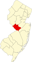
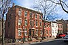
The Lawrence Township Historic District is a 550-acre (220 ha) historic district encompassing the community of Lawrenceville in Lawrence Township, Mercer County, New Jersey, United States. It was added to the National Register of Historic Places on September 14, 1972 for its significance in architecture, landscape architecture, literature, military history, and transportation. The district includes 45 contributing buildings.

<span class="mw-page-title-main">National Register of Historic Places listings in Mercer County, Pennsylvania</span>

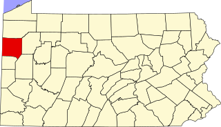
This is a list of the National Register of Historic Places listings in Mercer County, Pennsylvania.

<span class="mw-page-title-main">National Register of Historic Places listings in Hart County, Kentucky</span>

This is a list of the National Register of Historic Places listings in Hart County, Kentucky.

<span class="mw-page-title-main">National Register of Historic Places listings in Edmonson County, Kentucky</span>

This is a list of the National Register of Historic Places listings in Edmonson County, Kentucky.

<span class="mw-page-title-main">National Register of Historic Places listings in Mercer County, West Virginia</span>

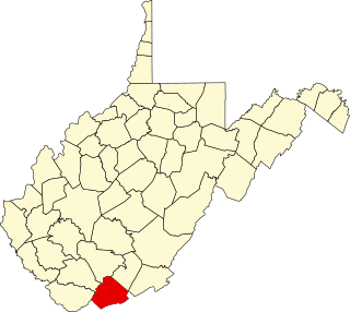
This is a list of the National Register of Historic Places listings in Mercer County, West Virginia.

<span class="mw-page-title-main">Douglass House (Trenton, New Jersey)</span> Historic house in New Jersey, United States

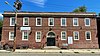
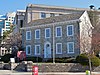
The Douglass House is a historic house currently located at the corner of Front and Montgomery Streets in the Mill Hill neighborhood of the city Trenton in Mercer County, New Jersey. It served as George Washington's headquarters prior to the Battle of Princeton on January 3, 1777. Listed as the Bright–Douglass House, it was documented by the Historic American Buildings Survey in 1936, when the house was located in Mahlon Stacy Park near the Delaware River. It was added to the National Register of Historic Places on December 18, 1970, for its significance in architecture, military and social history. It was added as a contributing property to the Mill Hill Historic District on December 12, 1977.

<span class="mw-page-title-main">Mansion House (Trenton, New Jersey)</span> Historic house in New Jersey, United States

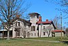
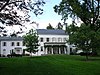
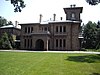
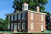
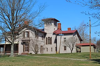
The Mansion House is a historic residence located in Cadwalader Park in the city of Trenton in Mercer County, New Jersey, United States. The house was built as a summer residence for Henry McCall Sr. of Philadelphia in 1848, and is one of the earliest examples of Italianate architecture in the United States. The building was added to the National Register of Historic Places on February 6, 1973, for its significance in architecture and landscape architecture.

<span class="mw-page-title-main">Mercer Street Friends Center</span> Historic church in New Jersey, United States

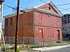
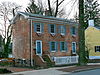
The Mercer Street Friends Center is located at 151 Mercer Street in the Mill Hill neighborhood of the city Trenton in Mercer County, New Jersey. Built in 1858, it was added to the National Register of Historic Places on August 12, 1971, for its significance in architecture, religion, and social history. It was added as a contributing property to the Mill Hill Historic District in 1977. It now houses the main offices of Mercer Street Friends, a Trenton-based Quaker-affiliated social service agency founded in 1958.

<span class="mw-page-title-main">Isaac Watson House</span> Historic house in New Jersey, United States

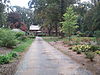
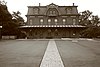
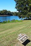
The Isaac Watson House is the headquarters of the New Jersey State Society of the National Society of the Daughters of the American Revolution (DAR). It is located just outside the state capital of Trenton in Hamilton Township, Mercer County, New Jersey. It is situated on a bluff overlooking Watson's Creek and the Abbott Farm National Historic Landmark in John A. Roebling Park, a 257-acre nature preserve.

<span class="mw-page-title-main">Samuel Sloan House</span> United States historic place

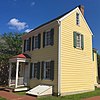
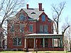
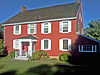
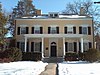
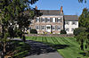
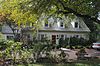
The Samuel Sloan House is a historic antebellum home in Hightstown, New Jersey. It is considered the finest home from the early history of the town. Its architecture can be described as Carpenter Italianate, with the impressive massing associated with an Italian villa combined with fanciful jigsaw carpentry. The home was originally thought to have designed by the architect, Samuel Sloan, as that name was found inscribed in a nineteenth century hand on a piece of millwork in the house. However, further research in 1997 established that the Samuel Sloan who built the home was in fact a local merchant and not the famed architect.

<span class="mw-page-title-main">John D. Hart House</span> United States historic place

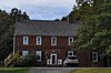
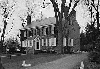
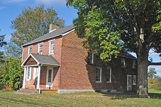
The John D. Hart House is a historic home built c. 1800 and located at 54 East Curlis Avenue in Hopewell Township near the borough of Pennington in Mercer County, New Jersey. It was documented by the Historic American Buildings Survey in 1937. The house was added to the National Register of Historic Places on October 18, 1972, for its significance in architecture.

<span class="mw-page-title-main">Hart–Hoch House</span> United States historic place

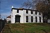
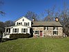
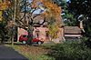
The Hart–Hoch House is a historic Federal style home, built c. 1800 in Hopewell Township, Mercer County, New Jersey, USA. It was added to the National Register of Historic Places on March 14, 1973.

<span class="mw-page-title-main">John Welling House</span> United States historic place

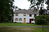
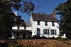
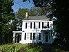
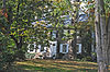
The John Welling House is a historic Dutch Colonial home in Pennington, New Jersey that dates to the early 18th century. John Welling moved to the Hopewell valley from Jamaica, New York in 1727 and leased the home and 223 acres (90 ha) farm from Terit Lester, purchasing it the next year. A tradition exists that during the British occupation of Pennington during the American Revolution a Hessian soldier was taken captive in the home. Welling's great-granddaughter, Elizabeth Welling, married John D. Hart who built the adjacent John D. Hart House, which is also on the National Register of Historic Places. The home remained in the Welling family until 1921 and from 1928 until 1973 was home to Congressman Charles R. Howell. The house is a rare example of a Dutch clapboard and shingle house, one of the few remaining in Mercer County.

<span class="mw-page-title-main">John White House (Lawrenceville, New Jersey)</span> United States historic place

The John White House is a historic stone house built c. 1800 and located on Cold Soil Road north of the Lawrenceville section of Lawrence Township in Mercer County, New Jersey. Featuring Federal architecture, the house was added to the National Register of Historic Places on January 29, 1973, for its significance in architecture.

<span class="mw-page-title-main">Ichabod Leigh House</span> United States historic place

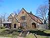
The Ichabod Leigh House is a historic Greek Revival style house constructed c. 1835 and located at 953 Cherry Valley Road in the Mount Rose section of Hopewell Township in Mercer County, New Jersey, United States. It was added to the National Register of Historic Places on March 4, 1975, for its significance in architecture.

References

  1. The latitude and longitude information provided in this table was derived originally from the National Register Information System, which has been found to be fairly accurate for about 99% of listings. Some locations in this table may have been corrected to current GPS standards.
  2. National Park Service, United States Department of the Interior, "National Register of Historic Places: Weekly List Actions", retrieved March 8, 2024.
  3. 1 2 Numbers represent an alphabetical ordering by significant words. Various colorings, defined here, differentiate National Historic Landmarks and historic districts from other NRHP buildings, structures, sites or objects.
  4. "National Register Information System". National Register of Historic Places . National Park Service. April 24, 2008.
  5. The eight-digit number below each date is the number assigned to each location in the National Register Information System database, which can be viewed by clicking the number.
  6. "2008 Interpretive Plan for Abbott Farm NHL" (PDF). Mercer County Parks Commission. Archived from the original (PDF) on 2013-10-02. Retrieved 2013-09-19.
  7. "The Northeast". On the Record. National Park Service. Retrieved 2011-07-21.
  8. West, Helen almy (1954). A History of Hamilton Township, Mercer County, New Jersey. Trenton: Trenton Printing Company. pp. 18–19.
  9. Clark, William J. (July 1, 1976). "Abbott-Decou House". National Register of Historic Places. National Park Service.
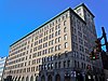
  10. Lamar, Martha L.; Powell, L. Matthew; Davies, David S. (June 5, 1979). "Adams and Sickles Building". National Register of Historic Places. National Park Service.
  11. Nash, Winona D. (October 28, 1971). "Anderson-Capner House". National Register of Historic Places. National Park Service.
  12. 1 2 3 Federal and state laws and practices restrict general public access to information regarding the specific location of this resource. In some cases, this is to protect archeological sites from vandalism, while in other cases it is restricted at the request of the owner. See: Knoerl, John; Miller, Diane; Shrimpton, Rebecca H. (1990), Guidelines for Restricting Information about Historic and Prehistoric Resources, National Register Bulletin, National Park Service, U.S. Department of the Interior, OCLC   20706997 .
  13. Gottuso, George M. (March 13, 1979). "Baker-Brearley House". National Register of Historic Places. National Park Service.
  14. Bertland, Dennis; Armstrong, Janice (October 2011). "Bear Tavern Road/Jacob's Creek Crossing Rural Historic District" (PDF). National Register of Historic Places. National Park Service.
  15. Wolf, Gary (August 26, 1976). "Henry Clay and Bock & Co. Ltd. Cigar Factory". National Register of Historic Places. National Park Service.
  16. Stryker, William S. (1898). The Battles of Trenton and Princeton. Boston and New York: Houghton, Mifflin and Company. p. 270.
  17. "The History Archived 2009-10-01 at the Wayback Machine ." Drumthwacket Foundation.
  18. Blake, Channing (March 10, 1973). "William Green House". National Register of Historic Places. National Park Service.
  19. Terry, Erik (October 28, 1997). "Green-Reading House". National Register of Historic Places. National Park Service.
  20. Greiff, Constance; Blake, Channing (September 8, 1971). "John D. Hart House". National Register of Historic Places. National Park Service.
  21. Greiff, Constance; Blake, Channing (September 1971). "Hart-Hoch House". National Register of Historic Places. National Park Service.
  22. English, Illona S. (March 1994). "Highfields". National Register of Historic Places. National Park Service.
  23. Fricker, Jonathan (July 12, 1977). "House at 379 West State Street". National Register of Historic Places. National Park Service.
  24. Zink, Clifford W. (October 15, 1986). "In and Out Social Club". National Register of Historic Places. National Park Service.
  25. Barucco, Suzanna (August 27, 2007). "Thomas Maddock's Sons Company". National Register of Historic Places. National Park Service.
  26. "Joseph Phillips Farm". National Register of Historic Places. National Park Service. June 1976.
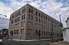
  27. Hand, Susanne (April 17, 1997). "Roebling Machine Shop". National Register of Historic Places. National Park Service.
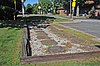
  28. Tvaryanas, Damon; Scott, Douglas; Hunter, Richard (November 26, 2012). "Trenton Ferry Historic District" (PDF). National Register of Historic Places. National Park Service.
  29. Greiff, Constance; Blake, Channing (September 8, 1971). "John Welling House". National Register of Historic Places. National Park Service.
  30. Israel, Nancy (October 1974). "Jeremiah Woolsey House". National Register of Historic Places. National Park Service.
  31. "Old inn reduced to ashes". Asbury Park Press . January 8, 1982. p. A9. Retrieved August 7, 2022 via Newspapers.com.