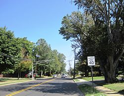
Ewing Township is a township in Mercer County, in the U.S. state of New Jersey. The township falls within the New York metropolitan area as defined by the U.S. Census Bureau. It borders the Philadelphia metropolitan area and is part of the Federal Communications Commission's Philadelphia Designated Market Area. As of the 2020 United States census, the township's population was 37,264, its highest decennial count ever and an increase of 1,474 (+4.1%) from the 35,790 recorded at the 2010 census, which in turn reflected an increase of 83 (+0.2%) from the 35,707 counted in the 2000 census.

Hamilton Township is a township and the most populous municipality in Mercer County, in the U.S. state of New Jersey. It is the largest suburb of Trenton, the state's capital, which is located to the township's west. The township is situated within the New York metropolitan area as defined by the United States Census Bureau but directly borders the Philadelphia metropolitan area and is part of the Federal Communications Commission's Philadelphia Designated Market Area. As of the 2020 United States census, the township's population was 92,297, its highest decennial count ever and an increase of 3,833 (+4.3%) from the 2010 census count of 88,464, which in turn reflected an increase of 1,355 (+1.6%) from the 2000 census count of 87,109. The township was the state's ninth-largest municipality in 2010 and 2020, after having been ranked 10th in 2000.
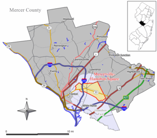
Mercerville-Hamilton Square is a census-designated place and unincorporated community located within Hamilton Township, in Mercer County, in the U.S. state of New Jersey. As of the 2000 United States Census, the CDP's population was 26,419. As part of the 2010 census, the area was split into two CDPs, Mercerville and Hamilton Square.

Princeton North, also known as North Princeton, is an unincorporated community that is located in Princeton, in Mercer County, in the U.S. state of New Jersey. As of the 2000 census, the CDP population was 4,528. While the area was categorized as a census-designated place in the 2000 Census, the CDP status was eliminated by the United States Census Bureau as of the 2010 census. The community is located in what was formerly Princeton Township.

White Horse is an unincorporated community and census-designated place (CDP) in Hamilton Township, Mercer County, New Jersey, in the United States. As of the 2020 United States census, the CDP's population was 9,791.

Yardville-Groveville was an unincorporated community and former census-designated place (CDP) located within Hamilton Township, in Mercer County, in the U.S. state of New Jersey. As of the 2000 United States Census, the CDP's population was 9,208.
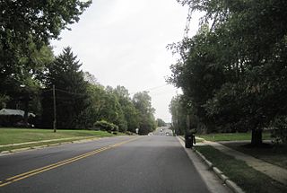
West Freehold is an unincorporated community and census-designated place (CDP) within Freehold Township, in Monmouth County, New Jersey, United States. As of the 2010 United States Census, the CDP's population was 13,613. Due to the community's close proximity to the Battle of Monmouth, West Freehold is home to several important historical structures, which have been preserved in the 'West Freehold Village Historic District'. The historically preserved Monmouth Battlefield, along with the historic villages of Clarksburg, Englishtown, Smithburg and Tennent are a short distance away.

County Route 535 is a county highway in the U.S. state of New Jersey. The highway extends 32.31 miles (52.00 km) from Logan Avenue, at the boundary between Trenton and Hamilton Township in Mercer County to an interchange with U.S. Route 9 (US 9) and Route 35 in South Amboy, Middlesex County.
County Route 533 is a county highway in the U.S. state of New Jersey. The highway extends 32.78 miles (52.75 km) from the White Horse Circle, in Hamilton Township to Middlesex CR 607 on the border of Bound Brook and Middlesex Borough. CR 533 shares a long concurrency with U.S. Route 206 through Princeton and Montgomery Township, while portions of the roadway in Somerset County are part of the Millstone River Valley Scenic Byway.
Port-au-peck is an unincorporated community located within Oceanport in Monmouth County, in the U.S. state of New Jersey. The name Port-Au-Peck comes from the Lenape name Pootapeck. The land was "sold" to English interests in 1670; however, it is unclear how fair this land transfer was or if the local residents were aware they were giving away their hunting and fishing rights in the transfer.

Columbus is an unincorporated community located within Mansfield Township in Burlington County, in the U.S. state of New Jersey. The area is served as United States Postal Service ZIP Code 08022. Most of Mansfield Township's governmental offices are located in and around Columbus. It is also the main business district in the township with many businesses lining the main roads in the area. It is located at the junction of County Route 543 and U.S. Route 206 which is a major highway that heads north and south. US 206 originally passed through the center of Columbus on Atlantic Avenue and New York Avenue until it was moved to a short four-lane bypass of downtown in the late 1950s/early 1960s. The old surface route became state-maintained New Jersey Route 170 but became a county-maintained road in 1986.
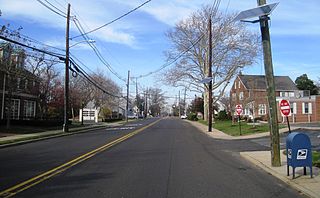
Yardville is an unincorporated community and census-designated place (CDP) in Hamilton Township, Mercer County, New Jersey, United States. As of the 2020 United States census, the CDP's population was 6,965. Before the 2010 census, the area was part of the Yardville-Groveville CDP.

Groveville is an unincorporated community and census-designated place (CDP) located within Hamilton Township, in Mercer County, in the U.S. state of New Jersey. As of the 2020 census, the CDP's population was 3,106. Before the 2010 Census, the area was part of the Yardville-Groveville CDP.

Mercerville is an unincorporated community and census-designated place (CDP) located within Hamilton Township, in Mercer County, in the U.S. state of New Jersey. As of the 2020 census, the CDP's population was 13,447. Until after the 2000 census, the area was part of the Mercerville-Hamilton Square CDP. For the 2010 Census it was split into two CDPs, Mercerville and Hamilton Square.

Hamilton Square is an unincorporated community and census-designated place (CDP) located within Hamilton Township, in Mercer County, in the U.S. state of New Jersey, that is the site of a historic colonial village. Until the 2000 census the area was part of the Mercerville-Hamilton Square CDP, which was split into two CDPs as of 2010: Mercerville and Hamilton Square.
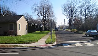
Slackwood is an unincorporated community located within Lawrence Township in Mercer County, in the U.S. state of New Jersey. The area is named for the owners of the land that was subdivided into the neighborhood today, Joseph Slack and William Wood. The neighborhood was first developed in 1890 as the first suburban development in the reconfigured Lawrence Township. Its location between Princeton Pike and Brunswick Pike allowed for an easy walk to nearby Trenton factories. Today, most of the homes in Slackwood are still small bungalows with some businesses along with Princeton and Brunswick Pikes. The neighborhood is bounded by the two highways on the northwest and southeast, Slackwood Park and forest on the southwest, and Shabakunk Creek and Park on the northeast.
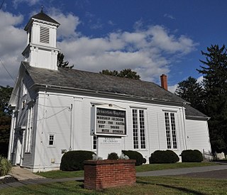
Penns Neck is an unincorporated community located within West Windsor Township in Mercer County, in the U.S. state of New Jersey. The community developed at the intersection of the Trenton-New Brunswick Turnpike and Washington Road. The Penns Neck Circle and the historic Penns Neck Baptist Church (1812) are both located in Penns Neck. The Princeton Branch rail line, known as the Dinky, has run through the area since 1865, and stopped at Penns Neck station until January 1971.
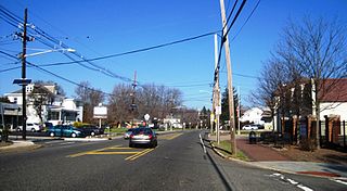
Eldridge Park is an unincorporated community located within Lawrence Township in Mercer County, in the U.S. state of New Jersey. The neighborhood is named for Stephen Eldridge, a farm owner in the township in the early 20th century. The neighborhood itself was established in 1906 as a settlement along the Trenton & Princeton Traction Company trolleyline and Lawrence Road for European immigrants to purchase small houses in the suburbs of Trenton. The growing population led to the construction of the Eldridge Park Elementary School and St. Ann's, the township's first Roman Catholic church. As it was in the past, the area is mostly made up of small houses with businesses clustered around US 206.
