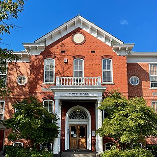
West Windsor is a township in Mercer County, in the U.S. state of New Jersey. Located at the cross-roads between the Delaware Valley region to the southwest and the Raritan Valley region to the northeast, the township is considered to be an outer-ring suburb of New York City in the New York metropolitan area, as defined by the United States Census Bureau. As of the 2020 United States census, the township's population was 29,518, its highest decennial count ever and an increase of 2,353 (+8.7%) from the 27,165 recorded at the 2010 census, which in turn reflected an increase of 5,258 (+24.0%) from the 21,907 counted in the 2000 census.
Cranbury is a township in southern Middlesex County, within the U.S. state of New Jersey. Located within the heart of the Raritan Valley region, Cranbury is roughly equidistant between New York City and Philadelphia, contributing to it being a regional historical, cultural, and commercial hub of Central New Jersey and as an outer-ring commuter suburb of New York City within the New York metropolitan area. The municipal taxes generated by the industrial properties have helped to keep residential property taxes steady over time. As of the 2020 United States census, the township's population was 3,842, a decrease of 15 (−0.4%) from the 2010 census count of 3,857, which in turn had reflected an increase of 630 (+19.5%) from the 3,227 counted at the 2000 census.

Plainsboro Township is a township situated in southern Middlesex County, within the U.S. state of New Jersey. Centrally located in the Raritan Valley region, the township is an outer-ring suburb of New York City in the New York metropolitan area, even though it is slightly geographically closer to Center City, Philadelphia than to Midtown Manhattan. As of the 2020 United States census, the township's population was 24,084, its highest decennial count ever and an increase of 1,085 (+4.7%) from the 22,999 recorded at the 2010 census, which in turn had reflected an increase of 2,784 (+13.8%) from the 20,215 counted at the 2000 census.
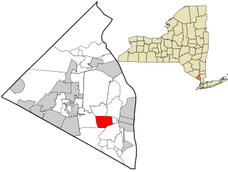
West Nyack is a hamlet and census-designated place in the town of Clarkstown, Rockland County, New York, United States. It is located north of Blauvelt, east of Nanuet, southwest of Valley Cottage, southeast of Bardonia, and west of Central Nyack. It is approximately 18 miles (29 km) north of New York City. The population was 3,439 at the 2010 census.

"The War of the Worlds" was a Halloween episode of the radio series The Mercury Theatre on the Air directed and narrated by Orson Welles as an adaptation of H. G. Wells's novel The War of the Worlds (1898) that was performed and broadcast live at 8 pm ET on October 30, 1938 over the CBS Radio Network. The episode is famous for inciting a panic by convincing some members of the listening audience that a Martian invasion was taking place, though the scale of panic is disputed, as the program had relatively few listeners.

New Windsor is a town in Orange County, New York, United States. The population was 27,805 at the 2020 census. It is located on the eastern side of the county and is adjacent to the Hudson River and the City of Newburgh.
Grover is a Muppet character on the children's television show Sesame Street.

The Hills District is a region of Sydney, within the northern part of the Greater Western Sydney region of Sydney, in the state of New South Wales, Australia. Stretching from the M2 Hills Motorway in the south to the Hawkesbury River in the north and Old Windsor Road in the west to Pennant Hills Road and Berowra Creek in the east, its constituent suburbs are located in the local government areas of The Hills Shire, and parts of Hornsby Shire, City of Parramatta and Blacktown City Council.
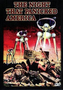
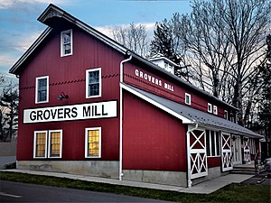
The Night That Panicked America is an American made-for-television drama film that was originally broadcast on the ABC network on October 31, 1975. The telefilm dramatizes events surrounding Orson Welles' famous - and infamous - War of the Worlds radio broadcast of October 30, 1938, which had led some Americans to believe that an invasion by Martians was occurring in the area near Grover's Mill in West Windsor, New Jersey.

Asher Benjamin was an American architect and author whose work transitioned between Federal architecture and the later Greek Revival architecture. His seven handbooks on design deeply influenced the look of cities and towns throughout New England until the Civil War. Builders also copied his plans in the Midwest and in the South.
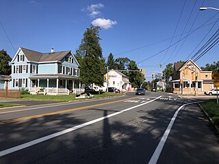
Dutch Neck is an unincorporated community located within West Windsor Township in Mercer County, in the U.S. state of New Jersey. The community is centered about the intersection of Village Road East, Village Road West, and South Mill Road and has in the vicinity several churches, the West Windsor Volunteer Fire Company No. 1, Dutch Neck Elementary School, and many residences.
The Trenton Bath House is an influential design by the architect Louis Kahn, with the help of his associate, architect Anne Tyng. This changing room facility is located adjacent to a swimming pool at 999 Lower Ferry Road, Ewing Township, Mercer County, New Jersey, United States. It was listed in the National Register of Historic Places in 1984.
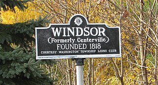
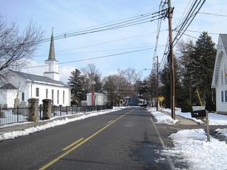
Windsor is a small historic unincorporated community and census-designated place (CDP) located within Robbinsville Township in Mercer County, in the U.S. state of New Jersey. The area is served as United States Postal Service ZIP Code 08561. As of the 2020 United States census, the CDP's population was 330, an increase of 104 (+46.0%) above the 226 counted at the 2010 census. The community, covering 570 acres (230 ha), was added to the National Register of Historic Places in 1992.

Benjamin Parke was an American lawyer, politician, militia officer, businessman, treaty negotiator in the Indiana Territory who also served as a United States federal judge in Indiana after it attained statehood in 1816. Parke was the Indiana Territory's attorney general (1804–1808); a representative to the territory's first general assembly (1805); its first territorial delegate to the United States House of Representatives (1805–1808); one of the five Knox County delegates to the Indiana constitutional convention of 1816; and a territorial court judge (1808–1816). After Indiana attained statehood, Parke served as the first United States District Judge of the United States District Court for the District of Indiana (1817–1835).

Bearden, also known as Bearden Village, is a neighborhood in Knoxville, Tennessee, United States, located along Kingston Pike in West Knoxville. Developed primarily as an agrarian community in the 19th century, this neighborhood now lies at the heart of one of Knoxville's major commercial corridors. Named for former Knoxville mayor and Tennessee state legislator, Marcus De Lafayette Bearden (1830–1885), the community was annexed by Knoxville in 1962.
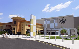
Clarksville is an unincorporated community partially in Lawrence Township, and partially in West Windsor Township, in Mercer County, in the U.S. state of New Jersey. It was historically centered at the intersection of the Trenton-New Brunswick Turnpike, Quakerbridge Road and Province Line Road, and had a blacksmith shop, saloon, store, hotel and school. Today, Clarksville is dominated by several large shopping centers, including the Quaker Bridge Mall.
Edinburg is a 1700s-era unincorporated community located within West Windsor in Mercer County, in the U.S. state of New Jersey. The community is located at the junction of Old Trenton Road, Edinburg Road, and Windsor Road.

Port Mercer is an unincorporated community located where the municipal boundaries of Lawrence Township, Princeton and West Windsor Township intersect in Mercer County, in the U.S. state of New Jersey. It is the location of the historic Port Mercer Canal House along the Delaware and Raritan Canal.

Old Church is an unincorporated community located within Monroe Township in Middlesex County, in the U.S. state of New Jersey. The settlement is named for a Presbyterian community that settled on the site but relocated to Cranbury c. 1740. Originally, the area was farmland. One of the farms in the area was the Dey Farm, in existence since the founding of Monroe Township in 1838 and the site of a command post used by George Washington during the Battle of Monmouth in 1778. Starting in 2004, the area experienced a major change from its agricultural roots to single-family residences on the south side of the area and age-restricted communities to the north. This redevelopment also caused the severing of the main north–south road, Old Church Road and the extension of Federal Road which formerly had its western end at Old Church Road to Applegarth Road. The a farmhouse named England House was moved 4,000 feet (1,200 m) to the Dey Farm site to preserve the area's history prior to the construction of the new houses in 2004.
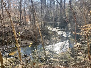
Nickajack Creek is a stream in Cobb and Fulton counties in the U.S. state of Georgia. It is a tributary to the Chattahoochee River. Groundwater serves as the water source, with the creek beginning in Marietta, Georgia. The creek runs through the city of Smyrna and terminates at the Chattahoochee River in the town of Mableton.