
Ewing Township is a township in Mercer County, in the U.S. state of New Jersey. The township falls within the New York metropolitan area as defined by the U.S. Census Bureau. It borders the Philadelphia metropolitan area and is part of the Federal Communications Commission's Philadelphia Designated Market Area. As of the 2020 United States census, the township's population was 37,264, its highest decennial count ever and an increase of 1,474 (+4.1%) from the 35,790 recorded at the 2010 census, which in turn reflected an increase of 83 (+0.2%) from the 35,707 counted in the 2000 census.

Scotch Plains is a township in Union County, in the U.S. state of New Jersey. The township is located on a ridge in northern-central New Jersey, within the Raritan Valley and Rahway Valley regions in the New York metropolitan area. As of the 2020 United States census, the township's population was 24,968, an increase of 1,458 (+6.2%) from the 2010 census count of 23,510, which in turn reflected an increase of 778 (+3.4%) from the 22,732 counted in the 2000 census.
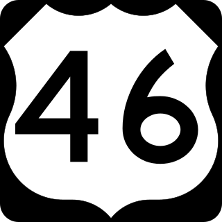
U.S. Route 46 (US 46) is an east–west U.S. Highway completely within the state of New Jersey, running for 75.34 mi (121.25 km), making it the shortest signed, non-spur U.S. Highway. The west end is at an interchange with Interstate 80 (I-80) and Route 94 in Columbia, Warren County, on the Delaware River. The east end is in the middle of the George Washington Bridge over the Hudson River in Fort Lee, Bergen County, while the route is concurrent with I-95 and US 1-9. Throughout much of its length, US 46 is closely paralleled by I-80. US 46 is a major local and suburban route, with some sections built to or near freeway standards and many other sections arterials with jughandles. The route runs through several communities in the northern part of New Jersey, including Hackettstown, Netcong, Dover, Parsippany-Troy Hills, Wayne, Clifton, Ridgefield Park, Palisades Park, and Fort Lee. It crosses over the Upper Passaic River at several points. The road has been ceremonially named the United Spanish–American War Veterans Memorial Highway.
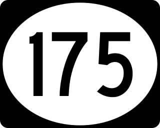
Route 175 is a short, 2.95-mile (4.75 km) long state highway in Mercer County, New Jersey, United States. The route runs along a former alignment of Route 29 before the construction of the John Fitch Parkway in the 1960s. The route begins at Route 29 in the capital city of Trenton, running along Sanhican Road, River Road, and West Upper Ferry Road into Ewing Township. The route serves primarily as a frontage road for Route 29. The northernmost portion of Route 175 is parallel to the Delaware and Raritan Canal until coming to an end at a merge with Route 29 in Ewing Township.

Upper Montclair is a census-designated place (CDP), unincorporated community and neighborhood within Montclair in Essex County, in the U.S. state of New Jersey. As of the 2010 United States Census, the population for the CDP was 11,565. The area is served as United States Postal Service ZIP Code 07043. It is often misperceived, even by Montclair residents, to be a separate municipality from Montclair, perhaps aided by this postal designation.
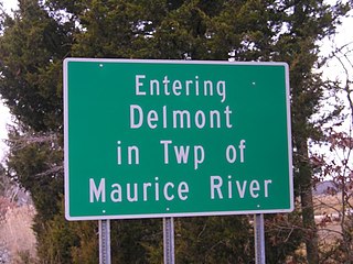
Delmont is an unincorporated community and census-designated place (CDP) located within Maurice River Township, in Cumberland County, in the U.S. state of New Jersey. The area is served as United States Postal Service ZIP Code 08314. It was first listed as a CDP in the 2020 census with a population of 122.

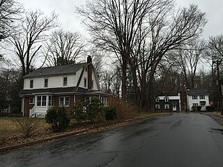
West Trenton is an unincorporated community within Ewing Township in Mercer County, New Jersey, United States. It is a suburban area located adjacent to the northwestern portion of the city of Trenton, from which it derives its name. Located at the intersection of Bear Tavern Road/Grand Avenue and West Upper Ferry Road, it is one of the oldest settlements in Ewing Township.
Old York Road, originally York Road, with reference to New York, is a roadway that was built during the 18th century to connect Philadelphia with New York City.

Ewingville is a section of Ewing Township in Mercer County, in the U.S. state of New Jersey originally settled as a village on Shabakunk Creek. Located at the intersection of Ewingville Road/Upper Ferry Road and Pennington Road, it is one of the oldest settlements in Ewing Township and dates back to the 18th century. The community was known as Cross Keys before adopting its current name in 1836, two years after the incorporation of Ewing Township in 1834.
Wilburtha is a section of Ewing Township in Mercer County, in the U.S. state of New Jersey. Located where Wilburtha Road crosses the Delaware and Raritan Canal, it is one of the oldest settlements in Ewing Township and developed due to the construction of the canal in the early 19th century. The community was known as Greensburg before adopting its current name in 1883. The Yardley–Wilburtha Bridge once connected Wilburtha to Yardley, Pennsylvania on the other side of the Delaware River. The Belvidere Delaware Railroad once passed through the village. Today, Wilburtha is primarily a residential neighborhood consisting of detached, single-family homes, the majority of which were built in the 1950s through the early 1980s. There are still many Georgian and Federal-style homes found in the area.

The Shabakunk Creek is a tributary of the Assunpink Creek in Mercer County, New Jersey, United States. Via the Assunpink, its water ultimately flows into the Delaware River. The name Shabakunk is from the Lenape word meaning "shore land".

Finesville is an unincorporated community and census-designated place (CDP) located within Pohatcong Township in Warren County, in the U.S. state of New Jersey. The CDP was defined as part of the 2010 United States Census. As of the 2010 Census, the CDP's population was 175.

Harbourton is an unincorporated community located within Hopewell Township in Mercer County, in the U.S. state of New Jersey. It is located along County Route 579 at the intersection with Harbourton-Mount Airy Road. The Harbourton Historic District, encompassing the community, was listed on the state and national registers of historic places in 1974.

Penns Neck is an unincorporated community located within West Windsor Township in Mercer County, in the U.S. state of New Jersey. The community developed at the intersection of the Trenton-New Brunswick Turnpike and Washington Road. The Penns Neck Circle and the historic Penns Neck Baptist Church (1812) are both located in Penns Neck. The Princeton Branch rail line, known as the Dinky, has run through the area since 1865, and stopped at Penns Neck station until January 1971.

New Canton is an unincorporated community located along the border of Robbinsville Township in Mercer County and Upper Freehold Township in Monmouth County, in the U.S. state of New Jersey. The area was once known as Cabbagetown and has been settled since the 18th century. The settlement is located at the intersection of Old York Road and New Canton-Stone Tavern Road just north of Interstate 195's interchange 8. The Upper Freehold side of the area contains farmland and new housing developments while the Robbinsville side features new commercial warehouse buildings including an Amazon.com Fulfillment Center opened in July 2014.

Emleys Hill is an unincorporated community located within Upper Freehold Township in Monmouth County, in the U.S. state of New Jersey. The settlement is located at the intersection of Emleys Hill Road and Burlington Path Road.

Fresh Ponds is an unincorporated community located within South Brunswick Township in Middlesex County, in the U.S. state of New Jersey. It is located in a rural portion of the township at the intersection of Fresh Ponds Road and Davidson Mill Road. Forest land, farms, homes, and a church are located around the settlement.

Red Valley is an unincorporated community located within Upper Freehold Township in Monmouth County, in the U.S. state of New Jersey. The settlement is located at the intersection of County Route 526 and Red Valley Road (south) and Yellow Meetinghouse Road (north) near the township's eastern border with Millstone Township. Except for some single-family houses located along the roads in the area, the area is primarily made up of farmland.

West Farms is an unincorporated community located within Howell Township in Monmouth County, in the U.S. state of New Jersey. The settlement is centered on the intersection of West Farms Road and Casino Drive, located to the west of Farmingdale and to the north of the Manasquan Reservoir. It was once home Jewish farmers who settled there in the early 20th century. The rural area is mostly made up of wooded areas with some houses and churches dotted along the two aforementioned roads. Numerous small farms are also located throughout the area.
Othello is an unincorporated community and census-designated place (CDP) located within Greenwich Township, Cumberland County, in the U.S. state of New Jersey. It was first listed as a CDP in the 2020 census with a population of 132.


