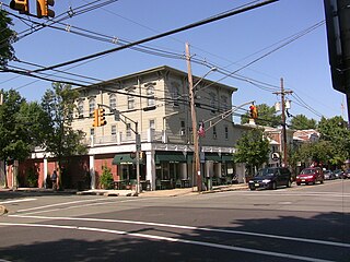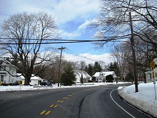
Lawrenceville is an unincorporated community and census-designated place (CDP) within Lawrence Township in Mercer County, in the U.S. state of New Jersey. The community is situated roughly halfway between Princeton and Trenton. Lawrenceville is part of the Trenton–Princeton metropolitan area within the New York combined statistical area; however, the CDP actually is located approximately 15 miles closer to Philadelphia than to New York City, and as with the remainder of Mercer County, lies within the Federal Communications Commission's Philadelphia Designated Market Area. As of the 2020 census, the CDP's population was 3,751, a decrease of 136 (−3.5%) from the 3,887 recorded at the 2010 census, which in turn had reflected a decrease of 194 (−4.8%) from the 4,081 counted in the 2000 census.

Ewing Township is a township in Mercer County, in the U.S. state of New Jersey. The township falls within the New York metropolitan area as defined by the U.S. Census Bureau. It borders the Philadelphia metropolitan area and is part of the Federal Communications Commission's Philadelphia Designated Market Area. As of the 2020 United States census, the township's population was 37,264, its highest decennial count ever and an increase of 1,474 (+4.1%) from the 35,790 recorded at the 2010 census, which in turn reflected an increase of 83 (+0.2%) from the 35,707 counted in the 2000 census.

Hopewell is a borough in Mercer County, in the U.S. state of New Jersey. Centrally located within the Raritan Valley region, this historical settlement is an exurban commuter suburb of New York City in the New York metropolitan area as defined by the United States Census Bureau. As of the 2020 United States census, the borough's population was 1,918, a decrease of 4 (−0.2%) from the 2010 census count of 1,922, which in turn had reflected a decline of 113 (−5.6%) from the 2,035 counted at the 2000 census.

Hopewell Township is a township in Mercer County, in the U.S. state of New Jersey. Located at the cross-roads between the Delaware Valley region to the southwest and the Raritan Valley region to the northeast, the township considered an exurb of New York City in the New York metropolitan area as defined by the United States Census Bureau, while also directly bordering the Philadelphia metropolitan area, being a part of the Federal Communications Commission's Philadelphia Designated Market Area. As of the 2020 United States census, the township's population was 17,491, its highest decennial count ever and an increase of 187 (+1.1%) from the 2010 census count of 17,304, which in turn reflected an increase of 1,199 (+7.4%) from the 16,105 counted in the 2000 census.

Lawrence Township is a township in Mercer County, in the U.S. state of New Jersey. Located at the cross-roads between the Delaware Valley region to the southwest and the Raritan Valley region to the northeast, the township is an outer-ring suburb of New York City in the New York Metropolitan area, as defined by the United States Census Bureau, while also directly bordering the Philadelphia metropolitan area and is part of the Federal Communications Commission's Philadelphia Designated Market Area.

Pennington is a borough in Mercer County, in the U.S. state of New Jersey. The borough is located at the cross-roads between the Delaware Valley region to the southwest and the Raritan Valley region to the northeast. As of the 2020 United States census, the borough's population was 2,802, its highest decennial count ever and an increase of 217 (+8.4%) from the 2010 census count of 2,585, which in turn had reflected a decline of 111 (−4.1%) from the 2,696 counted in the 2000 census.

Titusville is an unincorporated community and census-designated place (CDP) in Hopewell Township, Mercer County, in the U.S. state of New Jersey. As of the 2020 census, the population was 633. The area includes a post office with its own ZIP Code (08560), several restaurants, gas stations, a firehouse, and a small cluster of homes. Washington Crossing State Park, dedicated to George Washington's crossing of the Delaware River in 1776, is adjacent to the community.

County Route 546 is a county highway in the U.S. state of New Jersey. The highway begins at Route 29 within the Titusville, New Jersey section of Hopewell Township and extends 9.98 miles (16.06 km) to U.S. Route 1 (US 1) in Lawrence Township. The road runs entirely within Mercer County.

Sourland Mountain is a 17 miles (27 km) long ridge in central New Jersey, U.S., extending from the Delaware River at Lambertville to the western end of Hillsborough Township near the community of Neshanic, through Montgomery Township and into Hopewell Township in Mercer County. It comprises the largest contiguous forest in Central Jersey, nearly 90 square miles (233 km2) in area. The highest point is only 568 feet (173 m) above sea level, but the way it rises steeply from the surrounding farmland has earned it the title of 'mountain'. The ridge itself sits within a larger area of rough terrain called The Sourlands.

The Sourlands is a region in the central portion of the U.S. state of New Jersey that includes portions of Hunterdon County, Mercer County, and Somerset County. It is centered on Sourland Mountain and comprises parts of Lambertville, East Amwell, West Amwell, Hillsborough, Hopewell Boro, Hopewell Township, and Montgomery Township. The region is flanked by the Hopewell Fault to the south and Amwell Valley to the north that runs from Mount Airy to an area just west of Flagtown and a diabase formation running from Lambertville to Mount Airy. The Sourland also include a hilly area towards the southwest called Pleasant Valley, with a number of farms. Although much of the Sourlands is not conducive to farming, Pleasant Valley and the slopes on the surrounding ridges have a number of farms. The slopes of the ridge to the north are also home to Unionville Vineyard.
Mount Rose is a narrow section of the Rocky Hill Ridge in Hopewell Township, New Jersey which is 420 feet above sea level. The ridge's western end is at The Sourlands at Hopewell-Pennington Road and its eastern end is near Province Line Road. The ridge is a diabase intrusion and unlike many of the ridges in the state, it runs from northwest to southeast. Crusher Road travels along the ridge. Pennington-Rocky Hill Road, Cherry Valley Road, Hopewell-Princeton Road and Carter Road meet at a low point along the ridge at the village of Mount Rose.

Rocky Hill Ridge, also known as the Mount Lucas-Rocky Hill Ridge, named after Lucas Voorhees, an 18th-century landowner, is a diabase trap rock ridge running west to east in the US State of New Jersey. Diabase intrusions form Baldpate Mountain and Pennington Mountain, the Mount Rose extension of the Mount Lucas-Rocky Hill ridge, and part of the Sourland Mountains. The Ridge is nine miles (14 km) long and continues across the Millstone River, just below The Georgetown Franklin Turnpike, as the Ten-Mile Run Mountain and Lawrence Brook Mountain. The western section of the ridge, which runs to the northwest to The Sourlands, is the Mount Rose section of the ridge.

Hopewell Valley Vineyards is a winery in Hopewell Township in Mercer County, New Jersey. The vineyard was first planted in 2001, and opened to the public in 2003. Hopewell Valley has 25 acres of grapes under cultivation, and produces 6,000 cases of wine per year. The winery is named for the region where it is located.

Bear Tavern is an unincorporated community located within Hopewell Township in Mercer County, in the U.S. state of New Jersey.

Harbourton is an unincorporated community located within Hopewell Township in Mercer County, in the U.S. state of New Jersey. It is located along County Route 579 at the intersection with Harbourton-Mount Airy Road. The Harbourton Historic District, encompassing the community, was listed on the state and national registers of historic places in 1974.

Marshalls Corner is an unincorporated community located within Hopewell Township in Mercer County, in the U.S. state of New Jersey and is centered about the intersection of Pennington-Hopewell Road and Woodsville-Marshalls Corner Road. The community has many residences, a Kooltronic manufacturing facility, and is the site of the vacant Pennytown Shopping Center. The proposed redevelopment of Pennytown as a housing complex is controversial to residents due to concerns about increased traffic and site drainage.

The Jeremiah Woolsey House is a historic Dutch Colonial home located at 237 Washington Crossing–Pennington Road, southwest of Pennington, in Hopewell Township of Mercer County, New Jersey. Listed as the Jeremiah M. Woolsey House, it was documented by the Historic American Buildings Survey in 1936. The house was added to the National Register of Historic Places on January 27, 1975, for its significance in architecture and politics/government.

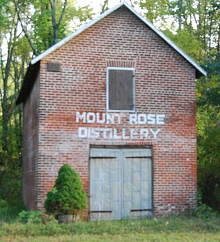
The Mount Rose Distillery Archaeological Site is a 1.3-acre (0.53 ha) archaeological site located at 192 Pennington-Rocky Hill Road in the Mount Rose section of Hopewell Township in Mercer County, New Jersey, United States. The site was added to the National Register of Historic Places on December 12, 1996, for its significance in archaeology and industry, in particular the history of cider milling and distilleries.

Jacobs Creek is a tributary of the Delaware River in Mercer County in the U.S. state of New Jersey. From its headwaters in Hopewell Township, the creek flows generally south and southwest. Along the creek's lower course, it flows along the border between Hopewell Township and Ewing Township, entering the Delaware River between Lambertville and Trenton.


