
Trenton is the capital city of the U.S. state of New Jersey and the county seat of Mercer County. It was the capital of the United States from November 1 until December 24, 1784. Trenton and Princeton are the two principal cities of the Trenton–Princeton metropolitan statistical area, which encompasses those cities and all of Mercer County for statistical purposes and constitutes part of the New York combined statistical area by the U.S. Census Bureau. However, Trenton directly borders the Philadelphia metropolitan area to its west, and the city was part of the Philadelphia combined statistical area from 1990 until 2000.

Lawrenceville is an unincorporated community and census-designated place (CDP) within Lawrence Township in Mercer County, in the U.S. state of New Jersey. The community is situated roughly halfway between Princeton and Trenton. Lawrenceville is part of the Trenton–Princeton metropolitan area within the New York combined statistical area; however, the CDP actually is located approximately 15 miles closer to Philadelphia than to New York City, and as with the remainder of Mercer County, lies within the Federal Communications Commission's Philadelphia Designated Market Area. As of the 2020 census, the CDP's population was 3,751, a decrease of 136 (−3.5%) from the 3,887 recorded at the 2010 census, which in turn had reflected a decrease of 194 (−4.8%) from the 4,081 counted in the 2000 census.

Mercer County is a county located in the U.S. state of New Jersey. Its county seat is Trenton, also the state capital, prompting its nickname The Capital County. Mercer County alone constitutes the Trenton–Princeton metropolitan statistical area and is considered part of the New York combined statistical area by the U.S. Census Bureau, but also directly borders the Philadelphia metropolitan area and is included within the Federal Communications Commission's Philadelphia Designated Media Market Area. The county is part of the Central Jersey region of the state.

Ewing Township is a township in Mercer County, in the U.S. state of New Jersey. The township falls within the New York metropolitan area as defined by the U.S. Census Bureau. It borders the Philadelphia metropolitan area and is part of the Federal Communications Commission's Philadelphia Designated Market Area. As of the 2020 United States census, the township's population was 37,264, its highest decennial count ever and an increase of 1,474 (+4.1%) from the 35,790 recorded at the 2010 census, which in turn reflected an increase of 83 (+0.2%) from the 35,707 counted in the 2000 census.

Hamilton Township is a township and the most populous municipality in Mercer County, in the U.S. state of New Jersey. It is the largest suburb of Trenton, the state's capital, which is located to the township's west. The township is situated within the New York metropolitan area as defined by the United States Census Bureau but directly borders the Philadelphia metropolitan area and is part of the Federal Communications Commission's Philadelphia Designated Market Area. As of the 2020 United States census, the township's population was 92,297, its highest decennial count ever and an increase of 3,833 (+4.3%) from the 2010 census count of 88,464, which in turn reflected an increase of 1,355 (+1.6%) from the 2000 census count of 87,109. The township was the state's ninth-largest municipality in 2010 and 2020, after having been ranked 10th in 2000.

Lawrence Township is a township in Mercer County, in the U.S. state of New Jersey. Located at the cross-roads between the Delaware Valley region to the southwest and the Raritan Valley region to the northeast, the township is an outer-ring suburb of New York City in the New York Metropolitan area, as defined by the United States Census Bureau, while also directly bordering the Philadelphia metropolitan area and is part of the Federal Communications Commission's Philadelphia Designated Market Area.

U.S. Route 206 is a 130.23-mile-long (209.58 km) north–south United States highway in New Jersey and Pennsylvania, United States. Only about a half a mile of its length is in Pennsylvania; the Milford–Montague Toll Bridge carries it over the Delaware River into New Jersey, where it connects to the remainder of the route. Its southern terminus is at an intersection with US 30 and Route 54 in Hammonton. The highway's northern terminus is at an intersection with US 209 near Milford, Pennsylvania; some sources and signs show an overlap with US 209 to end at its parent route US 6. For much of its length, US 206 is a rural two-lane undivided road that passes through the Pine Barrens, agricultural areas, and the Appalachian Mountains of northwestern New Jersey, with some urban and suburban areas. The route connects several cities and towns, including Bordentown, Trenton, Princeton, Somerville, Roxbury, Netcong, and Newton. The road is known as the Disabled American Veterans Highway for much of its length.
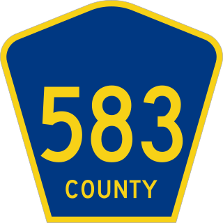
County Route 583 is a county highway in the U.S. state of New Jersey. Its northern end is at an intersection with Route 27 in Princeton; its southern end is in a concurrency with U.S. Route 1 Business and U.S. Route 206 at an intersection with County Route 653 in Trenton.

Interstate 295 (I-295) in Delaware, New Jersey, and Pennsylvania is an auxiliary Interstate Highway, designated as a bypass around Philadelphia, Pennsylvania, and a partial beltway of Trenton, New Jersey.
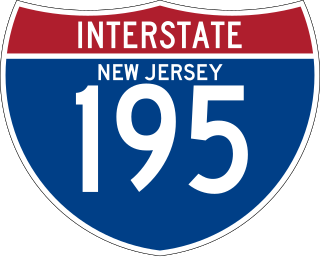
Interstate 195 (I-195) is an auxiliary route of the Interstate Highway System located in the US state of New Jersey. Its western end is at I-295 and Route 29 just south of Trenton in Hamilton Township, Mercer County, while its eastern end is at the Garden State Parkway, Route 138, and Route 34 in Wall Township, Monmouth County. I-195 is 34.17 miles (54.99 km) in length. The route is mostly a four-lane highway that mainly runs through agrarian and wooded areas in Central Jersey. It has an interchange with the New Jersey Turnpike (I-95) in Robbinsville Township and serves as a main access road to New Jersey's state capital of Trenton, the Horse Park of New Jersey, the Six Flags Great Adventure amusement park, and the Jersey Shore. I-195 is occasionally referred to as the Central Jersey Expressway. On April 6, 1988, President Ronald Reagan signed H.R. 4263 naming I-195 in New Jersey the James J. Howard Interstate Highway, in honor of the late James J. Howard.

Interstate 95 (I-95) is a major Interstate Highway that runs along the East Coast of the United States from Miami, Florida, north to the Canada–United States border at Houlton, Maine. In New Jersey, it runs along much of the mainline of the New Jersey Turnpike, as well as the Pearl Harbor Memorial Turnpike Extension, and the New Jersey Turnpike's I-95 Extension to the George Washington Bridge for a total of 77.96 miles (125.46 km). Located in the northeastern part of the state near New York City, the 11.03-mile (17.75 km) Western Spur of the New Jersey Turnpike, considered to be Route 95W by the New Jersey Department of Transportation (NJDOT), is also part of I-95.

U.S. Route 1 Business is a four-lane surface road that provides an alternate route to the Trenton Freeway (US 1) northeast of Trenton in Mercer County, New Jersey. The route is 2.73 miles (4.39 km) long and runs between US 1 in Trenton and Lawrence Township. On the border of Trenton and Lawrence Township, US 1 Bus. intersects the northbound direction of US 206 at the Brunswick Circle. The route was once part of a longer U.S. Route 1 Alternate, which continued southwest through downtown Trenton and into Morrisville, Pennsylvania.

North Trenton is a neighborhood located within the city of Trenton in Mercer County, in the U.S. state of New Jersey.

South Trenton is a neighborhood located within the city of Trenton in Mercer County, in the U.S. state of New Jersey. It is home to Italian Americans, Latin Americans, Irish Americans and their descendants. South Trenton borders Hamilton Township to the southeast and the Delaware River to the west. It had a brief existence as an independent municipality from 1840 to 1851.

East Trenton is a neighborhood located within the city of Trenton in Mercer County, in the U.S. state of New Jersey. It borders Hamilton Township and is home to a sizable African-American community, besides having small pockets of Latinos and Italians.
U.S. Route 1 (US 1) is a U.S. Route which parallels the East Coast of the United States, running from Key West, Florida, in the south to Fort Kent, Maine, at the Canadian border in the north. Of the entire length of the route, 66.06 miles (106.31 km) of it runs through New Jersey. It enters the state from Pennsylvania on the Trenton–Morrisville Toll Bridge over the Delaware River in the state capital of Trenton, running through the city on the Trenton Freeway. From here, US 1 continues northeast as a surface divided highway through suburban areas, heading into Middlesex County and passing through New Brunswick and Edison. US 1 merges with US 9 in Woodbridge, and the two routes continue through northern New Jersey as US 1/9 to the George Washington Bridge over the Hudson River in Fort Lee. At this point, the road continues into New York City along with I-95.
Chambersburg is a neighborhood located within the city of Trenton in Mercer County, in the U.S. state of New Jersey. It is considered part of South Trenton. Chambersburg was an independent municipality from 1872 to 1888.
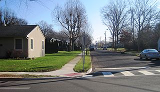
Slackwood is an unincorporated community located within Lawrence Township in Mercer County, in the U.S. state of New Jersey. The area is named for the owners of the land that was subdivided into the neighborhood today, Joseph Slack and William Wood. The neighborhood was first developed in 1890 as the first suburban development in the reconfigured Lawrence Township. Its location between Princeton Pike and Brunswick Pike allowed for an easy walk to nearby Trenton factories. Today, most of the homes in Slackwood are still small bungalows with some businesses along with Princeton and Brunswick Pikes. The neighborhood is bounded by the two highways on the northwest and southeast, Slackwood Park and forest on the southwest, and Shabakunk Creek and Park on the northeast.

Top Road is a neighborhood located within the city of Trenton in Mercer County, in the U.S. state of New Jersey. Much of Top Road was once part of Lawrence Township and then was added to the now-defunct Millham Township before being annexed by Trenton in 1888.


