National Register of Historic Places listings in Atlantic County, New Jersey

Last updated

Location of Atlantic County in New Jersey Map of New Jersey highlighting Atlantic County.svg
Location of Atlantic County in New Jersey

List of the National Register of Historic Places listings in Atlantic County, New Jersey

Contents: Counties and communities in New Jersey
AtlanticBergen (Closter, Franklin Lakes, Ridgewood, Saddle River, Wyckoff) – BurlingtonCamdenCape MayCumberlandEssexGloucesterHudsonHunterdonMercerMiddlesexMonmouthMorrisOceanPassaicSalemSomersetSussexUnionWarren

This is intended to be a complete list of properties and districts listed on the National Register of Historic Places in Atlantic County, New Jersey. Latitude and longitude coordinates of the sites listed on this page may be displayed in an online map. [1]


    This National Park Service list is complete through NPS recent listings posted March 1, 2024. [2]

[3] Name on the Register [4] ImageDate listed [5] Location City or townDescription
1 Absecon Lighthouse
Absecon Lighthouse ABSECON 72 500.jpg
Absecon Lighthouse
January 25, 1971
(#71000492)
Vermont and Pacific Aves.
39°21′58″N74°24′51″W / 39.366111°N 74.414167°W / 39.366111; -74.414167 (Absecon Lighthouse)
Atlantic City
2 Atlantic City Convention Hall
Atlantic City Convention Hall Atlantic City Convention Hall, On Boardwalk, West of Mississippi Avenue, Atlantic City (Atlantic County, New Jesey).jpg
Atlantic City Convention Hall
February 27, 1987
(#87000814)
Georgia and Mississippi Aves. and the Boardwalk
39°21′17″N74°26′20″W / 39.354722°N 74.438889°W / 39.354722; -74.438889 (Atlantic City Convention Hall)
Atlantic City
3 Capt. Francis Babcock House
Capt. Francis Babcock House Capt. Francis Babcock House.JPG
Capt. Francis Babcock House
July 28, 1999
(#99000907)
324 S. Shore Rd.
39°25′10″N74°30′01″W / 39.419444°N 74.500278°W / 39.419444; -74.500278 (Capt. Francis Babcock House)
Absecon City
4 Barclay Court
Barclay Court 9 to 15 sPennsy AC.JPG
Barclay Court
June 22, 1988
(#88000725)
9-11 S. Pennsylvania Ave.
39°21′48″N74°25′24″W / 39.363333°N 74.423333°W / 39.363333; -74.423333 (Barclay Court)
Atlantic City Demolished [6]
5 Bay Front Historic District
Bay Front Historic District Bay Front Historic District-01.jpg
Bay Front Historic District
March 22, 1989
(#89000227)
Roughly bounded by Decatur Ave., Egg Harbor Bay, George Ave., and Shore Rd.
39°18′41″N74°35′41″W / 39.311389°N 74.594722°W / 39.311389; -74.594722 (Bay Front Historic District)
Somers Point
6 Belcoville Post Office
Belcoville Post Office Belcoville Post Office NRHP.JPG
Belcoville Post Office
March 14, 2008
(#08000174)
1201 Madden Ave.
39°26′14″N74°44′00″W / 39.4371°N 74.7334°W / 39.4371; -74.7334 (Belcoville Post Office)
Weymouth Township
7 Bethlehem Loading Company Mays Landing Plant Archeological Historic District
Bethlehem Loading Company Mays Landing Plant Archeological Historic District BETHLEHEM LOADING CO. MAYS LANDING, ATLANTIC COUNTY , NJ.jpg
Bethlehem Loading Company Mays Landing Plant Archeological Historic District
July 12, 2006
(#06000559)
Address Restricted
Estell Manor
8 William L. Black House
William L. Black House William L. Black House.jpg
William L. Black House
August 26, 1993
(#93000828)
458 Bellevue Ave.
39°38′24″N74°47′56″W / 39.64°N 74.798889°W / 39.64; -74.798889 (William L. Black House)
Hammonton
9 Amanda Blake Store
Amanda Blake Store Amanda Blake Store, Port Republic, NJ.jpg
Amanda Blake Store
January 15, 1979
(#79001469)
104 Main St.
39°31′09″N74°29′29″W / 39.519167°N 74.491389°W / 39.519167; -74.491389 (Amanda Blake Store)
Port Republic
10 Church of the Ascension
Church of the Ascension Ascension AC NJ.JPG
Church of the Ascension
July 24, 1986
(#86001941)
1601 Pacific Ave.
39°21′35″N74°25′47″W / 39.359586°N 74.429584°W / 39.359586; -74.429584 (Church of the Ascension)
Atlantic City Demolished
11 Church of the Redeemer
Church of the Redeemer Redeemer Longport NJ.jpg
Church of the Redeemer
September 10, 1992
(#92001179)
Jct. of 20th and Atlantic Aves.
39°18′34″N74°31′51″W / 39.309444°N 74.530833°W / 39.309444; -74.530833 (Church of the Redeemer)
Longport Destroyed in a 2012 storm, later rebuilt. [7]
12 John Doughty House
John Doughty House John Doughty House.JPG
John Doughty House
March 5, 2002
(#02000107)
40 North Shore Rd.
39°25′28″N74°29′56″W / 39.424483°N 74.498956°W / 39.424483; -74.498956 (John Doughty House)
Absecon City
13 Egg Harbor Commercial Bank
Egg Harbor Commercial Bank Egg Harbor Comm Bank NJ.jpg
Egg Harbor Commercial Bank
August 28, 2007
(#07000875)
134 Philadelphia Ave.
39°31′46″N74°38′48″W / 39.529444°N 74.646667°W / 39.529444; -74.646667 (Egg Harbor Commercial Bank)
Egg Harbor City
14 Estellville Glassworks Historic District
Estellville Glassworks Historic District Estellville Glassworks Historic District.JPG
Estellville Glassworks Historic District
November 21, 1991
(#91001678)
Roughly bounded by Estell Manor Park, Stevens Cr. and NJ 50
39°23′43″N74°44′52″W / 39.395278°N 74.747778°W / 39.395278; -74.747778 (Estellville Glassworks Historic District)
Estell Manor City
15 Great Egg Coast Guard Station
Great Egg Coast Guard Station Great Egg NJ Coast Guard St.jpg
Great Egg Coast Guard Station
October 31, 2005
(#05000128)
2301 Atlantic Ave.
39°18′42″N74°31′41″W / 39.311761°N 74.527939°W / 39.311761; -74.527939 (Great Egg Coast Guard Station)
Longport
16 Head of the River Church
Head of the River Church Head of the River Church.jpg
Head of the River Church
March 7, 1979
(#79001467)
NJ 49
39°18′38″N74°49′19″W / 39.310556°N 74.821944°W / 39.310556; -74.821944 (Head of the River Church)
Estell Manor
17 Holmhurst Hotel
Holmhurst Hotel HolmhurstHotelAtlanticCity.jpg
Holmhurst Hotel
January 18, 1978
(#78001732)
121 S. Pennsylvania Ave.
39°21′41″N74°25′23″W / 39.361389°N 74.423056°W / 39.361389; -74.423056 (Holmhurst Hotel)
Atlantic City Demolished, March 1985. [6] Now a parking lot.
18 Jacobus Evangelical Lutheran Church
Jacobus Evangelical Lutheran Church St Jacobus NJ.JPG
Jacobus Evangelical Lutheran Church
June 9, 1988
(#88000635)
Mays Landing Rd. and NJ 54
39°36′25″N74°50′49″W / 39.606944°N 74.846944°W / 39.606944; -74.846944 (Jacobus Evangelical Lutheran Church)
Folsom Borough
19 Capt. John Jeffries Burial Marker
Capt. John Jeffries Burial Marker Capt. John Jeffries Burial Marker-01.jpg
Capt. John Jeffries Burial Marker
June 14, 1984
(#84002511)
Palestine Bible Church Cemetery, NJ 559
39°20′55″N74°39′42″W / 39.348611°N 74.661667°W / 39.348611; -74.661667 (Capt. John Jeffries Burial Marker)
Somers Point
20 Liberty Hotel
Liberty Hotel LIBERTY HOTEL ATLANTIC CITY, ATLANTIC COUNTY, NJ.jpg
Liberty Hotel
March 23, 2020
(#100005102)
1519 Baltic Ave.
39°21′51″N74°25′55″W / 39.3642°N 74.4320°W / 39.3642; -74.4320 (Liberty Hotel)
Atlantic City
21 Linwood Borough School No. 1
Linwood Borough School No. 1 Linwood Borough School No. 1-01.jpg
Linwood Borough School No. 1
December 20, 1984
(#84000510)
16 W. Poplar Ave.
39°21′03″N74°34′04″W / 39.350833°N 74.567778°W / 39.350833; -74.567778 (Linwood Borough School No. 1)
Linwood
22 Linwood Historic District
Linwood Historic District LINWOOD HIST. DIST. ATLANTIC COUNTY, NJ.jpg
Linwood Historic District
July 13, 1989
(#89000800)
Maple and Poplar avenues, and Shore Road
39°20′27″N74°34′30″W / 39.340833°N 74.575°W / 39.340833; -74.575 (Linwood Historic District)
Linwood
23 Lucy, the Margate Elephant
Lucy, the Margate Elephant Lucy the Elephant.jpg
Lucy, the Margate Elephant
August 12, 1971
(#71000493)
Decatur and Atlantic Aves.
39°19′15″N74°30′42″W / 39.320775°N 74.511597°W / 39.320775; -74.511597 (Lucy, the Margate Elephant)
Margate City
24 Madison Hotel
Madison Hotel Madison Hotel AC NJ.JPG
Madison Hotel
December 20, 1984
(#84000506)
123 S. Illinois Ave.
39°21′28″N74°25′49″W / 39.357778°N 74.430278°W / 39.357778; -74.430278 (Madison Hotel)
Atlantic City
25 Marven Gardens Historic District
Marven Gardens Historic District House 4 Marven Gardens New Jersey.jpg
Marven Gardens Historic District
September 13, 1990
(#90001440)
Bounded by Ventnor, Fredericksburg, Winchester and Brunswick Aves.
39°20′00″N74°29′43″W / 39.333333°N 74.495278°W / 39.333333; -74.495278 (Marven Gardens Historic District)
Margate City
26 Mays Landing Historic District
Mays Landing Historic District Abbott House, Mays Landing, NJ.jpg
Mays Landing Historic District
August 23, 1990
(#90001245)
East and West Main streets and intersecting streets
39°27′06″N74°43′51″W / 39.451667°N 74.730833°W / 39.451667; -74.730833 (Mays Landing Historic District)
Mays Landing Includes Mays Landing Presbyterian Church and Samuel Richards Hotel
27 Mays Landing Presbyterian Church
Mays Landing Presbyterian Church Presbyterian Church, Mays Landing, NJ.jpg
Mays Landing Presbyterian Church
April 20, 1982
(#82003261)
Main Street and Cape May Avenue
39°27′09″N74°43′40″W / 39.4525°N 74.727778°W / 39.4525; -74.727778 (Mays Landing Presbyterian Church)
Mays Landing
28 Morton Hotel
Morton Hotel Trump AC NJ.jpg
Morton Hotel
July 15, 1977
(#77000843)
150 S. Virginia Ave.
39°21′34″N74°25′14″W / 39.359444°N 74.420556°W / 39.359444; -74.420556 (Morton Hotel)
Atlantic City Demolished, [6] now occupied by Trump Taj Mahal
29 Neutral Water Health Resort Sanitarium
Neutral Water Health Resort Sanitarium Roundhouse Museum Egg Harbor NJ.JPG
Neutral Water Health Resort Sanitarium
March 20, 1991
(#91000267)
Junction of Claudius Street and London Avenue
39°32′11″N74°38′34″W / 39.536389°N 74.642778°W / 39.536389; -74.642778 (Neutral Water Health Resort Sanitarium)
Egg Harbor City
30 Northside Institutional Historic District
Northside Institutional Historic District NORTHSIDE INSTITUTIONAL HISTORIC DISTRICT ATLANTIC COUNTY NEW JERSEY.jpg
Northside Institutional Historic District
June 14, 2021
(#100004764)
117, 138 North Indiana Ave.; 1707, 1711, 1713, 1714 Arctic Ave.; 61A, 61B Martin Luther King Jr. Blvd.
39°21′42″N74°26′02″W / 39.3617°N 74.4340°W / 39.3617; -74.4340 (Northside Institutional Historic District)
Atlantic City
31 Dr. Jonathan Pitney House
Dr. Jonathan Pitney House Dr. Jonathan Pitney House.JPG
Dr. Jonathan Pitney House
August 14, 1998
(#98001062)
57 N. Shore Rd.
39°25′31″N74°29′55″W / 39.4252°N 74.4987°W / 39.4252; -74.4987 (Dr. Jonathan Pitney House)
Absecon City
32 Pleasant Mills
Pleasant Mills Pleasant Mills 1 AtlantiCo NJ.JPG
Pleasant Mills
March 3, 1995
(#95000182)
Elwood-Pleasant Mills Rd., E side
39°38′13″N74°39′39″W / 39.6369°N 74.6608°W / 39.6369; -74.6608 (Pleasant Mills)
Mullica Township
33 Port Republic Historic District
Port Republic Historic District Franklin Inn, Port Republic, NJ.jpg
Port Republic Historic District
May 16, 1991
(#91000596)
Roughly bounded by Mill St., Clark's Landing Rd., Adams Ave., Port Republic-Smithville Rd. and Riverside Dr.
39°31′15″N74°29′35″W / 39.5208°N 74.4931°W / 39.5208; -74.4931 (Port Republic Historic District)
Port Republic Includes Amanda Blake Store
34 Samuel Richards Hotel
Samuel Richards Hotel Samuel Richards Hotel, Mays Landing, NJ.jpg
Samuel Richards Hotel
August 31, 1979
(#79001468)
106 E. Main Street
39°27′04″N74°43′31″W / 39.4511°N 74.7253°W / 39.4511; -74.7253 (Samuel Richards Hotel)
Mays Landing Also known as the American Hotel
35 Jeremiah II or Edward Risley House
Jeremiah II or Edward Risley House JEREMIAH II OR EDWARD RISLEY HOUSE, ATLANTIC COUNTY, NJ.jpg
Jeremiah II or Edward Risley House
May 31, 1991
(#91000609)
8 Virginia Ave.
39°22′32″N74°32′22″W / 39.3756°N 74.5394°W / 39.3756; -74.5394 (Jeremiah II or Edward Risley House)
Northfield
36 Risley School
Risley School RISLEY SCHOOL, ATLANTIC COUNTY, NEW JERSEY.jpg
Risley School
May 4, 2011
(#11000256)
134 Cape May Ave.
39°22′37″N74°49′29″W / 39.3769°N 74.8247°W / 39.3769; -74.8247 (Risley School)
Estell Manor
37 USCS Robert J. Walker
USCS Robert J. Walker USCSRobertJWalker1852.jpg
USCS Robert J. Walker
March 19, 2014
(#14000064)
Ten miles off the New Jersey coast
39°16′44″N74°15′24″W / 39.2790°N 74.2566°W / 39.2790; -74.2566 (USCS Robert J. Walker)
Atlantic City
38 St. Nicholas of Tolentine Church
St. Nicholas of Tolentine Church St Nick Tolentine AC NJ.JPG
St. Nicholas of Tolentine Church
February 2, 2001
(#01000039)
1409 Pacific Avenue
39°21′38″N74°25′41″W / 39.3606°N 74.4281°W / 39.3606; -74.4281 (St. Nicholas of Tolentine Church)
Atlantic City
39 Santa Rita Apartments
Santa Rita Apartments SANTA RITA APARTMENTS, ATLANTIC CITY, ATLANTIC COUNTY, NJ.jpg
Santa Rita Apartments
June 14, 1991
(#91000675)
66 S. South Carolina Ave.
39°21′40″N74°25′35″W / 39.3611°N 74.4264°W / 39.3611; -74.4264 (Santa Rita Apartments)
Atlantic City Demolished
40 Segal Building
Segal Building Segal Building.jpg
Segal Building
February 9, 1984
(#84002517)
1200 Atlantic Ave.
39°21′46″N74°25′35″W / 39.3628°N 74.4264°W / 39.3628; -74.4264 (Segal Building)
Atlantic City
41 Shelburne Hotel
Shelburne Hotel Shelburne Hotel by Moonlight, Atlantic City, New Jersey.png
Shelburne Hotel
May 19, 1978
(#78001733)
Michigan Ave. and the Boardwalk
39°21′21″N74°26′03″W / 39.3558°N 74.4342°W / 39.3558; -74.4342 (Shelburne Hotel)
Atlantic City Demolished [6]
42 Smithville Apothecary
Smithville Apothecary Apothecary, Smithville, Atlantic County, NJ - front view.jpg
Smithville Apothecary
June 9, 1978
(#78001734)
Off Moss Mill Rd.
39°29′47″N74°27′49″W / 39.4964°N 74.4636°W / 39.4964; -74.4636 (Smithville Apothecary)
Smithville
43 Somers Mansion
Somers Mansion Somers Mansion-01.jpg
Somers Mansion
December 18, 1970
(#70000378)
Shore Rd. and Somers Point Circle
39°18′33″N74°35′55″W / 39.3092°N 74.5986°W / 39.3092; -74.5986 (Somers Mansion)
Somers Point
44 John Stafford Historic District
John Stafford Historic District 103 Marion Ventor.JPG
John Stafford Historic District
June 9, 1988
(#88000723)
Roughly bounded by Atlantic Ave., Vassar Ave., Boardwalk, and Austin Ave.
39°20′35″N74°28′01″W / 39.3431°N 74.4669°W / 39.3431; -74.4669 (John Stafford Historic District)
Ventnor City
45 Tofani–DiMuzio House
Tofani-DiMuzio House TOFANI-DIMUZIO HOUSE, VENTNOR, ATLANTIC COUNTY, NJ.jpg
Tofani–DiMuzio House
October 30, 2015
(#15000762)
12 S. Cambridge Ave.
39°20′18″N74°28′47″W / 39.3384°N 74.4797°W / 39.3384; -74.4797 (Tofani–DiMuzio House)
Ventnor City
46 Ventnor City Hall
Ventnor City Hall Ventor NJ city hall.jpg
Ventnor City Hall
October 10, 1996
(#96001088)
6201 Atlantic Ave.
39°20′15″N74°28′49″W / 39.3375°N 74.4803°W / 39.3375; -74.4803 (Ventnor City Hall)
Ventnor City
47 Weymouth
Weymouth Address restricted.PNG
Weymouth
April 25, 1985
(#85000874)
Address Restricted
Hamilton Township Surviving hulk of schooner
48 Weymouth Road Bridge
Weymouth Road Bridge WEYMOUTH ROAD BRIDGE, ATLANTIC COUNTY, NJ.jpg
Weymouth Road Bridge
June 21, 2001
(#01000671)
Weymouth Rd.
39°31′07″N74°46′45″W / 39.5186°N 74.7792°W / 39.5186; -74.7792 (Weymouth Road Bridge)
Hamilton Township
49 World War I Memorial
World War I Memorial WWI Memorial Atlantic City b.JPG
World War I Memorial
August 28, 1981
(#81000388)
O'Donnell Pkwy., S. Albany and Ventnor Aves.
39°21′05″N74°27′19″W / 39.3514°N 74.4553°W / 39.3514; -74.4553 (World War I Memorial)
Atlantic City

Former listings

[3] Name on the RegisterImageDate listedDate removedLocationCity or townDescription
1 Marlborough-Blenheim Hotel
Marlborough-Blenheim Hotel Marlborough-Blenheim Hotel (demolished) Atlantic City, NJ.jpg
Marlborough-Blenheim Hotel
August 23, 1977
(#77000842)
January 25, 1979Boardwalk and Ohio Aves.
Atlantic City Imploded on January 4, 1979. [8]
2 Traymore Hotel
Traymore Hotel Traymore1930.jpg
Traymore Hotel
December 13, 1971
(#71001049)
October 2, 1972Illinois Ave. and Boardwalk.
Atlantic City Imploded on April 27, 1972. [9]
3 U.S. Coast Guard Station June 23, 1976
(#76001144)
March 10, 1977About 3 mi. NNE of Brigantine City
Brigantine City vicinityDestroyed by fire on February 25, 1977.

Related Research Articles

<span class="mw-page-title-main">National Register of Historic Places listings in Lycoming County, Pennsylvania</span>

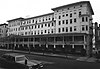
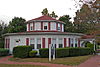
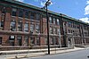
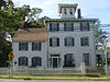
This is a list of the National Register of Historic Places listings in Lycoming County, Pennsylvania.

<span class="mw-page-title-main">National Register of Historic Places listings in Cumberland County, New Jersey</span>

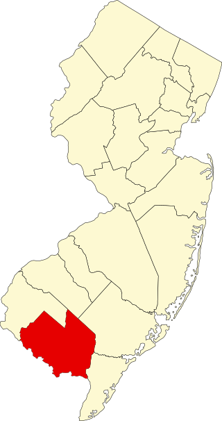
List of the National Register of Historic Places listings in Cumberland County, New Jersey

<span class="mw-page-title-main">National Register of Historic Places listings in Gloucester County, New Jersey</span>

List of the National Register of Historic Places listings in Gloucester County, New Jersey

<span class="mw-page-title-main">National Register of Historic Places listings in Salem County, New Jersey</span>

List of the National Register of Historic Places listings in Salem County, New Jersey

<span class="mw-page-title-main">National Register of Historic Places listings in Passaic County, New Jersey</span>

List of the National Register of Historic Places listings in Passaic County, New Jersey

<span class="mw-page-title-main">National Register of Historic Places listings in Monmouth County, New Jersey</span>

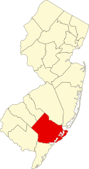
List of the National Register of Historic Places listings in Monmouth County, New Jersey

<span class="mw-page-title-main">National Register of Historic Places listings in Travis County, Texas</span>

This is a list of the National Register of Historic Places listings in Travis County, Texas.

<span class="mw-page-title-main">National Register of Historic Places listings in Anne Arundel County, Maryland</span>

This is a list of the National Register of Historic Places listings in Anne Arundel County, Maryland.

<span class="mw-page-title-main">National Register of Historic Places listings in Lackawanna County, Pennsylvania</span>

This is a list of the National Register of Historic Places listings in Lackawanna County, Pennsylvania.

<span class="mw-page-title-main">National Register of Historic Places listings in Lehigh County, Pennsylvania</span>

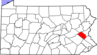
This is a list of the National Register of Historic Places listings in Lehigh County, Pennsylvania.

<span class="mw-page-title-main">National Register of Historic Places listings in Northumberland County, Pennsylvania</span>

This is a list of the National Register of Historic Places listings in Northumberland County, Pennsylvania.

<span class="mw-page-title-main">National Register of Historic Places listings in Pike County, Pennsylvania</span>

This is a list of the National Register of Historic Places listings in Pike County, Pennsylvania.

<span class="mw-page-title-main">National Register of Historic Places listings in Sandusky County, Ohio</span>

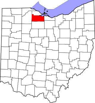
This is a list of the National Register of Historic Places listings in Sandusky County, Ohio.

<span class="mw-page-title-main">National Register of Historic Places listings in Salt Lake County, Utah</span>

This is a list of the National Register of Historic Places listings in Salt Lake County, Utah, except those in Salt Lake City. Listings for Salt Lake City can be found here.

<span class="mw-page-title-main">National Register of Historic Places listings in Utah County, Utah</span>

This is a list of the National Register of Historic Places listings in Utah County, Utah.

<span class="mw-page-title-main">National Register of Historic Places listings in Greenwood County, South Carolina</span>

This is a list of the National Register of Historic Places listings in Greenwood County, South Carolina.

<span class="mw-page-title-main">National Register of Historic Places listings in Richmond County, North Carolina</span>

This list includes properties and districts listed on the National Register of Historic Places in Richmond County, North Carolina. Click the "Map of all coordinates" link to the right to view a Google map of all properties and districts with latitude and longitude coordinates in the table below.

<span class="mw-page-title-main">National Register of Historic Places listings in Closter, New Jersey</span>

List of the National Register of Historic Places listings in the borough of Closter in Bergen County, New Jersey

<span class="mw-page-title-main">National Register of Historic Places listings in Franklin Lakes, New Jersey</span>

List of the National Register of Historic Places listings in the borough of Franklin Lakes in Bergen County, New Jersey

<span class="mw-page-title-main">National Register of Historic Places listings in Ridgewood, New Jersey</span>

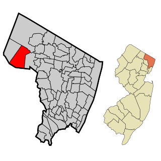
List of the National Register of Historic Places listings in the village of Ridgewood in Bergen County, New Jersey

References

  1. The latitude and longitude information provided in this table was derived originally from the National Register Information System, which has been found to be fairly accurate for about 99% of listings. Some locations in this table may have been corrected to current GPS standards.
  2. National Park Service, United States Department of the Interior, "National Register of Historic Places: Weekly List Actions", retrieved March 1, 2024.
  3. 1 2 Numbers represent an alphabetical ordering by significant words. Various colorings, defined here, differentiate National Historic Landmarks and historic districts from other NRHP buildings, structures, sites or objects.
  4. "National Register Information System". National Register of Historic Places . National Park Service. April 24, 2008.
  5. The eight-digit number below each date is the number assigned to each location in the National Register Information System database, which can be viewed by clicking the number.
  6. 1 2 3 4 NJ DEP Historic Preservation Office Archived 2006-10-17 at the Wayback Machine
  7. "Longport's Church of the Redeemer destroyed by storm-sparked fire".
  8. "Boardwalk Landmark Gone In 11 Seconds". Intelligencer Journal . January 5, 1979. p. 42. Retrieved August 6, 2022 via Newspapers.com.
  9. "Wreckers Blast Traymore Wings". Asbury Park Press . April 28, 1972. p. 3. Retrieved August 6, 2022 via Newspapers.com.