Related Research Articles
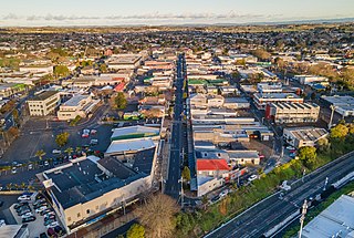
Pukekohe is a town in the Auckland Region of the North Island of New Zealand. Located at the southern edge of the Auckland Region, it is in South Auckland, between the southern shore of the Manukau Harbour and the mouth of the Waikato River. The hills of Pukekohe and nearby Bombay Hills form the natural southern limit of the Auckland region. Pukekohe is located within the political boundaries of the Auckland Council, following the abolition of the Franklin District Council on 1 November 2010.

The North Island Main Trunk (NIMT) is the main railway line in the North Island of New Zealand, connecting the capital city Wellington with the country's largest city, Auckland. The line is 682 kilometres (424 mi) long, built to the New Zealand rail gauge of 1,067 mm and serves the large cities of Palmerston North and Hamilton.

Manurewa railway station is a station serving the suburb of Manurewa in Auckland, New Zealand. It is located on the Southern Line of the Auckland railway network. The station has a side platform layout connected by a pedestrian bridge.

Papatoetoe railway station is on the Southern Line and Eastern Line of the Auckland railway network in New Zealand. It is between Station Road and Shirley Road, across the street from Papatoetoe West School, and has an island platform layout.

Ōtāhuhu railway station is located on the Eastern and Southern Lines of the Auckland rail network in New Zealand. It has an island platform configuration and is part of an integrated bus-train major transport hub. It can be reached by steps and lift from an overhead concourse that leads from the adjacent bus transfer station and Walmsley Road.

Middlemore railway station is on the Southern Line and Eastern Line of the Auckland railway network in New Zealand. The station has side platforms on the northbound and southbound lines connected by a pedestrian level crossing at the south end of the platforms. Access to the station is via Hospital Road: it is next to Middlemore Hospital.

Papakura railway station is a railway station in Papakura, New Zealand, on the Southern Line of the Auckland railway network.

Pukekohe railway station is a railway station in Pukekohe, New Zealand. It is the southern terminus of the Southern Line of the Auckland railway network. The station has an island platform between the main lines and an original wooden station building complete with signal panel.

Homai railway station is on the Southern Line of the Auckland railway network in New Zealand. It has an Island platform layout. A bus stop and a park and ride facility are located adjacent to the station.

Takaanini railway station, formerly spelt Takanini, is on the Southern Line of the Auckland railway network in New Zealand. The station has an island platform layout and is accessed from Manuroa Road, Station Road and Taka Street in the Takanini suburb of Auckland.

Te Mahia railway station is on the Southern Line of the Auckland railway network in New Zealand. It has an island platform layout and is reached by level crossings from Great South Road and Ferguson Street.

Public transport in Auckland, the largest metropolitan area of New Zealand, consists of three modes: bus, train and ferry. Services are coordinated by Auckland Transport under the AT Metro brand. Britomart Transport Centre is the main transport hub.
The Southern Line in Auckland, New Zealand is the name given to suburban train services that operate between Britomart Transport Centre in central Auckland and Pukekohe via Newmarket.
Auckland railway electrification occurred in phases as part of investment in a new infrastructure for Auckland's urban railway network. Electrification of the network had been proposed for several decades. Installation started in the late 2000s after funds were approved from a combination of regional and central government budgets.

Tironui railway station was a station on the North Island Main Trunk in New Zealand, south of Auckland between Takanini railway station and Papakura railway station. It had a station building and a 92 m (302 ft) long, 42 cm (17 in) high platform. Electric light was added in 1933. According to Scoble, it was opened on 10 May 1926 and closed on 13 August 1983.
Paerata is a small settlement immediately to the north of Pukekohe, in the North Island of New Zealand. It is located on State Highway 22 some 10 kilometres (6.2 mi) south of the Manukau Harbour. Wesley College is located close to the northern edge of Paerata.

Te Huia is a passenger train service between Hamilton, Papakura, and Auckland (Strand) in New Zealand. The service is a five-year trial with subsidies from the NZ Transport Agency and Waikato local authorities. The opening was delayed because of the COVID pandemic and the need to replace some rail track. A new starting date was announced, and the service began on 6 April 2021.
Paerātā railway station is an under construction railway station in Auckland, New Zealand. It is due to open in 2025 as part of the Auckland railway electrification project. It will serve the Paerata area, linking with the new Paerata Rise housing development. The station will be located on the existing rail line, adjacent to the planned eastern extent of the development.
Ngākōroa railway station, formerly known as Drury West railway station, is an under construction railway station in Auckland, New Zealand. It is due to open in 2025 as part of the Auckland railway electrification project. It will serve the Drury West and Runciman area, linking with new housing developments in the area. The station will be located on the existing rail line, about 450 m south of the existing intersection of State Highway 22/Karaka Road and Jesmond Road.
References
- ↑ "Southern station locations announced". KiwiRail. 11 February 2021. Retrieved 27 May 2022.
- ↑ "Approval For Two Stations In Southern Auckland". Scoop. 3 February 2022. Retrieved 27 May 2022.
- ↑ "The Papakura to Pukekohe upgrade". Greater Auckland. 11 November 2021. Retrieved 27 May 2022.
- ↑ Auckland Transport [@AklTransport] (19 May 2022). "Today Kiwirail and AT are announcing the proposed names for the three new stations to be constructed between Papakura & Pukekohe. – Maketuu, – Ngaakooroa – Paeraataa. We are honoured to have been gifted these names by Mana Whenua, which restore the original Māori place names" (Tweet) – via Twitter.
- ↑ Auckland Transport [@AklTransport] (19 May 2022). "Maketuu Station (for Drury Central) - The name Maketuu gives tribute to the traditional name for the Maketuu stream and the historic name's sake of the ancient Te Maketuu Pā (The Pratts Road Historic Reserve) all located within the area" (Tweet) – via Twitter.