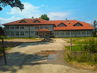
South Amherst is a census-designated place (CDP) in the town of Amherst in Hampshire County, Massachusetts, United States. The population was 4,994 at the 2010 census. The CDP includes the village of South Amherst and residential subdivisions south of the Amherst town center.

Mohawk Island is a small island in Lake Erie, in the province of Ontario, Canada. It was formerly known as Gull Island. The island contains the ruins of the Gull Island Lighthouse, built in 1848 to guide ships into the Welland Canal. It was automated in 1933, and decommissioned in 1969. It is located close to the shore of Rock Point Provincial Park. The lantern room and stairs inside the lighthouse were removed, and the wood roof, the lighthouse keeper, door and windows are missing.
Wierzbica is a village in the administrative district of Gmina Leśniowice, within Chełm County, Lublin Voivodeship, in eastern Poland.
Kowalowy Gród is a village in the administrative district of Gmina Michałowo, within Białystok County, Podlaskie Voivodeship, in north-eastern Poland, close to the border with Belarus.
Maciejkowa Góra is a village in the administrative district of Gmina Michałowo, within Białystok County, Podlaskie Voivodeship, in north-eastern Poland, close to the border with Belarus.

Florentynów is a village in the administrative district of Gmina Kodrąb, within Radomsko County, Łódź Voivodeship, in central Poland. It lies approximately 8 kilometres (5 mi) west of Kodrąb, 6 km (4 mi) east of Radomsko, and 79 km (49 mi) south of the regional capital Łódź.

Stanisławowo is a village in the administrative district of Gmina Serock, within Legionowo County, Masovian Voivodeship, in east-central Poland. It lies approximately 11 kilometres (7 mi) west of Serock, 14 km (9 mi) north of Legionowo, and 35 km (22 mi) north of Warsaw.
Drochowo is a village in the administrative district of Gmina Naruszewo, within Płońsk County, Masovian Voivodeship, in east-central Poland.
Dąbrowa is a village in the administrative district of Gmina Łochów, within Węgrów County, Masovian Voivodeship, in east-central Poland.

Bronisławki is a village in the administrative district of Gmina Ujście, within Piła County, Greater Poland Voivodeship, in west-central Poland. It lies approximately 12 kilometres (7 mi) south of Ujście, 21 km (13 mi) south of Piła, and 65 km (40 mi) north of the regional capital Poznań.

Sierbowice is a village in the administrative district of Gmina Pilica, within Zawiercie County, Silesian Voivodeship, in southern Poland. It lies approximately 7 kilometres (4 mi) north of Pilica, 17 km (11 mi) east of Zawiercie, and 56 km (35 mi) north-east of the regional capital Katowice.

Władysławek is a village in the administrative district of Gmina Chojnice, within Chojnice County, Pomeranian Voivodeship, in northern Poland. It lies approximately 2 kilometres (1 mi) west of Chojnice and 104 km (65 mi) south-west of the regional capital Gdańsk.

Nieckowo is a village in the administrative district of Gmina Potęgowo, within Słupsk County, Pomeranian Voivodeship, in northern Poland. It lies approximately 5 kilometres (3 mi) north of Potęgowo, 32 km (20 mi) east of Słupsk, and 76 km (47 mi) west of the regional capital Gdańsk.

Łabędnik is a village in the administrative district of Gmina Bartoszyce, within Bartoszyce County, Warmian-Masurian Voivodeship, in northern Poland, close to the border with the Kaliningrad Oblast of Russia. It lies approximately 14 kilometres (9 mi) south-east of Bartoszyce and 55 km (34 mi) north-east of the regional capital Olsztyn.

Łęczno is a village in the administrative district of Gmina Białogard, within Białogard County, West Pomeranian Voivodeship, in north-western Poland. It lies approximately 5 kilometres (3 mi) south-west of Białogard and 110 km (68 mi) north-east of the regional capital Szczecin.
Inates is a village and rural commune in the Tillabéri Region of Niger.

Bogojevce is a village in the municipality of Leskovac, Serbia. According to the 2002 census, the village has a population of 1571 people.
Mäebe is a village in Saaremaa Parish, Saare County in western Estonia.

Peći is a village in the municipality of Srebrenica, Bosnia and Herzegovina.
Cuadrilla de Zuia is a comarca of the province of Álava, Spain. It covers an area of 461.58 km² with a population of 9,420 people (2010). The capital lies at Murgia in the municipality of Zuia.


