Dunbar Street

Last updated

Dunbar Street is a road in Vancouver, British Columbia, Canada. The main thoroughfare runs through the Dunbar–Southlands neighbourhood from 51st Avenue and the Point Grey Golf and Country Club in the south and continues to the north as Alma Street, via the Dunbar Diversion. The built-up commercial area along Dunbar Street is surrounded predominantly by single-family properties - the only such commercial strip in Vancouver. [1] Separately, Dunbar Street runs through West Point Grey as a narrow residential road, from 13th Avenue to Point Grey Road.

Vancouver City in British Columbia, Canada

Vancouver is a coastal seaport city in western Canada, located in the Lower Mainland region of British Columbia. As the most populous city in the province, the 2016 census recorded 631,486 people in the city, up from 603,502 in 2011. The Greater Vancouver area had a population of 2,463,431 in 2016, making it the third-largest metropolitan area in Canada. Vancouver has the highest population density in Canada with over 5,400 people per square kilometre, which makes it the fifth-most densely populated city with over 250,000 residents in North America behind New York City, Guadalajara, San Francisco, and Mexico City according to the 2011 census. Vancouver is one of the most ethnically and linguistically diverse cities in Canada according to that census; 52% of its residents have a first language other than English. Roughly 30% of the city's inhabitants are of Chinese heritage. Vancouver is classed as a Beta global city.

British Columbia Province of Canada

British Columbia is the westernmost province of Canada, located between the Pacific Ocean and the Rocky Mountains. With an estimated population of 5.016 million as of 2018, it is Canada's third-most populous province.

Canada Country in North America

Canada is a country in the northern part of North America. Its ten provinces and three territories extend from the Atlantic to the Pacific and northward into the Arctic Ocean, covering 9.98 million square kilometres, making it the world's second-largest country by total area. Canada's southern border with the United States is the world's longest bi-national land border. Its capital is Ottawa, and its three largest metropolitan areas are Toronto, Montreal, and Vancouver. As a whole, Canada is sparsely populated, the majority of its land area being dominated by forest and tundra. Consequently, its population is highly urbanized, with over 80 percent of its inhabitants concentrated in large and medium-sized cities, many near the southern border. Canada's climate varies widely across its vast area, ranging from arctic weather in the north, to hot summers in the southern regions, with four distinct seasons.

Contents

The commercial area along Dunbar is resistant to change; [1] many businesses in the area have been established in their locations for more than 50 years. Examples include Dunbar Cycles, which opened in 1927, Stong's Market, which opened in 1931, and the Dunbar Theatre, which has been in business since 1935. [2] Translink runs two routes along Dunbar Street and maintains the Dunbar Loop at the intersection of Dunbar and 41st Avenue. Route 7 provides service from the Dunbar Loop to Nanaimo Station, and Route 32 is a weekday express bus that runs from the Dunbar Loop to downtown. [3]

TransLink (British Columbia) transport company in British Columbia, Canada

TransLink, formally the South Coast British Columbia Transportation Authority, is the statutory authority responsible for the regional transportation network of Metro Vancouver in British Columbia, Canada, including public transport, major roads and bridges. Its main operating facilities are located in the city of New Westminster.

Dunbar Loop TransLink exchange point in the western side of Vancouver

Dunbar Loop is one of the major transit exchanges in the western side of Vancouver. Opened on May 22, 1950, it is part of the TransLink system and is the westernmost exchange in the city of Vancouver..

Route

Beginning at 16th Avenue near the Dunbar district, the street passes south, intersecting King Edward Avenue and on through 41st Avenue. It mostly passes through residential districts, with the exception near King Edward Avenue and 41st Avenue. It also passes by the Dunbar Loop of Translink. The route ends at 51st Avenue, where the Point Grey Golf and Country Club lies to the south.

41st Avenue is a busy road used in Vancouver, British Columbia. The road goes from the east side of Vancouver to the west side of Vancouver, where it merges on to Marine Drive.

Intersections

The following are the major east-west intersections with Dunbar Street (north to south):

Related Research Articles

Keele Street

Keele Street is a north-south road in Toronto, Vaughan and King in Ontario, Canada. It stretches 47 km, running from Bloor Street in Toronto to the Holland Marsh. South of Bloor Street, the roadway is today known as Parkside Drive, but was originally part of Keele Street. It was renamed in 1921 by the City of Toronto.

Joyce–Collingwood station Metro Vancouver SkyTrain station

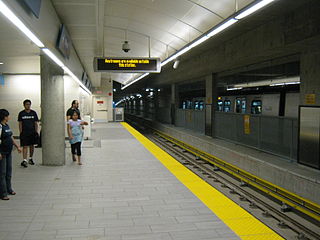
Joyce–Collingwood is an elevated station on the Expo Line, a part of Metro Vancouver's SkyTrain rapid transit system. The station is located on Joyce Street at Vanness Avenue, in the Collingwood neighbourhood of Vancouver, British Columbia, Canada. It is the tenth-busiest station on the SkyTrain system.

Texas State Highway Loop 279 highway in Texas

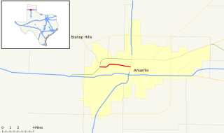
Loop 279, formerly Business U.S. Highway 66, is a state highway in Amarillo, Texas, United States. It runs from Amarillo Boulevard and Bell Street east along 9th Avenue, Bushland Boulevard and 6th Avenue to end at Fillmore Street.

Edmonds station (SkyTrain) Metro Vancouver SkyTrain station

Edmonds is an at-grade station on the Expo Line of Metro Vancouver's SkyTrain rapid transit system. The station is located southwest of the intersection of Griffiths Drive and 18th Avenue, near Edmonds Street, south of Kingsway in the Edmonds area of Burnaby, British Columbia.

County Route 577 (New Jersey) highway in New Jersey

County Route 577, abbreviated CR 577, is a county highway in the U.S. state of New Jersey. The highway extends 9.96 miles (16.03 km) from Springfield Avenue in Springfield Township to Bloomfield Avenue in Verona.

99 B-Line

The 99 B-Line is an express bus line with bus rapid transit elements in Metro Vancouver, British Columbia, Canada. It travels along Broadway, a major east-west thoroughfare, and connects the University of British Columbia (UBC) to Commercial–Broadway station on the SkyTrain system. It is operated by Coast Mountain Bus Company and funded by TransLink.

County Route 561 (New Jersey) highway in New Jersey

County Route 561, abbreviated CR 561, is a county highway in the U.S. state of New Jersey. The highway extends 51.05 miles (82.16 km) from New York Road in Galloway Township to Federal Street in Camden.

Marine Drive station Metro Vancouver SkyTrain station

Marine Drive is an elevated station on the Canada Line of Metro Vancouver's SkyTrain rapid transit system. The station is located at the intersection of Cambie Street and SW Marine Drive in Vancouver, British Columbia.

Langara–49th Avenue station Metro Vancouver SkyTrain station

Langara–49th Avenue is an underground station on the Canada Line of Metro Vancouver's SkyTrain rapid transit system. It is located at the intersection of West 49th Avenue and Cambie Street in Vancouver, British Columbia, Canada.

Oakridge–41st Avenue station Metro Vancouver SkyTrain station

Oakridge–41st Avenue is an underground station on the Canada Line of Metro Vancouver's SkyTrain rapid transit system. It is located at the intersection of West 41st Avenue and Cambie Street in Vancouver, British Columbia, Canada.

County Route 502 (New Jersey) highway in New Jersey

County Route 502, abbreviated CR 502, is a county highway in the U.S. state of New Jersey. The highway extends 23.79 miles (38.29 km) from Paterson-Hamburg Turnpike (CR 504) in Wayne to Palisades Boulevard in Alpine.

Main Street (Vancouver) major road in Vancouver, British Columbia

Main Street is a major north-south thoroughfare bisecting Vancouver, British Columbia, Canada. It runs from Waterfront Road by Burrard Inlet in the north, to Kent Avenue alongside the north arm of the Fraser River in the south.

Broadway (Vancouver) thoroughfare in Vancouver, British Columbia

Broadway is a major east-west thoroughfare in the city of Vancouver, British Columbia, Canada. In Vancouver's numbered avenue grid system, it runs in place of a 9th Avenue, between 8th and 10th. The street has six lanes for most of its course. Portions of the street carry the British Columbia Highway 7 designation.

Oak Street is a major north-south street in Vancouver, British Columbia, Canada. The street begins in the north at an intersection with 6th Avenue in the Fairview neighbourhood and continues to the Oak Street Bridge in the south, leading towards Richmond. There is a small portion west of the bridge that is in the industrial area of Vancouver along the Fraser River From its intersection with 70th Avenue southwards, the route is a component section of Highway 99, except for the aforementioned industrial section.

Stony Plain Road

Stony Plain Road is a major Roadway in west Edmonton, Alberta, Canada. Parkland Highway is an alternative route to the corresponding section of Highway 16 in Parkland County.

The 91 B-Line is a future express bus line with bus rapid transit elements in Metro Vancouver, Canada that was outlined in the 2005 Vancouver/UBC Transit Plan for implementation in December 2009. It will replace the 43 Express that travels along 41st Avenue, a major east–west route which connects the University of British Columbia (UBC) to Joyce–Collingwood station on the SkyTrain system. The service will also connect with the Canada Line at Oakridge–41st Avenue station.

111 Street, Edmonton

111 Street is a major arterial road in south Edmonton, Alberta, Canada. The south leg of the LRT runs between the northbound and southbound lanes north of 23 Avenue. It passes by Southgate Centre and the former location of Heritage Mall, now the location of the Century Park transit-oriented development.

State Road 684 is a state road located in Manatee County, Florida, United States. The road runs from an intersection with SR 789 in Bradenton Beach east to U.S. Route 41 and unsigned SR 55 in South Bradenton. SR 684 is known as Cortez Road its entire length and varies from a two-lane road between Bradenton Beach and Cortez to a four- to six-lane road east of Cortez. The easternmost portion of SR 684 is concurrent with US 41 and is unsigned.

References

  1. 1 2 McElroy, Justin. "Dunbar: A traditional community defying density". The Province. Postmedia Network. Retrieved 21 December 2015.
  2. "Dunbar". Dunbar Life. Retrieved 22 December 2015.
  3. "Metro Vancouver Transit Map" (PDF) (Map). Regional Transit System Maps. Translink. 7 September 2015. Retrieved 22 December 2015.

Further reading

Route map: Google

KML file (edithelp)
KML is from Wikidata
International Standard Book Number Unique numeric book identifier

The International Standard Book Number (ISBN) is a numeric commercial book identifier which is intended to be unique. Publishers purchase ISBNs from an affiliate of the International ISBN Agency.