Dundee, Ohio | |
|---|---|
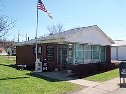 Dundee Post Office | |
 Location of Dundee, Ohio | |
| Coordinates: 40°35′13″N81°36′25″W / 40.58694°N 81.60694°W | |
| Country | United States |
| State | Ohio |
| County | Tuscarawas |
| Township | Wayne |
| Elevation | 1,027 ft (313 m) |
| Population | |
• Total | 269 |
| Time zone | UTC-5 (Eastern (EST)) |
| • Summer (DST) | UTC-4 (EDT) |
| ZIP code | 44624 |
| GNIS feature ID | 2628886 [1] |
Dundee is a census-designated place in central Wayne Township, Tuscarawas County, Ohio, United States. [1] It has a post office with the ZIP code 44624. [3] It lies at the intersection of State Routes 93 and 516. The population was 269 at the 2020 census.
