Strasburg, Ohio

Last updated

Strasburg, Ohio
StrasburgOH.jpg
Houses in Strasburg
OHMap-doton-Strasburg.png
Location of Strasburg, Ohio
Map of Tuscarawas County Ohio Highlighting Strasburg Village.png
Location of Strasburg in Tuscarawas County
Coordinates: 40°36′02″N81°31′46″W / 40.60056°N 81.52944°W / 40.60056; -81.52944
Country United States
State Ohio
County Tuscarawas
Township Franklin
Area
[1]
  Total1.44 sq mi (3.73 km2)
  Land1.44 sq mi (3.73 km2)
  Water0.00 sq mi (0.00 km2)
Elevation
[2]
919 ft (280 m)
Population
 (2020)
  Total2,735
  Density1,899.31/sq mi (733.33/km2)
Time zone UTC-5 (Eastern (EST))
  Summer (DST) UTC-4 (EDT)
ZIP code
44680
Area code 330
FIPS code 39-74958 [3]
GNIS feature ID2399915 [2]
Website https://www.villageofstrasburg.org/

Strasburg is a village in Tuscarawas County, Ohio, United States. The population was 2,735 at the 2020 census.

Contents

Strasburg is the location of the Lynn Auto Theatre and Strasburg-Franklin High School.

History

The first settlement at Strasburg was made in 1828. [4] A large share of the early settlers being natives of Strasbourg (German: Strasburg) caused the name to be selected. [5]

Geography

Strasburg is located along Sugar Creek. [6]

According to the United States Census Bureau, the village has a total area of 1.39 square miles (3.60 km2), all land. [7]

Demographics

Historical population
CensusPop.Note
1850 109
1860 1144.6%
1870 14224.6%
1880 18127.5%
1900 461
1910 83581.1%
1920 9179.8%
1930 1,30542.3%
1940 1,297−0.6%
1950 1,3665.3%
1960 1,68723.5%
1970 1,87411.1%
1980 2,09111.6%
1990 1,995−4.6%
2000 2,31015.8%
2010 2,60812.9%
2020 2,7354.9%
U.S. Decennial Census [8]

2010 census

As of the census [9] of 2010, there were 2,608 people, 1,121 households, and 748 families living in the village. The population density was 1,876.3 inhabitants per square mile (724.4/km2). There were 1,187 housing units at an average density of 854.0 per square mile (329.7/km2). The racial makeup of the village was 97.5% White, 0.2% African American, 0.1% Native American, 0.4% Asian, 0.6% Pacific Islander, 0.9% from other races, and 0.3% from two or more races. Hispanic or Latino of any race were 1.6% of the population.

There were 1,121 households, of which 26.4% had children under the age of 18 living with them, 53.4% were married couples living together, 8.7% had a female householder with no husband present, 4.6% had a male householder with no wife present, and 33.3% were non-families. 27.7% of all households were made up of individuals, and 13.6% had someone living alone who was 65 years of age or older. The average household size was 2.33 and the average family size was 2.81.

The median age in the village was 44.1 years. 20.3% of residents were under the age of 18; 8.5% were between the ages of 18 and 24; 22.6% were from 25 to 44; 28.9% were from 45 to 64, and 19.7% were 65 years of age or older. The gender makeup of the village was 48.7% male and 51.3% female.

2000 census

As of the census [3] of 2000, there were 2,310 people, 947 households, and 646 families living in the village. The population density was 1,936.8 inhabitants per square mile (747.8/km2). There were 988 housing units at an average density of 828.4 per square mile (319.8/km2). The racial makeup of the village was 98.05% White, 0.09% African American, 0.13% Native American, 0.13% Asian, 0.35% Pacific Islander, 0.78% from other races, and 0.48% from two or more races. Hispanic or Latino of any race were 1.90% of the population.

There were 947 households, out of which 31.8% had children under the age of 18 living with them, 55.9% were married couples living together, 8.3% had a female householder with no husband present, and 31.7% were non-families. 27.5% of all households were made up of individuals, and 14.1% had someone living alone who was 65 years of age or older. The average household size was 2.42 and the average family size was 2.91.

In the village, the population was spread out, with 24.6% under the age of 18, 7.6% from 18 to 24, 29.6% from 25 to 44, 21.7% from 45 to 64, and 16.5% who were 65 years of age or older. The median age was 36 years. For every 100 females, there were 94.1 males. For every 100 females age 18 and over, there were 91.3 males.

The median income for a household in the village was $36,371, and the median income for a family was $44,583. Males had a median income of $31,171 versus $20,033 for females. The per capita income for the village was $16,389. About 4.6% of families and 8.2% of the population were below the poverty line, including 8.7% of those under age 18 and 14.4% of those age 65 or over.

Education

Strasburg is served by a branch of the Tuscarawas County Public Library. [10] [11]

Related Research Articles

<span class="mw-page-title-main">Harrison County, Ohio</span> County in Ohio, United States

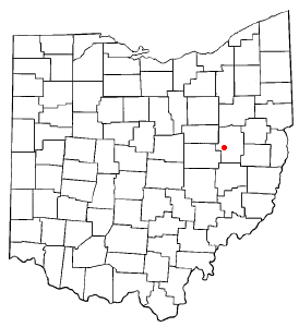
Harrison County is a county located in the U.S. state of Ohio. As of the 2020 census, the population was 14,483, making it the fifth-least populous county in Ohio. Its county seat and largest village is Cadiz. The county is named for General William Henry Harrison, who was later President of the United States.

<span class="mw-page-title-main">Leesville, Ohio</span> Village in Ohio, United States

Leesville is a village in southwestern Carroll County, Ohio, United States. The population was 127 at the 2020 census. It is part of the Canton–Massillon metropolitan area.

<span class="mw-page-title-main">South Russell, Ohio</span> Village in Ohio, United States

South Russell is a village in Geauga County, Ohio, United States. The population was 3,972 at the 2020 census. It is part of the Cleveland metropolitan area.

<span class="mw-page-title-main">Addyston, Ohio</span> Village in Ohio, United States

Addyston is a village in Miami Township, Hamilton County, Ohio, United States. Located along the Ohio River, it is a western suburb of the neighboring city of Cincinnati. The population was 927 at the 2020 census.

<span class="mw-page-title-main">East Sparta, Ohio</span> Village in Ohio, United States

East Sparta is a village in southern Stark County, Ohio, United States. The population was 749 at the 2020 census. It is part of the Canton–Massillon metropolitan area.

<span class="mw-page-title-main">Navarre, Ohio</span> Village in Ohio, United States

Navarre is a village in southwestern Stark County, Ohio, United States. The population was 1,846 at the 2020 census. It is part of the Canton–Massillon metropolitan area.

<span class="mw-page-title-main">Clinton, Ohio</span> Village in Ohio, United States

Clinton is a village in southwestern Summit County, Ohio, United States. The population was 1,197 at the 2020 Census. It is part of the Akron metropolitan area.

<span class="mw-page-title-main">Barnhill, Ohio</span> Village in Ohio, United States

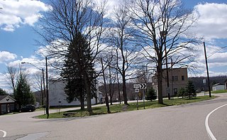
Barnhill is a village in Tuscarawas County, Ohio, United States. The population was 383 at the 2020 census.

<span class="mw-page-title-main">Bolivar, Ohio</span> Village in Ohio, United States

Bolivar is a village in Tuscarawas County, Ohio, United States. The population was 1,000 at the 2020 census. Bolivar is also home to Fort Laurens, the only American Revolutionary War-era fort in what is now Ohio.

<span class="mw-page-title-main">Dennison, Ohio</span> Village in Ohio, United States

Dennison is a village in Tuscarawas County, Ohio, United States. The population was 2,709 at the 2020 census.

<span class="mw-page-title-main">Dover, Ohio</span> City in Ohio, United States

Dover is a city in Tuscarawas County, Ohio, United States, along the Tuscarawas River. The population was 13,112 at the 2020 census. It is a principal city of the New Philadelphia–Dover micropolitan area, approximately 68 miles (109 km) south of Cleveland and borders the city of New Philadelphia.

<span class="mw-page-title-main">Midvale, Ohio</span> Village in Ohio, United States

Midvale is a village in Tuscarawas County, Ohio, United States. The population was 673 at the 2020 census.

<span class="mw-page-title-main">Mineral City, Ohio</span> Village in Ohio, United States

Mineral City is a village in Tuscarawas County, Ohio, United States. The population was 652 at the 2020 census.

<span class="mw-page-title-main">Newcomerstown, Ohio</span> Village in Ohio, United States

Newcomerstown is a village in Tuscarawas County, Ohio, United States, 85 miles (137 km) east-northeast of Columbus. The population was 3,702 at the 2020 census.

<span class="mw-page-title-main">Parral, Ohio</span> Village in Ohio, United States

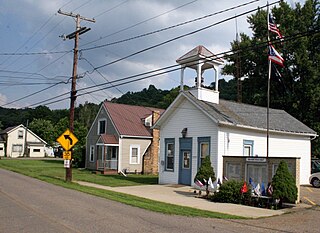
Parral is a village in Tuscarawas County, Ohio, United States. The population was 205 at the 2020 census.

<span class="mw-page-title-main">Port Washington, Ohio</span> Village in Ohio, United States

Port Washington is a village in Tuscarawas County, Ohio, United States. The population was 548 at the 2020 census.

<span class="mw-page-title-main">Roswell, Ohio</span> Village in Ohio, United States

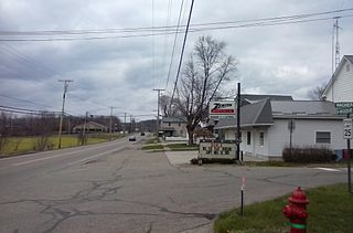
Roswell is a village in Tuscarawas County, Ohio, United States. The population was 219 at the 2020 census.

<span class="mw-page-title-main">Stone Creek, Ohio</span> Village in Ohio, United States

Stone Creek is a village in Tuscarawas County, Ohio, United States. The population was 153 at the 2020 census.

<span class="mw-page-title-main">Sugarcreek, Ohio</span> Village in Ohio, United States

Sugarcreek is a village in Tuscarawas County, Ohio, United States. The population was 2,373 at the 2020 census. It is known as "The Little Switzerland of Ohio." Located in Ohio's Amish Country, the village is part of a large regional tourism industry. In the center of town stands one of the world's largest cuckoo clocks, which was previously featured on the cover of the Guinness World Records book in 1977.

<span class="mw-page-title-main">Tuscarawas, Ohio</span> Village in Ohio, United States

Tuscarawas, originally Trenton, is a village in Tuscarawas County, Ohio, United States. The population was 1,035 at the 2020 census.

References

  1. "ArcGIS REST Services Directory". United States Census Bureau. Retrieved September 20, 2022.
  2. 1 2 U.S. Geological Survey Geographic Names Information System: Strasburg, Ohio
  3. 1 2 "U.S. Census website". United States Census Bureau . Retrieved January 31, 2008.
  4. Overman, William Daniel (1958). Ohio Town Names. Akron, OH: Atlantic Press. p. 130.
  5. Mangus, Michael; Herman, Jennifer L. (2008). Ohio Encyclopedia. North American Book Dist LLC. p. 540. ISBN   978-1-878592-68-2.
  6. DeLorme (1991), Ohio Atlas & Gazetteer, Yarmouth, Maine, p. 51 ISBN   0-89933-233-1
  7. "US Gazetteer files 2010". United States Census Bureau. Archived from the original on January 25, 2012. Retrieved January 6, 2013.
  8. "Census of Population and Housing". Census.gov. Retrieved June 4, 2015.
  9. "U.S. Census website". United States Census Bureau . Retrieved January 6, 2013.
  10. "Strasburg". Tuscarawas County Public Library. Retrieved August 11, 2014.
  11. "Strasburg | Tuscarawas County Public Library".