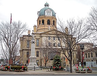
Stone Creek, Ohio | |
---|---|
Motto: "A Small Town With A Big Heart | |
Coordinates: 40°23′59″N81°33′29″W / 40.39972°N 81.55806°W | |
Country | United States |
State | Ohio |
County | Tuscarawas |
Township | Jefferson |
Founded by | Phillip Leonhardt [1] |
Government | |
• Mayor | Leslie Kissinger [2] |
Area | |
• Total | 0.43 sq mi (1.10 km2) |
• Land | 0.42 sq mi (1.10 km2) |
• Water | 0.00 sq mi (0.00 km2) |
Elevation | 922 ft (281 m) |
Population (2020) | |
• Total | 153 |
• Density | 360.00/sq mi (138.94/km2) |
Time zone | UTC-5 (Eastern (EST)) |
• Summer (DST) | UTC-4 (EDT) |
ZIP code | 43840 |
Area code | 330 |
FIPS code | 39-74804 [5] |
GNIS feature ID | 2399907 [4] |
Stone Creek is a village in Tuscarawas County, Ohio, United States. The population was 153 at the 2020 census.
Because of its distance from principal streams, early settlers did not arrive to the valley until 1827 when John Hawk, who is credited as the first settler arrived. Other settlers soon followed thanks to the construction of the Ohio and Erie Canal through Tuscarawas County. These settlers were mostly of Germans descent, some of whom came directly from Germany, while others were second or third generation from citizens from Pennsylvania. Although the canal did not go through Jefferson Township, it still opened up many opportunities to the region. It allowed shipping to eastern markets and increased the price of farm produce such as wheat. This helped to stimulate the settlement of the area, since it was close enough to canal shipping points.
In the early years of the settlement, a resident by the name of Philip Burrier hauled loads of stone to create a passage across the creek for horses and wagons to cross. The residents then referred to this creek as “Stone Creek.” Thanks to this newly given name to the creek, when a post office was established on the property of Michael Harmon in 1840, it was named Stone Creek.
The first formal attempt to establish a town was made in 1848 when Adam Sherrets platted a site at the junction of Dott's Fork with Stone Creek. It ultimately failed, so the present town of Stone Creek was laid out in 1854 by Philip Leonhart and named Phillipsburg. This was later changed to Stone Creek. From here the town grew slowly until the construction of the Cleveland & Marietta Railroad through the town in the 1870s. [6]
In 1904, village council members, Charlie Kughler and Fred Haas took the a train from the village to Akron to file incorporation papers for the village, only to discover that another Phillipsburg already existed in Ohio near Dayton. It was then they decided to name the village after the post office that had already been established there. [7]
The village at one time had its own school that served Jefferson Township. It was established as the result of several smaller school houses merging to form one central school one of which, the Angel Valley Schoolhouse still stands and has been preserved. The consolidated Stone Creek-Jefferson school building was erected in 1927. The school operated independently until 1965, when they were forced by the Ohio Department of Education to consolidated with a larger district, ultimately merging with the neighboring district, New Philadelphia City Schools. After the consolidation with the district, the Stone Creek school building housed an elementary school “Stone Creek Elementary,” as well as a steel and welding shop for the students of New Philadelphia High School who were bused out for their lab. The school was ultimately closed in 1974, with it being demolished on October 17, 1979. [8]
The village still has its own volunteer fire department, which was officially established in 1949, although the building itself dates back further. Before this the town had a fire wagon that community members would use to fight fires.
According to the United States Census Bureau, the village has a total area of 0.43 square miles (1.11 km2), all land. [9]
Interstate 77 intersects Stone Creek, while SR 751 starts here.
Census | Pop. | Note | %± |
---|---|---|---|
1910 | 144 | — | |
1920 | 133 | −7.6% | |
1930 | 225 | 69.2% | |
1940 | 214 | −4.9% | |
1950 | 225 | 5.1% | |
1960 | 226 | 0.4% | |
1970 | 171 | −24.3% | |
1980 | 150 | −12.3% | |
1990 | 181 | 20.7% | |
2000 | 184 | 1.7% | |
2010 | 177 | −3.8% | |
2020 | 153 | −13.6% | |
2021 (est.) | 151 | [10] | −1.3% |
U.S. Decennial Census [11] |
As of the census [12] of 2020, there were 153 people and 62 households living in the village. The population density was 411.6 inhabitants per square mile (158.9/km2). There were 71 housing units at an average density of 160.5 per square mile (62.0/km2).
As of the census [13] of 2010, there were 177 people, 65 households, and 54 families living in the village. The population density was 411.6 inhabitants per square mile (158.9/km2). There were 69 housing units at an average density of 160.5 per square mile (62.0/km2). The racial makeup of the village was 97.7% White, 0.6% African American, 0.6% from other races, and 1.1% from two or more races. Hispanic or Latino of any race were 0.6% of the population.
There were 65 households, of which 38.5% had children under the age of 18 living with them, 66.2% were married couples living together, 9.2% had a female householder with no husband present, 7.7% had a male householder with no wife present, and 16.9% were non-families. 12.3% of all households were made up of individuals, and 4.6% had someone living alone who was 65 years of age or older. The average household size was 2.72 and the average family size was 2.96.
The median age in the village was 35.5 years. 24.3% of residents were under the age of 18; 12.3% were between the ages of 18 and 24; 26.5% were from 25 to 44; 23.6% were from 45 to 64; and 13% were 65 years of age or older. The gender makeup of the village was 53.1% male and 46.9% female.
As of the census [5] of 2000, there were 184 people, 66 households, and 55 families living in the village. The population density was 426.9 inhabitants per square mile (164.8/km2). There were 70 housing units at an average density of 162.4 per square mile (62.7/km2). The racial makeup of the village was 100.00% White.
There were 66 households, out of which 47.0% had children under the age of 18 living with them, 66.7% were married couples living together, 10.6% had a female householder with no husband present, and 15.2% were non-families. 12.1% of all households were made up of individuals, and 9.1% had someone living alone who was 65 years of age or older. The average household size was 2.79 and the average family size was 3.05.
In the village, the population was spread out, with 32.6% under the age of 18, 7.6% from 18 to 24, 29.9% from 25 to 44, 14.7% from 45 to 64, and 15.2% who were 65 years of age or older. The median age was 34 years. For every 100 females there were 100.0 males. For every 100 females age 18 and over, there were 96.8 males.
The median income for a household in the village was $30,625, and the median income for a family was $31,250. Males had a median income of $35,625 versus $15,625 for females. The per capita income for the village was $15,308. About 10.0% of families and 8.8% of the population were below the poverty line, including 13.0% of those under the age of eighteen and 7.5% of those 65 or over.
Tuscarawas County is a county located in the northeastern part of the U.S. state of Ohio. As of the 2020 census, the population was 93,263. Its county seat is New Philadelphia. Its name is a Delaware Indian word variously translated as "old town" or "open mouth". Tuscarawas County comprises the New Philadelphia–Dover, OH Micropolitan Statistical Area, which is also included in the Cleveland–Akron–Canton, OH Combined Statistical Area.
Rock Creek is a village in Ashtabula County, Ohio, United States. The population was 667 at the 2020 census. It is part of the Ashtabula micropolitan area, 45 miles (72 km) northeast of Cleveland.
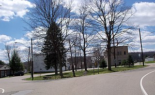
Leesville is a village in southwestern Carroll County, Ohio, United States. The population was 127 at the 2020 census. It is part of the Canton–Massillon metropolitan area.
Byesville is a village in Guernsey County, Ohio, United States, along Wills Creek. The population was 2,364 at the 2020 census.
Wintersville is a village in central Jefferson County, Ohio. The population was 3,609 as of the 2020 Census. It is part of the Weirton–Steubenville metropolitan area. The village is suburban in nature and is governed by a mayor and council elected by non-partisan ballot.
East Sparta is a village in southern Stark County, Ohio, United States. The population was 749 at the 2020 census. It is part of the Canton–Massillon metropolitan area.
Navarre is a village in southwestern Stark County, Ohio, United States. The population was 1,846 at the 2020 census. It is part of the Canton–Massillon metropolitan area.
Clinton is a village in southwestern Summit County, Ohio, United States. The population was 1,197 at the 2020 Census. It is part of the Akron metropolitan area.
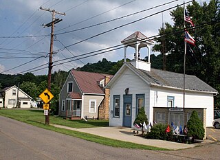
Barnhill is a village in Tuscarawas County, Ohio, United States. The population was 383 at the 2020 census.
Bolivar is a village in Tuscarawas County, Ohio, United States. The population was 1,000 at the 2020 census. Bolivar is also home to Fort Laurens, the only American Revolutionary War-era fort in what is now Ohio.
Dennison is a village in Tuscarawas County, Ohio, United States. The population was 2,709 at the 2020 census.
Dover is a city in Tuscarawas County, Ohio, United States, along the Tuscarawas River. The population was 13,112 at the 2020 census. It is a principal city of the New Philadelphia–Dover micropolitan area, approximately 68 miles (109 km) south of Cleveland and borders the city of New Philadelphia.
Mineral City is a village in Tuscarawas County, Ohio, United States. The population was 652 at the 2020 census.
Newcomerstown is a village in Tuscarawas County, Ohio, United States, 85 miles (137 km) east-northeast of Columbus. The population was 3,702 at the 2020 census.
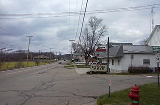
Parral is a village in Tuscarawas County, Ohio, United States. The population was 205 at the 2020 census.
Port Washington is a village in Tuscarawas County, Ohio, United States. The population was 548 at the 2020 census.
Roswell is a village in Tuscarawas County, Ohio, United States. The population was 219 at the 2020 census.
Strasburg is a village in Tuscarawas County, Ohio, United States. The population was 2,735 at the 2020 census.
Sugarcreek is a village in Tuscarawas County, Ohio, United States. The population was 2,373 at the 2020 census. It is known as "The Little Switzerland of Ohio." Located in Ohio's Amish Country, the village is part of a large regional tourism industry. In the center of town stands one of the world's largest cuckoo clocks, which was previously featured on the cover of the Guinness World Records book in 1977.
Tuscarawas, originally Trenton, is a village in Tuscarawas County, Ohio, United States. The population was 1,035 at the 2020 census.