
Atlantic County is a county located in the U.S. state of New Jersey. As of the 2010 United States Census, the county had a population of 274,549, having increased by 21,997 from the 252,552 counted at the 2000 Census, As of the 2018 Census Bureau estimate, the county's population was 265,429, making it the 15th-largest of the state's 21 counties. Its county seat is the Mays Landing section of Hamilton Township. The most populous place was Egg Harbor Township, with 43,323 residents at the time of the 2010 Census; Galloway Township, covered 115.21 square miles (298.4 km2), the largest total area of any municipality, though Hamilton Township has the largest land area, covering 111.13 square miles (287.8 km2).
Route 54 is a state highway located in Atlantic County in New Jersey, United States. It is considered to be a southern extension of U.S. Route 206, running 11.86 mi (19.09 km) from an intersection with US 206 and US 30 in Hammonton to an intersection with US 40 in Buena Vista Township. The road passes through the center of Hammonton before running into rural areas. It intersects US 322 and Route 73 in Folsom and the Atlantic City Expressway in Hammonton.
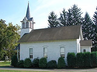
Folsom is a borough in Atlantic County, New Jersey, United States. As of the 2010 United States Census, the borough's population was 1,885, reflecting a decline of 87 (-4.4%) from the 1,972 counted in the 2000 Census, which had in turn declined by 209 (-9.6%) from the 2,181 counted in the 1990 Census.
Hamilton Township is a township in Atlantic County, New Jersey, United States. As of the 2010 United States Census, the township's population was 26,503, reflecting an increase of 6,004 (+29.3%) from the 20,499 counted in the 2000 Census, which had in turn increased by 4,487 (+28.0%) from the 16,012 counted in the 1990 Census. The Township of Hamilton was incorporated by the New Jersey Legislature on February 5, 1813.

Hammonton is a town in Atlantic County, New Jersey, United States, known as the "Blueberry Capital of the World." As of the 2010 United States Census, the town's population was 14,791, reflecting an increase of 2,187 (+17.4%) from the 12,604 counted in the 2000 Census, which had in turn increased by 396 (+3.2%) from the 12,208 counted in the 1990 Census.

Mullica Township is a township in Atlantic County, New Jersey, United States. As of the 2010 United States Census, the township's population was 6,147 reflecting an increase of 235 (+4.0%) from the 5,912 counted in the 2000 Census, which had in turn increased by 16 (+0.3%) from the 5,896 counted in the 1990 Census.

Waterford Township is a township in Camden County, New Jersey, United States. As of the 2010 United States Census, the township's population was 10,649, reflecting an increase of 155 (+1.5%) from the 10,494 counted in the 2000 Census, which had in turn declined by 446 (-4.1%) from the 10,940 counted in the 1990 Census.

Atco is an unincorporated community in Waterford Township in Camden County, New Jersey, United States. It is part of the Philadelphia-Camden metropolitan area, located 16 miles (26 km) southeast of Camden. Though generally considered part of Waterford Township, a small section of the southern edge of Atco is located in Winslow Township.
County Route 559, abbreviated CR 559, is a county highway in the U.S. state of New Jersey. The highway extends 30.84 miles (49.63 km) from the former Somers Point Circle at MacArthur Boulevard in Somers Point to Egg Harbor Road in Hammonton.
County Route 542, abbreviated CR 542, is a county highway in the U.S. state of New Jersey. The highway extends 20.57 miles (33.10 km) from Route 54 in Hammonton to U.S. Route 9 (US 9) in Bass River Township.
County Route 536, abbreviated CR 536, is a county highway in the U.S. state of New Jersey. The highway extends 39 miles (63 km) from the Commodore Barry Bridge crossing the Delaware River at Chester at the Pennsylvania state line and Logan Township, to U.S. Route 206 (US 206) in Hammonton. Much of the western portion of the route is concurrent with US 322 though it is unsigned along this portion.
County Route 534, abbreviated CR 534, is a county highway in the U.S. state of New Jersey. The highway extends 22.86 miles (36.79 km) from Cooper Street on the border of Woodbury and Deptford Township to Indian Mills Road in Shamong Township.
The Hammonton Public Schools are a comprehensive community public school district that serve students in kindergarten through twelfth grade from Hammonton, in Atlantic County, New Jersey, United States.
Folsom Borough School District is a community public school district that serves students in pre-Kindergarten through eighth grade from Folsom, in Atlantic County, New Jersey, United States.
The Waterford Township School District is a community public school district that serves students in kindergarten through sixth grade from Waterford Township, in Camden County, New Jersey, United States.

Hammonton High School is a comprehensive community public high school that serves students in ninth through twelfth grades from Hammonton, in Atlantic County, New Jersey, United States, operating as the lone secondary school of the Hammonton Public Schools.
U.S. Route 30 is a U.S. highway running from Astoria, Oregon east to Atlantic City, New Jersey. In the U.S. state of New Jersey, US 30 runs 58.26 miles (93.76 km) from the Benjamin Franklin Bridge at the Delaware River in Camden, Camden County while concurrent with Interstate 676 (I-676) southeast to Virginia Avenue in Atlantic City, Atlantic County. Most of the route in New Jersey is known as the White Horse Pike and is four lanes wide. The road runs through mostly developed areas in Camden County, with surroundings becoming more rural as the road approaches Atlantic County. US 30 runs through several towns including Collingswood, Berlin, Hammonton, Egg Harbor City, and Absecon.
Zion is an unincorporated community along the border of Hillsborough Township and Montgomery Township in Somerset County, New Jersey, United States. It is located on Rock Brook, approximately 3 mi (4.8 km) north of Hopewell.
Nesco is an unincorporated community in Mullica Township, Atlantic County, New Jersey, United States.

Dutchtown is an unincorporated community located within Montgomery Township in Somerset County, New Jersey, United States. The area consists mainly of forested land with some houses grouped around the intersection of Dutchtown-Zion Road and Belle Meade-Blawenberg Road in the northern portion of the township. Also nearby are the Unionville Cemetery and a rock quarry.


