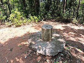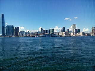
Kowloon is an urban area in Hong Kong comprising the Kowloon Peninsula and New Kowloon. It has a population of 2,019,533 and a population density of 43,033/km2 (111,450/sq mi) in 2006. It is one of the three regions of Hong Kong, along with Hong Kong Island and the New Territories, and is the smallest, second most populous and most densely populated.

Sha Tin District is one of the 18 districts of Hong Kong. As one of the 9 districts located in the New Territories, it covers the areas of Sha Tin, Tai Wai, Ma On Shan, Fo Tan, Siu Lek Yuen, Kwun Yam Shan and Ma Liu Shui. The district is the most populous district in Hong Kong, with a population of 659,794 as per 2016 by-census, having a larger population than many states or dependencies including Iceland, Malta, Montenegro and Brunei.
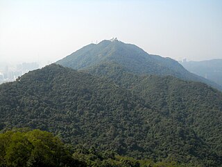
Beacon Hill is a hill in the northern part of the Kowloon peninsula in Hong Kong. It is the 71st-highest hill of Hong Kong and is 457m tall. Beacon Hill is located within the Lion Rock Country Park. The tower and its relevant equipment on the top of Beacon Hill is not open to the public and is a secured facility controlled and maintained by the Hong Kong Civil Aviation Department.

Tai Wai is an area in the New Territories, Hong Kong, located between Sha Tin and the Lion Rock, within the Sha Tin District.
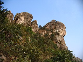
Lion Rock, or less formally Lion Rock Hill, is a mountain in Hong Kong. It is located in Sha Tin District, between Kowloon Tong of Kowloon and Tai Wai of the New Territories, and is 495 metres (1,624 ft) high. The peak consists of granite covered sparsely by shrubs. The Kowloon granite, which includes Lion Rock, is estimated to be around 140 million years old.

The Lion Rock Tunnel, the first major road tunnel in Hong Kong, is a twin-bored toll tunnel, connecting Hin Tin, Sha Tin in the New Territories and New Kowloon near Kowloon Tong. It has two southbound lanes, and there are two northbound lanes in the Second Lion Rock Tunnel, with the toll booths located at the Sha Tin end. They are vital components of Route 1.

Lion Rock Country Park is a country park, located in the New Territories, Hong Kong. It consists of approximately 5.57 square kilometres (2.15 sq mi) of land, including Lion Rock and Mong Fu Shek and their surrounding scenic hillsides, of which 3.48 square kilometres (1.34 sq mi) is forestry plantation.

Sha Tin, also spelt Shatin, is a neighbourhood along Shing Mun River in the eastern New Territories, Hong Kong. Administratively, it is part of the Sha Tin District. Sha Tin is one of the neighbourhoods of the Sha Tin New Town project.
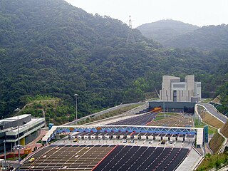
Eagle's Nest Tunnel and Sha Tin Heights Tunnel are road tunnels in the New Territories of Hong Kong. Both tunnels were officially opened on 21 March 2008. The tunnels connect Cheung Sha Wan through Eagle's Nest hill to Tai Wai, and are linked by a shared toll plaza. Eagle's Nest Tunnel is connected at its southern end to Stonecutters Bridge and Ching Cheung Road, whereas Sha Tin Heights Tunnel is linked at the northern end to Che Kung Miu Road and Tai Po Road. The tunnels are part of the Tsing Sha Highway of Route 8, and were constructed in anticipation of future traffic demands generated by development in the northeast New Territories. The combined toll for the two tunnels is HK$8.
Tai Po Road is the second longest road in Hong Kong. It spans from Sham Shui Po in Kowloon to Tai Po in the New Territories of Hong Kong. Initially, the road was named Frontier Road.

Ma On Shan is a saddle-shaped peak in east of Tolo Harbour in the New Territories of Hong Kong. With a height of 702 metres (2,303 ft), it stands among the ten highest mountains in Hong Kong. The mountain borders Sha Tin and Tai Po districts.

Mount Nicholson is a 430 m (1,411 ft) tall mountain located in Wan Chai District, on Hong Kong Island, Hong Kong. The hill is believed to be named for Hong Kong Volunteer Corps Adjunct Lieutenant W.C.A. Nicholson.

Piper's Hill is a hill north of Cheung Sha Wan in Kowloon of Hong Kong. Administratively, it is on the border between Sham Shui Po District and Sha Tin District.
Crow's Nest is a hill north of So Uk in Cheung Sha Wan of New Kowloon in Hong Kong. It has a height of 194 metres and is located south of Eagle's Nest. It is one of the Eight Mountains of Kowloon.

Sun Tin Wai Estate is a public housing estate in Tai Wai, New Territories, Hong Kong. It was built on the hill at the south of Chun Shek Estate along Lion Rock Tunnel Road and consists of 8 residential blocks completed in 1981 and 1982.

Shek Ngau Chau is an uninhabited island of Hong Kong within Tai Po District. It has an area of 0.92 hectares and is located in Mirs Bay, in the north-east of the New Territories.
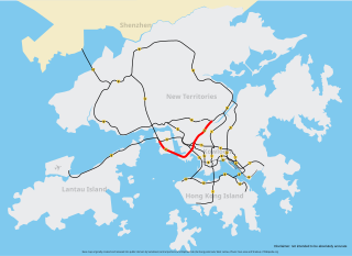
Tsing Sha Highway is a major expressway in Hong Kong, which links the island of Tsing Yi to Sha Tin. The road is part of Route 8, which starts in Sha Tin and terminates in Tung Chung. It was opened in March 2008 and extended in December 2009.
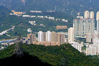
Sha Tin Heights is a 160 metres (525 ft) tall hill located in Tai Wai, Sha Tin District, in Hong Kong's New Territories.
