
Columbia Falls is a city in Flathead County, Montana, United States. The population was 4,710 at the 2010 census

Whitefish is a city in Flathead County, Montana, United States. The population was 6,357 at the 2010 census. It is home to a ski resort on Big Mountain called Whitefish Mountain Resort.

Elmo is a census-designated place (CDP) in Lake County, Montana, United States. The population was 143 at the 2000 census.

Finley Point is a census-designated place (CDP) in Lake County, Montana, United States. As per the 2000 United States Census its population is 493.

Corvallis is a census-designated place (CDP) in Ravalli County, Montana, United States. The population was 976 at the 2010 census.

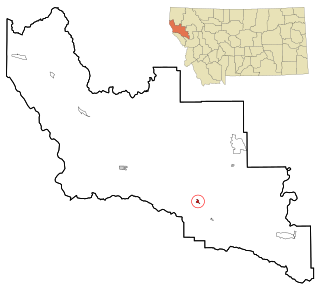
Darby is a town in Ravalli County, Montana, United States. The population was 720 at the 2010 census. Darby is located near the southwestern border of Montana and Idaho, along the Continental Divide.

Florence is a census-designated place (CDP) in Ravalli County, Montana, United States. The population was 765 at the 2010 census.

Hamilton is a city in and the county seat of Ravalli County, Montana, United States. The population was 4,348 at the 2010 census. Significant outlying population growth is shown in the area; the ZIP Code Tabulation Area for Hamilton's ZIP Code, 59840, had a population of 12,979 at the United States Census Bureau 2013 estimate. If the city of Hamilton annexed all the area in its zipcode it would be the 8th largest city in Montana.

Stevensville is a town in Ravalli County, Montana, United States. The population was 1,809 at the 2010 census.

Paradise is a census-designated place (CDP) in Sanders County, Montana, United States. The population was 184 at the 2000 census.
Plains is a town in Sanders County, Montana, United States. The population was 1,048 at the 2010 census. It was founded as Horse Plains and sometimes called Wild Horse Plains, as the local Native Americans would winter their horses here to feed on the grasses in the valley. The name was later shortened to Plains when the US Postal Service established a presence in 1905.

Dayton is a census-designated place (CDP) in Lake County, Montana, United States. The population was 95 at the 2000 census.
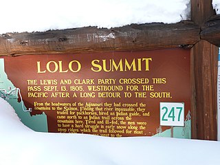
Lolo Pass, elevation 5,233 feet (1,595 m), is a mountain pass in the western United States, in the Bitterroot Range of the northern Rocky Mountains. It is on the border between the states of Montana and Idaho, approximately 40 miles (65 km) west-southwest of Missoula, Montana.

Lolo Hot Springs is an unincorporated community in Missoula County, Montana, United States. It is centered on a commercial hot springs. It also contains a hotel and restaurant. It is the westernmost settlement along U.S. Highway 12 in Montana.
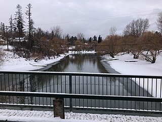
The Whitefish River is a 24.8-mile-long (39.9 km) southward-flowing stream originating at the outlet of Whitefish Lake. The river is a tributary of the Stillwater River just before it reaches the Flathead River in Flathead County, in the U.S. state of Montana. The Whitefish River is part of the Columbia River basin, as the Flathead River is a tributary of Clark Fork, which is tributary to the Pend Oreille River, which is tributary to the Columbia River.
The Jocko River is a roughly 40-mile (64 km) tributary of the Flathead River in western Montana in the United States. It rises in the foothills of the Rocky Mountains and flows west into the Flathead at Dixon. The elevation is 2,503 feet (763 m) where it joins the Flathead. It is also known as Jacques Fork, Jim’s Fork, Prune River or Wild Horse Creek. The river breaks into three forks, the North, Middle and South Forks, of which the Middle Fork is considered the main stem.

Charlos Heights or Charlo's Heights is a census-designated place (CDP) in Ravalli County, Montana, United States. The population was 120 at the 2010 census.
Conner is a census-designated place (CDP) in Ravalli County, Montana, United States. The population was 216 at the 2010 census.

Whitefish Lake ; is a natural oligotrophic freshwater lake in Flathead County, Montana, United States.


