
Monroe County is a county in the state of Florida. As of the 2010 census, the population was 73,090. Its county seat is Key West. Monroe County includes the islands of the Florida Keys and comprises the Key West Micropolitan Statistical Area. Over 99.9% of the county's population lives on the Florida Keys. The mainland, which is part of the Everglades, comprises 87% of the county's land area and is virtually uninhabited with only 19 people in total.

Key Colony Beach is a municipality in the middle of the Florida Keys, Monroe County, Florida, United States. The population was 797 at the 2010 census. As of 2018, the population estimated by the U.S. Census Bureau was 814.
Key Largo is a census-designated place in Monroe County, Florida, United States, located on the island of Key Largo in the upper Florida Keys. The population was 10,433 at the 2010 census. The name comes from the Spanish Cayo Largo, or "long key". It is both the first island and town of the Florida Keys to be reached from the Overseas Highway to Key West. It was also the location of one of the stations of the Overseas Railroad.
Stock Island is a census-designated place (CDP) & Unincorporated community on an island of the same name in Monroe County, Florida, United States. The population of the CDP was 4,410 at the 2000 census. It is located on the portion of the island south of US 1. It is supposedly named for the herds of livestock formerly kept there. Alternatively, some local historians suggest that it may be named for an early settler.

Odessa is a census-designated place (CDP) in Pasco County, Florida, United States. The population was 3,173 at the 2000 census and more than doubled to 7,267 in 2010. Northwest of Tampa, Odessa had been an area of open spaces, ranching, and horse properties. More recently it has seen many suburban property developments as Tampa's population expands.

Woodsfield is a village in Monroe County, Ohio, United States located 30 miles northeast of Marietta. The population was 2,384 at the 2010 census. It is the county seat of Monroe County and houses the Monroe County Courthouse.

The Florida Keys are a coral cay archipelago located off the southern coast of Florida, forming the southernmost part of the continental United States. They begin at the southeastern coast of the Florida peninsula, about 15 miles (24 km) south of Miami, and extend in a gentle arc south-southwest and then westward to Key West, the westernmost of the inhabited islands, and on to the uninhabited Dry Tortugas. The islands lie along the Florida Straits, dividing the Atlantic Ocean to the east from the Gulf of Mexico to the northwest, and defining one edge of Florida Bay. At the nearest point, the southern part of Key West is just 90 miles (140 km) from Cuba. The Florida Keys are between about 24.3 and 25.5 degrees North latitude.

Scout Key is an island in the lower Florida Keys. It was previously known as West Summerland Key until 2010. U.S. 1 crosses the key at approximately mile markers 34–35, between Spanish Harbor Key and Big Pine Key.

Big Coppitt Key is an island in Monroe County, Florida, United States, in the lower Florida Keys. The name is said to be a derivation of the old English word "coppice", meaning thicket. According to A.D. Bache, in the notes for his coast survey conducted in 1861, this key was the location of Happy Jack's plantation in 1855.

Stock Island is an island in the lower Florida Keys immediately east of Key West. Immediately northwest is Key Haven, from which it is connected by causeway with US 1. The part north of U.S. 1 is part of the City of Key West, while the southern part is a census-designated place (CDP) in Monroe County, Florida, United States. The population of the CDP was 4,410 at the 2000 census. Stock Island was supposedly named for herds of livestock formerly kept there. Alternatively, some local historians suggest that it may be named for an early settler.
Plantation Key, Florida is a former census-designated place on Plantation Key in the Florida Keys, in Monroe County, Florida, United States. It is located just South of the Tavernier bridge and North of the Snake Creek bridge and was reported to have a population of 4,405 in 1990. It became part of the Village of Islamorada when the latter incorporated in 1997.

Conch Key is an island and unincorporated community in Monroe County, Florida, United States, located in the middle Florida Keys. U.S. 1 crosses the key at approximately mile markers 62–63, between Long and Duck Keys. It is part of the census-designated place of Duck Key.
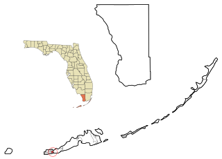
Bay Point is an unincorporated community in Monroe County, Florida, United States, located in the lower Florida Keys in the Saddlebunch Keys near mile marker 15 on US 1.

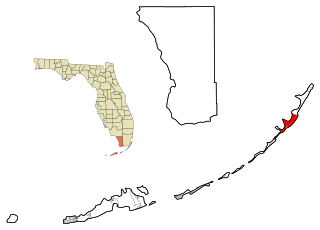
Perky is a ghost town in Monroe County, Florida, United States. It is located in the lower Florida Keys on Lower Sugarloaf Key near mile marker 17 on US 1.
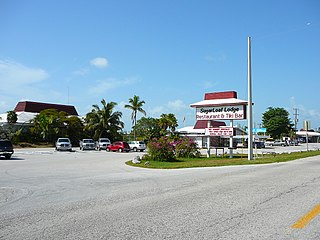
Sugarloaf Shores is an unincorporated community in Monroe County, Florida, United States, located in the lower Florida Keys on Lower Sugarloaf Key near mile marker 17 on US 1.
Pirates Cove is an unincorporated community in Monroe County, Florida, United States, located in the lower Florida Keys on Sugarloaf Key on the old State Road 4A just south of US 1. The settlement was the location of one of the stations of the Overseas Railroad.
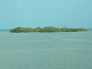
Indian Key was an unincorporated community in Monroe County and, for a while, Dade County, Florida, United States. It was located in the upper Florida Keys on the island of Indian Key and is currently a ghost town.
Marathon Shores is a neighborhood within the city of Marathon in Monroe County, Florida, United States. It is located in the middle Florida Keys on the island of Key Vaca.
