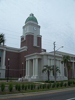
Clay County is a county located in the U.S. state of Florida. As of 2018, the population was 216,072. Its county seat is Green Cove Springs. It is included in the Jacksonville, FL Metropolitan Statistical Area.

Cudjoe Key is a census-designated place and unincorporated community in Monroe County, Florida, United States, on an island of the same name in the lower Florida Keys. As of the 2000 census, the CDP had a total population of 1,695.
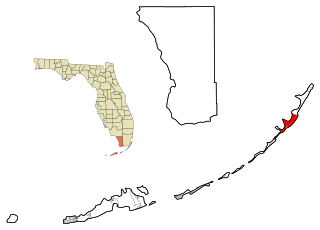
Key Largo is a census-designated place in Monroe County, Florida, United States, located on the island of Key Largo in the upper Florida Keys. The population was 10,433 at the 2010 census. The name comes from the Spanish Cayo Largo, or "long key". It is both the first island and town of the Florida Keys to be reached from the Overseas Highway to Key West. It was also the location of one of the stations of the Overseas Railroad.
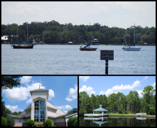
Fruit Cove is a census-designated place (CDP) in St. Johns County, Florida, United States. The population was 16,077 at the 2000 census. It is located in the community of St. Johns.

Scout Key is an island in the lower Florida Keys. It was previously known as West Summerland Key until 2010. U.S. 1 crosses the key at approximately mile markers 34—35, between Spanish Harbor Key and Big Pine Key.

Big Coppitt Key is an island in Monroe County, Florida, United States, in the lower Florida Keys. The name is said to be a derivation of the old English word "coppice", meaning thicket. According to A.D. Bache, in the notes for his coast survey conducted in 1861, this key was the location of Happy Jack's plantation in 1855.

Summerland Key is an island in the lower Florida Keys about 20 miles (32 km) east of Key West; it contains an unincorporated community of Monroe County of the same name.

Key Haven is an unincorporated community on Raccoon Key, an island in the lower Florida Keys about a mile (1.6 km) east of the island of Key West. It is a suburb of greater Key West, and houses around a thousand residents. The city limits of Key West on northern Stock Island are separated from Key Haven by a channel about a quarter mile (400 m) wide.

Stock Island is an island in the lower Florida Keys immediately east of Key West. Immediately northwest is Key Haven, from which it is connected by causeway with US 1. The part north of U.S. 1 is part of the City of Key West, while the southern part is a census-designated place (CDP) in Monroe County, Florida, United States. The population of the CDP was 4,410 at the 2000 census. Stock Island was supposedly named for herds of livestock formerly kept there. Alternatively, some local historians suggest that it may be named for an early settler.

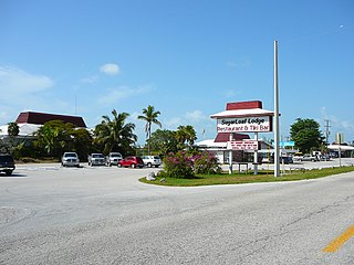
Sugarloaf Key is a single island in the lower Florida Keys that forms a loop on the Atlantic Ocean side giving the illusion of separate islands. Although frequently referred to simply and with technical accuracy as "Sugarloaf Key", this island contains two distinct island communities, known as Lower Sugarloaf Key and Upper Sugarloaf Key.
Lower Sugarloaf Key is the lower arm of an island known as Sugarloaf Key in the lower Florida Keys about 13 miles east of Key West.
Bay Point is an unincorporated community in Monroe County, Florida, United States, located in the lower Florida Keys in the Saddlebunch Keys near mile marker 15 on US 1.

Perky is a ghost town in Monroe County, Florida, United States. It is located in the lower Florida Keys on Lower Sugarloaf Key near mile marker 17 on US 1.

Black Creek is a 13.0-mile-long (20.9 km) tributary of the St. Johns River. It is located in Clay County, Florida. Black Creek has two major tributaries; North Fork Black Creek and South Fork Black Creek. North Fork originates as an outflow from Kingsley Lake and flows north and then east through Camp Blanding and Jennings State Forest, meeting South Fork in Middleburg, Florida. North Fork Black Creek has Yellow Water Creek and Big Branch as its main tributaries. South Fork Black Creek is fed by areas of wetlands and numerous small streams. The confluence of North Fork Black Creek and South Fork Black Creek near Middleburg form the main channel of Black Creek.

Ocklawaha is an unincorporated community in Marion County, Florida, United States. The community is part of the Ocala Metropolitan Statistical Area.
Sugarloaf Shores is an unincorporated community in Monroe County, Florida, United States, located in the lower Florida Keys on Lower Sugarloaf Key near mile marker 17 on US 1.
Tyler is an unincorporated community in Gilchrist County, Florida, United States. It is located approximately 5 miles (8.0 km) northeast of Trenton.
El Chico is an unincorporated community in Monroe County, Florida, United States, located in the lower Florida Keys on Big Coppitt Key. It is within the Census-designated place (CDP) of Big Coppitt Key.

Upper Sugarloaf Key is located at ~24.7° N 81.5° W in the Florida Keys. It located between MM20.5-MM19 and bridge number 28/29 at Bow Channel/Park Key. U.S. 1 crosses the key at approximately mile markers 19–20.5. Upper Sugarloaf Key is located about 15 miles east of Key West, between Park Key and Cudjoe Key. It is the upper arm of a large island, Sugarloaf Key, that includes Lower Sugarloaf Key.
