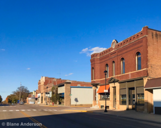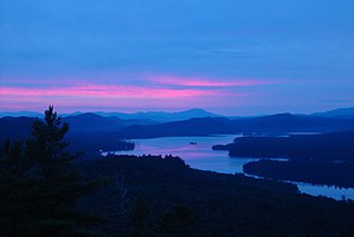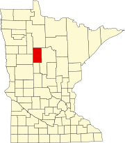
Hubbard County is a county in the northwestern part of the U.S. state of Minnesota. As of the 2020 census, the population was 21,344. Its county seat is Park Rapids.

Scouting in Minnesota has a long history, from the 1910s to the present day, serving thousands of youth in programs that suit the environment in which they live.

Lake Crystal is a city in Blue Earth County, Minnesota, United States, established in 1869. The population was 2,539 at the 2020 census. It is part of the Mankato-North Mankato Metropolitan Statistical Area.
Benton Township is a rural township in Carver County, Minnesota, United States. The population was 939 as of the 2000 census.
Camden Township is a rural township in Carver County, Minnesota, United States. The population was 955 as of the 2000 census.

Hancock Township is a township in Carver County, Minnesota, United States. The population was 367 as of the 2000 census.
Hollywood Township is a rural township in Carver County, Minnesota, United States. The population was 1,102 as of the 2000 census.
Laketown Township is a township in Carver County, Minnesota, United States. The population was 2,331 as of the 2000 census.

Inver Grove Heights is a city in Dakota County, Minnesota, United States. The population was 35,801 at the 2020 census. The city was formed on March 9, 1965, with the merger of the village of Inver Grove and Inver Grove Township.

Lakeville is an exurb of Minneapolis-Saint Paul, and the largest city in Dakota County, Minnesota, United States. It is approximately 20 miles (32 km) south of both downtown Minneapolis and downtown St. Paul along Interstate Highway 35. Starting as a flourishing milling center, its agriculture industry and other major industries are still in operation. Lakeville is one of the fastest-growing cities in the Twin Cities area. The population was 69,490 at the 2020 census. making it Minnesota's tenth most populous city.

Greenfield is a city in northwestern Hennepin County, Minnesota. It has a population of 2,903 residents, according to the 2020 United States Census, and is located 26.5 miles northwest of Minneapolis. It is part of the Twin Cities Metropolitan Statistical Area.

Long Lake is a small city in Hennepin County, Minnesota, United States named after the lake the eastern end of town lies on. A commercial hub for the surrounding communities, Long Lake is home to many local shops and businesses. U.S. Highway 12 runs through the town. The population was 1,768 at the 2010 census.

Trout Lake Township is located in north central Minnesota in Itasca County, United States. It is bordered by the City of Coleraine to the west and north, City of Bovey on the north, an unorganized township on the east, and Blackberry Township to the south. Town government was adopted on March 6, 1894. The population was 1,056 at the 2020 census.
Fayal Township is an urban township in Saint Louis County, Minnesota, United States. The population was 1,809 at the 2010 census.

Park Rapids is a city in and the county seat of Hubbard County, Minnesota, United States. It is near Itasca State Park, the source of the Mississippi River, as well as the beginning of the Heartland State Trail. The city was founded in 1890 near the Fish Hook River rapids and is along U.S. Highway 71 and Minnesota State Highway 34. The population was 4,142 at the 2020 census.

Howard Lake is a city in Wright County, Minnesota, United States. It is the host of the annual Wright county fair. The population was 2,071 at the 2020 census.

Hastings is a city mostly in Dakota County, Minnesota, of which it is the county seat, with a portion in Washington County, Minnesota, United States. It is near the confluence of the Mississippi, Vermillion, and St. Croix Rivers. The population was 22,154 at the 2020 census. It is named for the first elected governor of Minnesota, Henry Hastings Sibley.

The Fulton Chain of Lakes is a string of eight lakes located in the Adirondack Park in upstate New York, United States. The chain is the dammed-up Moose River, and the dam which creates the chain holds back nearly 6.8 billion US gallons (26,000,000 m3) of water. The lakes are located in Herkimer and Hamilton Counties. Inlet, Old Forge, and Eagle Bay are towns on them. The chain begins near Old Forge and ends before it reaches Raquette Lake. The lakes are named for Robert Fulton, inventor of the steamboat, who proposed connecting the lakes to create an Adirondack canal. They are suitable for pontoon boats, kayaks, and motorboats. The chain is part of the 740-mile (1,190 km) Northern Forest Canoe Trail, which begins on First Lake and ends in Fort Kent, Maine.

Chippewa National Forest is a National Forest located in north central Minnesota, United States, in the counties of Itasca, Cass and Beltrami. Forest headquarters are located in Cass Lake, Minnesota. There are local ranger district offices in Blackduck, Deer River and Walker.
Lake George is an unincorporated community and census-designated place (CDP) in Lake George Township, Hubbard County, Minnesota, United States. As of the 2010 census, its population was 230.


