Rollins is an unincorporated community in Ault Township, Saint Louis County, Minnesota, United States.

Minnesota State Highway 64 (MN 64) is a 64.817-mile-long (104.313 km) highway in north-central Minnesota, which runs from its intersection with State Highway 210 in Motley and continues north to its northern terminus at its intersection with State Highway 200 near Laporte and Kabekona.
Cherry is an unincorporated community in Cherry Township, Saint Louis County, Minnesota, United States.
Forbes is an unincorporated community in Saint Louis County, Minnesota, United States.
Fairbanks is an unincorporated community in Fairbanks Township, Saint Louis County, Minnesota, United States; located within the Superior National Forest.
Central Lakes is an unincorporated community in Saint Louis County, Minnesota, United States.
Independence is an unincorporated community in New Independence Township, Saint Louis County, Minnesota, United States.
Kabetogama is an unincorporated community in Kabetogama Township, Saint Louis County, Minnesota, United States, located within the Kabetogama State Forest.
Bassett is an unincorporated community in Bassett Township, Saint Louis County, Minnesota, United States located within the Superior National Forest.
Peary is an unincorporated community in Saint Louis County, Minnesota, United States.
Angora is an unincorporated community in Angora Township, Saint Louis County, Minnesota, United States.
Bear River is an unincorporated community in Itasca and Saint Louis counties in the U.S. state of Minnesota.
Florenton is an unincorporated community in Wuori Township, Saint Louis County, Minnesota, United States; located near Britt.
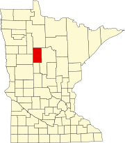
Zerkel is an unincorporated community in Rice Township, Clearwater County, Minnesota, United States. In the past it has also been referred to as "Pine Center."
Ah-gwah-ching is an unincorporated community in Shingobee Township, Cass County, Minnesota, United States, near Walker.
Benedict is an unincorporated community in Lakeport Township, Hubbard County, Minnesota, United States.
Lake George is an unincorporated community and census-designated place (CDP) in Lake George Township, Hubbard County, Minnesota, United States. As of the 2010 census, its population was 230.
Wahlsten is an unincorporated community in Kugler Township, Saint Louis County, Minnesota, United States.
Whipholt is an unincorporated community and census-designated place (CDP) in Pine Lake Township, Cass County, Minnesota, United States, along Leech Lake. Its population was 99 as of the 2010 census. The community is located along State Highway 200 near Pine Lake Road. Whipholt is 13 miles east of Walker.
Rabey is an unincorporated community in Aitkin County, Minnesota, United States, within the Savanna State Forest. The community is located between Hill City and Jacobson along State Highway 200 near Rabey Road and Elliot Road. Rabey is located within Northwest Aitkin Unorganized Territory of Aitkin County.


