Related Research Articles

Remote sensing is the acquisition of information about an object or phenomenon without making physical contact with the object, in contrast to in situ or on-site observation. The term is applied especially to acquiring information about Earth and other planets. Remote sensing is used in numerous fields, including geophysics, geography, land surveying and most Earth science disciplines ; it also has military, intelligence, commercial, economic, planning, and humanitarian applications, among others.

Bathymetry is the study of underwater depth of ocean floors, lake floors, or river floors. In other words, bathymetry is the underwater equivalent to hypsometry or topography. The first recorded evidence of water depth measurements are from Ancient Egypt over 3000 years ago. Bathymetric charts, are typically produced to support safety of surface or sub-surface navigation, and usually show seafloor relief or terrain as contour lines and selected depths (soundings), and typically also provide surface navigational information. Bathymetric maps may also use a Digital Terrain Model and artificial illumination techniques to illustrate the depths being portrayed. The global bathymetry is sometimes combined with topography data to yield a global relief model. Paleobathymetry is the study of past underwater depths.

Satellite images are images of Earth collected by imaging satellites operated by governments and businesses around the world. Satellite imaging companies sell images by licensing them to governments and businesses such as Apple Maps and Google Maps.
TerraSAR-X, is an imaging radar Earth observation satellite, a joint venture being carried out under a public-private-partnership between the German Aerospace Center (DLR) and EADS Astrium. The exclusive commercial exploitation rights are held by the geo-information service provider Astrium. TerraSAR-X was launched on 15 June 2007 and has been in operational service since January 2008. With its twin satellite TanDEM-X, launched 21 June 2010, TerraSAR-X acquires the data basis for the WorldDEM, the worldwide and homogeneous DEM available from 2014.

Copernicus is the Earth observation component of the European Union Space Programme, managed by the European Commission and implemented in partnership with the EU Member States, the European Space Agency (ESA), the European Organisation for the Exploitation of Meteorological Satellites (EUMETSAT), the European Centre for Medium-Range Weather Forecasts (ECMWF), the Joint Research Centre (JRC), the European Environment Agency (EEA), the European Maritime Safety Agency (EMSA), Frontex, SatCen and Mercator Océan.

COSMO-SkyMed is an Earth-observation satellite space-based radar system funded by the Italian Ministry of Research and Ministry of Defence and conducted by the Italian Space Agency (ASI), intended for both military and civilian use. The prime contractor for the spacecraft was Thales Alenia Space. COSMO SkyMed is a constellation of four dual use Intelligence, surveillance, target acquisition, and reconnaissance (ISR) Earth observation satellites with a synthetic-aperture radar (SAR) as main payload, the result of the intuition of Giorgio Perrotta in the early nineties. The synthetic-aperture radar was developed starting in the late nineties with the SAR 2000 program funded by ASI.

Landsat 8 is an American Earth observation satellite launched on 11 February 2013. It is the eighth satellite in the Landsat program; the seventh to reach orbit successfully. Originally called the Landsat Data Continuity Mission (LDCM), it is a collaboration between NASA and the United States Geological Survey (USGS). NASA Goddard Space Flight Center in Greenbelt, Maryland, provided development, mission systems engineering, and acquisition of the launch vehicle while the USGS provided for development of the ground systems and will conduct on-going mission operations. It comprises the camera of the Operational Land Imager (OLI) and the Thermal Infrared Sensor (TIRS), which can be used to study Earth surface temperature and is used to study global warming.

Sentinel-1 is the first of the Copernicus Programme satellite constellation conducted by the European Space Agency. This mission was originally composed of a constellation of two satellites, Sentinel-1A and Sentinel-1B, which shared the same orbital plane. Two more satellites, Sentinel-1C and Sentinel-1D are in development. Sentinel-1B has been retired, leaving Sentinel-1A the only satellite of the constellation. The Sentinel-1 satellites carry a C-band synthetic-aperture radar instrument which provides a collection of data in all-weather, day or night. This instrument has a spatial resolution of down to 5 m and a swath of up to 410 km. The satellite orbits a sun-synchronous, near-polar orbit. The orbit has a 12-day repeat cycle and completes 175 orbits per cycle.

Sentinel-2 is an Earth observation mission from the Copernicus Programme that systematically acquires optical imagery at high spatial resolution over land and coastal waters. The mission is currently a constellation with two satellites, Sentinel-2A and Sentinel-2B; a third satellite, Sentinel-2C, is currently undergoing testing in preparation for launch in 2024.

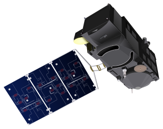
Sentinel-3 is an Earth observation heavy satellite series developed by the European Space Agency as part of the Copernicus Programme. It currently consists of 2 satellites: Sentinel-3A and Sentinel-3B. After initial commissioning, each satellite was handed over to EUMETSAT for the routine operations phase of the mission. Two recurrent satellites— Sentinel-3C and Sentinel-3D— will follow in approximately 2024 and 2028 respectively to ensure continuity of the Sentinel-3 mission.

ADEOS I was an Earth observation satellite launched by NASDA in 1996. The mission's Japanese name, Midori means "green". The mission ended in July 1997 after the satellite sustained structural damage to the solar panel. Its successor, ADEOS II, was launched in 2002. Like the first mission, it ended after less than a year, also following solar panel malfunctions.

The Joint Polar Satellite System (JPSS) is the latest generation of U.S. polar-orbiting, non-geosynchronous, environmental satellites. JPSS will provide the global environmental data used in numerical weather prediction models for forecasts, and scientific data used for climate monitoring. JPSS will aid in fulfilling the mission of the U.S. National Oceanic and Atmospheric Administration (NOAA), an agency of the Department of Commerce. Data and imagery obtained from the JPSS will increase timeliness and accuracy of public warnings and forecasts of climate and weather events, thus reducing the potential loss of human life and property and advancing the national economy. The JPSS is developed by the National Aeronautics and Space Administration (NASA) for the National Oceanic and Atmospheric Administration (NOAA), who is responsible for operation of JPSS. Three to five satellites are planned for the JPSS constellation of satellites. JPSS satellites will be flown, and the scientific data from JPSS will be processed, by the JPSS – Common Ground System (JPSS-CGS).
The Flora Hiperspectral satellite, initially scheduled to launch in 2017, is a proposed Brazilian–American earth observation satellite. It will produce hyperspectral surface images of comparable resolution to Landsat satellites. The Flora Hiperspectral is a joint project between the Jet Propulsion Laboratory (JPL) of NASA and the National Institute for Space Research of Brazil.

The Suomi National Polar-orbiting Partnership, previously known as the National Polar-orbiting Operational Environmental Satellite System Preparatory Project (NPP) and NPP-Bridge, is a weather satellite operated by the United States National Oceanic and Atmospheric Administration (NOAA). It was launched in 2011 and is currently in operation.

The Visible Infrared Imaging Radiometer Suite (VIIRS) is a sensor designed and manufactured by the Raytheon Company on board the polar-orbiting Suomi National Polar-orbiting Partnership, NOAA-20, and NOAA-21 weather satellites. VIIRS is one of five key instruments onboard Suomi NPP, launched on October 28, 2011. VIIRS is a whiskbroom scanner radiometer that collects imagery and radiometric measurements of the land, atmosphere, cryosphere, and oceans in the visible and infrared bands of the electromagnetic spectrum.
PRISMA is an Italian Space Agency pre-operational and technology demonstrator mission focused on the development and delivery of hyperspectral products and the qualification of the hyperspectral payload in space.

Gaofen is a series of Chinese high-resolution Earth imaging satellites launched as part of the China High-resolution Earth Observation System (CHEOS) program. CHEOS is a state-sponsored, civilian Earth-observation program used for agricultural, disaster, resource, and environmental monitoring. Proposed in 2006 and approved in 2010, the CHEOS program consists of the Gaofen series of space-based satellites, near-space and airborne systems such as airships and UAVs, ground systems that conduct data receipt, processing, calibration, and taskings, and a system of applications that fuse observation data with other sources to produce usable information and knowledge.

Resurs-P is a series of Russian commercial Earth observation satellites capable of acquiring high-resolution hyperspectral (HSI), wide-field multispectral (MSI), and panchromatic imagery. These spacecraft cost over 5 billion rubles and are operated by Roscosmos replacing the Resurs-DK No.1 satellite.

Sentinel-4 is a European Earth observation mission developed to support the European Union Copernicus Programme for monitoring the Earth. It focuses on monitoring of trace gas concentrations and aerosols in the atmosphere to support operational services covering air-quality near-real time applications, air-quality protocol monitoring and climate protocol monitoring. The specific objective of Sentinel-4 is to support this with a high revisit time over Europe.

HySIS is an Earth observation satellite which will provide hyperspectral imaging services to India for a range of applications in agriculture, forestry and in the assessment of geography such as coastal zones and inland waterways The data will also be accessible to India's defence forces.
References
- ↑ Kaiser, Angela (2021). "EnMAP". DLR . Retrieved 21 August 2021.
- ↑ "EnMAP Mission". German Spaceborne Imaging Spectrometer Mission. Retrieved December 11, 2022.
- ↑ "EnMAP (Environmental Monitoring and Analysis Program)". eoPortal.org. May 28, 2012. Retrieved December 11, 2022.
- ↑ Clark, Stephen (1 April 2022). "Forty payloads ride into orbit on SpaceX Falcon 9 rocket". Spaceflight Now. Retrieved 1 April 2022.