GOES-18

Last updated

GOES-18
GOES-T Satellite at Processing Facility (51854351059).jpg
GOES-T in the Astrotech Space Operations facility in Titusville, Florida in January 2022
Mission type Weather and Meteorology
Operator NOAA  / NASA
COSPAR ID 2022-021A [1]
SATCAT no. 51850
Mission duration15 years (planned)
1 year, 2 months, 26 days (elasped)
Spacecraft properties
Spacecraft GOES
Spacecraft typeGOES-R Series
Bus LM-A2100A
Manufacturer Lockheed Martin
Launch mass5,192 kg (11,446 lb)
Dry mass2,857 kg (6,299 lb)
Dimensions6.1 × 5.6 × 3.9 m (20 × 18 × 13 ft)
Power4 kW
Start of mission
Launch date1 March 2022, 21:38 UTC
Rocket Atlas V 541
Launch site Cape Canaveral, SLC-41
Contractor United Launch Alliance
Entered service3 January 2023
Orbital parameters
Reference system Geocentric orbit
Regime Geostationary orbit
Longitude136.9° west
Semi-major axis 42,164.0 km (26,199.5 mi)
Eccentricity 0.0001730
Perigee altitude 35,957 km (22,343 mi)
Apogee altitude 35,972 km (22,352 mi)
Inclination 0.0558°
Period 24 hours
Epoch June 2, 2022 [2] [3]
GOES-T logo.png
GEOS T mission insignia
  GOES-17
GOES-U  
 

GOES-18 (designated pre-launch as GOES-T) is the third of the "GOES-R Series", the current generation of weather satellites operated by the National Oceanic and Atmospheric Administration (NOAA). The current and next satellites of the Series (GOES-16, GOES-17, GOES-18, and GOES-U) will extend the availability of the Geostationary Operational Environmental Satellite (GOES) satellite system until 2037. The satellite is built by Lockheed Martin in Littleton, Colorado. It is based on the A2100A satellite bus and will have an expected useful life of 15 years (10 operational after five years in orbit replacement). [4]

Contents

Benefits and applications

The GOES-R Series also continues the legacy Geostationary SAR (GEOSAR) function of the SARSAT system onboard NOAA's GOES satellites which has contributed to the rescue of thousands of individuals in distress. The GOES-R Series SARSAT transponder operates with a lower uplink power than the previous system, enabling GOES-R Series satellites to detect weaker beacon signals.

Redesign

In May 2018, NOAA announced that the recently launched GOES-17 satellite was suffering from a severe malfunction in its instrument cooling system which resulted in degraded performance of its infrared sensors. The cause of the problem was determined to be with the loop heat pipe (LHP), which transports heat from the Advanced Baseline Imager (ABI) to a radiator for rejection into space. Since the LHP design was shared among all four GOES-R Series satellites, a redesign was required to prevent the anomaly from happening again on GOES-T and GOES-U. Lockheed Martin had already completed assembly of GOES-T and had to remove the ABI instrument in October 2018 and ship it to its manufacturer, Harris Corporation, to be rebuilt. [5] [nb 1]

Launch

GOES-T was launched on March 1, 2022 from Cape Canaveral Space Force Station (CCSFS), Florida, United States. [6] Because of the repairs to correct the loop heat pipe problem, the launch had slipped from its originally scheduled date of February 16, 2022. [7] PHOTOS of Launch

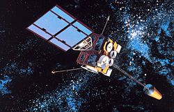
GOES-T was renamed GOES-18 on March 14, 2022 after reaching geostationary orbit. [8]

GOES-18 will undergo a "split" post-launch testing (PLT) phase that will get GOES-18 into position near the current GOES-West location in August 2022, so its Advanced Baseline Imager (ABI) data will be available for the "warm" period that degrades some GOES-17 imagery during the height of hurricane season. [9]

The satellite was launched to the regular 89.5 degrees west checkout location and will undergo part one of PLT from this location. GOES-18 will then drift to 136.8 west and perform the remainder of PLT at that location near GOES-West. The 0.4 degree offset from GOES-17 will allow X-band RDL downlink from both GOES-17 and GOES-18. The 0.2 degree offset from 137.0W meet ground system product generation requirements. Both GOES-17 and GOES-18 images will be remapped to 137.0W. [9]

The transition plan allows for early operational use of GOES-18 ABI data after Beta maturity is achieved and incorporates radio frequency conflict mitigation between GOES-17 and GOES-18 and telemetry and command uplinks and downlinks. Users will not need to repoint their antennas. GOES-18 ABI data will be available via a Cloud interface and interleaving with GOES-17 non-ABI product data. [9]

After its operational transition, GOES-18 will be nudged over to the GOES-West position at 137.2W and GOES-17 will drift to 105W and placed in on-orbit storage. Assuming a normal launch and checkout, GOES-18 will transition to become the operational GOES-West satellite in early 2023. [9]

NOAA announced plans to move the geostationary weather satellite into an operational role "as soon as possible" by ensuring GOES-T systems perform as expected before moving it into an operational role. [10]

The ABI data of GOES-T is scheduled to be interleaved in GOES-17 data from August 1 to September 6 and October 15 to November 11, 2022, also the ABI warm periods of GOES-17. [9] GOES-T became operational as GOES-West on January 4, 2023 joining GOES-16 (operating as GOES-East), while GOES-17 was moved to an intermediate position between the two to serve as backup. [11]

The GOES-T launch was dedicated to Mark Timm, with the following message inscribed on the rocket fairing: "In memory of our colleague and friend - Mark Timm - The ULA Team"

Imagery

This GOES-18 image shows the contiguous United States observed by each of the ABI's 16 channels on May 5, 2022. 2022-05 CONUS 16Panel GOES18 05May2022 1801UTC WithLogosAndLabels.gif
This GOES-18 image shows the contiguous United States observed by each of the ABI's 16 channels on May 5, 2022.

On May 11, 2022, NOAA shared the first images of the Western Hemisphere from its GOES-18 satellite. The satellite's Advanced Baseline Imager (ABI) instrument captured views of Earth. The ABI views Earth with sixteen different channels, each measuring energy at different wavelengths along the electromagnetic spectrum to obtain information about Earth's atmosphere, land, and ocean.

GOES-18 full disk GeoColor image from May 5, 2022 GOES-18 full disk GeoColor image from May 5, 2022.png
GOES-18 full disk GeoColor image from May 5, 2022

Data from multiple ABI channels can be combined to create imagery that approximates what the human eye would see from space. Combining data from different channels in different ways also allows meteorologists to highlight features of interest.

Notes

  1. The LHP was actually manufactured by Orbital ATK, which is now a part of Northrop Grumman, while the ABI was built by Exelis Inc., now a part of L3Harris Technologies.

Related Research Articles

<span class="mw-page-title-main">Geostationary Operational Environmental Satellite</span> US weather satellite series

The Geostationary Operational Environmental Satellite (GOES), operated by the United States' National Oceanic and Atmospheric Administration (NOAA)'s National Environmental Satellite, Data, and Information Service division, supports weather forecasting, severe storm tracking, and meteorology research. Spacecraft and ground-based elements of the system work together to provide a continuous stream of environmental data. The National Weather Service (NWS) and the Meteorological Service of Canada use the GOES system for their North American weather monitoring and forecasting operations, and scientific researchers use the data to better understand land, atmosphere, ocean, and climate dynamics.

<span class="mw-page-title-main">Weather satellite</span> Type of satellite designed to record the state of the Earths atmosphere

A weather satellite or meteorological satellite is a type of Earth observation satellite that is primarily used to monitor the weather and climate of the Earth. Satellites can be polar orbiting, or geostationary.

<span class="mw-page-title-main">National Environmental Satellite, Data, and Information Service</span>

The National Environmental Satellite, Data, and Information Service (NESDIS) was created by the National Oceanic and Atmospheric Administration (NOAA) to operate and manage the United States environmental satellite programs, and manage the data gathered by the National Weather Service and other government agencies and departments.

<span class="mw-page-title-main">NOAA-17</span>

NOAA-17, also known as NOAA-M before launch, was an operational, polar orbiting, weather satellite series operated by the National Environmental Satellite Service (NESS) of the National Oceanic and Atmospheric Administration (NOAA). NOAA-17 also continued the series of Advanced TIROS-N (ATN) spacecraft begun with the launch of NOAA-8 (NOAA-E) in 1983 but with additional new and improved instrumentation over the NOAA A-L series and a new launch vehicle.

<span class="mw-page-title-main">NOAA-16</span>

NOAA-16, also known as NOAA-L before launch, was an operational, polar orbiting, weather satellite series operated by the National Environmental Satellite Service (NESS) of the National Oceanic and Atmospheric Administration (NOAA). NOAA-16 continued the series of Advanced TIROS-N (ATN) spacecraft that began with the launch of NOAA-8 (NOAA-E) in 1983; but it had additional new and improved instrumentation over the NOAA A-K series and a new launch vehicle. It was launched on 21 September 2000 and, following an unknown anomaly, it was decommissioned on 9 June 2014. In November of 2015 it broke up in orbit, creating more than 200 pieces of debris.

<span class="mw-page-title-main">NOAA-18</span>

NOAA-18, also known as NOAA-N before launch, is an operational, polar orbiting, weather satellite series operated by the National Environmental Satellite Service (NESS) of the National Oceanic and Atmospheric Administration (NOAA). NOAA-18 also continued the series of Advanced TIROS-N (ATN) spacecraft begun with the launch of NOAA-8 (NOAA-E) in 1983 but with additional new and improved instrumentation over the NOAA A-M series and a new launch vehicle. NOAA-18 is in an afternoon equator-crossing orbit and replaced NOAA-17 as the prime afternoon spacecraft.

<span class="mw-page-title-main">NOAA-15</span>

NOAA-15, also known as NOAA-K before launch, is an operational, polar-orbiting of the NASA-provided Television Infrared Observation Satellite (TIROS) series of weather forecasting satellite operated by National Oceanic and Atmospheric Administration (NOAA). NOAA-15 was the latest in the Advanced TIROS-N (ATN) series. It provided support to environmental monitoring by complementing the NOAA/NESS Geostationary Operational Environmental Satellite program (GOES).

<span class="mw-page-title-main">GOES 1</span> NOAA weather satellite

GOES-1, designated GOES-A and SMS-C prior to entering service, was a weather satellite, developed by the NASA, operated by the United States National Oceanic and Atmospheric Administration (NOAA). It was the first Geostationary Operational Environmental Satellite (GOES) to be launched.

<span class="mw-page-title-main">GOES 14</span> NOAA weather satellite

GOES-14, known as GOES-O prior to reaching its operational orbit, is an American weather satellite, which is part of the US National Oceanic and Atmospheric Administration (NOAA)'s Geostationary Operational Environmental Satellite (GOES) system. The spacecraft was built by Boeing and is based on the BSS-601 bus. It is the second of three GOES satellites to use the BSS-601 bus, after GOES-13, which was launched in May 2006.

The Polar-orbiting Operational Environmental Satellite (POES) is a constellation of polar orbiting weather satellites funded by the National Oceanic and Atmospheric Administration (NOAA) and the European Organisation for the Exploitation of Meteorological Satellites (EUMETSAT) with the intent of improving the accuracy and detail of weather analysis and forecasting. The spacecraft were provided by NASA and the European Space Agency (ESA), and NASA's Goddard Space Flight Center oversaw the manufacture, integration and test of the NASA-provided TIROS satellites. The first polar-orbiting weather satellite launched as part of the POES constellation was the Television Infrared Observation Satellite-N (TIROS-N), which was launched on 13 October 1978. The final spacecraft, NOAA-19, was launched on 6 February 2009. The ESA-provided MetOp satellite operated by EUMETSAT utilize POES-heritage instruments for the purpose of data continuity. The Joint Polar Satellite System, which was launched on 18 November 2017, is the successor to the POES Program.

<span class="mw-page-title-main">GOES 13</span> U.S. Space Force weather satellite

EWS-G1 is a weather satellite of the U.S. Space Force, formerly GOES-13 and part of the National Oceanic and Atmospheric Administration's Geostationary Operational Environmental Satellite system. On 14 April 2010, GOES-13 became the operational weather satellite for GOES-East. It was replaced by GOES-16 on 18 December 2017 and on 8 January 2018 its instruments were shut off and it began its three-week drift to an on-orbit storage location at 60.0° West longitude, arriving on 31 January 2018. It remained there as a backup satellite in case one of the operational GOES satellites had a problem until early July 2019, when it started to drift westward and was being transferred to the U.S. Air Force, and then the U.S. Space Force.

<span class="mw-page-title-main">GOES 15</span> US Space Force weather satellite

EWS-G2 is a weather satellite of the U.S. Space Force, formerly GOES-15. The spacecraft was constructed by Boeing, and is the last of three GOES satellites to be based on the BSS-601 bus. It was launched in 2010, while the other BSS-601 GOES satellites—GOES-13 and GOES-14—were launched in May 2006 and June 2009 respectively. It was the sixteenth GOES satellite to be launched.

<span class="mw-page-title-main">Elektro–L</span>

Elektro–L is a series of meteorological satellites developed for the Russian Federal Space Agency by NPO Lavochkin. The first satellite, Elektro-L No.1, was launched on 2 January 2011. It is the first Russian weather satellite that successfully operates in geostationary orbit, and is currently the second operational Russian weather satellite. The satellites have a mass of about 1620 kg and are designed to operate for 10 years each. They are capable of producing images of the Earth's whole hemisphere in both visible and infrared frequencies, providing data for climate change and ocean monitoring in addition to their primary weather forecasting role.

<span class="mw-page-title-main">Joint Polar Satellite System</span> Constellation of American meteorology satellites

The Joint Polar Satellite System (JPSS) is the latest generation of U.S. polar-orbiting, non-geosynchronous, environmental satellites. JPSS will provide the global environmental data used in numerical weather prediction models for forecasts, and scientific data used for climate monitoring. JPSS will aid in fulfilling the mission of the U.S. National Oceanic and Atmospheric Administration (NOAA), an agency of the Department of Commerce. Data and imagery obtained from the JPSS will increase timeliness and accuracy of public warnings and forecasts of climate and weather events, thus reducing the potential loss of human life and property and advancing the national economy. The JPSS is developed by the National Aeronautics and Space Administration (NASA) for the National Oceanic and Atmospheric Administration (NOAA), who is responsible for operation of JPSS. Three to five satellites are planned for the JPSS constellation of satellites. JPSS satellites will be flown, and the scientific data from JPSS will be processed, by the JPSS – Common Ground System (JPSS-CGS).

<span class="mw-page-title-main">GOES-16</span> NOAA weather satellite

GOES-16, formerly known as GOES-R before reaching geostationary orbit, is the first of the GOES-R series of Geostationary Operational Environmental Satellites (GOES) operated by NASA and the National Oceanic and Atmospheric Administration (NOAA). GOES-16 serves as the operational geostationary weather satellite in the GOES East position at 75.2°W, providing a view centered on the Americas. GOES-16 provides high spatial and temporal resolution imagery of the Earth through 16 spectral bands at visible and infrared wavelengths using its Advanced Baseline Imager (ABI). GOES-16's Geostationary Lightning Mapper (GLM) is the first operational lightning mapper flown in geostationary orbit. The spacecraft also includes four other scientific instruments for monitoring space weather and the Sun.

<span class="mw-page-title-main">GOES-17</span> NOAA weather satellite

GOES-17 is an environmental satellite operated by the National Oceanic and Atmospheric Administration (NOAA). The satellite is second in the four-satellite GOES-R series. GOES-17 supports the Geostationary Operational Environmental Satellite (GOES) system, providing multi-spectral imaging for weather forecasts and meteorological and environmental research. The satellite was built by Lockheed Martin, based on the A2100A platform, and expected to have a useful life of 15 years. GOES-17 is intended to deliver high-resolution visible and infrared imagery and lightning observations of more than half the globe.

<span class="mw-page-title-main">ESA Vigil</span> 2018 ESA concept study for a solar weather mission

The Vigil mission, formerly known as Lagrange, is a Space weather weather mission developed by European Space Agency. The mission will provide the ESA Space Weather Office with instruments able to monitor the Sun, its solar corona and interplanetary medium between the Sun and Earth, to provide early warnings of increased solar activity, to identify and mitigate potential threats to society and ground, airborne and space based infrastructure as well as to allow 4 to 5 days space weather forecasts. To this purpose the Vigil mission will place for the first time a spacecraft at Sun-Earth Lagrange point 5 (L5) from where it would get a 'side' view of the Sun, observing regions of solar activity on the solar surface before they turn and face Earth.

GOES-U is a planned weather satellite, the fourth and last of the GOES-R series of satellites operated by the National Oceanic and Atmospheric Administration (NOAA). The GOES-R series will extend the availability of the Geostationary Operational Environmental Satellite (GOES) system until 2036. The satellite will be built by Lockheed Martin, based on the A2100 platform.

NOAA-14, also known as NOAA-J before launch, was an American weather satellite operated by the National Oceanic and Atmospheric Administration (NOAA). NOAA-14 continued the third-generation operational, Polar Orbiting Environmental Satellite (POES) series operated by the National Environmental Satellite Service (NESS) of the National Oceanic and Atmospheric Administration (NOAA). NOAA-14 continued the series of Advanced TIROS-N (ATN) spacecraft begun with the launch of NOAA-8 (NOAA-E) in 1983.

The Geostationary Extended Observations (GeoXO) satellite system is the National Oceanic and Atmospheric Administration (NOAA)'s planned replacement for the existing Geostationary Operational Environmental Satellite (GOES) satellites. These new geostationary satellites will make weather, ocean, and climate observations. The project aims to begin observations in the early 2030s as the GOES-R satellites reach their operational lifetime. The first GeoXO satellite is scheduled to be launched in 2032, with two more following in 2035, and the mission will maintain and advance NOAA’s geostationary observations through 2055.

References

  1. Goddard Space Flight Center. "GOES 18". NASA Space Science Data Coordinated Archive. Retrieved 5 May 2022.
  2. "GOES 18". heavens-above.com. Retrieved 15 July 2022.
  3. "GOES 18". orbitalfocus.uk. Retrieved 15 July 2022.
  4. "Mission overview". NOAA. January 2021. Retrieved 20 January 2021.PD-icon.svg This article incorporates text from this source, which is in the public domain .
  5. "Lockheed Martin halts work on GOES-T to wait for instrument fix". SpaceNews. 9 January 2019. Retrieved 26 May 2019.
  6. Foust, Jeff (2 March 2022). "Atlas 5 launches GOES-T weather satellite". SpaceNews. Retrieved 2 March 2022.
  7. "NASA, NOAA Adjust GOES-T Launch Date". NASA. 18 November 2021. Retrieved 18 November 2021.PD-icon.svg This article incorporates text from this source, which is in the public domain .
  8. NOAA, NESDIS (14 March 2022). "NOAA's GOES-T Reaches Geostationary Orbit, Now Designated GOES-18". NOAA NESDIS. Retrieved 14 March 2022.
  9. 1 2 3 4 5 "GOES-18 Post-Launch Testing and Transition to Operations". GOES-R Series Program Office. Retrieved 2 February 2022.PD-icon.svg This article incorporates text from this source, which is in the public domain .
  10. Werner, Debra (25 June 2021). "NOAA to replace GOES-17 satellite ahead of schedule". SpaceNews. Retrieved 28 June 2021.
  11. "Earth from Orbit: NOAA's GOES-18 is now GOES West". NOAA . 4 January 2023. Retrieved 5 January 2023.