Etna, Wyoming

Last updated

Etna, Wyoming
WYMap-doton-Etna.PNG
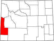
Location of Etna, Wyoming
Usa edcp location map.svg
Red pog.svg
Etna, Wyoming
Location in the United States
Coordinates: 43°1′52″N111°0′58″W / 43.03111°N 111.01611°W / 43.03111; -111.01611
Country United States
State Wyoming
County Lincoln
Area
  Total
2.0 sq mi (5.1 km2)
  Land2.0 sq mi (5.1 km2)
  Water0.0 sq mi (0.0 km2)
Elevation
5,827 ft (1,776 m)
Population
 (2020)
  Total
185
  Density93/sq mi (36/km2)
Time zone UTC-7 (Mountain (MST))
  Summer (DST) UTC-6 (MDT)
ZIP code
83118
Area code 307
FIPS code 56-25475 [1]
GNIS feature ID1599637 [2]
Etna, Wyoming Etna (Wyoming) 7-09-2014 15-46-01 7-9-2014 15-46-01.JPG
Etna, Wyoming

Etna is a census-designated place (CDP) in Lincoln County, Wyoming, United States. The population was 185 at the 2020 census.

Contents

Geography

Etna is located at 43°2′0″N111°0′58″W / 43.03333°N 111.01611°W / 43.03333; -111.01611 (43.031124, -111.016042). [3] in Star Valley, a grassland valley surrounded by forested mountains.

According to the United States Census Bureau, the CDP has a total area of 2.0 square miles (5.1 km2), all land.

Demographics

As of the census [1] of the year 2000, there were 123 people, 44 households, and 34 families residing in the CDP. The population density was 62.8 people per square mile (24.2/km2). There were 55 housing units at an average density of 28.1/sq mi (10.8/km2). The racial makeup of the CDP was 93.50% White, 1.63% African American, 1.63% from other races, and 3.25% from two or more races. Hispanic or Latino of any race were 4.88% of the population.

There were 44 households, out of which 45.5% had children under the age of 18 living with them, 65.9% were married couples living together, 9.1% had a female householder with no husband present, and 20.5% were non-families. 15.9% of all households were made up of individuals, and 13.6% had someone living alone who was 65 years of age or older. The average household size was 2.80 and the average family size was 3.17.

In the CDP, the population was spread out, with 34.1% under the age of 18, 4.1% from 18 to 24, 29.3% from 25 to 44, 19.5% from 45 to 64, and 13.0% who were 65 years of age or older. The median age was 34 years. For every 100 females, there were 89.2 males. For every 100 females age 18 and over, there were 84.1 males.

The median income for a household in the CDP was $42,917, and the median income for a family was $44,375. Males had a median income of $41,667 versus $0 for females. The per capita income for the CDP was $17,423. There were 19.4% of families and 24.5% of the population living below the poverty line, including 17.1% of under eighteens and 48.1% of those over 64.

Education

Public education in the community of Etna is provided by Lincoln County School District #2. [4]

Related Research Articles

<span class="mw-page-title-main">Stanfield, Arizona</span> CDP in Pinal County, Arizona

Stanfield is a census-designated place (CDP) in Pinal County, Arizona, United States. The population was 651 at the 2000 census. Shamrock Farms operates a farm in Stanfield.

<span class="mw-page-title-main">Etna, California</span> City in California, United States

Etna is a town in the Scott Valley area of Siskiyou County, California, United States. Its population is 678 as of the 2020 census, down from 737 from the 2010 census.

<span class="mw-page-title-main">Richgrove, California</span> Census-designated place in California, United States

Richgrove is a census-designated place (CDP) in Tulare County, California, United States. The population was 2,358 at the 2020 United States census, down from 2,882 at the 2010 census.

Damariscotta-Newcastle was a census-designated place (CDP) in Lincoln County, Maine, United States. It designated a concentration of population around where the most developed portions of the towns of Damariscotta and Newcastle meet, generally corresponding to the "Twin Villages" area. As of the 2000 census, the CDP population was 1,751. For the 2010 census, the area was delineated as two separate CDPs, Damariscotta and Newcastle.

<span class="mw-page-title-main">Helena Valley Northeast, Montana</span> Census-designated place in Montana, United States

Helena Valley Northeast is a census-designated place (CDP) in Lewis and Clark County, Montana, United States. The population was 2,995 at the 2010 census. It is part of the Helena Micropolitan Statistical Area.

<span class="mw-page-title-main">Hillside, New York</span> CDP in New York, United States

Hillside is a census-designated place (CDP) in Ulster County, New York, United States. The population was 860 at the 2020 census. It is located just south of the city of Kingston, and the Town of Ulster.

<span class="mw-page-title-main">Lincoln Park, New York</span> CDP in New York, United States

Lincoln Park is a hamlet in Ulster County, New York, United States. The population was 2,545 at the 2020 census.

<span class="mw-page-title-main">Beechwood Trails, Ohio</span> Census-designated place in Ohio, United States

Beechwood Trails is a census-designated place (CDP) in Harrison Township, Licking County, Ohio, United States. The population was 3,276 at the 2020 census.

Iron Post is a census-designated place (CDP) in Mayes County, Oklahoma, United States. The population was 117 at the 2000 census, but had declined to 92 in 2010, a loss of more than 21 percent.

<span class="mw-page-title-main">Machias, Washington</span> CDP in Washington, United States

Machias is a census-designated place (CDP) in Snohomish County, Washington, United States. The population was 1,264 at the 2020 census.

Alpine Northeast is a census-designated place in Lincoln County, Wyoming, United States. The population was 246 at the 2020 census.

Alpine Northwest is a census-designated place (CDP) in Lincoln County, Wyoming, United States. The population was 305 at the 2020 census.

<span class="mw-page-title-main">Auburn, Wyoming</span> Census-designated place in Wyoming, United States

Auburn is a census-designated place (CDP) in Lincoln County, Wyoming, United States. As of the 2020 census, the CDP population was 375.

<span class="mw-page-title-main">Star Valley Ranch, Wyoming</span> Town in Wyoming, United States

Star Valley Ranch is a town in Lincoln County, Wyoming, United States. The population was 1,866 at the 2020 census. It was incorporated on November 8, 2005; at the 2000 census, it was only a census-designated place (CDP).

<span class="mw-page-title-main">Turnerville, Wyoming</span> Census-designated place in Wyoming, United States

Turnerville is a census-designated place (CDP) in Lincoln County, Wyoming, United States. The population was 192 at the 2010 census.

Red Butte is a census-designated place (CDP) in Natrona County, Wyoming, United States. It is part of the Casper, Wyoming Metropolitan Statistical Area. The population was 1,430 at the 2020 census.

<span class="mw-page-title-main">Teton Village, Wyoming</span> CDP in Wyoming, United States

Teton Village is a census-designated place (CDP) in Teton County, Wyoming, United States. The population was 517 at the 2020 census. The village surrounds the base of the Jackson Hole Mountain Resort. It is accessed from nearby Jackson and the surrounding area via the Moose-Wilson Road.

<span class="mw-page-title-main">Osage, Wyoming</span> CDP in Wyoming, United States

Osage is a census-designated place (CDP) in Weston County, Wyoming, United States. The population was 151 at the 2020 census. The CDP is named after the town of Osage, which is included within its boundaries. The CDP was established by the United States Census Bureau in time for the 2000 census.

<span class="mw-page-title-main">Boothbay Harbor (CDP), Maine</span> Census-designated place in Maine, United States

Boothbay Harbor is a census-designated place (CDP) comprising the densely populated center of the town of Boothbay Harbor in Lincoln County, Maine, United States. The population was 1,086 at the 2010 census, down from 1,237 at the 2000 census.

Lincoln is a census-designated place (CDP) consisting of the primary settlement in the town of Lincoln in Penobscot County, Maine, United States. The population was 2,884 at the 2010 census.

References

  1. 1 2 "U.S. Census website". United States Census Bureau . Retrieved January 31, 2008.
  2. "US Board on Geographic Names". United States Geological Survey. October 25, 2007. Retrieved January 31, 2008.
  3. "US Gazetteer files: 2010, 2000, and 1990". United States Census Bureau. February 12, 2011. Retrieved April 23, 2011.
  4. "2020 CENSUS - SCHOOL DISTRICT REFERENCE MAP: Lincoln County, WY" (PDF). U.S. Census Bureau. p. 1 (PDF p. 2/3). Retrieved December 6, 2024. - Text list