Fontenelle, Wyoming | |
---|---|
Coordinates: 41°59′24″N110°3′12″W / 41.99000°N 110.05333°W Coordinates: 41°59′24″N110°3′12″W / 41.99000°N 110.05333°W | |
Country | United States |
State | Wyoming |
County | Lincoln |
Area | |
• Total | 3.6 sq mi (9.3 km2) |
• Land | 3.5 sq mi (8.9 km2) |
• Water | 0.1 sq mi (0.4 km2) |
Elevation | 6,490 ft (1,978 m) |
Population | |
• Total | 13 |
• Density | 3.6/sq mi (1.4/km2) |
Time zone | UTC-7 (Mountain (MST)) |
• Summer (DST) | UTC-6 (MDT) |
ZIP code | 83101 |
Area code | 307 |
FIPS code | 56-27650 [2] |
GNIS feature ID | 1588605 [3] |
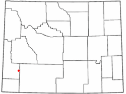
Fontenelle is a census-designated place (CDP) in Lincoln County, Wyoming, United States. The population was 13 at the 2010 census. It is named after the hamlet of Fontenelle, which is located in the southeast corner of the roughly-rectangular CDP.
Fontenelle is located at 41°59′24″N110°3′12″W / 41.99000°N 110.05333°W (41.990006, −110.053420). [4]
According to the United States Census Bureau, the CDP has a total area of 3.6 square miles (9.3 km2), of which 3.5 square miles (8.9 km2) is land and 0.1 square mile (0.4 km2) (3.90%) is water.
As of the census [2] of 2000, there were 19 people, 5 households, and 5 families residing in the CDP. The population density was 5.5 people per square mile (2.1/km2). There were 8 housing units at an average density of 2.3/sq mi (0.9/km2). The racial makeup of the CDP was 100.00% White.
There were 5 households, out of which 80.0% had children under the age of 18 living with them, 100.0% were married couples living together, and 0.0% were non-families. No households were made up of individuals, and none had someone living alone who was 65 years of age or older. The average household size was 3.80 and the average family size was 3.80.
In the CDP, the population was spread out, with 42.1% under the age of 18, 5.3% from 18 to 24, 31.6% from 25 to 44, and 21.1% from 45 to 64. The median age was 30 years. For every 100 females, there were 72.7 males. For every 100 females age 18 and over, there were 83.3 males.
The median income for a household in the CDP was $0, and the median income for a family was $0. Males had a median income of $0 versus $0 for females. The per capita income for the CDP was $0. There are 100.0% of families living below the poverty line and 100.0% of the population, including no under eighteens and none of those over 64.
According to the Köppen Climate Classification system, Fontenelle has a cold semi-arid climate, abbreviated "BSk" on climate maps. The hottest temperature recorded in Fontenelle was 100 °F (38 °C) on July 22, 2007, while the coldest temperature recorded was −46 °F (−43 °C) on December 31, 1978 and February 2, 1985. [5]
Climate data for Fontenelle Dam, Wyoming, 1991–2020 normals, extremes 1963–present | |||||||||||||
---|---|---|---|---|---|---|---|---|---|---|---|---|---|
Month | Jan | Feb | Mar | Apr | May | Jun | Jul | Aug | Sep | Oct | Nov | Dec | Year |
Record high °F (°C) | 53 (12) | 57 (14) | 71 (22) | 79 (26) | 87 (31) | 94 (34) | 100 (38) | 95 (35) | 91 (33) | 81 (27) | 70 (21) | 60 (16) | 100 (38) |
Mean maximum °F (°C) | 39.5 (4.2) | 42.5 (5.8) | 56.2 (13.4) | 68.0 (20.0) | 76.2 (24.6) | 84.9 (29.4) | 90.2 (32.3) | 88.3 (31.3) | 81.5 (27.5) | 71.5 (21.9) | 56.5 (13.6) | 43.1 (6.2) | 90.7 (32.6) |
Average high °F (°C) | 28.5 (−1.9) | 31.3 (−0.4) | 42.5 (5.8) | 52.3 (11.3) | 62.7 (17.1) | 74.0 (23.3) | 83.3 (28.5) | 81.5 (27.5) | 71.1 (21.7) | 56.8 (13.8) | 40.8 (4.9) | 28.8 (−1.8) | 54.5 (12.5) |
Daily mean °F (°C) | 14.1 (−9.9) | 17.2 (−8.2) | 28.6 (−1.9) | 36.8 (2.7) | 46.9 (8.3) | 56.2 (13.4) | 64.1 (17.8) | 62.3 (16.8) | 52.5 (11.4) | 39.6 (4.2) | 25.6 (−3.6) | 14.4 (−9.8) | 38.2 (3.4) |
Average low °F (°C) | −0.2 (−17.9) | 3.1 (−16.1) | 14.7 (−9.6) | 21.2 (−6.0) | 31.0 (−0.6) | 38.4 (3.6) | 44.8 (7.1) | 43.1 (6.2) | 33.8 (1.0) | 22.5 (−5.3) | 10.4 (−12.0) | −0.1 (−17.8) | 21.9 (−5.6) |
Mean minimum °F (°C) | −20.7 (−29.3) | −17.9 (−27.7) | −3.8 (−19.9) | 10.0 (−12.2) | 18.6 (−7.4) | 27.8 (−2.3) | 34.8 (1.6) | 32.2 (0.1) | 21.3 (−5.9) | 7.1 (−13.8) | −9.2 (−22.9) | −21.5 (−29.7) | −28.4 (−33.6) |
Record low °F (°C) | −43 (−42) | −46 (−43) | −33 (−36) | −9 (−23) | 6 (−14) | 14 (−10) | 21 (−6) | 17 (−8) | 4 (−16) | −23 (−31) | −29 (−34) | −46 (−43) | −46 (−43) |
Average precipitation inches (mm) | 0.35 (8.9) | 0.36 (9.1) | 0.50 (13) | 0.78 (20) | 1.43 (36) | 0.83 (21) | 0.46 (12) | 0.73 (19) | 0.85 (22) | 0.66 (17) | 0.34 (8.6) | 0.26 (6.6) | 7.55 (193.2) |
Average snowfall inches (cm) | 5.4 (14) | 6.6 (17) | 3.8 (9.7) | 2.2 (5.6) | 0.6 (1.5) | 0.0 (0.0) | 0.0 (0.0) | 0.0 (0.0) | 0.0 (0.0) | 1.3 (3.3) | 2.1 (5.3) | 4.5 (11) | 26.5 (67.4) |
Average precipitation days (≥ 0.01 in) | 3.4 | 3.8 | 4.6 | 5.4 | 8.2 | 5.0 | 4.5 | 5.5 | 5.7 | 4.4 | 3.4 | 3.8 | 57.7 |
Average snowy days (≥ 0.1 in) | 2.8 | 2.9 | 1.7 | 1.0 | 0.2 | 0.0 | 0.0 | 0.0 | 0.1 | 0.7 | 1.9 | 3.3 | 14.6 |
Source 1: NOAA [6] | |||||||||||||
Source 2: National Weather Service [5] |
Lukachukai is a census-designated place (CDP) in Apache County, Arizona, United States. The population was 1,701 at the 2010 census. It is within the Navajo Nation.
Mountainaire is a census-designated place (CDP) in Coconino County, Arizona, United States. The population was 1,119 at the 2010 census.
Claypool is a census-designated place (CDP) in Gila County, Arizona, United States. The population was 1,538 at the 2010 census, down from 1,794 at the 2000 census. It was named after W. D. Claypool, a member of both the State House of Representatives and State Senate in the 1910s and 1920s.
Shongopovi is a census-designated place (CDP) in Navajo County, Arizona, United States. It is located on the Second Mesa, within the Hopi Reservation.
Avra Valley is a census-designated place (CDP) in Pima County, Arizona, United States. The population was 6,050 at the 2010 census, up from 5,038 in 2000.
Bluewater is a census-designated place (CDP) in San Bernardino County, California, United States. The population was 172 at the 2010 census, down from 265 at the 2000 census.
Pine Valley is a community and census-designated place (CDP) in the Cuyamaca Mountains of the Mountain Empire area, in southeastern San Diego County, California. The population was 1,510 at the 2010 census, up from 1,501 at the 2000 census.
Caratunk is a town in Somerset County, Maine, United States. The population was 81 at the 2020 census.
Carter is a census-designated place (CDP) in Chouteau County, Montana, United States. The population was 58 at the 2010 census.
Kremlin is an unincorporated community and census-designated place (CDP) in Hill County, Montana, United States. The population was 98 at the 2010 census, down from 126 in 2000.
Shark River Hills is an unincorporated community and census-designated place (CDP) within Neptune Township, in Monmouth County, New Jersey, United States. As of the 2010 United States Census, the CDP's population was 3,697.
San Juan is a census-designated place (CDP) in Rio Arriba County, New Mexico, United States. The population was 592 at the 2000 census.
Congress is a village in Wayne County, Ohio, United States. The population was 185 at the 2010 census.
Warm Springs is a census-designated place (CDP) and an unincorporated community in Jefferson County, Oregon, United States. Located on the Warm Springs Indian Reservation, the community is also known as the "Warm Springs Agency". The population was 2,945 at the 2010 census, up from 2,431 at the 2000 census.
Springetts Manor-Yorklyn was a census-designated place (CDP) in York County, Pennsylvania, United States. The population was 4,156 at the 2000 census. The area was delineated as the Yorklyn CDP for the 2010 census.
Lipscomb is an unincorporated community and census-designated place (CDP) in Lipscomb County, Texas, United States. It is the Lipscomb county seat. The population was 37 at the 2010 census.
Serenada is a census-designated place (CDP) in Williamson County, Texas, United States. The population was 1,641 at the 2010 census. Those living in Serenada have Georgetown addresses.
Farson is a census-designated place (CDP) in Sweetwater County, Wyoming, United States. The population was 313 at the 2010 census.
Lonetree is a census-designated place (CDP) in Uinta County, Wyoming, United States. The population was 49 at the 2010 census.
Bridgewater was a census-designated place (CDP) in the town of Bridgewater in Plymouth County, Massachusetts, United States. The CDP ceased to exist when Bridgewater was given de facto city status in 2010. The population was 7,841 at the 2010 census.