The River Fowey is a river in Cornwall, England, United Kingdom.

The River Fal flows through Cornwall, England, rising at Pentevale on Goss Moor and reaching the English Channel at Falmouth. On or near the banks of the Fal are the castles of Pendennis and St Mawes as well as Trelissick Garden. The River Fal separates the Roseland peninsula from the rest of Cornwall. Like most of its kind on the south coast of Cornwall and Devon, the Fal estuary is a classic ria, or drowned river valley. The Fal estuary from Tregony to the Truro River was originally called Hafaraell.

Goonhilly Downs is a Site of Special Scientific Interest (SSSI) that forms a raised plateau in the central western area of the Lizard peninsula in southern Cornwall, England. It is one of 229 English national nature reserves designated by Natural England with an area of almost 1,270 hectares.

Aire Point to Carrick Du SSSI is a Site of Special Scientific Interest on the Penwith Peninsula, Cornwall, England. It is 5.98 square kilometres in extent, stretching from grid reference SW360279 to grid reference SW513410. The site is designated both for its biological and its geological interest.

Mining in Cornwall and Devon, in the southwest of Britain, began in the early Bronze Age, around 2150 BC. Tin, and later copper, were the most commonly extracted metals. Some tin mining continued long after the mining of other metals had become unprofitable, but ended in the late 20th century. In 2021, it was announced that a new mine was extracting battery-grade lithium carbonate, more than 20 years after the closure of the last South Crofty tin mine in Cornwall in 1998.

The Davey Elm, Ulmus × hollandica 'Daveyi', is an English hybrid cultivar of unknown specific origin, generally restricted to the valleys of Cornwall. Its apparent south-west England provenance, along with its foliage and habit, suggest that it may be a hybrid of Wych Elm and Cornish Elm.

The Culm Measures are a thick sequence of geological strata originating during the Carboniferous Period that occur in south-west England, principally in Devon and Cornwall, now known as the Culm Supergroup. Its estimated thickness varies between 3600 m and 4750 m though intense folding complicates it at outcrop. They are so called because of the occasional presence in the Barnstaple–Hartland area of a soft, often lenticular, sooty coal, which is known in Devon as culm. The word culm may be derived from the Old English word for coal col or from the Welsh word cwlwm meaning knot.
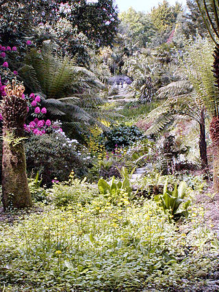
Cornwall is the county that forms the tip of the southwestern peninsula of England; this area has a mild and warm climate regulated by the Gulf Stream. The mild climate allows rich plant cover, such as palm trees in the far south and west of the county and in the Isles of Scilly, due to sub-tropical conditions in the summer.
Lowland heath is a Biodiversity Action Plan habitat as it is a type of ancient wild landscape. Natural England's Environmental Stewardship scheme describes lowland heath as containing dry heath, wet heath and valley mire communities, usually below 250 metres (820 ft) in altitude, on acidic soils and shallow peat, typically comprising heathers, gorses, fine grasses, wild flowers and lichens in a complex mosaic. Heathers and other dwarf shrubs usually account for at least 25% of the ground cover. By contrast, upland heath, which is above 300 metres (980 ft) in altitude, is called moorland, Dartmoor being an example.

The River Ottery is a small river in northeast Cornwall, United Kingdom. The river is about twenty miles (32 km) long from its source southeast of Otterham to its confluence with the River Tamar at Nether Bridge, two miles (3.2 km) northeast of Launceston.
Steeple Point to Marsland Mouth is a coastal Site of Special Scientific Interest (SSSI) in Cornwall, England, UK, noted for its biological characteristics.

Godrevy Head to St Agnes is a coastal Site of Special Scientific Interest (SSSI) in north Cornwall, England], noted for both its biological and geological characteristics. A number of rare and scarce plant species can be found on the site, along with many breeding seabirds.

Rosenannon Downs is a nature reserve in mid Cornwall, England, UK, being designated Rosenannon Bog and Downs Site of Special Scientific Interest (SSSI), noted for its biological characteristics. The site supports a wide variety of flora and fauna and includes Bronze Age barrows. Conservation work is carried out on the site by the owners, the Cornwall Wildlife Trust.
Ventongimps Moor is a moorland nature reserve and Site of Special Scientific Interest (SSSI), noted for its biological characteristics, in mid Cornwall, England, United Kingdom. The site, important for the occurrence of the plant Dorset heath, was the first reserve to be purchased by the Cornwall Wildlife Trust.

Helman Tor is a granite hill in mid Cornwall, UK with several separated tors, and is designated as a (non-statutory) County Geology Site. The hill also has a Scheduled Ancient Monument. Helman Tor is also the name of the largest nature reserve managed by the Cornwall Wildlife Trust which includes Breney Common and Red Moor. The Wildlife Trust aims to rewild the reserve, including potentially releasing beavers, as well as long-horn cattle and Cornish black pigs. Helman Tor, along with Breney Common, Red Moor and Belowda Beacon, is part of the Mid Cornwall Moors Site of Special Scientific Interest. It lies on the Saints' Way, a long-distance footpath completed in 1986.

Chyenhal Moor is a poorly drained shallow valley, 2 miles (3.2 km) to the south-west of Penzance, Cornwall. Due to several rare plants in a diverse range of habitats, it was notified as a Site of Special Scientific Interest (SSSI) in 1951.

Arcot Hall Grasslands and Ponds is the name given to a Site of Special Scientific Interest (SSSI) near Cramlington in Northumberland, England, notable as the largest lowland species-rich grassland in North East England. The site is composed of grassland, heath, ponds, and associated damp habitats now rare in Northumberland.