The name Euroa comes from an Aboriginal word in the old local dialect meaning 'joyful'.[citation needed]
History
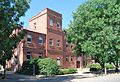
Seven Creeks Park Euroa
Major T.L. Mitchell camped on the banks of the Seven Creeks at Euroa during his 1836 "Australia Felix" expedition. The Post Office opened on 1 January 1854 in the old town, as the township was settled.[3]
Euroa's claim to fame is that the National Bank was robbed by Ned Kelly in 1878. Much of the region's wealth once came from sheep but now it comes from horse studs.
The Euroa Magistrates' Court closed on 1 January 1990.[4]
Heritage sites
Euroa contains a number of heritage-listed sites, including:
1 Binney Street: National Bank of Australasia Building[5]
Euroa is roughly midway between Melbourne and Albury. The area is geographically very flat, as the town is located in the huge Goulburn Valley, however the Strathbogie Ranges are not far away.
Climate
Euroa possesses a humid subtropical climate bordering on an oceanic climate (Köppen: Cfa/Cfb), with very warm, relatively dry summers and cool, wetter winters. Average maxima vary from 29.7°C (85.5°F) in February to 12.3°C (54.1°F) in July while average minima fluctuate between 15.3°C (59.5°F) in January and 4.1°C (39.4°F) in July. Mean precipitation is moderately low (averaging 648.9mm (25.55in) per annum). Euroa receives 100.6 precipitation days annually, with a maximum frequency of rain in winter. Extreme temperatures have ranged from 42.8°C (109.0°F) on 31 January 1968 to −3.5°C (25.7°F) on 6 August 1974.[8]
The town is home to the Shire of Strathbogie headquarters. The shire was established as part of the conservative Kennett government mass rationalisation across Victoria in the 1990s. Shire of Strathbogie incorporates the former Shires of Euroa, Violet Town, and Goulburn.
The town was bypassed by a deviation of the Hume Highway that was constructed around 1992.
St John's is Euroa's only Catholic primary school and has served the Euroa community since 1921. The school has an approximate enrolment of 180 students and, from its founding until 2002, the school was run by the Sisters of Mercy.[9]
Euroa Primary School (School Number: 1706) is the town's only government-run primary school.[10] It has an enrolment of 120 students.
Euroa Secondary College
Euroa Secondary College (School Number: 7820) is the only secondary school in the Shire of Strathbogie and, in 2007, had an enrolment of 371 students. These students come from the surrounding area including Nagambie, Avenel, Longwood, Ruffy and Violet Town.[11] The current principal is Anna Eddy[11]
This page is based on this Wikipedia article Text is available under the CC BY-SA 4.0 license; additional terms may apply. Images, videos and audio are available under their respective licenses.