
Fagundus is an extinct town in Forest and Warren counties, in the U.S. state of Pennsylvania. [1]
Fagundus is an extinct town in Forest and Warren counties, in the U.S. state of Pennsylvania. [1]
Fagundus had its start in the 1860s during an area oil boom. [2] The community was named after Charles Fagundus, a pioneer settler. [3] A variant name was "Fagundus Corners". [1]
{{cite book}}: ISBN / Date incompatibility (help)Municipalities and communities of Forest County, Pennsylvania, United States | ||
|---|---|---|
| Borough |  | |
| Townships | ||
| CDP | ||
| Unincorporated communities | ||
| Ghost town | ||
| Footnotes | ‡This populated place also has portions in an adjacent county or counties | |
Municipalities and communities of Warren County, Pennsylvania, United States | ||
|---|---|---|
| City | 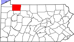 | |
| Boroughs | ||
| Townships | ||
| CDPs | ||
| Unincorporated communities | ||
| Ghost towns | ||
| Footnotes | ‡This populated place also has portions in an adjacent county or counties | |
41°37′57″N79°25′59″W / 41.63250°N 79.43306°W
| | This Forest County, Pennsylvania state location article is a stub. You can help Wikipedia by expanding it. |
| | This Warren County, Pennsylvania location article is a stub. You can help Wikipedia by expanding it. |