Eldred Township, Warren County, Pennsylvania

Last updated

Eldred Township
Map of Eldred Township, Warren County, Pennsylvania Highlighted.png
Location of Eldred Township in Warren County
Map of Pennsylvania highlighting Warren County.svg
Location of Warren County in Pennsylvania
CountryUnited States
State Pennsylvania
County Warren County
Area
[1]
  Total36.22 sq mi (93.80 km2)
  Land36.22 sq mi (93.80 km2)
  Water0.00 sq mi (0.00 km2)
Highest elevation
[2] (high point in northeast corner of township, about 1 mile east-northeast of Sanford, PA)
1,882 ft (574 m)
Lowest elevation
[2] (West Branch Caldwell Creek, where it flows out of the southern part of the township)
1,302 ft (397 m)
Population
 (2020) [3]
  Total587
  Estimate 
(2022) [3]
575
  Density17.18/sq mi (6.63/km2)
Time zone UTC-4 (EST)
  Summer (DST) UTC-5 (EDT)
Area code 814

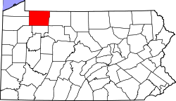
Eldred Township is a township in Warren County, Pennsylvania, United States. The population was 587 at the 2020 census, [3] down from 650 at the 2010 census.

Contents

Geography

According to the United States Census Bureau, the township has a total area of 36.1 square miles (93 km2), all land.

Natural Features

Eldred Township is located in the southwestern part of Warren County in the Pittsburgh High Plateau. The township is drained primarily by Caldwell Creek, a tributary to Pine Creek, which is a tributary to Oil Creek, a south-flowing tributary of the Allegheny River. Tributaries of Caldwell Creek in Eldred Township include West Branch Caldwell Creek and its tributaries, Three Bridges Run and Middle Branch. Dunderdale Creek joins Caldwell Creek upstream of West Branch Caldwell Creek. The very northeastern part of the townships is drained by Gar Run, a tributary of Brokenstraw Creek and the southeast by George Run of Tidioute Creek. Pine Creek, Oil Creek tributary, drains a small portion of the southeast section. The lowest elevation in Eldred Township is 1,302 ft (397 m) where West Branch Caldwell Creek flows south out of the township. The highest elevation is 1,882 ft (574 m) on a high point at the northeastern part of the township about 1 mile east-northeast of Sanford, Pennsylvania. [2]

Demographics

Historical population
CensusPop.Note
2000 790
2010 650−17.7%
2020 587−9.7%
2022 (est.)575 [3] −2.0%
U.S. Decennial Census [4]

As of the census [5] of 2000, there were 709 people, 261 households, and 198 families residing in the township. The population density was 19.6 people per square mile (7.6/km2). There were 502 housing units at an average density of 13.9/sq mi (5.4/km2). The racial makeup of the township was 98.17% White, 0.85% African American, 0.28% Native American, 0.42% from other races, and 0.28% from two or more races. Hispanic or Latino of any race were 0.42% of the population.

There were 261 households, out of which 32.2% had children under the age of 18 living with them, 62.8% were married couples living together, 5.7% had a female householder with no husband present, and 24.1% were non-families. 20.7% of all households were made up of individuals, and 7.7% had someone living alone who was 65 years of age or older. The average household size was 2.72 and the average family size was 3.08.

In the township the population was spread out, with 28.5% under the age of 18, 6.8% from 18 to 24, 28.5% from 25 to 44, 24.4% from 45 to 64, and 11.8% who were 65 years of age or older. The median age was 37 years. For every 100 females, there were 109.1 males. For every 100 females age 18 and over, there were 109.5 males.

The median income for a household in the township was $35,000, and the median income for a family was $36,364. Males had a median income of $29,226 versus $18,750 for females. The per capita income for the township was $13,132. About 6.5% of families and 11.9% of the population were below the poverty line, including 15.3% of those under age 18 and none of those age 65 or over.

Related Research Articles

<span class="mw-page-title-main">Matteson Township, Michigan</span> Civil township in Michigan, United States

Matteson Township is a civil township of Branch County in the U.S. state of Michigan. As of the 2010 census, the township population was 1,218.

<span class="mw-page-title-main">Athens Township, Crawford County, Pennsylvania</span> Township in Pennsylvania, United States

Athens Township is a township in Crawford County, Pennsylvania, United States. The population was 638 at the 2020 census.

<span class="mw-page-title-main">Bloomfield Township, Crawford County, Pennsylvania</span> Township in Pennsylvania, United States

Bloomfield Township is a township in Crawford County, Pennsylvania, United States. The population was 1,867 at the 2020 census.

<span class="mw-page-title-main">Oil Creek Township, Crawford County, Pennsylvania</span> Township of Titusville Pennsylvania in the United States

Oil Creek Township is a township in Crawford County, Pennsylvania, United States. The population was 1,702 at the 2020 census, a decrease from 1,877 at the 2010 census.

<span class="mw-page-title-main">Rome Township, Crawford County, Pennsylvania</span> Township in Pennsylvania, United States

Rome Township is a township in Crawford County, Pennsylvania, United States. The population was 1,993 at the 2020 census, up from 1,840 at the 2010 census.

<span class="mw-page-title-main">Sparta Township, Crawford County, Pennsylvania</span> Township in Pennsylvania, United States

Sparta Township is a township in Crawford County, Pennsylvania, United States. The population was 1,910 at the 2020 census, up from 1,832 at the 2010 census.

<span class="mw-page-title-main">Steuben Township, Crawford County, Pennsylvania</span> Township in Pennsylvania, United States

Steuben Township is a township in Crawford County, Pennsylvania, United States. The population was 773 at the 2020 census, down from 804 at the 2010 census, down from 908 in 2000.

<span class="mw-page-title-main">Greenfield Township, Erie County, Pennsylvania</span> Township in Pennsylvania, United States

Greenfield Township is a township in Erie County, Pennsylvania, United States. The population was 1,804 at the 2020 census,

<span class="mw-page-title-main">Union Township, Erie County, Pennsylvania</span> Township in Pennsylvania, United States

Union Township is a township in Erie County, Pennsylvania, United States. The population was 1,542 at the 2020 census, down from 1,655 at the 2010 census.

<span class="mw-page-title-main">Wayne Township, Erie County, Pennsylvania</span> Township in Pennsylvania, United States

Wayne Township is a township in Erie County, Pennsylvania, United States. The population was 1,539 at the 2020 census, down from 1,659 at the 2010 census, down from 1,766 in 2000.

<span class="mw-page-title-main">Connellsville Township, Fayette County, Pennsylvania</span> Township in Pennsylvania, United States

Connellsville Township is a township in Fayette County, Pennsylvania, United States. The population was 2,072 at the 2020 census, a decline from the figure of 2,391 tabulated in 2010.

<span class="mw-page-title-main">Dunkard Township, Greene County, Pennsylvania</span> Township in Pennsylvania, United States

Dunkard Township is a township in Greene County, Pennsylvania, United States. The population was 2,181 at the 2020 census.

<span class="mw-page-title-main">Gilmore Township, Greene County, Pennsylvania</span> Township in Pennsylvania, United States

Gilmore Township is a township in Greene County, Pennsylvania, United States. The population was 240 at the 2020 census, down from 260 at the 2010 census.

<span class="mw-page-title-main">Eldred Township, Jefferson County, Pennsylvania</span> Township in Pennsylvania, United States

Eldred Township is a township in Jefferson County, Pennsylvania, United States. The population was 1,273 at the 2020 census. It was named for Nathaniel B. Eldred, President Judge of the judicial district of which Jefferson County was a part.

<span class="mw-page-title-main">Eldred Township, Lycoming County, Pennsylvania</span> Township in Pennsylvania, United States

Eldred Township is a township in Lycoming County, Pennsylvania, United States. The population was 1,996 at the 2020 census. It is part of the Williamsport Metropolitan Statistical Area. The unincorporated village of Warrensville is located in Eldred Township.

<span class="mw-page-title-main">Jackson Township, Lycoming County, Pennsylvania</span> Township in Pennsylvania, United States

Jackson Township is a township in Lycoming County, Pennsylvania, United States. The population was 394 at the 2020 census. It is part of the Williamsport Metropolitan Statistical Area.

<span class="mw-page-title-main">McNett Township, Lycoming County, Pennsylvania</span> Township in Pennsylvania, United States

McNett Township is a township in Lycoming County, Pennsylvania, United States. The population was 145 at the 2020 census, down from 174 in 2010. It is part of the Williamsport Metropolitan Statistical Area.

<span class="mw-page-title-main">Columbus Township, Warren County, Pennsylvania</span> Township in Pennsylvania, United States

Columbus Township is a township in Warren County, Pennsylvania, United States. The population was 1,604 at the 2020 census, down from 2,034 at the 2010 census.

<span class="mw-page-title-main">Southwest Township, Warren County, Pennsylvania</span> Township in Pennsylvania, United States

Southwest Township is a township in Warren County, Pennsylvania, United States. The population was 426 at the 2020 census, down from 527 at the 2010 census. 561 at the 2000 census.

<span class="mw-page-title-main">Spring Creek Township, Warren County, Pennsylvania</span> Township in Pennsylvania, United States

Spring Creek Township is a township in Warren County, Pennsylvania, United States. The population was 776 at the 2020 census, down from 852 at the 2010 census.

References

  1. "2016 U.S. Gazetteer Files". United States Census Bureau. Retrieved August 14, 2017.
  2. 1 2 3
  3. 1 2 3 4 Bureau, US Census. "City and Town Population Totals: 2020-2022". Census.gov. US Census Bureau. Retrieved September 4, 2023.
  4. "Census of Population and Housing". Census.gov. Retrieved June 4, 2016.
  5. "U.S. Census website". United States Census Bureau . Retrieved January 31, 2008.

41°46′00″N79°32′59″W / 41.76667°N 79.54972°W / 41.76667; -79.54972