Russell, Pennsylvania

Last updated

Russell, Pennsylvania
Unincorporated community and census-designated place
Russell, Pennsylvania.jpg
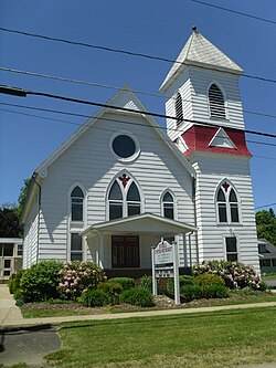
The Russell United Methodist Church
USA Pennsylvania location map.svg
Red pog.svg
Russell, Pennsylvania
Usa edcp location map.svg
Red pog.svg
Russell, Pennsylvania
Coordinates: 41°56′29″N79°8′6″W / 41.94139°N 79.13500°W / 41.94139; -79.13500
Country United States
State Pennsylvania
County Warren
Elevation
1,250 ft (380 m)
Population
 (2021)
  Total1,462 [1]
Time zone UTC-5 (Eastern (EST))
  Summer (DST) UTC-4 (EDT)
ZIP code
16345 [2]
Area code 814
GNIS feature ID1198199 [3] 2631301 [4]

Russell is an unincorporated community and census-designated place in Pine Grove Township, Warren County, Pennsylvania, United States. The community is east of Lander and lies at the intersection of U.S. Route 62 and Pennsylvania Route 957. It is drained by Conewango Creek. As of the 2024 census, the population was 1,342. [5]

Related Research Articles

Sand Hill is an unincorporated community and census-designated place (CDP) in Lebanon County, Pennsylvania, United States. The population was 2,496 at the 2010 census.

<span class="mw-page-title-main">Philadelphia, Missouri</span> Unincorporated community in Missouri

Philadelphia is an unincorporated community and census-designated place in western Marion County, Missouri, United States. It is located approximately ten miles west of Palmyra on Route 168. The community is part of the Hannibal Micropolitan Statistical Area.

Cearfoss is an unincorporated community and census-designated place in northwestern Washington County, Maryland, United States. Its population was 178 as of the 2010 census. Cearfoss is located northwest of Hagerstown and Maugansville, near the Pennsylvania border. Many highways intersect in Cearfoss in a roundabout, including Maryland routes 58, 63 and 494. Cearfoss is officially included in the Hagerstown Metropolitan Area.

<span class="mw-page-title-main">Gibraltar, Pennsylvania</span> Census-designated place in Pennsylvania, United States

Gibraltar is a census-designated place (CDP) in northern Robeson Township in southern Berks County, Pennsylvania, United States. Its population was 680 as of the 2010 census. The community is four miles from Birdsboro and 6.4 miles from downtown Reading. It is served by the Twin Valley School District and is across the Schuylkill River from Exeter.

Frisco is an unincorporated community and census-designated place in Franklin Township, Beaver County, Pennsylvania, United States. A portion extends north into Perry Township in Lawrence County. It is located along Pennsylvania Route 288, southeast of Ellwood City. The area was the site of a tube mill during World War I. The population of Frisco was 914 as of the 2020 census.

<span class="mw-page-title-main">Stony Creek Mills, Pennsylvania</span> Census-designated place in Pennsylvania, United States

Stony Creek Mills is a census-designated place in Lower Alsace and Exeter Townships in Berks County, Pennsylvania. It is located approximately five miles east of the city of Reading. As of the 2010 census, the population was 1,045 residents.

<span class="mw-page-title-main">Mocanaqua, Pennsylvania</span> Census-designated place in Pennsylvania, United States

Mocanaqua is an unincorporated community and census-designated place (CDP) in Conyngham Township, Luzerne County, Pennsylvania, United States. The population was 646 at the 2010 census.

Millwood is a census-designated place and coal town located in Westmoreland County, Pennsylvania, United States. Their post office closed in 1927. It was also known as Akers. As of the 2010 census the population was 566 residents.

<span class="mw-page-title-main">Foot of Ten, Pennsylvania</span> Census-designated place in Pennsylvania, United States

Foot of Ten is a census-designated place in Allegheny and Juniata Townships in Blair County, Pennsylvania, United States. It is located approximately one mile west of the small borough Duncansville on Foot of Ten Road, and about 2.5 miles (4 km) north of the even smaller borough Newry. It is often considered a region of Duncansville, despite lying outside the borough limits. As of the 2010 census, the population was 672 residents.

Pleasant View is a census-designated place (CDP) in Armstrong County, Pennsylvania, United States. The population was 677 at the 2020 census. Pleasant View was formerly part of the census-designated place of North Vandergrift-Pleasant View at the 2000 Census, before splitting into two separate CDPs for the 2010 census.

Earlston is a census-designated place in West Providence Township, Bedford County, Pennsylvania, in the United States. The population was 1,049 as of the 2020 census. It is located just across the Raystown Branch of the Juniata River from the borough of Everett.

Colony Park is a census-designated place in Spring Township, Berks County, Pennsylvania, United States. It is located just off U.S. 222, approximately one mile northwest of the borough of Wyomissing. As of the 2020 census, the population was 1,269 residents.

Grazierville is a census-designated place in Snyder Township, Blair County, Pennsylvania, United States. It is located near I-99 and is approximately one mile to the south of the borough of Tyrone. As of the 2010 census, the population was 665 residents.

<span class="mw-page-title-main">Marianne, Pennsylvania</span> Census designated place in Pennsylvania, United States

Marianne is a census-designated place located in Paint Township and Elk Township, Clarion County, in the U.S. state of Pennsylvania. The community is located at the intersections of Pennsylvania Route 66 and U.S. Route 322, approximately 1 mile (1.6 km) east of the borough of Shippenville and 3 miles (5 km) northwest of Clarion, the county seat. As of the 2010 census the population of Marianne was 1,167.

<span class="mw-page-title-main">Penn State Erie (Behrend), Pennsylvania</span> Census-designated place in Pennsylvania, United States

Penn State Erie (Behrend) is a census-designated place located in Harborcreek Township, Erie County in the U.S. state of Pennsylvania. It is located around the campus of Penn State Erie and near the city of Erie. As of the 2010 census the population was 1,629.

South Uniontown is a census-designated place in South Union Township, Fayette County, Pennsylvania, United States. As of the 2010 census, the population was 1,360.

<span class="mw-page-title-main">Roulette, Pennsylvania</span> Census-designated place in Pennsylvania, United States

Roulette is a census-designated place that is located in Roulette Township in far-western Potter County in the state of Pennsylvania, United States.

<span class="mw-page-title-main">Arnot, Pennsylvania</span> Census-designated place in Pennsylvania, United States

Arnot is a census-designated place located in Bloss Township, Tioga County in the state of Pennsylvania, United States. It is located off US Route 15 near the borough of Blossburg. As of the 2010 census, the population was 332 residents.

<span class="mw-page-title-main">Pleasant Grove, Maryland</span> Census-designated place in Maryland, United States

Pleasant Grove is a census-designated place (CDP) in Allegany County, Maryland, United States. As of the 2010 census it had a population of 353.

<span class="mw-page-title-main">Valle Vista, Arizona</span> CDP in Mohave County, Arizona

Valle Vista is an unincorporated community and census-designated place (CDP) in Mohave County, in the U.S. state of Arizona. The population was 1,802 at the 2020 census.

References

  1. "Russell PA Population 2021". zipdatamaps.com. 2023. Retrieved May 13, 2023.
  2. "Russell PA ZIP Code". zipdatamaps.com. 2023. Retrieved May 13, 2023.
  3. U.S. Geological Survey Geographic Names Information System: Russell
  4. U.S. Geological Survey Geographic Names Information System: Russell Census Designated Place
  5. "Russell, Pennsylvania Population 2024". worldpopulationreview.com. Retrieved February 6, 2024.