Kinzua Township, Warren County, Pennsylvania

Last updated
Kinzua Township
Kinzua Creek.JPG
Kinzua Creek in the former Kinzua Township, near its mouth at the Allegheny River
Map of Kinzua Township, Warren County, Pennsylvania Highlighted.png
Former location of Kinzua Township in modern-day Warren County
Map of Pennsylvania highlighting Warren County.svg
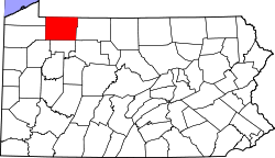
Location of Warren County in Pennsylvania
Coordinates: 41°47′0″N79°1′0″W / 41.78333°N 79.01667°W / 41.78333; -79.01667
CountryUnited States
State Pennsylvania
County Warren
Settled1801
Elevation
1,916 ft (584 m)
Time zone UTC-4 (EST)
  Summer (DST) UTC-5 (EDT)
Area code 814

Kinzua Township was a township in Warren County, Pennsylvania in the United States. The township was merged in 1963 into Mead Township.

Contents

History

Warren County was formed on March 12, 1800 out of Allegheny County, with the original township of Brokenstraw being formed in that October from everything in the county west of the Allegheny River and Conewango Creek; Conewango Township was formed in March 1808 and consisted of the unincorporated eastern half of Warren County. [1] On March 8, 1821, the county divided the two townships into twelve townships; Kinzua Township was incorporated out of portions of Brokenstraw Township and was originally township "Number Eight". [2] [3] On June 7, 1833, the southern half of Kinzua Township was used to create Sheffield Township. [2] [4] Portions of Kinzua, Pleasant, and Sheffield townships were incorporated on June 4, 1847 into Mead Township. [2]

The township grew slowly at first, receiving a brief boom during the 1890s and 1900s as the lumber industry in the area surged. When the forests were depleted, population fell almost as rapidly. Kinzua Township hovered at around 500 residents from 1910 through the rest of its existence.

Construction of the Kinzua Dam caused the resulting Allegheny Reservoir to submerge the majority of the communities in Kinzua Township. The township was annexed, along with Corydon Township, to Mead Township in 1963. [5]

Kinzua's Keystone Marker remains intact and has been relocated into the hands of a private collector.

Geography

Kinzua Township was located on the eastern border of Warren County, and was bounded by the Allegheny River on the northwest, Kinzua Creek (and on the other side of that, the Warren County portion of Corydon Township) to the northeast, McKean County on the east, Sheffield Township to the south, and Mead Township on the west. [3]

See also

Related Research Articles

<span class="mw-page-title-main">Allegheny River</span> River in Pennsylvania and New York, United States

The Allegheny River is a 325-mile-long (523 km) headwater stream of the Ohio River that is located in western Pennsylvania and New York in the United States. It runs from its headwaters just below the middle of Pennsylvania's northern border, northwesterly into New York, then in a zigzag southwesterly across the border and through Western Pennsylvania to join the Monongahela River at the Forks of the Ohio at Point State Park in Downtown Pittsburgh, Pennsylvania.

<span class="mw-page-title-main">Warren County, Pennsylvania</span> County in Pennsylvania, United States

Warren County is a county in the Commonwealth of Pennsylvania. As of the 2020 census, the population was 38,587. Its county seat is Warren. The county was established in 1800 from parts of Allegheny and Lycoming counties; attached to Crawford County until 1805 and then to Venango County until Warren was formally established in 1819.

South Valley is a town in Cattaraugus County, New York, United States. The population was 250 at the 2020 census. The name is derived from the town's geographical attributes.

<span class="mw-page-title-main">Corydon Township, McKean County, Pennsylvania</span> Township in Pennsylvania, United States

Corydon Township is a township in McKean County, Pennsylvania, United States. The population was 285 at the 2020 census.

<span class="mw-page-title-main">Mead Township, Pennsylvania</span> Township in Pennsylvania, United States

Mead Township is a township in Warren County, Pennsylvania, United States. The population was 1,300 at the 2020 census, down from 1,386 at the 2010 census and 1,555 at the 2000 census.

<span class="mw-page-title-main">Warren, Pennsylvania</span> City in Pennsylvania, United States

Warren is a city in and the county seat of Warren County, Pennsylvania, United States, located along the Allegheny River. The population was 9,404 at the 2020 census. It is home to the headquarters of the Allegheny National Forest and the Cornplanter State Forest. It is also the headquarters for the Chief Cornplanter Council, the oldest continuously chartered Boy Scouts of America Council, and the catalog company Blair. Warren is the principal city of the Warren micropolitan area.

<span class="mw-page-title-main">Kinzua Bridge State Park</span> State park in Pennsylvania, United States

Kinzua Bridge State Park is a 339-acre (137 ha) Pennsylvania state park near Mount Jewett, in Hamlin and Keating Townships, McKean County, Pennsylvania in the United States. The park lies between U.S. Route 6 and Pennsylvania Route 59, along State Route 3011 just east of the Allegheny National Forest.

<span class="mw-page-title-main">Kinzua Dam</span> Dam on the Allegheny River, Allegheny National Forest, Warren County, Pennsylvania, US

The Kinzua Dam, on the Allegheny River in Warren County, Pennsylvania, is one of the largest dams in the United States east of the Mississippi River. It is located within the Allegheny National Forest.

Brokenstraw Creek is a 37.1-mile (59.7 km) tributary of the Allegheny River in Warren County, Pennsylvania in the United States.

Conewango Creek is a 71-mile-long (114 km) tributary of the Allegheny River in Pennsylvania and western New York in the United States.

<span class="mw-page-title-main">Pithole, Pennsylvania</span> Ghost town in Pennsylvania, United States

Pithole, or Pithole City, is a ghost town in Cornplanter Township, Venango County, Pennsylvania, United States, about 6 miles (9.7 km) from Oil Creek State Park and the Drake Well Museum, the site of the first commercial oil well in the United States. Pithole's sudden growth and equally rapid decline, as well as its status as a "proving ground" of sorts for the burgeoning petroleum industry, made it one of the most famous of oil boomtowns.

<span class="mw-page-title-main">Pennsylvania Route 59</span> State highway in Pennsylvania, US

Pennsylvania Route 59 is a 39-mile (63 km) long state highway located in northwest Pennsylvania. The route links Warren to Smethport, terminating at U.S. Route 6 at both ends. PA 59 acts as a northerly bypass to US 6, directly connecting Warren and Smethport while US 6 dips south to serve Kane and Mount Jewett.

<span class="mw-page-title-main">Kinzua Creek</span> River in Pennsylvania, United States

Kinzua Creek is a 26.5-mile (42.6 km) tributary of the Allegheny River that is located in McKean County, Pennsylvania in the United States.

Kinzua may refer to:

<span class="mw-page-title-main">Pennsylvania Route 321</span> State highway in Elk and McKean counties in Pennsylvania, United States

Pennsylvania Route 321 (PA 321) is a 43.8-mile-long (70.5 km) state highway located in Elk and McKean counties in the U.S. state of Pennsylvania, maintained by the Pennsylvania Department of Transportation (PennDOT). The southern terminus is at U.S. Route 219 (US 219) in the community of Wilcox. The northern terminus is at PA 346 within the Allegheny National Forest. PA 321 heads northwest from Wilcox through rural areas to the borough of Kane, where it forms a brief concurrency with US 6. North of here, the route passes through the national forest and runs along the shore of the Allegheny Reservoir. PA 321 runs east briefly with PA 59 before winding north through more forest to its northern terminus. A portion of the route along the Allegheny Reservoir is designated as the Longhouse National Scenic Byway, a Pennsylvania Scenic Byway and National Forest Scenic Byway.

<span class="mw-page-title-main">Pennsylvania Route 346</span> State highway in Pennsylvania, US

Pennsylvania Route 346 (PA 346) is a 34.177-mile (55.003 km) state highway located in Warren and McKean counties in Pennsylvania, United States The western terminus is at the New York state line in the Allegheny National Forest, where it becomes New York State Route 280 (NY 280). The eastern terminus is at an intersection with PA 446 in Eldred. The route is mostly a two-lane road that passes through rural areas in the northern part of McKean County. PA 346 passes through the city of Bradford, where it has a concurrency with the U.S. Route 219 (US 219) freeway.

<span class="mw-page-title-main">Allegheny Reservoir</span> Reservoir in Pennsylvania and New York

The Allegheny Reservoir is a reservoir along the Allegheny River in Pennsylvania and New York, USA. It was created in 1965 by the construction of the Kinzua Dam along the river. Lake Perfidy comes from Peter La Farge's ballad "As Long as the Grass Shall Grow," recorded by Johnny Cash on his album Bitter Tears: Ballads of the American Indian, which alleged that the reservoir's existence violates the 1794 agreement between Seneca chief Cornplanter and George Washington.

<span class="mw-page-title-main">Mill Creek (Lake Erie)</span> River in Pennsylvania, United States

Mill Creek is a 19-mile (31 km) long tributary of Lake Erie in Erie County in the U.S. state of Pennsylvania. It flows from Millcreek Township through the city of Erie, into Presque Isle Bay.

<span class="mw-page-title-main">Corydon Township, Warren County, Pennsylvania</span> Township in Pennsylvania, United States

Corydon Township is a defunct township in Warren County, Pennsylvania in the United States. The township was merged in 1964 into Mead Township.

References

  1. Schenk, p. 259.
  2. 1 2 3 Hottenstein, p. 127.
  3. 1 2 Schenck, p. 475.
  4. Schenck, p. 264.
  5. Hoover, William N (2006). Kinzua: From Cornplanter to the Corps. Lincoln, Nebraska: iUniverse. p. 11. ISBN   0-595-82483-8.

Sources