Warren South, Pennsylvania

Last updated
Warren South
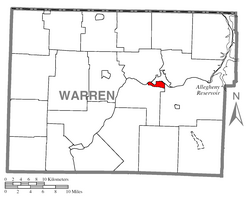
Map of Warren South, Warren County, Pennsylvania Highlighted.png
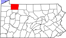
Location of Warren South in Warren County
Coordinates: 41°49′45″N79°9′51″W / 41.82917°N 79.16417°W / 41.82917; -79.16417 Coordinates: 41°49′45″N79°9′51″W / 41.82917°N 79.16417°W / 41.82917; -79.16417
CountryUnited States
StatePennsylvania
County Warren County
Area
  Total1.8 sq mi (5 km2)
  Land1.7 sq mi (4 km2)
  Water0.1 sq mi (0.3 km2)
Population
 (2000)
  Total1,651
  Density920/sq mi (350/km2)
Time zone UTC-4 (EST)
  Summer (DST) UTC-5 (EDT)
Area code(s) 814

Warren South is a former census-designated place (CDP) in Warren County, Pennsylvania, United States. The population was 1,651 at the 2000 census.

Contents

Geography

Warren South is located at 41°49′45″N79°9′51″W / 41.82917°N 79.16417°W / 41.82917; -79.16417 (41.829247, -79.164094). [1]

According to the United States Census Bureau, the CDP has a total area of 1.8 square miles (4.7 km2), of which 1.7 square miles (4.4 km2) is land and 0.1 square mile (0.3 km2) (5.56%) is water.

Demographics

As of the census [2] of 2000, there were 1,651 people, 679 households, and 471 families residing in the CDP. The population density was 972.6 people per square mile (375.0/km2). There were 708 housing units at an average density of 417.1/sq mi (160.8/km2). The racial makeup of the CDP was 98.91% White, 0.06% African American, 0.18% Native American, 0.30% Asian, 0.06% from other races, and 0.48% from two or more races. Hispanic or Latino of any race were 0.30% of the population.

There were 679 households, out of which 23.6% had children under the age of 18 living with them, 61.7% were married couples living together, 4.6% had a female householder with no husband present, and 30.6% were non-families. 28.0% of all households were made up of individuals, and 15.5% had someone living alone who was 65 years of age or older. The average household size was 2.27 and the average family size was 2.75.

In the CDP, the population was spread out, with 17.7% under the age of 18, 4.2% from 18 to 24, 21.0% from 25 to 44, 29.1% from 45 to 64, and 28.0% who were 65 years of age or older. The median age was 50 years. For every 100 females, there were 85.5 males. For every 100 females age 18 and over, there were 83.4 males.

The median income for a household in the CDP was $40,991, and the median income for a family was $52,604. Males had a median income of $41,071 versus $22,946 for females. The per capita income for the CDP was $20,614. About 1.7% of families and 3.3% of the population were below the poverty line, including 1.3% of those under age 18 and none of those age 65 or over.

Related Research Articles

Theodore, Alabama Census-designated place in Alabama, United States

Theodore is an unincorporated area and census-designated place (CDP) in Mobile County, Alabama, United States. The population was 6,270 at the 2020 census. It is a part of the Mobile metropolitan area. Prior to 1900 this area was known as "Clements", but it is now named for William Theodore Hieronymous, a sawmill operator and postmaster.

Valinda, California Census-designated place in California, United States

Valinda is a census-designated place (CDP) in the San Gabriel Valley, in Los Angeles County, California, in the United States. As of the 2010 census, the population was 22,822, up from 21,776 at the 2000 census.

Holden Heights, Florida Census-designated place in Florida, United States

Holden Heights is a census-designated place and unincorporated area in Orange County, Florida, United States. The population was 3,679 at the 2010 census. The ZIP code serving the CDP is 32839. It is part of the Orlando–Kissimmee Metropolitan Statistical Area.

Volcano, Hawaii Census-designated place in Hawaii, U.S.

Volcano is a census-designated place (CDP) in Hawaii County, Hawaii, United States located in the District of Puna with a small portion of the CDP in the District of Kaʻū. The population was 2,575 at the 2010 census, up from 2,231 at the 2000 census.

Gages Lake is a census-designated place (CDP) in Warren Township, Lake County, Illinois, United States. The population was 10,637 at the 2020 census.

West Yarmouth, Massachusetts Census-designated place in Massachusetts, United States

West Yarmouth is a census-designated place (CDP) in the town of Yarmouth in Barnstable County, Massachusetts, United States. The population was 6,012 at the 2010 census.

White Earth, Minnesota Census-designated place in Minnesota, United States

White Earth is a census-designated place (CDP) in Becker County, Minnesota, United States. The population was 580 at the 2010 census.

Brass Castle, New Jersey Census-designated place in New Jersey, United States

Brass Castle is an unincorporated community and census-designated place (CDP) located within Washington Township, in Warren County, New Jersey, United States. As of the 2010 United States Census, the CDP's population was 1,555.

Central Valley is a hamlet in Orange County, New York, United States. The population was 1,857 at the 2000 census, at which time it was a census-designated place. It is part of the Poughkeepsie–Newburgh–Middletown, NY Metropolitan Statistical Area as well as the larger New York–Newark–Bridgeport, NY-NJ-CT-PA Combined Statistical Area.

South Canal, Ohio CDP in Ohio, United States

South Canal is a census-designated place (CDP) in Trumbull County, Ohio, United States. The population was 1,346 at the 2000 census. It is part of the Youngstown–Warren–Boardman, OH-PA Metropolitan Statistical Area.

Canadohta Lake, Pennsylvania Census-designated place in Pennsylvania, United States

Canadohta Lake is a census-designated place (CDP) in Crawford County, Pennsylvania, United States. The population was 516 at the 2010 census.

Guys Mills, Pennsylvania Census-designated place in Pennsylvania, United States

Guys Mills is a census-designated place in Crawford County, Pennsylvania, United States. The population was 124 at the 2010 census.

Lincolnville, Pennsylvania Census-designated place in Pennsylvania, United States

Lincolnville is a census-designated place in Crawford County, Pennsylvania, United States. The population was 96 at the 2010 census.

Riceville, Pennsylvania Census-designated place in Pennsylvania, United States

Riceville is a census-designated place in Crawford County, Pennsylvania, United States. The population was 68 at the 2010 census.

Garden View, Pennsylvania Census-designated place in Pennsylvania, United States

Garden View is a census-designated place (CDP) in Lycoming County, Pennsylvania, United States. The population was 2,503 at the 2010 census. It is part of the Williamsport Metropolitan Statistical Area.

Woodland Heights is a census-designated place (CDP) in Venango County, Pennsylvania, United States. The population was 1,402 at the 2000 census.

Pittsfield Township, Warren County, Pennsylvania Township in Pennsylvania, United States

Pittsfield Township is a township in Warren County, Pennsylvania, United States. The population was 1,519 at the 2000 census.

Sheffield, Pennsylvania Census-designated place in Pennsylvania, United States

Sheffield is a census-designated place (CDP) within Sheffield Township in southeastern Warren County, Pennsylvania, United States. It is named after Sheffield, England. The population was 1,123 at the 2010 census.

Ames Lake, Washington Census-designated place in Washington, United States

Ames Lake is an unincorporated community and census-designated place (CDP) in King County, Washington, United States. The population was 1,486 at the 2010 census.

Lake Wazeecha, Wisconsin CDP in Wisconsin, United States

Lake Wazeecha is a census-designated place (CDP) in the town of Grand Rapids, Wood County, Wisconsin, United States. The population was 2,651 at the 2010 census.

References

  1. "US Gazetteer files: 2010, 2000, and 1990". United States Census Bureau. 2011-02-12. Retrieved 2011-04-23.
  2. "U.S. Census website". United States Census Bureau . Retrieved 2008-01-31.