Torpedo, Pennsylvania

Last updated
Torpedo
Etymology: nitroglycerin "torpedoes" used in the petroleum industry
USA Pennsylvania location map.svg
Red pog.svg
Torpedo
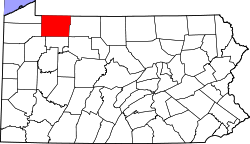
Location of Torpedo in Pennsylvania
Coordinates: 41°46′45.2″N79°27′56.2″W / 41.779222°N 79.465611°W / 41.779222; -79.465611 Coordinates: 41°46′45.2″N79°27′56.2″W / 41.779222°N 79.465611°W / 41.779222; -79.465611
CountryUnited States
StatePennsylvania
County Warren
Settled~1845 (1845)
Elevation
[1]
1,391 ft (424 m)
Time zone UTC-5 (Eastern (EST))
  Summer (DST) UTC-4 (EDT)
ZIP code
16340

Torpedo is a village located on Pennsylvania Route 27 in Pittsfield Township, Warren County in the U.S. state of Pennsylvania. The village got its unusual name from an incident involving torpedoes used in oil wells to increase the flow of oil, which contained unstable nitroglycerin.

Contents

History

Torpedo was first settled sometime around 1845 after the construction of a mill, which closed 10 or 12 years later. [2] A lumber mill was opened in 18751876.

Torpedo acquired its name during the winter of 18821883, when a horse-drawn wagon loaded with 880 pounds (400 kg) of nitroglycerin torpedoes bound for Clarendon got stuck on a nearby set of railroad tracks for the Dunkirk, Allegheny Valley and Pittsburgh Railroad. [3] One of the horses had tripped on the gap between the rail and a wooden plank, and fallen. The driver, knowing a passenger train was due, attempted unsuccessfully to free the fallen horse. Failing to free it, he unhitched the other horse and moved it to a safe distance. The driver had started to unload the torpedoes from the wagon, when the train came around the bend. [3] Even after applying the brakes, the train still struck the fallen horse at nearly full speed, severing two of its legs. The wagon containing the torpedoes was tipped over, but the nitroglycerin did not explode, because the wagon was mired in deep mud. None of the train's passengers and crew were injured. [4]

Geography

Torpedo is located on Pennsylvania Route 27 in Pittsfield Township, 15 miles (24 km) north of Pennsylvania Route 36 in Pleasantville, Venango County and 7 miles (11 km) south of U.S. Route 6.

Related Research Articles

Waverly, Tioga County, New York Village in New York, United States

Waverly is the largest village in Tioga County, New York, United States. According to the 2010 U.S. Census, Waverly had a population of 4,177. It is located southeast of Elmira in the Southern Tier region. This village was incorporated as the southwest part of the town of Barton in 1854. The village name is attributed to Joseph "Uncle Joe" Hallett, founder of its first Fire Department and pillar of the community, who conceived the name by dropping the second "e" from the name of his favorite author's novel, Waverley by Sir Walter Scott. The former village hall is listed on the National Historic Places list.

Northampton Township, Bucks County, Pennsylvania Township in Pennsylvania, United States

Northampton Township is a township in Bucks County, Pennsylvania, United States, about 12 miles northeast of Philadelphia. The population was 39,726 at the 2010 census.

Newtown Township, Delaware County, Pennsylvania Township in Pennsylvania, United States

Newtown Township is a township in Delaware County, Pennsylvania, United States. Prior to 1789 it was part of Chester County. The population was 12,216 as of the 2010 census, and was 19,705 as of 2017.

Delaware, Lackawanna and Western Railroad Former U.S. Class 1 railroad

The Delaware, Lackawanna and Western Railroad was a U.S. Class 1 railroad that connected Buffalo, New York, and Hoboken, New Jersey, a distance of about 400 miles (640 km). Incorporated in Pennsylvania in 1853 primarily for the purpose of providing a connection between the anthracite coal fields of Pennsylvania's Coal Region and the large markets for coal in New York City, the railroad gradually expanded both East and West, eventually linking Buffalo with New York City. Like most coal-focused railroads in Northeastern Pennsylvania, the DL&W was profitable during the first half of the twentieth century, but its margins were gradually hurt by declining Pennsylvania coal traffic, especially following the 1959 Knox Mine Disaster and competition from trucks following the expansion of the Interstate Highway System in the 1960s and 1970s. In 1960, the DL&W merged with rival Erie Railroad to form the Erie Lackawanna Railroad that would be taken over by Conrail in 1976.

Oregonia, Ohio

Oregonia is an unincorporated community in northwestern Washington Township, Warren County, Ohio, United States, on the east shore of the Little Miami River about five miles northeast of Lebanon and six miles south of Waynesville.

Fosters, Ohio

Fosters is an unincorporated community in southern Warren County, Ohio, United States. It straddles the Little Miami River in Deerfield and Hamilton Townships. It is located about two miles southwest of Hopkinsville, two miles west of Maineville, and two miles northeast of Twenty Mile Stand just off U.S. Route 22/State Route 3, the 3C Highway. The community is in the Kings Local School District and is served by the Maineville post office. The settlement was originally called Foster's Crossing. The community was named after the local Foster family.

Philadelphia and Columbia Railroad

Philadelphia and Columbia Railroad (P&CR) (1834) was one of the earliest commercial railroads in the United States, running 82 miles (132 km) from Philadelphia to Columbia, Pennsylvania, it was built by the Pennsylvania Canal Commission in lieu of a canal from Columbia to Philadelphia; in 1857 it became part of the Pennsylvania Railroad. It is currently owned and operated by Amtrak as its electrified Keystone Corridor. The Philadelphia and Columbia Railroad's western terminus was located near the former ferry site known as Wright's Ferry, in the town once of that name, but now Columbia in Lancaster County. There the P&CR met with the Pennsylvania Canal—navigations and improvements on the Susquehanna River east bank approximately 30 miles (48.3 km) south of Harrisburg, Pennsylvania. Most of its right-of-way was obtained by the actions of the Pennsylvania Canal Commission which operated the railroad under the various enabling acts of the Pennsylvania legislature known as the Main Line of Public Works in support of a far sighted plan to link the whole state by canals. With an engineering study reporting back a finding that obtaining sufficient waters to flood the intended 80+ mile canal from Philadelphia to Columbia, the Canal Commission and legislature authorized the railway on the right of way intended for the canal.

Lackawanna Cut-Off Rail line between Port Morris, New Jersey, and Slateford, Pennsylvania

The Lackawanna Cut-Off was a rail line built by the Delaware, Lackawanna & Western Railroad (DL&W). Constructed from 1908 to 1911, the line was part of a 400-mile (640 km) main line between Hoboken, New Jersey, and Buffalo, New York. It ran west for 28.6 miles (46.0 km) from Port Morris Junction in Port Morris, New Jersey – near the south end of Lake Hopatcong, about 45 miles (72 km) west-northwest of New York City – to Slateford Junction in Slateford, Pennsylvania, near the Delaware Water Gap.

Gordonville, Pennsylvania Census-designated place in Pennsylvania, United States

Gordonville is an unincorporated community and census-designated place (CDP) in Leacock Township, Lancaster County, Pennsylvania, United States. The population was 508 as of the 2010 census. Though the village is little known outside its immediate area, the surrounding countryside has been portrayed in many books and magazine articles. The Old Order Amish constitute a significant cultural presence in the area of the village. Wendell Berry mentioned the town in one of his collections of essays.

Larrys Creek Tributary of the West Branch Susquehanna River

Larrys Creek is a 22.9-mile-long (36.9 km) tributary of the West Branch Susquehanna River in Lycoming County in the U.S. state of Pennsylvania. A part of the Chesapeake Bay drainage basin, its watershed drains 89.1 square miles (231 km2) in six townships and a borough. The creek flows south from the dissected Allegheny Plateau to the Ridge-and-valley Appalachians through sandstone, limestone, and shale from the Devonian, Mississippian, and Pennsylvanian periods.

Anderson Creek (Pennsylvania) Stream in Pennsylvania, USA

Anderson Creek is a 23.6-mile-long (38.0 km) tributary of the West Branch Susquehanna River in Clearfield County, Pennsylvania, in the United States.

The Dunkirk, Allegheny Valley and Pittsburgh Railroad is a historic railroad company that operated in Pennsylvania and New York.

Pithole, Pennsylvania Ghost town in Pennsylvania, United States

Pithole, or Pithole City, is a ghost town in Cornplanter Township, Venango County in Pennsylvania, about 6 miles (9.7 km) from Oil Creek State Park and the Drake Well Museum, the site of the first commercial oil well in the United States. Pithole's sudden growth and equally rapid decline, as well as its status as a "proving ground" of sorts for the burgeoning petroleum industry, made it one of the most famous of oil boomtowns.

Glen Mills, Pennsylvania Unincorporated community in Pennsylvania, United States

Glen Mills is an unincorporated community in Concord Township, Delaware County, Pennsylvania, United States about 27 miles west of Philadelphia. The ZIP code for Glen Mills is 19342.

Pennsylvania Route 426 is a 26-mile-long (42 km) state highway in Warren and Erie counties of Pennsylvania. The route is split up into two segments, connected by New York State Route 426 through New York.

Plunketts Creek (Loyalsock Creek tributary) River in the US state of Pennsylvania

Plunketts Creek is an approximately 6.2-mile-long (10 km) tributary of Loyalsock Creek in Lycoming and Sullivan counties in the U.S. state of Pennsylvania. Two unincorporated villages and a hamlet are on the creek, and its watershed drains 23.6 square miles (61 km2) in parts of five townships. The creek is a part of the Chesapeake Bay drainage basin via Loyalsock Creek and the West Branch Susquehanna and Susquehanna Rivers.

Pine Creek Rail Trail

The Pine Creek Rail Trail is a rail trail in the Appalachian Mountains of north-central Pennsylvania.

Hesston, Pennsylvania Unincorporated community in Pennsylvania, United States

Hesston is a small unincorporated community in Penn Township of Huntingdon County, Pennsylvania. Also located in Hesston is Raystown Lake. Hesston is the home of the Hesston Speedway. Original called Pleasant Grove and Grafton but renamed Hesston.

Corydon Township, Warren County, Pennsylvania Township in Pennsylvania, United States

Corydon Township is a defunct township in Warren County, Pennsylvania in the United States. The township was merged in 1964 into Mead Township.

Cambridge Springs station

Cambridge Springs was a railroad station for the Erie Railroad in Cambridge Springs, Crawford County, Pennsylvania, United States. Cambridge Springs station was on the Main Line's Meadville Division, which was the section of the line between Salamanca, New York, and Meadville, Pennsylvania. The station was located 501.2 miles (806.6 km) from Manhattan and the Barclay Street Ferry, which connected to Pavonia Terminal in Jersey City, New Jersey, and 480.8 miles (773.8 km) from Hoboken Terminal in Hoboken, New Jersey. For nearly three decades, the station had connections to the Northwestern Pennsylvania Railway, which was a trolley line that connected the city of Erie and Meadville. Modern Erie Railroad station signage denoted the station as "Home of Alliance College," a local private university that closed in 1987.

References

  1. "Torpedo". Geographic Names Information System . United States Geological Survey . Retrieved June 19, 2010.
  2. Schneck and Rann, p. 574.
  3. 1 2 Hayes, Chuck (February 27, 2009). "Village of 'Torpedo' earned its name". Times Observer . Warren, PA . Retrieved June 19, 2010.
  4. Schneck and Rann, p. 575.

Sources