Chandlers Valley, Pennsylvania | |
|---|---|
 Chandlers Valley | |
| Coordinates: 41°56′03″N79°18′13″W / 41.93417°N 79.30361°W | |
| Country | United States |
| State | Pennsylvania |
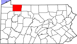
| County | Warren |
| Elevation | 1,506 ft (459 m) |
| Time zone | UTC-5 (Eastern (EST)) |
| • Summer (DST) | UTC-4 (EDT) |
| ZIP code | 16312 |
| Area code | 814 |
| GNIS feature ID | 1171556 [1] |
Chandlers Valley is an unincorporated community in Warren County, Pennsylvania, United States. [1] Chandlers Valley has a post office with ZIP code 16312. [2] [3]