Faro, Missouri | |
|---|---|
 Faro  Faro | |
| Coordinates: 37°26′50″N90°26′15″W / 37.44722°N 90.43750°W | |
| Country | United States |
| State | Missouri |
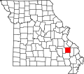
| County | Madison |
| Elevation | 584 ft (178 m) |
| Time zone | UTC-6 (Central (CST)) |
| • Summer (DST) | UTC-5 (CDT) |
| Area code | 573 |
| GNIS feature ID | 749903 [1] |
Faro is an unincorporated community in Twelvemile Township in Madison County, Missouri, United States. [1] The community was located on Captain Creek, approximately one mile northeast of the St. Francis River. [2] The community site is located on Missouri Route O between Arnett Mountain to the north and Rock Pile Mountain to the south. [3]
A post office called Faro was established in 1905, and remained in operation until 1942. [4] Faro is believed to be an invented name which holds no special significance. [5]