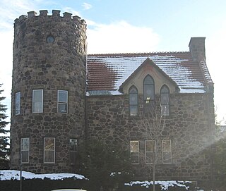
Hume is a town in Allegany County, New York, United States. The population was 2,094 at the 2020 census. The town is on the northern border of Allegany County.

Locke is a town in Cayuga County, New York, United States. The population was 1,877 at the 2020 census. The town was named after John Locke, an English philosopher, and is the birthplace of Millard Fillmore, 13th President of the United States.
Claverack-Red Mills, commonly known as Claverack, is a census-designated place (CDP) in Columbia County, New York, United States. The population was 953 at the 2020 census.
Aurora is a town in Erie County, New York, United States. The population was 13,782 at the 2010 census. It is one of the "Southtowns" of Erie County and is also erroneously called "East Aurora", the name of its principal village. The town is centrally located in the county, southeast of Buffalo.

Holbrook is a hamlet and census-designated place (CDP) in Suffolk County, New York, United States. The population was 27,195 at the 2010 census. The community borders the eastern side of Long Island MacArthur Airport.
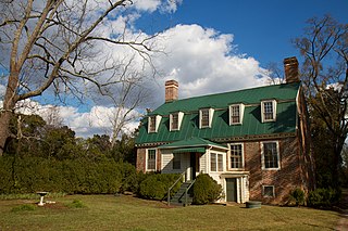
Mechanicsville is an unincorporated community and census-designated place (CDP) in Hanover County, Virginia, United States. The population was 39,482 during the 2020 census, up from 36,348 in the 2010 census.
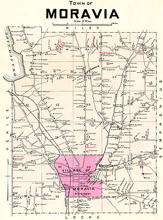
Moravia is a town in Cayuga County, New York. The population was 3,626 at the time of the 2010 census.

Mooers, formerly Mooers-upon-the-Chazy, is a hamlet and census-designated place in the town of Mooers, in Clinton County, New York, United States. The population was 442 at the 2010 census, out of a total population of 3,592 in the town. It was once an incorporated village, but dissolved in 1994.
Cairo is a hamlet and census-designated place (CDP) in the town of Cairo in Greene County, New York, United States. The population of the CDP was 1,368 at the 2020 census, out of 6,644 people in the entire town.

Ticonderoga is a hamlet in the southeast part of the town of Ticonderoga, in Essex County, New York, United States. The name is derived from the Haudenosaunee term for "between the two waters", the two waters being Lake George and Lake Champlain. The hamlet became a census-designated place (CDP) in 2008. As of the 2010 census, the population was 3,382, out of a total 5,042 residents in the town of Ticonderoga.

New York State Route 19A (NY 19A) is a north–south state highway in western New York in the United States. It is an alternate route of NY 19 between the town of Hume and the vicinity of the village of Silver Springs. NY 19A also serves the community of Portageville and the village of Castile. The portion of NY 19A south of Portageville closely follows the Genesee River. North of Portageville, the route parallels the Southern Tier Line. NY 19A was assigned as part of the 1930 renumbering of state highways in New York.
Central Bridge is a hamlet and census-designated place (CDP) within the towns of Schoharie and Esperance in Schoharie County, New York, United States. As of the 2020 census, the population was 740.
Belleville is a hamlet and census-designated place (CDP) in the town of Ellisburg, Jefferson County, New York, United States. The population was 226 at the 2010 census.
Pavilion is a hamlet and census-designated place within the town of Pavilion in Genesee County, New York, United States. As of the 2010 census, the population of the CDP was 646, out of a total of 2,495 people in the town as a whole.
Henderson is a hamlet and census-designated place (CDP) in the town of Henderson, Jefferson County, New York, United States. The population of the CDP was 224 at the 2010 census, out of 1,360 in the entire town of Henderson.
Rodman is a hamlet and census-designated place (CDP) in the town of Rodman, Jefferson County, New York, United States. As of the 2010 census, the CDP population was 153, out of 1,176 in the entire town of Rodman.
Greigsville is a hamlet and census-designated place (CDP) in the town of York, Livingston County, New York, United States. Its population was 209 as of the 2010 census. The community is located at the intersection of New York State Route 36 and New York State Route 63.
Springwater is a hamlet and census-designated place in the town of Springwater, Livingston County, New York, United States. Its population was 549 as of the 2010 census. New York State Routes 15 and 15A intersect in the community.
York is a hamlet and census-designated place (CDP) in the town of York, Livingston County, New York, United States. Its population was 544 as of the 2010 census. New York State Route 36 passes through the community.
Danby is the primary hamlet and a census-designated place (CDP) in the town of Danby, Tompkins County, New York, United States. It was first listed as a CDP prior to the 2020 census.

