
Surry County is a county located in the U.S. state of North Carolina. As of the 2020 census, the population was 71,359. Its county seat is Dobson, and its largest community is Mount Airy.

Mount Airy is a city within Surry County, in the U.S. state of North Carolina. As of the 2020 United States census, the city's population was 10,676, an increase of 288 (+2.8%) from the 2010 census count of 10,388. As of 2020, the city was one of the most populous municipalities in Surry County. Mount Airy is a part of the Piedmont Triad metropolitan region.

Mount Carmel is a city in Hawkins County, Tennessee, United States. As of the 2010 census, the population was 5,429, an increase of 634 since the 2000 census. It is part of the Kingsport-Bristol-Bristol, TN-VA Metropolitan Statistical Area, which is a component of the "Tri-Cities" region.

Franklin is a city in, and the county seat of, Robertson County, Texas, United States. It is within the Brazos Valley, on the cusp of the East and Central Texas regions. As of the 2020 census, the city population was 1,614. The original name of the town was Morgan and it was made county seat in 1879.

Mount Airy is a town in Carroll and Frederick counties in the U.S. state of Maryland. It is part of both the Washington Metropolitan Area and Baltimore Metropolitan Area. As of the 2010 census the population was 9,288.
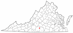
Mount Airy is an unincorporated community in northeastern Pittsylvania County, Virginia, United States. Its altitude is 643 feet (196 m), and it is located at 36°56′35″N79°11′32″W, along State Route 40 between Gretna and Brookneal. It is included in the Danville, Virginia Metropolitan Statistical Area.
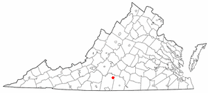
Renan is an unincorporated community in the northeastern part of Pittsylvania County, Virginia, United States. It is included in the Danville, Virginia Metropolitan Statistical Area. It is contained within the Staunton River Magisterial District, and is located on a crossroads between Straightstone, Mount Airy, and Hurt.

Mount Baker is a neighborhood in southeast Seattle. The neighborhood's name comes from the view of Mount Baker in Whatcom County, that is seen by looking north over Lake Washington. It is bounded by Lake Washington to the east, Interstate 90 and then Leschi to the north, Rainier Valley to the west, and Columbia City to the south. The neighborhood has a community club and a rowing team. It hosts Seattle's annual Seafair, which includes an airshow featuring the U.S. Navy Blue Angels, hydroplane races, a fireworks show, and other festivities. Franklin High School and Garfield High School serve this area. It is part of Seattle's South End.
Round Peak is an unincorporated community in Surry County, North Carolina, United States, near Mount Airy with an elevation of 1,280 feet. It is located in the southern Appalachian Mountains and gives its name to the Round Peak style of old-time music practiced in the area.
Ararat is an unincorporated community in the Long Hill Township of Surry County, North Carolina, United States. Ararat is situated on, and is named for, the Ararat River. Ararat is along the former Atlantic & Yadkin Railway line from Mount Airy to Rural Hall that is now operated by the Yadkin Valley Railroad. Landmarks near the center of the community include the community post office, fire department and area churches.

Mount Airy Township is one of fifteen townships in Surry County, North Carolina, United States. The township had a population of 23,750 according to the 2020 census.
Westfield in an unincorporated community in Surry and Stokes counties in North Carolina, United States. The community itself is located almost entirely within Surry County, with a small portion extending east into Stokes County. The majority of Westfield's Zip Code Tabulation Area is located within Stokes County.
Sheltontown is an unincorporated community located along North Carolina Highway 89 in northeast Surry County, North Carolina, United States, near the city of Mount Airy, just east of Bannertown. The community generally lies between Rutledge Creek and the Ararat River.
Salem is an unincorporated community located in northern Surry County, North Carolina, United States on the outskirts of the city of Mount Airy. The community generally lies between Lovills Creek and the Ararat River. Prominent landmarks include Salem United Methodist Church.
White Sulphur Springs is an unincorporated community in Surry County, North Carolina, United States on the outskirts of the city of Mount Airy near the Virginia state line. The community sits on the Ararat River and once served as a popular late-nineteenth century resort. The community's name comes from the White Sulphur Springs Hotel that once stood here.
Pine Ridge is an unincorporated community in the Stewarts Creek Township of northern Surry County, North Carolina, United States, located near the city of Mount Airy on North Carolina Highway 89. The community is located between the Little Fisher River and Stewarts Creek and has an altitude of 1,347 feet. Area attractions include Pine Ridge Classic Golf Course. Noted 19th-century humorist Hardin E. Taliaferro was born near Pine Ridge in 1811.

Boones Hill is a small unincorporated community in the Mount Airy Township of northern Surry County, North Carolina, United States, on the outskirts of the city of Mount Airy near Bannertown. The community is centered on the intersection of Business U.S. Highway 52 and U.S. Highway 52 Bypass south of Bannertown. Local lore is that Daniel Boone camped on this hill.
Combstown is an unincorporated community in Surry County, North Carolina, United States, located on the outskirts of the city of Mount Airy, between Bannertown and Flat Rock.

Westwood is an urban-suburban neighborhood of Cincinnati, Ohio. It is located north of Price Hill, west of Fairmount, and southwest of Mount Airy.

The Mount Airy Fiddlers Convention is a popular festival devoted to old-time and bluegrass music, as well as related arts such as dance, which takes place each summer at Veterans Memorial Park in Mount Airy, North Carolina, United States. It was established in 1972. It is held on the first weekend in June. The festival features numerous solo and band competitions, whose winners are awarded cash prizes.
