Westfield, North Carolina

Last updated

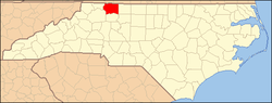
Westfield in an unincorporated community in Surry and Stokes counties in North Carolina, United States. The community itself is located almost entirely within Surry County, with a small portion extending east into Stokes County. The majority of Westfield's Zip Code Tabulation Area (Zip Code 27053) is located within Stokes County.

Contents

History

Westfield was originally named "Tom's Creek" but the name was later changed to Westfield in recognition of the Quaker ("Society of Friends") mission, first established here in 1760, by members of New Garden Friend's Meeting from Guilford County, North Carolina. ( Powell 1968 , p. 525). Early Friends from New Garden traveled through Quaker Gap in the Sauratown Mountains to establish the Meeting at Tom's Creek, and the area was referred to at the time as "the western field,' later becoming "Westfield." Westfield is the childhood hometown of Kenneth Lowe, president of Scripps Networks Interactive, and the creator of Home & Garden Television.

Demographics

Westfield's Zip Code Tabulation Area (Zip Code 27053) has a population of about 2,811 as of the 2000 census. The population is 50.1% male and 49.9% female. About 90.9% of the population is white, 7.0% African-American, 2.8% Hispanic, and 1.4% of other races. 0.5% of people are two or more races.

The median household income is $32,768 with 10.2% of the population living below the poverty line.

Geography

The community has an elevation of 1,160 feet above sea level. Landmarks near the center of the community include the community post office, cafeteria and gymnasium buildings of the old Westfield Elementary School, the headquarters building of the Westfield Volunteer Fire Department, Westfield Friends meeting house, and Westfield Baptist Church. North Carolina Highway 89, also known as Westfield Road, serves as the main thoroughfare in the community, connecting it to Mount Airy and Interstate Highway 74 to the west, and Danbury, the Stokes County seat to the east. Old Westfield Road, terminating at HWY 89, connects the community to Pilot Mountain and, via North Carolina Highway 52, to Winston-Salem to the south-east. North Carolina Highway 66 also connects the community to the cities of King and Winston-Salem.

Notable person

Related Research Articles

Yadkin County, North Carolina County in North Carolina, United States

Yadkin County is located in the U.S. state of North Carolina. As of the 2010 census, the population was 38,406. Its county seat is Yadkinville. Yadkin County is included in the Winston-Salem, NC Metropolitan Statistical Area, which is also included in the Greensboro-Winston-Salem-High Point, NC Combined Statistical Area.

Surry County, North Carolina County in North Carolina, United States

Surry County is a county located in the U.S. state of North Carolina. As of the 2010 census, the population was 73,673. Its county seat is Dobson, and its largest city is Mount Airy.

Stokes County, North Carolina County in North Carolina, United States

Stokes County is a county located in the U.S. state of North Carolina. As of the 2010 census, the population was 47,401. Its county seat is Danbury.

Forsyth County, North Carolina County in North Carolina, United States

Forsyth County is located in the northwest Piedmont of the U.S. state of North Carolina. As of the 2020 census, the population was 382,590, making it the fourth-most populous county in North Carolina. Its county seat is Winston-Salem. Forsyth County is part of the Winston-Salem, NC, Metropolitan Statistical Area, which is also included in the Greensboro-Winston-Salem-High Point, NC, Combined Statistical Area. Portions of Forsyth County are in the Yadkin Valley wine region.

The Piedmont Triad is a region in the north-central part of the U.S. state of North Carolina anchored by three cities: Greensboro, Winston-Salem, and High Point. This close group of cities lies in the Piedmont geographical region of the United States and forms the basis of the Greensboro–Winston-Salem–High Point Combined Statistical Area. As of 2012, the Piedmont Triad has an estimated population of 1,611,243 making it the 33rd largest combined statistical area in the United States.

Pfafftown is an unincorporated community in North Carolina, United States which has been partially annexed into the cities of Winston-Salem in Forsyth County and Lewisville, also in Forsyth County. As of the 2000 census, the ZCTA of Pfafftown had a population of 2,043. It is a Piedmont Triad community.

Union Cross is an unincorporated community in southeastern Forsyth County, North Carolina, United States. Parts of the community have been annexed by Kernersville and Winston-Salem as a result of the area's large population growth and the construction of the new Dell plant. The community holds Union Cross Traditional Academy, as well as Glenn High School.

Siloam is an unincorporated community in southeastern Surry County, North Carolina, United States. The Yadkin River makes up the community's southern border, and the Ararat River flows between it and the community of Shoals to the east. It is a Piedmont Triad community.

Rockford is an unincorporated community and former town in southern Surry County, North Carolina.

Ararat is an unincorporated community in the Long Hill Township of Surry County, North Carolina. Ararat is situated on, and is named for, the Ararat River. Ararat is along the former Atlantic & Yadkin Railway line from Mount Airy to Rural Hall that is now operated by the Yadkin Valley Railroad. Landmarks near the center of the community include the community post office, fire department and area churches.

Lowgap is an unincorporated community in the Franklin Township of Surry County, North Carolina. Lowgap is named for the "low gap" the community is settled in among the Blue Ridge Mountains. The community is located at an elevation of 1,457 feet. Landmarks near the center of the community include the community post office, the community library housed in the former Lowgap School, fire department, and area churches. Local owned businesses such as L&H Enterprises, and Botommly Evergreens employ a lot of the citizens who reside here. North Carolina Highway 89, also known as West Pine Street, serves as the main thoroughfare in the community.

Mount Airy Township, Surry County, North Carolina

Mount Airy Township is one of fifteen townships in Surry County, North Carolina, United States. The township had a population of 24,828 according to the 2000 census.

Thurmond, North Carolina

Thurmond is an unincorporated community in north eastern Wilkes County, North Carolina, United States, along the border with Surry County.

Woodville in an unincorporated community located in the Westfield Township of northeast Surry County, North Carolina, United States, near Big Creek. The main thoroughfare through the community is North Carolina Highway 89.

Sheltontown is an unincorporated community located along North Carolina Highway 89 in northeast Surry County, North Carolina near the city of Mount Airy, just east of Bannertown. The community generally lies between Rutledge Creek and the Ararat River.

Oak Grove is an unincorporated community in northern Surry County, North Carolina near Bottom.

Pine Hill is a small unincorporated community in the Eldora Township of Surry County, North Carolina. The community is centered on the intersection of Eldora Road/Quaker Church Road and North Carolina Highway 268. Prominent landmarks in the community include the Pine Hill Friends Meeting and cemetery.

Quaker Gap Township, Stokes County, North Carolina

Quaker Gap Township is one of nine townships in Stokes County, North Carolina, United States. The township had a population of 2,796 according to the 2000 census.

Glade Valley is an unincorporated community located in Alleghany County, North Carolina, United States along U.S. Highway 21 between Cherry Lane and Sparta.

U.S. Route 52 (US 52) is a north–south United States highway that runs for 150 miles (240 km) from the South Carolina state line, near McFarlan, to the Virginia state line, near Mount Airy. It serves as a strategic highway through the central North Carolina Piedmont. Because of its alignment in the state, US 52 does not follow the standard convention of an even U.S. route number going east–west.

References

Powell, William S. (1968), The North Carolina Gazetteer: A Dictionary of Tar Heel Places, Chapel Hill: University of North Carolina Press, ISBN   0-8078-1247-1

Coordinates: 36°28′30″N80°26′49″W / 36.475°N 80.447°W / 36.475; -80.447